| Home | City Bus | Maps | Villages | Cities | Rail | Tourist Places | School | College | Pin Codes | Corona Cases Count |
| Distance Calculator Bus Services IFSC Codes Trace Mobile Number Weather Search Place Trace IP Available Cash ATM/Banks Locate Polling Booth Report an Error contact People |
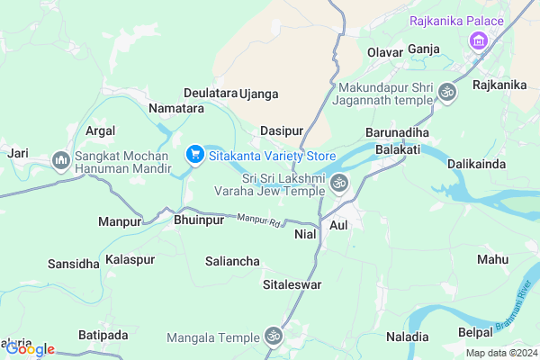
Tunga
Tunga Map
EDIT Map
Add Your House
 ..
..
Current Corona Virus Infected Patients Count in Kendrapara District
| City Name | District Name | Total Covid cases |
|---|---|---|
| Kendrapara District | Kendrapara | 2 |
Locality Name :
Tunga
( ତୁଙ୍ଗ )
Tehsil Name : Aul
District : Kendrapara
State : Odisha
Language : Oriya and Hindi
Current Time 01:26 PM
Date: Tuesday , Apr 29,2025 (IST)
Time zone: IST (UTC+5:30)
Elevation / Altitude: 21 meters. Above Seal level
Telephone Code / Std Code: 06729
Assembly constituency : Aul assembly constituency
Assembly MLA : devendra sharma
Lok Sabha constituency : Kendrapara parliamentary constituency
Parliament MP : Anubhav Mohanty
Serpanch Name :
Pin Code : 754219
Post Office Name : Aul
Commodities Prices : Pattamundai Market / Mandi
Tunga Live Weather
Temperature: 34.8 °C
clear sky
Humidity: 43%
Wind : 3.37 mt/sec towards S
StationName : "PatÄ\u0081mundai"
observed on 2 Hours Back
Temperature: 34.8 °C
clear sky
Humidity: 43%
Wind : 3.37 mt/sec towards S
StationName : "PatÄ\u0081mundai"
observed on 2 Hours Back
Tunga Weather Forecast for Next 5 days
30-04-2025
25.7°C to 36.1°C
clear sky, moderate rain, light rain, scattered clouds
25.7°C to 36.1°C
clear sky, moderate rain, light rain, scattered clouds
01-05-2025
24.2°C to 36.6°C
few clouds, clear sky, moderate rain, heavy intensity rain, light rain
24.2°C to 36.6°C
few clouds, clear sky, moderate rain, heavy intensity rain, light rain
02-05-2025
21.5°C to 32.2°C
few clouds, light rain, heavy intensity rain, moderate rain
21.5°C to 32.2°C
few clouds, light rain, heavy intensity rain, moderate rain
03-05-2025
23.1°C to 32.5°C
few clouds, clear sky, light rain, moderate rain, overcast clouds
23.1°C to 32.5°C
few clouds, clear sky, light rain, moderate rain, overcast clouds
04-05-2025
23.0°C to 35.8°C
broken clouds, clear sky, light rain, overcast clouds
23.0°C to 35.8°C
broken clouds, clear sky, light rain, overcast clouds
National Highways Reachable To Tunga
Nationa High Way :NH53
Nationa High Way :NH55
Nationa High Way :NH53
Nationa High Way :NH55
Rivers Near Tunga
Brahmani :Брагмані
Salandi
Brahmani :Брагмані
Salandi
About Tunga
Correct below Info and add more info about TungaTunga is a Village in Aul Tehsil in Kendrapara District of Odisha State, India. It is located 34 KM towards East from District head quarters Kendrapara. 3 KM from Aul. 109 KM from State capital Bhubaneswar
Tunga Pin code is 754219 and postal head office is Aul .
Nial ( 2 KM ) , Demal ( 2 KM ) , Aul ( 3 KM ) , Bhuinpur ( 4 KM ) , Mendhapur ( 4 KM ) are the nearby Villages to Tunga. Tunga is surrounded by Rajkanika Tehsil towards East , Pattamundai Tehsil towards South , Rajnagar Tehsil towards East , Binjharpur Tehsil towards west .
Pattamundai , Kendrapara , Jajapur , Paradip are the near by Cities to Tunga.
This Place is in the border of the Kendrapara District and Bhadrak District. Bhadrak District Chandabali is East towards this place .
Tunga 2011 Census Details
Tunga Local Language is Oriya. Tunga Village Total population is 1124 and number of houses are 250. Female Population is 58.5%. Village literacy rate is 84.3% and the Female Literacy rate is 48.9%.
Population
| Census Parameter | Census Data |
| Total Population | 1124 |
| Total No of Houses | 250 |
| Female Population % | 58.5 % ( 657) |
| Total Literacy rate % | 84.3 % ( 948) |
| Female Literacy rate | 48.9 % ( 550) |
| Scheduled Tribes Population % | 0.0 % ( 0) |
| Scheduled Caste Population % | 0.0 % ( 0) |
| Working Population % | 29.2 % |
| Child(0 -6) Population by 2011 | 130 |
| Girl Child(0 -6) Population % by 2011 | 51.5 % ( 67) |
Tunga Census More Deatils.
Politics in Tunga
BJD , INC are the major political parties in this area.Polling Stations /Booths near Tunga
1)Thakursahi Pry. School2)Khantiapatna Project Pry. School
3)Ekamania Ugup School
4)Batipada Nodal Up School
5)Baulajodi Pry. School
HOW TO REACH Tunga
By Rail
There is no railway station near to Tunga in less than 10 km.Colleges near Tunga
Laxmi Barah College, Ayatpur, Aul, Kendrapara
Address :
Aul College
Address : Kendraparaorissapin-754219
Schools in Tunga
C. P. B. E. T. High School
Address : tunga , aul , kendrapara , Sikkim . PIN- 754219 , Post - Aul
Tunga U. G. U.p.s.
Address : tunga , aul , kendrapara , Sikkim . PIN- 754219 , Post - Aul
Govt Health Centers near Tunga
1) Pattamundai MC , , HQ Sector , CHC Campus2) Alaba SC , , Alava Sector , NearAlava Primery School
3) SC Bandhapad , , HQ Sector , Near Block Colony
Hospitals in Tunga,Aul
Union Health Center
Aali; Kendrapara; SH-9A; Bhadrak Chandbali Road; Rajkanika; Rajkanika; Odisha 754219; India
3.6 KM distance Detail
more ..
Petrol Bunks in Tunga,Aul
HP PETROL PUMP - BAIDYANATH FILLING STATION
AT: Lokapada PO: Aali Aali; Bhubaneshwar; Odisha 754219; India
4.3 KM distance Detail
Hindustan Petroleum
Aali; Kendrapara; SH-9A; Bhadrak Chandbali Road; Rajkanika; Rajkanika; Odisha 754219; India
4.3 KM distance Detail
GOPINATH FUEL FILLING STATION
Rajkanika-Olavar Rd; KENDRAPADA; Odisha 754220; India
12.0 KM distance Detail
more ..
Colleges in Tunga,Aul
Mahima Institute of Information Technology
SH 9A; Demal; Odisha 754219; India
3.4 KM distance Detail
more ..
Super Markets in Tunga,Aul
Shibashree Puja Veriety Store
Tahasil Road; nuabazar; Demal; Odisha 754219; India
3.4 KM distance Detail
About Tunga &
History
How to reach Tunga
Tourist Places Near By Tunga
Schools in Tunga
Colleges in Tunga
Temperature & weather of Tunga
places in Tunga
Tunga photos
More Information
How to reach Tunga
Tourist Places Near By Tunga
Schools in Tunga
Colleges in Tunga
Temperature & weather of Tunga
places in Tunga
Tunga photos
More Information
Village Talk
Post News or Events about this Village
Near Cities
Pattamundai 14 KM near
Kendrapara 33 KM near
Jajapur 39 KM near
Paradip 46 KM near
Pattamundai 14 KM near
Kendrapara 33 KM near
Jajapur 39 KM near
Paradip 46 KM near
Near By Taluks
Aul 3 KM near
Rajkanika 11 KM near
Pattamundai 16 KM near
Rajnagar 22 KM near
Aul 3 KM near
Rajkanika 11 KM near
Pattamundai 16 KM near
Rajnagar 22 KM near
Near By Air Ports
Bhubaneswar Airport 108 KM near
Netaji Subhas Chandra Bose Airport 321 KM near
Ranchi Airport 359 KM near
Gaya Airport 540 KM near
Bhubaneswar Airport 108 KM near
Netaji Subhas Chandra Bose Airport 321 KM near
Ranchi Airport 359 KM near
Gaya Airport 540 KM near
Near By Tourist Places
Paradeep Beach 46 KM near
Cuttack 90 KM near
Nandan Kanan National Park 100 KM near
Bhubaneswar 104 KM near
Chandipur 105 KM near
Paradeep Beach 46 KM near
Cuttack 90 KM near
Nandan Kanan National Park 100 KM near
Bhubaneswar 104 KM near
Chandipur 105 KM near
Near By Districts
Kendrapara 32 KM near
Jajapur 38 KM near
Bhadrak 49 KM near
Jagatsinghapur 74 KM near
Kendrapara 32 KM near
Jajapur 38 KM near
Bhadrak 49 KM near
Jagatsinghapur 74 KM near
Near By RailWay Station
Bhadrak Rail Way Station 51 KM near
Jajpur Keonjhar Road Rail Way Station 64 KM near
Bhadrak Rail Way Station 51 KM near
Jajpur Keonjhar Road Rail Way Station 64 KM near