| Home | City Bus | Maps | Villages | Cities | Rail | Tourist Places | School | College | Pin Codes | Corona Cases Count |
| Distance Calculator Bus Services IFSC Codes Trace Mobile Number Weather Search Place Trace IP Available Cash ATM/Banks Locate Polling Booth Report an Error contact People |
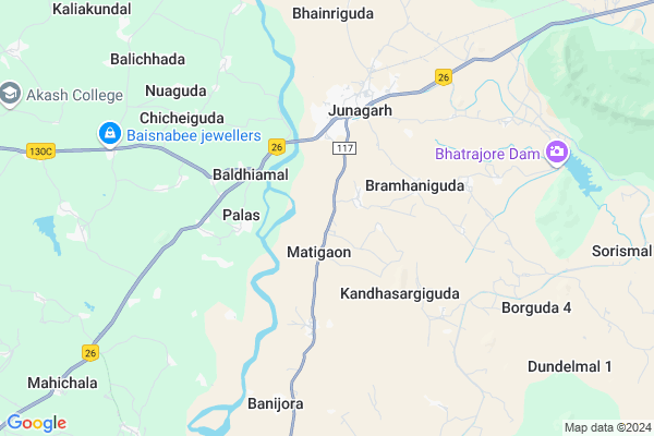
Antarla Map
EDIT Map
Add Your House
 ..
..
Current Corona Virus Infected Patients Count in Kalahandi District
| City Name | District Name | Total Covid cases |
|---|---|---|
| Golamunda | Kalahandi | 1 |
| Kalahandi District | Kalahandi | 1 |
Locality Name :
Antarla
( ଅନ୍ତର୍ଲା )
Tehsil Name : Junagarh
District : Kalahandi
State : Odisha
Language : Oriya and Hindi,
Current Time 05:22 AM
Date: Monday , Apr 28,2025 (IST)
Time zone: IST (UTC+5:30)
Elevation / Altitude: 241 meters. Above Seal level
Telephone Code / Std Code: 06672
Assembly constituency : Junagarh assembly constituency
Assembly MLA : dibya sankar mishra
Lok Sabha constituency : Kalahandi parliamentary constituency
Parliament MP : BASANTA KUMAR PANDA
Serpanch Name :
Pin Code : 766023
Post Office Name : Mahichala
Commodities Prices : Junagarh Market / Mandi
Antarla Live Weather
Temperature: 25.3 °C
scattered clouds
Humidity: 39%
Wind : 1.57 mt/sec towards S
StationName : "JÅ«nÄ\u0081garh"
observed on 10 Mins Back
Temperature: 25.3 °C
scattered clouds
Humidity: 39%
Wind : 1.57 mt/sec towards S
StationName : "JÅ«nÄ\u0081garh"
observed on 10 Mins Back
Antarla Weather Forecast for Next 5 days
29-04-2025
25.4°C to 40.9°C
scattered clouds, few clouds, broken clouds, clear sky
25.4°C to 40.9°C
scattered clouds, few clouds, broken clouds, clear sky
30-04-2025
25.2°C to 41.4°C
clear sky, few clouds, light rain, scattered clouds, broken clouds
25.2°C to 41.4°C
clear sky, few clouds, light rain, scattered clouds, broken clouds
01-05-2025
25.2°C to 42.7°C
clear sky, scattered clouds, light rain, few clouds
25.2°C to 42.7°C
clear sky, scattered clouds, light rain, few clouds
02-05-2025
24.6°C to 43.8°C
clear sky, light rain, broken clouds
24.6°C to 43.8°C
clear sky, light rain, broken clouds
National Highways Reachable To Antarla
Nationa High Way :NH130C
Nationa High Way :NH130C
Rivers Near Antarla
Vamsadhara
Nala
Vamsadhara
Nala
About Antarla
Correct below Info and add more info about AntarlaAntarla is a small Village/hamlet in Junagarh Tehsil in Kalahandi District of Odisha State, India. It is located 29 KM towards west from District head quarters Bhawanipatna. 360 KM from State capital Bhubaneswar
Antarla Pin code is 766023 and postal head office is Mahichala .
Antarla is surrounded by Golamunda Tehsil towards west , Dharamagarh Tehsil towards west , Kalampur Tehsil towards South , Bhawanipatna Tehsil towards East .
Bhawanipatna , Titlagarh , Kantabanji , Umarkote are the near by Cities to Antarla.
Antarla 2011 Census Details
Antarla Local Language is Oriya. Antarla Village Total population is 927 and number of houses are 259. Female Population is 50.5%. Village literacy rate is 59.9% and the Female Literacy rate is 25.8%.
Population
| Census Parameter | Census Data |
| Total Population | 927 |
| Total No of Houses | 259 |
| Female Population % | 50.5 % ( 468) |
| Total Literacy rate % | 59.9 % ( 555) |
| Female Literacy rate | 25.8 % ( 239) |
| Scheduled Tribes Population % | 0.0 % ( 0) |
| Scheduled Caste Population % | 10.4 % ( 96) |
| Working Population % | 47.0 % |
| Child(0 -6) Population by 2011 | 100 |
| Girl Child(0 -6) Population % by 2011 | 46.0 % ( 46) |
Antarla Census More Deatils.
Politics in Antarla
BJP , BJD , INC are the major political parties in this area.Polling Stations /Booths near Antarla
1)Bhatipada Pups2)Dhaner Ps (e)
3)Talabandhapada Ps(e)
4)Junagarh (ambedkar) Ps
5)Supel Ps
HOW TO REACH Antarla
By Rail
There is no railway station near to Antarla in less than 10 km.Colleges near Antarla
Swami Chidananda Jr.mahavidyalaya Karchala
Address :
Priyadarshini Indira Mahavidyalaya
Address : Junagarh
Schools near Antarla
Malati Choudhuri Adarsha Balika Bidyalaya , Kalopala
Address : At/po-kalopala, Via-mahichala, Dist-kalahandi, (Odisha) Pin-766023
Govt.u.g.high School Kalopala
Address : At/po - kalopala , via - mahichala , dist - kalahandi , ( odisha ) pin - 766023
Krupa Sindhu High School Charbahal
Address : At -near sbi charbahal
Po-charbahal
Krupa Sindhu High School Charbahal
Address : At -near sbi charbahal
Po-charbahal
Govt Health Centers near Antarla
1) Parla SC , , PARLA ,2) SC Umergaon , SC Umergaon , Umergaon , School
3) SC BADIBAHAL , SC BADIBAHAL , KENDUMUNDA ,
Petrol Bunks in Antarla,Junagarh
RAJ SERVICE STATION
NH201; JUNAGARH; KALAHANDI; KALAHANDI; Odisha 766014; India
3.9 KM distance Detail
more ..
About Antarla &
History
How to reach Antarla
Tourist Places Near By Antarla
Schools in Antarla
Colleges in Antarla
Temperature & weather of Antarla
places in Antarla
Antarla photos
More Information
How to reach Antarla
Tourist Places Near By Antarla
Schools in Antarla
Colleges in Antarla
Temperature & weather of Antarla
places in Antarla
Antarla photos
More Information
Village Talk
Post News or Events about this Village
Near Cities
Bhawanipatna 28 KM near
Titlagarh 62 KM near
Kantabanji 80 KM near
Umarkote 86 KM near
Bhawanipatna 28 KM near
Titlagarh 62 KM near
Kantabanji 80 KM near
Umarkote 86 KM near
Near By Taluks
Junagarh 0 KM near
Golamunda 19 KM near
Dharamagarh 19 KM near
Kalampur 25 KM near
Junagarh 0 KM near
Golamunda 19 KM near
Dharamagarh 19 KM near
Kalampur 25 KM near
Near By Air Ports
Raipur Airport 218 KM near
Vishakhapatnam Airport 264 KM near
Bhubaneswar Airport 341 KM near
Rajahmundry Airport 363 KM near
Raipur Airport 218 KM near
Vishakhapatnam Airport 264 KM near
Bhubaneswar Airport 341 KM near
Rajahmundry Airport 363 KM near
Near By Tourist Places
Kalahandi 27 KM near
Jeypore 127 KM near
Jagdalpur 140 KM near
Bastar 145 KM near
Phulbani 172 KM near
Kalahandi 27 KM near
Jeypore 127 KM near
Jagdalpur 140 KM near
Bastar 145 KM near
Phulbani 172 KM near
Near By Districts
Kalahandi 28 KM near
Nabarangpur 86 KM near
Rayagada 99 KM near
Balangir 127 KM near
Kalahandi 28 KM near
Nabarangpur 86 KM near
Rayagada 99 KM near
Balangir 127 KM near
Near By RailWay Station
Kesinga Rail Way Station 56 KM near
Rupra Road Rail Way Station 56 KM near
Kesinga Rail Way Station 56 KM near
Rupra Road Rail Way Station 56 KM near