| Home | City Bus | Maps | Villages | Cities | Rail | Tourist Places | School | College | Pin Codes | Corona Cases Count |
| Distance Calculator Bus Services IFSC Codes Trace Mobile Number Weather Search Place Trace IP Available Cash ATM/Banks Locate Polling Booth Report an Error contact People |
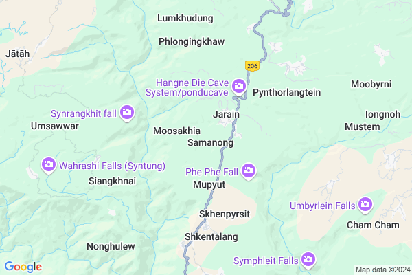
Samanong
Samanong Map
EDIT Map
Add Your House
 ..
..
Current Corona Virus Infected Patients Count in Jaintia Hills District
| City Name | District Name | Total Covid cases |
|---|
Locality Name :
Samanong
( समानोंग )
Block Name : Amlarem
District : Jaintia Hills
State : Meghalaya
Language : English and Khasi, Garo
Current Time 12:47 PM
Date: Tuesday , Apr 29,2025 (IST)
Time zone: IST (UTC+5:30)
Telephone Code / Std Code: 03653
Assembly constituency : Amlarem assembly constituency
Assembly MLA : stephanson mukhim
Lok Sabha constituency : Shillong parliamentary constituency
Parliament MP : VINCENT H. PALA
Serpanch Name :
Pin Code : 793150
Post Office Name : Jowai
Commodities Prices : Jowai Market / Mandi
National Highways Reachable To Samanong
Nationa High Way :NH6
Nationa High Way :NH6
Rivers Near Samanong
Simleng
Umngot
Simleng
Umngot
About Samanong
Correct below Info and add more info about SamanongSamanong is a Village in Amlarem Block in Jaintia Hills District of Meghalaya State, India. It is located 12 KM towards South from District head quarters Jowai. 20 KM from Amlarem. 39 KM from State capital Shillong
Samanong Pin code is 793150 and postal head office is Jowai .
Moosakhia ( 2 KM ) , Mupyut ( 2 KM ) , Madantyrpait ( 3 KM ) , Pynthorlangtein ( 5 KM ) , Shkentalang ( 5 KM ) are the nearby Villages to Samanong. Samanong is surrounded by Mawkynrew Block towards west , Amlarem Block towards South , Khliehriat Block towards East , Thadlaskein Block towards North .
Jowai , Shillong , Karimganj , Hailakandi are the near by Cities to Samanong.
This Place is in the border of the Jaintia Hills District and East Khasi Hills District. East Khasi Hills District Pynursla is west towards this place .
Samanong 2011 Census Details
Samanong Local Language is English. Samanong Village Total population is 199 and number of houses are 32. Female Population is 54.8%. Village literacy rate is 69.3% and the Female Literacy rate is 36.2%.
Population
| Census Parameter | Census Data |
| Total Population | 199 |
| Total No of Houses | 32 |
| Female Population % | 54.8 % ( 109) |
| Total Literacy rate % | 69.3 % ( 138) |
| Female Literacy rate | 36.2 % ( 72) |
| Scheduled Tribes Population % | 99.5 % ( 198) |
| Scheduled Caste Population % | 0.0 % ( 0) |
| Working Population % | 64.3 % |
| Child(0 -6) Population by 2011 | 39 |
| Girl Child(0 -6) Population % by 2011 | 69.2 % ( 27) |
Samanong Census More Deatils.
Politics in Samanong
UDP , Indian National Congress , INC are the major political parties in this area.Polling Stations /Booths near Samanong
1)Sankhad2)Lamin Shnong B (female)
3)Pynthorlangtein
4)Shkenpyrsit
5)Muktapur
HOW TO REACH Samanong
By Rail
There is no railway station near to Samanong in less than 10 km.Colleges near Samanong
Shangpung College
Address :
Schools in Samanong
Govt. Lps
Address : samanong , amlarem , jaintia hills , Meghalaya . PIN- 793150 , Post - Jowai
Govt Health Centers near Samanong
1) Mupyut SC , Mupyut Sub Centre , Jowai Amlarem road , Near Mupyut Village Road Entrance2) Mustem SC , Mustem SC , Mustem Main Road ,
3) Jarain PHC , Jarain PHC , Jowai Amlarem road , Near Football Field
Colleges in Samanong,Amlarem
Jowai Polytechnic
Ladthadlaboh; Near Kiang Nongbah Government College; West Jaintia Hills; Jowai; Meghalaya 793150; India
13.6 KM distance Detail
Martin Luther Christian University
Nongtalang Mission; Nongtalang Road; Nongtalang; Meghalaya 793109; India
22.7 KM distance Detail
more ..
Schools in Samanong,Amlarem
Amwi Jarain Secondery School Jarain
West Jaintia Hills; Meghalaya 793150; India
6.5 KM distance Detail
Khimusniang Presbyterian Secondary School Jowai
Jowai; Meghalaya 793150; India
10.3 KM distance Detail
North Liberty Higher Secondary School; Science Stream
Jowai; Meghalaya 793150; India
11.0 KM distance Detail
Khasi Jaintia Presbyterian Synod Mihngi Higher Secondary School
Chutwakhu Rd; Jowai; Meghalaya 793150; India
11.1 KM distance Detail
Super Markets in Samanong,Amlarem
Local Parks in Samanong,Amlarem
Panaliar Children's Park
Panaliar soccer field; Jowai; Meghalaya 793150; India
11.5 KM distance Detail
Police Stations near Samanong,Amlarem
Office Of The Commandant 3rd Meghalaya Police Indian Reserve Battalion Headquarter
West Jaintia Hills; Meghalaya 793151; India
13.6 KM distance Detail
About Samanong &
History
How to reach Samanong
Tourist Places Near By Samanong
Schools in Samanong
Colleges in Samanong
Temperature & weather of Samanong
places in Samanong
Samanong photos
More Information
How to reach Samanong
Tourist Places Near By Samanong
Schools in Samanong
Colleges in Samanong
Temperature & weather of Samanong
places in Samanong
Samanong photos
More Information
Village Talk
Post News or Events about this Village
Near Cities
Jowai 8 KM near
Shillong 39 KM near
Karimganj 66 KM near
Hailakandi 97 KM near
Jowai 8 KM near
Shillong 39 KM near
Karimganj 66 KM near
Hailakandi 97 KM near
Near By Taluks
Jowal 12 KM near
Mawkynrew 14 KM near
Amlarem 20 KM near
Khliehriat 23 KM near
Jowal 12 KM near
Mawkynrew 14 KM near
Amlarem 20 KM near
Khliehriat 23 KM near
Near By Air Ports
Shillong Airport 37 KM near
Kumbhirgram Airport 110 KM near
Borjhar Airport 110 KM near
Salonibari Airport 182 KM near
Shillong Airport 37 KM near
Kumbhirgram Airport 110 KM near
Borjhar Airport 110 KM near
Salonibari Airport 182 KM near
Near By Tourist Places
Jowai 11 KM near
Shillong 38 KM near
Cherrapunjee 50 KM near
Karimganj 68 KM near
Nongpoh 72 KM near
Jowai 11 KM near
Shillong 38 KM near
Cherrapunjee 50 KM near
Karimganj 68 KM near
Nongpoh 72 KM near
Near By Districts
Jaintia Hills 11 KM near
East Khasi Hills 37 KM near
Karimganj 66 KM near
Ri Bhoi 72 KM near
Jaintia Hills 11 KM near
East Khasi Hills 37 KM near
Karimganj 66 KM near
Ri Bhoi 72 KM near
Near By RailWay Station
Badarpur Junction Rail Way Station 78 KM near
Jagi Road Rail Way Station 94 KM near
Badarpur Junction Rail Way Station 78 KM near
Jagi Road Rail Way Station 94 KM near