| Home | City Bus | Maps | Villages | Cities | Rail | Tourist Places | School | College | Pin Codes | Corona Cases Count |
| Distance Calculator Bus Services IFSC Codes Trace Mobile Number Weather Search Place Trace IP Available Cash ATM/Banks Locate Polling Booth Report an Error contact People |
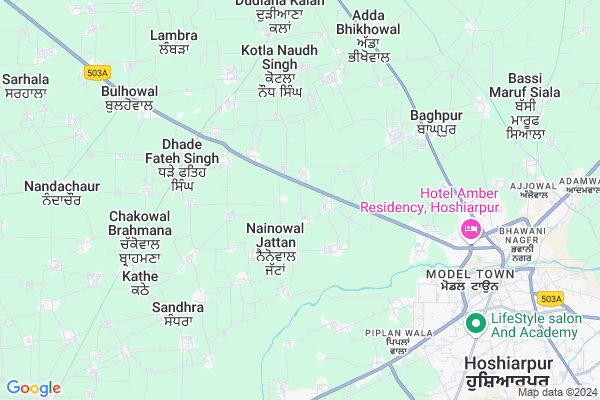
Pathial
Pathial Map
EDIT Map
Add Your House
 ..
..
Current Corona Virus Infected Patients Count in Hoshiarpur District
| City Name | District Name | Total Covid cases |
|---|---|---|
| Hoshiarpur District | Hoshiarpur | 5 |
| Garhshankar | Hoshiarpur | 2 |
Locality Name :
Pathial
( ਪੈਥੀਅਲ )
Tehsil Name : Hoshiarpur-i
District : Hoshiarpur
State : Punjab
Language : Punjabi and Hindi
Current Time 11:10 AM
Date: Monday , Apr 28,2025 (IST)
Time zone: IST (UTC+5:30)
Elevation / Altitude: 296 meters. Above Seal level
Telephone Code / Std Code: 01886
Assembly constituency : Sham Chaurasi assembly constituency
Assembly MLA : Dr.Ravjot Singh
Lok Sabha constituency : Hoshiarpur parliamentary constituency
Parliament MP : SOM PARKASH
Serpanch Name :
Commodities Prices : Hoshiarpur Market / Mandi
Pathial Live Weather
Temperature: 38.0 °C
clear sky
Humidity: 8%
Wind : 5.48 mt/sec towards S
StationName : "HariÄ\u0081na"
observed on 31 Mins Back
Temperature: 38.0 °C
clear sky
Humidity: 8%
Wind : 5.48 mt/sec towards S
StationName : "HariÄ\u0081na"
observed on 31 Mins Back
Pathial Weather Forecast for Next 5 days
29-04-2025
27.5°C to 41.9°C
clear sky
27.5°C to 41.9°C
clear sky
30-04-2025
25.8°C to 43.2°C
clear sky
25.8°C to 43.2°C
clear sky
01-05-2025
26.0°C to 43.0°C
clear sky
26.0°C to 43.0°C
clear sky
02-05-2025
27.5°C to 42.4°C
clear sky, scattered clouds, overcast clouds
27.5°C to 42.4°C
clear sky, scattered clouds, overcast clouds
03-05-2025
26.4°C to 39.3°C
broken clouds, overcast clouds, clear sky
26.4°C to 39.3°C
broken clouds, overcast clouds, clear sky
National Highways Reachable To Pathial
Nationa High Way :NH3
Nationa High Way :NH103A
Nationa High Way :NH3
Nationa High Way :NH103A
Rivers Near Pathial
Kanjali River
Swan
Kanjali River
Swan
About Pathial
Correct below Info and add more info about PathialPathial is a Village in Hoshiarpur-i Tehsil in Hoshiarpur District of Punjab State, India. It is located 8 KM towards west from District head quarters Hoshiarpur. 2 KM from Hoshiarpur-I. 149 KM from State capital Chandigarh
Asalpur ( 1 KM ) , Nainowal Jattan ( 2 KM ) , Chakowal Shekhan ( 2 KM ) , Pandori Khajoor ( 2 KM ) , Golind ( 2 KM ) are the nearby Villages to Pathial. Pathial is surrounded by Hoshiarpur-Ii Tehsil towards South , Bhunga Tehsil towards North , Adampur Tehsil towards South , Bhogpur Tehsil towards west .
Hoshiarpur , Urmar Tanda , Dasua , Jalandhar are the near by Cities to Pathial.
Pathial 2011 Census Details
Pathial Local Language is Punjabi. Pathial Village Total population is 748 and number of houses are 159. Female Population is 49.1%. Village literacy rate is 80.5% and the Female Literacy rate is 38.0%.
Population
| Census Parameter | Census Data |
| Total Population | 748 |
| Total No of Houses | 159 |
| Female Population % | 49.1 % ( 367) |
| Total Literacy rate % | 80.5 % ( 602) |
| Female Literacy rate | 38.0 % ( 284) |
| Scheduled Tribes Population % | 0.0 % ( 0) |
| Scheduled Caste Population % | 32.4 % ( 242) |
| Working Population % | 31.0 % |
| Child(0 -6) Population by 2011 | 68 |
| Girl Child(0 -6) Population % by 2011 | 48.5 % ( 33) |
Pathial Census More Deatils.
Politics in Pathial
Bharatiya Janata Party , SAD , INC are the major political parties in this area.Polling Stations /Booths near Pathial
1)Govt.elem.school Arniala Shahpur2)Govt.elem.school Kunta
3)Govt.sr.sec.school Mehngrowal
4)Govt.ele.school Badowal
5)Govt.elem.school Goraya
HOW TO REACH Pathial
By Rail
Hoshiarpur Rail Way Station , Nasrala Rail Way Station are the very nearby railway stations to Pathial.Pincodes near Pathial
146001 ( Hoshiarpur ) , 146113 ( Bulhowal ) , 146114 ( Nandachaur )Colleges near Pathial
Sant Shardha Ram Degree College For Women
Address :
Govt College Hoshiarpur
Address :
Param Dayal Public School
Address :
Schools in Pathial
Gsss Pathial
Address : pathial , hsp 1 , hoshiarpur , Punjab . PIN- 146000
Govt Health Centers near Pathial
1) Pathial , SC Pathial , Vill. Pathial Vill. Nainowal Jattan , Near Angarwari centre2) Sataur , SC Sataur , V.P.O Sataur , Near Ravidass Gurudawara Sahib
3) Fatehpur , SC Fatehpur , Vill. Fatehpur P.O Bullowal , Near Baba Jhanda Sahib
Colleges in Pathial,Hoshiarpur-i
G.E.S. Polytechnic College
01;Hoshiarpur;Vill-Lohar Kangana; Nainowal Jattan;Tanda Road; Jalandar; Punjab 146001; India
0.9 KM distance Detail
Hoshiarpur Institute of Management & Technology; Hoshiarpur
SH24; Punjab 146001; India
5.7 KM distance Detail
Guru Ram Dass Nursing Hospital
Tagore Nagar; Hoshiarpur; Punjab 146001; India
5.9 KM distance Detail
more ..
Schools in Pathial,Hoshiarpur-i
Sri Guru Harkrishan Sen. Sec. Public school Pandori khajoor
Hoshiarpur; Punjab 146001; India
1.7 KM distance Detail
THE TRINITY SCHOOL
Asalpur; Nainowal Jattan; Hoshiarpur; Punjab 247667; India
2.1 KM distance Detail
Super Markets in Pathial,Hoshiarpur-i
Guru Nanak Sanitary Store
New Deshmesh Nagar; Hoshiarpur; Punjab 146001; India
6.7 KM distance Detail
More
Gogia Sons Complex; Near Presidency Hotel; Jalandhar Road; Hoshiarpur; Punjab 146001; India
7.7 KM distance Detail
M/S Mangi Motor
Sanyay Nagar; Near Valmiki Murti; Hoshiarpur; Punjab 146001; India
7.7 KM distance Detail
Police Stations near Pathial,Hoshiarpur-i
Police Station Model Town; Hoshiarpur
Model colony; Hoshiarpur; Punjab 146001; India
7.3 KM distance Detail
Model Town Police Station
Roshan Rd; Near Bus Stand; Hoshiarpur; Punjab 146001; India
7.3 KM distance Detail
Singribala
Jalandhar Rd; Tulsi Nagar; Kamalpur; Hoshiarpur; Punjab 146001; India
7.7 KM distance Detail
Governement Offices near Pathial,Hoshiarpur-i
Kandi Watershed Drainage Division
Balwant Singh Bajwa Marg; Tagore Nagar; Hoshiarpur; Punjab 146001; India
6.5 KM distance Detail
Om Logistics Limited
Village Singriwala; Railway Road; Railway Road; Hoshiarpur; Punjab 146001; India
6.9 KM distance Detail
About Pathial &
History
How to reach Pathial
Tourist Places Near By Pathial
Schools in Pathial
Colleges in Pathial
Temperature & weather of Pathial
places in Pathial
Pathial photos
More Information
How to reach Pathial
Tourist Places Near By Pathial
Schools in Pathial
Colleges in Pathial
Temperature & weather of Pathial
places in Pathial
Pathial photos
More Information
Village Talk
Post News or Events about this Village
Near Cities
Hoshiarpur 8 KM near
Urmar Tanda 27 KM near
Dasua 37 KM near
Jalandhar 38 KM near
Hoshiarpur 8 KM near
Urmar Tanda 27 KM near
Dasua 37 KM near
Jalandhar 38 KM near
Near By Taluks
Hoshiarpur-I 2 KM near
Hoshiarpur-Ii 17 KM near
Bhunga 18 KM near
Adampur 21 KM near
Hoshiarpur-I 2 KM near
Hoshiarpur-Ii 17 KM near
Bhunga 18 KM near
Adampur 21 KM near
Near By Air Ports
Ludhiana Airport 82 KM near
Pathankot Airport 84 KM near
Gaggal Airport 102 KM near
Raja Sansi Airport 111 KM near
Ludhiana Airport 82 KM near
Pathankot Airport 84 KM near
Gaggal Airport 102 KM near
Raja Sansi Airport 111 KM near
Near By Tourist Places
Hoshiarpur 9 KM near
Jalandhar 38 KM near
Una 47 KM near
Kapurthala 53 KM near
Nawanshehar 61 KM near
Hoshiarpur 9 KM near
Jalandhar 38 KM near
Una 47 KM near
Kapurthala 53 KM near
Nawanshehar 61 KM near
Near By Districts
Hoshiarpur 8 KM near
Jalandhar 39 KM near
Una 47 KM near
Kapurthala 55 KM near
Hoshiarpur 8 KM near
Jalandhar 39 KM near
Una 47 KM near
Kapurthala 55 KM near
Near By RailWay Station
Hoshiarpur Rail Way Station 8.5 KM near
Tanda Urmar Rail Way Station 25 KM near
Dasuya Rail Way Station 36 KM near
Hoshiarpur Rail Way Station 8.5 KM near
Tanda Urmar Rail Way Station 25 KM near
Dasuya Rail Way Station 36 KM near