| Home | City Bus | Maps | Villages | Cities | Rail | Tourist Places | School | College | Pin Codes | Corona Cases Count |
| Distance Calculator Bus Services IFSC Codes Trace Mobile Number Weather Search Place Trace IP Available Cash ATM/Banks Locate Polling Booth Report an Error contact People |
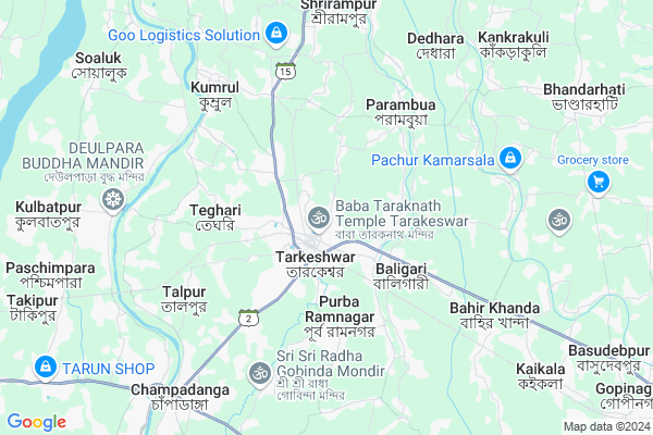
Bhanjipur
Bhanjipur Map
EDIT Map
Add Your House
 ..
..
Current Corona Virus Infected Patients Count in Hooghly District
| City Name | District Name | Total Covid cases |
|---|---|---|
| Hooghly District | Hooghly | 1 |
Locality Name :
Bhanjipur
( ভাঁজিপুর )
Block Name : Tarakeswar
District : Hooghly
State : West Bengal
Division : Burdwan
Language : Bengali
Current Time 11:27 AM
Date: Tuesday , Apr 29,2025 (IST)
Time zone: IST (UTC+5:30)
Elevation / Altitude: 16 meters. Above Seal level
Telephone Code / Std Code: 03212
Assembly constituency : Tarakeswar assembly constituency
Assembly MLA : Ramendu Sinharay
Lok Sabha constituency : Arambagh parliamentary constituency
Parliament MP : APARUPA PODDAR (AFRIN ALI)
Serpanch Name :
Pin Code : 712410
Post Office Name : Tarakeswar
Commodities Prices : Champadanga Market / Mandi
Bhanjipur Live Weather
Temperature: 30.2 °C
clear sky
Humidity: 51%
Wind : 1.98 mt/sec towards E
StationName : "Tarakeswar"
observed on 2 Hours Back
Temperature: 30.2 °C
clear sky
Humidity: 51%
Wind : 1.98 mt/sec towards E
StationName : "Tarakeswar"
observed on 2 Hours Back
Bhanjipur Weather Forecast for Next 5 days
30-04-2025
23.6°C to 37.0°C
clear sky, light rain, moderate rain, scattered clouds, broken clouds
23.6°C to 37.0°C
clear sky, light rain, moderate rain, scattered clouds, broken clouds
01-05-2025
23.2°C to 35.0°C
broken clouds, clear sky, light rain, moderate rain, overcast clouds
23.2°C to 35.0°C
broken clouds, clear sky, light rain, moderate rain, overcast clouds
02-05-2025
23.4°C to 36.7°C
broken clouds, clear sky, few clouds, scattered clouds, heavy intensity rain, light rain, overcast clouds
23.4°C to 36.7°C
broken clouds, clear sky, few clouds, scattered clouds, heavy intensity rain, light rain, overcast clouds
03-05-2025
24.2°C to 36.6°C
light rain, broken clouds, few clouds, scattered clouds
24.2°C to 36.6°C
light rain, broken clouds, few clouds, scattered clouds
04-05-2025
25.6°C to 35.3°C
scattered clouds, clear sky, light rain, broken clouds, few clouds
25.6°C to 35.3°C
scattered clouds, clear sky, light rain, broken clouds, few clouds
National Highways Reachable To Bhanjipur
Nationa High Way :NH19
Nationa High Way :NH19
Rivers Near Bhanjipur
Dwarakeshwar
Jamuna River
Dwarakeshwar
Jamuna River
About Bhanjipur
Correct below Info and add more info about BhanjipurBhanjipur is a Village in Tarakeswar Block in Hooghly District of West Bengal State, India. It belongs to Burdwan Division . It is located 45 KM towards west from District head quarters Hugli-chuchura. 1 KM from Tarakeswar. 58 KM from State capital Kolkata
Bhanjipur Pin code is 712410 and postal head office is Tarakeswar .
Tarakeswar ( 1 KM ) , Vivekananda Palli ( 1 KM ) , Santoshpur ( 4 KM ) , Purbaramnagar ( 4 KM ) , Shyampur ( 5 KM ) are the nearby Villages to Bhanjipur. Bhanjipur is surrounded by Pursurah Block towards west , Haripal Block towards East , Dhaniakhali Block towards East , Jangipara Block towards South .
Tarakeswar , Arambagh , Pandua , Memari are the near by Cities to Bhanjipur.
This Place is in the border of the Hooghly District and Bardhaman District. Bardhaman District Raina-ii is west towards this place . Also it is in the Border of other district Howrah .
Demographics of Bhanjipur
Bengali is the Local Language here.Politics in Bhanjipur
CPM , AITC , BJP , All India Trinamool Congress , INC are the major political parties in this area.Polling Stations /Booths near Bhanjipur
1)Tarakeswar Girls Pry. School.2)Tarakeshwar High School
3)Tarakeswar Vidya Mandir
4)Tarakeswar High School
5)Tarakeswar High School
HOW TO REACH Bhanjipur
By Rail
Tarakeswar Rail Way Station , Loknath Rail Way Station are the very nearby railway stations to Bhanjipur.Colleges near Bhanjipur
Bejoy Krishna College
Address :
Modern Institute Of Engineering And Technology
Address :
Hooghly Mohsin College
Address :
Schools near Bhanjipur
Kshudrarampur High School
Address : malpaharpur-ii , tarakashwar , hugli , West Bengal . PIN- 712401 , Post - Champadanga
Moheshpur High School
Address : baligori-ii/iv , tarakashwar , hugli , West Bengal . PIN- 712403 , Post - Haripal
Muktarpurhigh School
Address : talpur-xi , tarakashwar , hugli , West Bengal . PIN- 712401 , Post - Champadanga
Mozepur Bharati Vidyamandir
Address : astara-duttapur-vii , tarakashwar , hugli , West Bengal . PIN- 712410 , Post - Tarakeswar
Govt Health Centers near Bhanjipur
1) Bhanjipur SC , Bhanjipur Sub Centre , Purba Bhanjipur Khaler Bandh , Bhanjipur G.p2) Howli SC , Howli Club Building , Howli Sainta Road , Howli Chhelekalitala
3) Bhata SC , Bhata Sub Centre , Tarakeswar Bhata Road , Near Bhata Mansha Mandir
Colleges in Bhanjipur,Tarakeswar
G. N. M. School Of Nursing
Shop No. 3; Tarakeshwar J. K. Bazar; Near Tarkeshwar Bus Stand;; Kolkata; West Bengal 712410; India
1.6 KM distance Detail
Tarakeswar Degree Collage Indore Stadium
Guriabhata; Sahapur P; West Bengal 712410; India
1.9 KM distance Detail
Netaji Subhas Open University
Guriabhata; Sahapur P; West Bengal 712410; India
1.9 KM distance Detail
Monimohes Drama Centure&Pankojini Tetorial
Guriabhata; Sahapur P; West Bengal 712410; India
1.9 KM distance Detail
more ..
Schools in Bhanjipur,Tarakeswar
Bhanjipur Deshbandhu BIDYANIKETAN High School
Guest House Rd; Bhanjipur; West Bengal 712410; India
0.5 KM distance Detail
Kendriya Vidyalaya Tarakeswar
Guest House Rd; Tarakeswar; Hooghly; Bhanjipur; West Bengal 712410; India
0.7 KM distance Detail
Taraknath Tailoring & Lady Brabourne School
Kayra Bhavan; Guest House Rd; Bhanjipur; West Bengal 712410; India
0.8 KM distance Detail
Electronic Shops in Bhanjipur,Tarakeswar
Goswami Computers
Noton Bazar; Shop-16; Sonar Kuthi; Tarakeswar; Hooghly; Hooghly; West Bengal 712410; India
0.9 KM distance Detail
BHOLANATH ELECTRONICS (SEAL & SERVICE)
Mandir Rd; Tarkeshwar; West Bengal 712410; India
0.9 KM distance Detail
Governement Offices near Bhanjipur,Tarakeswar
Office Of The ADSR; Tarkeshwar
Saradapally; Tarkeshwar; West Bengal 712410; India
1.5 KM distance Detail
About Bhanjipur &
History
How to reach Bhanjipur
Tourist Places Near By Bhanjipur
Schools in Bhanjipur
Colleges in Bhanjipur
Temperature & weather of Bhanjipur
places in Bhanjipur
Bhanjipur photos
More Information
How to reach Bhanjipur
Tourist Places Near By Bhanjipur
Schools in Bhanjipur
Colleges in Bhanjipur
Temperature & weather of Bhanjipur
places in Bhanjipur
Bhanjipur photos
More Information
Village Talk
Post News or Events about this Village
Near Cities
Tarakeswar 0 KM near
Arambagh 26 KM near
Pandua 37 KM near
Memari 40 KM near
Tarakeswar 0 KM near
Arambagh 26 KM near
Pandua 37 KM near
Memari 40 KM near
Near By Taluks
Tarakeswar 1 KM near
Pursurah 8 KM near
Haripal 11 KM near
Dhaniakhali 13 KM near
Tarakeswar 1 KM near
Pursurah 8 KM near
Haripal 11 KM near
Dhaniakhali 13 KM near
Near By Air Ports
Netaji Subhas Chandra Bose Airport 56 KM near
Ranchi Airport 313 KM near
Singerbhil Airport 389 KM near
Bhubaneswar Airport 415 KM near
Netaji Subhas Chandra Bose Airport 56 KM near
Ranchi Airport 313 KM near
Singerbhil Airport 389 KM near
Bhubaneswar Airport 415 KM near
Near By Tourist Places
Shankarpur 35 KM near
Jairambati 45 KM near
Howrah 46 KM near
Bardhaman 47 KM near
Burdwan 47 KM near
Shankarpur 35 KM near
Jairambati 45 KM near
Howrah 46 KM near
Bardhaman 47 KM near
Burdwan 47 KM near
Near By Districts
Hooghly 42 KM near
Bardhaman 48 KM near
Howrah 50 KM near
24 Paraganas North 57 KM near
Hooghly 42 KM near
Bardhaman 48 KM near
Howrah 50 KM near
24 Paraganas North 57 KM near
Near By RailWay Station
Tarakeswar Rail Way Station 1.3 KM near
Loknath Rail Way Station 2.9 KM near
Tilakpur Rail Way Station 7.5 KM near
Seoraphuli Junction Rail Way Station 38 KM near
Bandel Junction Rail Way Station 41 KM near
Tarakeswar Rail Way Station 1.3 KM near
Loknath Rail Way Station 2.9 KM near
Tilakpur Rail Way Station 7.5 KM near
Seoraphuli Junction Rail Way Station 38 KM near
Bandel Junction Rail Way Station 41 KM near