| Home | City Bus | Maps | Villages | Cities | Rail | Tourist Places | School | College | Pin Codes | Corona Cases Count |
| Distance Calculator Bus Services IFSC Codes Trace Mobile Number Weather Search Place Trace IP Available Cash ATM/Banks Locate Polling Booth Report an Error contact People |
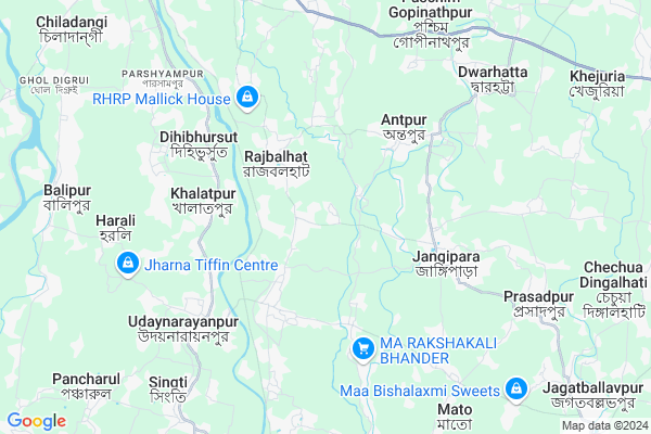
Nabagram
Nabagram Map
EDIT Map
Add Your House
 ..
..
Current Corona Virus Infected Patients Count in Hooghly District
| City Name | District Name | Total Covid cases |
|---|---|---|
| Hooghly District | Hooghly | 1 |
Locality Name :
Nabagram
( নবগ্রাম )
Block Name : Sirampur-uttarpara
District : Hooghly
State : West Bengal
Division : Burdwan
Language : Bengali
Current Time 10:43 AM
Date: Friday , Apr 25,2025 (IST)
Time zone: IST (UTC+5:30)
Elevation / Altitude: 9 meters. Above Seal level
Telephone Code / Std Code: 033
Assembly constituency : Jangipara assembly constituency
Assembly MLA : Snehasis Chakraborty
Lok Sabha constituency : Serampore parliamentary constituency
Parliament MP : KALYAN BANERJEE
Serpanch Name :
Pin Code : 712246
Post Office Name : Nabagram (Hooghly)
Commodities Prices : Champadanga Market / Mandi
National Highways Reachable To Nabagram
Nationa High Way :NH19
Nationa High Way :NH12
Nationa High Way :NH19
Nationa High Way :NH12
About Nabagram
Correct below Info and add more info about NabagramNabagram is a Village in Sirampur-uttarpara Block in Hooghly District of West Bengal State, India. It belongs to Burdwan Division . It is located 48 KM towards west from District head quarters Hugli-chuchura. 37 KM from Sirampur-Uttarpara. 47 KM from State capital Kolkata
Nabagram Pin code is 712246 and postal head office is Nabagram (Hooghly).
Rajbalhat-i ( 2 KM ) , Rasidpur ( 3 KM ) , Antpur ( 4 KM ) , Dilakash ( 4 KM ) , Jangipara ( 4 KM ) are the nearby Villages to Nabagram. Nabagram is surrounded by Udaynarayanpur Block towards South , Pursurah Block towards North , Haripal Block towards North , Tarakeswar Block towards North .
Tarakeswar , Panchla , Arambagh , Monoharpur are the near by Cities to Nabagram.
This Place is in the border of the Hooghly District and 24 Paraganas North District. 24 Paraganas North District Madhyamgram is East towards this place . Also it is in the Border of other district Howrah .
Demographics of Nabagram
Bengali is the Local Language here.Politics in Nabagram
CPM , CPI(M) , AITC , All India Trinamool Congress are the major political parties in this area.Polling Stations /Booths near Nabagram
1)Mundalika Prathamik Bidyalay - Room - 22)Nabagram Elokeshi Prathamik Bidyalay - Room - 1
3)Nabagram Elokeshi Prathamik Bidyalay - Room - 2
4)Antpur Uchha Bidyalay(hallghar) -room - 1
5)Radhanagar Prathamik Bidyalay - Room - 4
HOW TO REACH Nabagram
By Rail
There is no railway station near to Nabagram in less than 10 km.Colleges near Nabagram
Bejoy Krishna College
Address :
Modern Institute Of Engineering And Technology
Address :
Hooghly Mohsin College
Address :
Schools near Nabagram
Uttarpara Childreans Own Home
Address : ward no.-xiv , uttarpara kotrang , hugli , West Bengal . PIN- 712258 , Post - Uttarpara
Dream Land School
Address : ward no.-xxii , uttarpara kotrang , hugli , West Bengal . PIN- 712245 , Post - Makhla
Uttarpara Amarendra Girls
Address : ward no.-xv , uttarpara kotrang , hugli , West Bengal . PIN- 712258 , Post - Uttarpara
Raghunathpur Balika Vidyalaya
Address : raghunathpur-iv , serampur-uttarpara , hugli , West Bengal . PIN- 712247 , Post - Raghunathpur (Hooghly)
Govt Health Centers near Nabagram
1) Chaiman Chak SC , Chaiman Chak Sub-Centre , Antpur , Near Tarajal Bus Stand2) Rajbolhat PHC , Rajbalhat Primary Health Centre , Rajbalhat-II , Near Dighir Ghat
3) Ajodhya SC , Ajodhya Sub-Centre , Jangipara , Near Ajodhya Pole
Schools in Nabagram,Sirampur-uttarpara
Rahimpur Nabagram Primary School
Paschimpara Rd; Rahimpur; West Bengal 712408; India
1.1 KM distance Detail
Electronic Shops in Nabagram,Sirampur-uttarpara
Paul Electronics & Telecom
Baroary Tola Rd; Nabagram; West Bengal 712408; India
0.8 KM distance Detail
Police Stations near Nabagram,Sirampur-uttarpara
Jagatballavpur Police Station
SH-15; Howrah- Domjur- Bargachhia- Amta Road; Howrah; West Bengal 711408; India
4.6 KM distance Detail
Udaynarayanpur Police Station
Harali-Udaynarayanpur Road; Near BDO Office; Udaynarayanpur; West Bengal 711226; India
6.0 KM distance Detail
Governement Offices near Nabagram,Sirampur-uttarpara
Marriage Registration Office
Udaynarayanpur-Jagatballabhpur 1; Guti Singti; West Bengal 712408; India
4.1 KM distance Detail
About Nabagram &
History
How to reach Nabagram
Tourist Places Near By Nabagram
Schools in Nabagram
Colleges in Nabagram
Temperature & weather of Nabagram
places in Nabagram
Nabagram photos
More Information
How to reach Nabagram
Tourist Places Near By Nabagram
Schools in Nabagram
Colleges in Nabagram
Temperature & weather of Nabagram
places in Nabagram
Nabagram photos
More Information
Village Talk
Post News or Events about this Village
Near Cities
Tarakeswar 17 KM near
Panchla 29 KM near
Arambagh 31 KM near
Monoharpur 33 KM near
Tarakeswar 17 KM near
Panchla 29 KM near
Arambagh 31 KM near
Monoharpur 33 KM near
Near By Taluks
Jangipara 2 KM near
Udaynarayanpur 10 KM near
Pursurah 14 KM near
Haripal 15 KM near
Jangipara 2 KM near
Udaynarayanpur 10 KM near
Pursurah 14 KM near
Haripal 15 KM near
Near By Air Ports
Netaji Subhas Chandra Bose Airport 49 KM near
Ranchi Airport 317 KM near
Singerbhil Airport 395 KM near
Bhubaneswar Airport 402 KM near
Netaji Subhas Chandra Bose Airport 49 KM near
Ranchi Airport 317 KM near
Singerbhil Airport 395 KM near
Bhubaneswar Airport 402 KM near
Near By Tourist Places
Shankarpur 27 KM near
Howrah 33 KM near
Alipore 44 KM near
Kolkata 45 KM near
Jairambati 49 KM near
Shankarpur 27 KM near
Howrah 33 KM near
Alipore 44 KM near
Kolkata 45 KM near
Jairambati 49 KM near
Near By Districts
Howrah 39 KM near
Kolkata 46 KM near
Hooghly 46 KM near
24 Paraganas South 51 KM near
Howrah 39 KM near
Kolkata 46 KM near
Hooghly 46 KM near
24 Paraganas South 51 KM near
Near By RailWay Station
Seoraphuli Junction Rail Way Station 35 KM near
Uluberia Rail Way Station 35 KM near
Seoraphuli Junction Rail Way Station 35 KM near
Uluberia Rail Way Station 35 KM near