| Home | City Bus | Maps | Villages | Cities | Rail | Tourist Places | School | College | Pin Codes | Corona Cases Count |
| Distance Calculator Bus Services IFSC Codes Trace Mobile Number Weather Search Place Trace IP Available Cash ATM/Banks Locate Polling Booth Report an Error contact People |
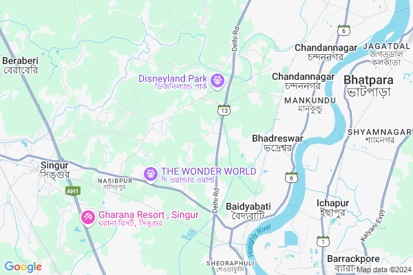
Bighati
Bighati Map
EDIT Map
Add Your House
 ..
..
Current Corona Virus Infected Patients Count in Hooghly District
| City Name | District Name | Total Covid cases |
|---|---|---|
| Hooghly District | Hooghly | 1 |
Locality Name :
Bighati
( বিঘাতী )
Block Name : Singur
District : Hooghly
State : West Bengal
Division : Burdwan
Language : Bengali
Current Time 07:27 AM
Date: Saturday , Apr 26,2025 (IST)
Time zone: IST (UTC+5:30)
Elevation / Altitude: 16 meters. Above Seal level
Telephone Code / Std Code: 03214
Assembly constituency : Singur assembly constituency
Assembly MLA : Becharam Manna
Lok Sabha constituency : Hooghly parliamentary constituency
Parliament MP : LOCKET CHATTERJEE
Serpanch Name :
Pin Code : 712124
Post Office Name : K G R S Path
Commodities Prices : Sheoraphuly Market / Mandi
Bighati Live Weather
Temperature: 29.0 °C
clear sky
Humidity: 76%
Wind : 7.31 mt/sec towards S
StationName : "Baidyabati"
observed on 28 Mins Back
Temperature: 29.0 °C
clear sky
Humidity: 76%
Wind : 7.31 mt/sec towards S
StationName : "Baidyabati"
observed on 28 Mins Back
Bighati Weather Forecast for Next 5 days
27-04-2025
27.2°C to 40.7°C
clear sky, scattered clouds
27.2°C to 40.7°C
clear sky, scattered clouds
28-04-2025
27.2°C to 40.3°C
broken clouds, overcast clouds, light rain
27.2°C to 40.3°C
broken clouds, overcast clouds, light rain
29-04-2025
23.2°C to 39.0°C
light rain, overcast clouds, broken clouds, scattered clouds, moderate rain
23.2°C to 39.0°C
light rain, overcast clouds, broken clouds, scattered clouds, moderate rain
30-04-2025
22.5°C to 34.7°C
broken clouds, clear sky, few clouds, heavy intensity rain, light rain, overcast clouds
22.5°C to 34.7°C
broken clouds, clear sky, few clouds, heavy intensity rain, light rain, overcast clouds
01-05-2025
22.2°C to 34.7°C
broken clouds, few clouds, scattered clouds, light rain, moderate rain
22.2°C to 34.7°C
broken clouds, few clouds, scattered clouds, light rain, moderate rain
National Highways Reachable To Bighati
Nationa High Way :NH19
Nationa High Way :NH112
Nationa High Way :NH19
Nationa High Way :NH112
Rivers Near Bighati
Damodar
Damodar
About Bighati
Correct below Info and add more info about BighatiBighati is a Village in Singur Block in Hooghly District of West Bengal State, India. It belongs to Burdwan Division . It is located 13 KM towards west from District head quarters Hugli-chuchura. 10 KM from Singur. 33 KM from State capital Kolkata
Bighati Pin code is 712124 and postal head office is K G R S Path .
Anandanagar ( 6 KM ) , Bainchipota ( 6 KM ) , Bora ( 9 KM ) , Singur ( 9 KM ) , Rajyadharpur ( 10 KM ) are the nearby Villages to Bighati. Bighati is surrounded by Chinsurah Block towards North , Sirampur-Uttarpara Block towards South , Barrackpur-Ii Block towards East , Polba-Dadpur Block towards North .
Chandannagar , Barrackpur , Bhatpara , Chinsura are the near by Cities to Bighati.
This Place is in the border of the Hooghly District and Howrah District. Howrah District Jagatballavpur is South towards this place .
Bighati 2011 Census Details
Bighati Local Language is Bengali. Bighati Village Total population is 4388 and number of houses are 1024. Female Population is 48.2%. Village literacy rate is 78.6% and the Female Literacy rate is 35.9%.
Population
| Census Parameter | Census Data |
| Total Population | 4388 |
| Total No of Houses | 1024 |
| Female Population % | 48.2 % ( 2117) |
| Total Literacy rate % | 78.6 % ( 3450) |
| Female Literacy rate | 35.9 % ( 1577) |
| Scheduled Tribes Population % | 0.3 % ( 11) |
| Scheduled Caste Population % | 18.2 % ( 800) |
| Working Population % | 37.3 % |
| Child(0 -6) Population by 2011 | 332 |
| Girl Child(0 -6) Population % by 2011 | 47.9 % ( 159) |
Bighati Census More Deatils.
Politics in Bighati
CPM , Bharatiya Janata Party , CPI(M) , AITC are the major political parties in this area.Polling Stations /Booths near Bighati
1)Singur Golapmohini Mallick Primary School2)Dhitara Primary School R-2
3)Dhobapukur Primary School R-1
4)Mahattampara Icds Centre
5)Mallickpur Primary School R-2
HOW TO REACH Bighati
By Rail
Bhadreshwar Rail Way Station , Mankundu Rail Way Station are the very nearby railway stations to Bighati.Colleges near Bighati
Bejoy Krishna College
Address :
Modern Institute Of Engineering And Technology
Address :
Hooghly Mohsin College
Address :
Schools near Bighati
Jogamaya Memorial Ins
Address : singur-ii/xiv , singur , hugli , West Bengal . PIN- 712409 , Post - Singur
Gopalnagore Menaka Sundaki Gs
Address : singur-ii/v , singur , hugli , West Bengal . PIN- 712249 , Post - Prabasnagar
Gopalnagore High School
Address : gopalnagore-xi , singur , hugli , West Bengal . PIN- 712409 , Post - Singur
Bora Madhusudan Balika Vidyala
Address : bora-i , singur , hugli , West Bengal . PIN- 712306 , Post - Begampur (Hooghly)
Govt Health Centers near Bighati
1) Bighati GPSC , Bighati G.P Sub Center , Bighati Linc Road , Bighati Kishori Mohan High School (Near Delhi Road)2) Palarah SC , Palarah Sub Center , Laha Road , Palarah Rasbihari Club Laha Road
3) Bighati SC , Bighati Gram Panchyat , Bhadreswar Station Road , Bighati Gram Panchyat
Hospitals in Bighati,Singur
Homiopathy Doctor
Aparna Blouse Centre near e-Computer Service Center;; Aparna Blouse Centre; Chhutipur; West Bengal; India
2.3 KM distance Detail
more ..
Petrol Bunks in Bighati,Singur
Chinsurah Court Motor Licence Office And Indian Oil Petrol Pump
Bighati; West Bengal 712124; India
0.9 KM distance Detail
Maa Mangal Chandi Fuel Station Bharat Petroleum
SH 13; Nowapara; West Bengal 712138; India
3.1 KM distance Detail
more ..
Colleges in Bighati,Singur
Netaji Subhash Agricultural Marketing Training Institute
Baidyabati; West Bengal 712222; India
4.9 KM distance Detail
Krishna Prasad Pal Memorial Teachers' Training College
Sheoraphuli; West Bengal 712223; India
6.5 KM distance Detail
ICA PMKK HINDMOTOR
49; Chatterjee Para Ln; Baidyapara; Kolkata; West Bengal 712223; India
6.8 KM distance Detail
B.ED COLLEGE NCTE Approved
1No. Rampada Halder Road; Beniapara; Barrackpore; Near Mahadevnanda College; Kolkata; West Bengal 700120; India
7.5 KM distance Detail
more ..
Schools in Bighati,Singur
KIDS' HEAVEN NURSERY SCHOLL
bhadreswar station road; Bighati; West Bengal 712124; India
1.1 KM distance Detail
Electronic Shops in Bighati,Singur
Invilink ( Broadband Office)
Bighati Road; Bighati; West Bengal 712124; India
0.5 KM distance Detail
Super Markets in Bighati,Singur
Ghosh Hardware
Bhadreswar Station Road; Sarada Pally; Mankundu; Dhitara; West Bengal 712124; India
3.5 KM distance Detail
Fish Market Palpara
222; Palpara Ln; Telinipara; Bhadreswar; West Bengal 712139; India
5.0 KM distance Detail
Local Parks in Bighati,Singur
Purbachal Pally park
Tarakeswar Pally; Purbachal Pally; Bhadreswar; West Bengal 712124; India
4.1 KM distance Detail
MAHILA MAHAL
12;Rishi Bankim Avenue; Station Road; Bhadreswar; West Bengal 712124; India
4.2 KM distance Detail
Police Stations near Bighati,Singur
Highways Police Quarter.
Supermarket; Baidyabati; hooghly. pin-712222; SH 2; Baidyabati; West Bengal 712222; India
5.1 KM distance Detail
Bhadreswar Police Station
Grand Trunk Road; Shantilly; Bhadreswar; West Bengal 712125; India
5.6 KM distance Detail
Chandannagore Traffic Guard
Barasat Banerjee Para Bye Lane; Tematha; Mankundu; Chandannagar; West Bengal 712139; India
6.3 KM distance Detail
Governement Offices near Bighati,Singur
CSC Tathya Mitra Kendra Chhutipur
Unnamed Rd;; Chhutipur; West Bengal 712124; India
2.3 KM distance Detail
About Bighati &
History
How to reach Bighati
Tourist Places Near By Bighati
Schools in Bighati
Colleges in Bighati
Temperature & weather of Bighati
places in Bighati
Bighati photos
More Information
How to reach Bighati
Tourist Places Near By Bighati
Schools in Bighati
Colleges in Bighati
Temperature & weather of Bighati
places in Bighati
Bighati photos
More Information
Village Talk
Post News or Events about this Village
Near Cities
Chandannagar 9 KM near
Barrackpur 11 KM near
Bhatpara 12 KM near
Chinsura 12 KM near
Chandannagar 9 KM near
Barrackpur 11 KM near
Bhatpara 12 KM near
Chinsura 12 KM near
Near By Taluks
Singur 9 KM near
Chinsurah 11 KM near
Sirampur-Uttarpara 11 KM near
Barrackpur-Ii 13 KM near
Singur 9 KM near
Chinsurah 11 KM near
Sirampur-Uttarpara 11 KM near
Barrackpur-Ii 13 KM near
Near By Air Ports
Netaji Subhas Chandra Bose Airport 27 KM near
Ranchi Airport 347 KM near
Singerbhil Airport 360 KM near
Bhubaneswar Airport 431 KM near
Netaji Subhas Chandra Bose Airport 27 KM near
Ranchi Airport 347 KM near
Singerbhil Airport 360 KM near
Bhubaneswar Airport 431 KM near
Near By Tourist Places
Howrah 29 KM near
Kolkata 32 KM near
Alipore 37 KM near
Shankarpur 61 KM near
Bardhaman 72 KM near
Howrah 29 KM near
Kolkata 32 KM near
Alipore 37 KM near
Shankarpur 61 KM near
Bardhaman 72 KM near
Near By Districts
Hooghly 12 KM near
24 Paraganas North 24 KM near
Howrah 30 KM near
Kolkata 38 KM near
Hooghly 12 KM near
24 Paraganas North 24 KM near
Howrah 30 KM near
Kolkata 38 KM near
Near By RailWay Station
Bhadreshwar Rail Way Station 3.8 KM near
Mankundu Rail Way Station 5.0 KM near
Baidyabati Rail Way Station 5.2 KM near
Seoraphuli Junction Rail Way Station 7 KM near
Bandel Junction Rail Way Station 13 KM near
Bhadreshwar Rail Way Station 3.8 KM near
Mankundu Rail Way Station 5.0 KM near
Baidyabati Rail Way Station 5.2 KM near
Seoraphuli Junction Rail Way Station 7 KM near
Bandel Junction Rail Way Station 13 KM near