| Home | City Bus | Maps | Villages | Cities | Rail | Tourist Places | School | College | Pin Codes | Corona Cases Count |
| Distance Calculator Bus Services IFSC Codes Trace Mobile Number Weather Search Place Trace IP Available Cash ATM/Banks Locate Polling Booth Report an Error contact People |
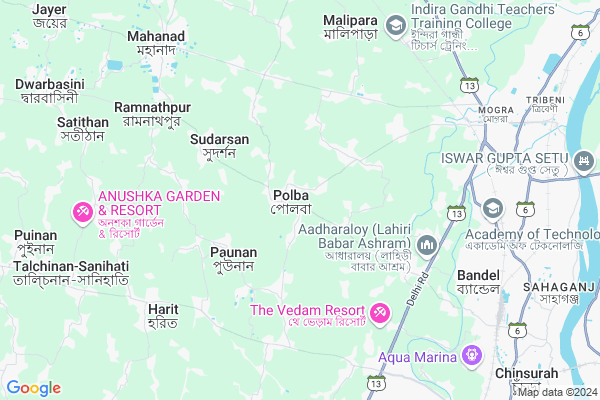
Polba
Polba Map
EDIT Map
Add Your House
 ..
..
Current Corona Virus Infected Patients Count in Hooghly District
| City Name | District Name | Total Covid cases |
|---|---|---|
| Hooghly District | Hooghly | 1 |
Locality Name :
Polba
( পেলব )
Block Name : Polba-dadpur
District : Hooghly
State : West Bengal
Division : Burdwan
Language : Bengali
Current Time 08:48 AM
Date: Wednesday , Apr 30,2025 (IST)
Time zone: IST (UTC+5:30)
Elevation / Altitude: 15 meters. Above Seal level
Telephone Code / Std Code: 03213
Assembly constituency : Saptagram assembly constituency
Assembly MLA : Tapan Dasgupta
Lok Sabha constituency : Hooghly parliamentary constituency
Parliament MP : LOCKET CHATTERJEE
Serpanch Name :
Pin Code : 712154
Post Office Name : Polba
Commodities Prices : Kalyani Market / Mandi
National Highways Reachable To Polba
Nationa High Way :NH19
Nationa High Way :NH19
Rivers Near Polba
Ichamati :ইছামতী নদী :Ichamati River
Bhagirathi :Hooghly River
Ichamati :ইছামতী নদী :Ichamati River
Bhagirathi :Hooghly River
About Polba
Correct below Info and add more info about PolbaPolba is a Town in Polba-dadpur Block in Hooghly District of West Bengal State, India. It belongs to Burdwan Division . It is located 13 KM towards west from District head quarters Hugli-chuchura. It is a Block head quarter.
Polba Pin code is 712154 and postal head office is Polba.
Rajhat ( 4 KM ) , Harit ( 7 KM ) , Saptagram ( 7 KM ) , Goswamimalipara ( 7 KM ) , Sugandha ( 7 KM ) are the nearby Villages to Polba. Polba is surrounded by Chinsurah-Magrah Block towards East , Chinsurah Block towards East , Pandua Block towards North , Barrackpur-I Block towards East .
Chinsura , Hugli-Chuchura , Chandannagar , Naihati are the nearby Cities to Polba.
Polba 2011 Census Details
Polba Local Language is Bengali. Polba town Total population is 6626 and number of houses are 1596. Female Population is 49.7%. town literacy rate is 70.1% and the Female Literacy rate is 32.1%.
Population
| Census Parameter | Census Data |
| Total Population | 6626 |
| Total No of Houses | 1596 |
| Female Population % | 49.7 % ( 3293) |
| Total Literacy rate % | 70.1 % ( 4643) |
| Female Literacy rate | 32.1 % ( 2127) |
| Scheduled Tribes Population % | 16.6 % ( 1101) |
| Scheduled Caste Population % | 33.2 % ( 2199) |
| Working Population % | 49.1 % |
| Child(0 -6) Population by 2011 | 628 |
| Girl Child(0 -6) Population % by 2011 | 46.0 % ( 289) |
Polba Census More Deatils.
Demographics of Polba
Bengali is the Local Language here.Politics in Polba
CPM , Bharatiya Janata Party , AITC are the major political parties in this area.Polling Stations /Booths near Polba
1)Mareya Jitendra Prathamik Vidyalaya(room1)2)Manipur Pry. School
3)Mareya Jitendra Prathamik Vidyalaya(room 2)
4)Akhana High School No-2
5)Maheswarbati Uttar Primary School
HOW TO REACH Polba
By Rail
Magra Rail Way Station , Talandu Rail Way Station are the very nearby railway stations to Polba.Govt Health Centers near Polba
1) Polba RH , Polba RH , Polba - Mogra Road , Polba GP2) Sonatikri , , Polba - Mogra Road , High School
3) Sultangacha , , Chinsurah - Tarakeswar 23 no. Road , High School
Petrol Bunks in Polba,Polba-dadpur
Arabinda Automobile
Delhi Road; Rajhat; hooghly; Bandel; West Bengal 712123; India
5.9 KM distance Detail
Probha Petromart
Simurali - Brahma Para Road; Bandel; West Bengal 712123; India
6.0 KM distance Detail
more ..
Colleges in Polba,Polba-dadpur
Modern Institute of Engineering & Technology
Barol-Malimpur; Rajhat; Dist. Hooghly; Bandel; West Bengal 712123; India
5.5 KM distance Detail
District Institute Of Education And Training Hooghly DIET
Ampala; West Bengal 712305; India
5.5 KM distance Detail
more ..
Super Markets in Polba,Polba-dadpur
KOLEY MARKET COMPLEX
Chunchura-Dhaniakali Rd; Sugandha; West Bengal 712102; India
7.7 KM distance Detail
Police Stations near Polba,Polba-dadpur
Mogra Police Station
Grand Trunk Rd; Boropukur Area; Mogra; Hansghara; West Bengal 712148; India
8.4 KM distance Detail
About Polba &
History
How to reach Polba
Tourist Places Near By Polba
Schools in Polba
Colleges in Polba
Temperature & weather of Polba
places in Polba
Polba photos
More Information
How to reach Polba
Tourist Places Near By Polba
Schools in Polba
Colleges in Polba
Temperature & weather of Polba
places in Polba
Polba photos
More Information
Town Talk
Post News or Events about this Town
Near Cities
Chinsura 11 KM near
Hugli-Chuchura 11 KM near
Chandannagar 13 KM near
Naihati 14 KM near
Chinsura 11 KM near
Hugli-Chuchura 11 KM near
Chandannagar 13 KM near
Naihati 14 KM near
Near By Taluks
Polba-Dadpur 5 KM near
Chinsurah-Magrah 6 KM near
Chinsurah 11 KM near
Pandua 15 KM near
Polba-Dadpur 5 KM near
Chinsurah-Magrah 6 KM near
Chinsurah 11 KM near
Pandua 15 KM near
Near By Air Ports
Netaji Subhas Chandra Bose Airport 41 KM near
Ranchi Airport 344 KM near
Singerbhil Airport 354 KM near
Rupsi Airport 436 KM near
Netaji Subhas Chandra Bose Airport 41 KM near
Ranchi Airport 344 KM near
Singerbhil Airport 354 KM near
Rupsi Airport 436 KM near
Near By Tourist Places
Howrah 45 KM near
Kolkata 48 KM near
Alipore 53 KM near
Navadvipa 56 KM near
Mayapur 58 KM near
Howrah 45 KM near
Kolkata 48 KM near
Alipore 53 KM near
Navadvipa 56 KM near
Mayapur 58 KM near
Near By Districts
Hooghly 12 KM near
24 Paraganas North 35 KM near
Howrah 46 KM near
Kolkata 54 KM near
Hooghly 12 KM near
24 Paraganas North 35 KM near
Howrah 46 KM near
Kolkata 54 KM near
Near By RailWay Station
Magra Rail Way Station 7.7 KM near
Talandu Rail Way Station 7.8 KM near
Adi Saptagram Rail Way Station 8.3 KM near
Bandel Junction Rail Way Station 9 KM near
Naihati Junction Rail Way Station 15 KM near
Magra Rail Way Station 7.7 KM near
Talandu Rail Way Station 7.8 KM near
Adi Saptagram Rail Way Station 8.3 KM near
Bandel Junction Rail Way Station 9 KM near
Naihati Junction Rail Way Station 15 KM near