| Home | City Bus | Maps | Villages | Cities | Rail | Tourist Places | School | College | Pin Codes | Corona Cases Count |
| Distance Calculator Bus Services IFSC Codes Trace Mobile Number Weather Search Place Trace IP Available Cash ATM/Banks Locate Polling Booth Report an Error contact People |
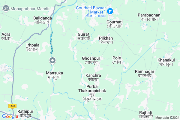
Ghoshpur
Ghoshpur Map
EDIT Map
Add Your House
 ..
..
Current Corona Virus Infected Patients Count in Hooghly District
| City Name | District Name | Total Covid cases |
|---|---|---|
| Hooghly District | Hooghly | 1 |
Locality Name :
Ghoshpur
( ঘোষপুর )
Block Name : Khanakul-i
District : Hooghly
State : West Bengal
Division : Burdwan
Language : Bengali
Current Time 12:55 PM
Date: Tuesday , Apr 29,2025 (IST)
Time zone: IST (UTC+5:30)
Elevation / Altitude: 15 meters. Above Seal level
Telephone Code / Std Code: 03225
Assembly constituency : Khanakul assembly constituency
Assembly MLA : Susanta Ghosh
Lok Sabha constituency : Arambagh parliamentary constituency
Parliament MP : APARUPA PODDAR (AFRIN ALI)
Serpanch Name :
Pin Code : 712613
Post Office Name : Gourhati
Commodities Prices : Ghatal Market / Mandi
Ghoshpur Live Weather
Temperature: 36.9 °C
clear sky
Humidity: 31%
Wind : 0.66 mt/sec towards N
StationName : "GhÄ\u0081tÄ\u0081l"
observed on Now
Temperature: 36.9 °C
clear sky
Humidity: 31%
Wind : 0.66 mt/sec towards N
StationName : "GhÄ\u0081tÄ\u0081l"
observed on Now
Ghoshpur Weather Forecast for Next 5 days
30-04-2025
24.1°C to 37.6°C
clear sky, light rain, moderate rain, broken clouds, overcast clouds
24.1°C to 37.6°C
clear sky, light rain, moderate rain, broken clouds, overcast clouds
01-05-2025
23.9°C to 37.9°C
overcast clouds, clear sky, scattered clouds, light rain
23.9°C to 37.9°C
overcast clouds, clear sky, scattered clouds, light rain
02-05-2025
23.7°C to 37.4°C
broken clouds, clear sky, moderate rain, light rain, overcast clouds
23.7°C to 37.4°C
broken clouds, clear sky, moderate rain, light rain, overcast clouds
03-05-2025
24.4°C to 36.5°C
overcast clouds, scattered clouds, few clouds, clear sky, broken clouds
24.4°C to 36.5°C
overcast clouds, scattered clouds, few clouds, clear sky, broken clouds
04-05-2025
24.7°C to 35.1°C
broken clouds, scattered clouds, light rain, moderate rain
24.7°C to 35.1°C
broken clouds, scattered clouds, light rain, moderate rain
National Highways Reachable To Ghoshpur
Nationa High Way :NH112
Nationa High Way :NH12
Nationa High Way :NH112
Nationa High Way :NH12
Rivers Near Ghoshpur
Damodar
Damodar
About Ghoshpur
Correct below Info and add more info about GhoshpurGhoshpur is a Village in Khanakul-i Block in Hooghly District of West Bengal State, India. It belongs to Burdwan Division . It is located 76 KM towards west from District head quarters Hugli-chuchura. 10 KM from Khanakul-I. 72 KM from State capital Kolkata
Ghoshpur Pin code is 712613 and postal head office is Gourhati .
Jagatpur ( 8 KM ) , Radhanagar ( 10 KM ) , Khanakul-i ( 10 KM ) , Khanakul-ii ( 10 KM ) , Salepur ( 11 KM ) are the nearby Villages to Ghoshpur. Ghoshpur is surrounded by Ghatal Block towards South , Khanakul-Ii Block towards East , Daspur-I Block towards South , Goghat-I Block towards North .
Arambagh , Tarakeswar , Panchla , Uluberia are the near by Cities to Ghoshpur.
This Place is in the border of the Hooghly District and Howrah District. Howrah District Udaynarayanpur is East towards this place .
Ghoshpur 2011 Census Details
Ghoshpur Local Language is Bengali. Ghoshpur Village Total population is 19014 and number of houses are 4039. Female Population is 48.3%. Village literacy rate is 70.9% and the Female Literacy rate is 31.5%.
Population
| Census Parameter | Census Data |
| Total Population | 19014 |
| Total No of Houses | 4039 |
| Female Population % | 48.3 % ( 9176) |
| Total Literacy rate % | 70.9 % ( 13473) |
| Female Literacy rate | 31.5 % ( 5991) |
| Scheduled Tribes Population % | 0.0 % ( 0) |
| Scheduled Caste Population % | 13.5 % ( 2576) |
| Working Population % | 32.6 % |
| Child(0 -6) Population by 2011 | 2371 |
| Girl Child(0 -6) Population % by 2011 | 49.4 % ( 1171) |
Ghoshpur Census More Deatils.
Politics in Ghoshpur
CPM , CPI(M) , AITC , All India Trinamool Congress , INC are the major political parties in this area.Polling Stations /Booths near Ghoshpur
1)Ghoshpur Pallishri Balika Uchcha Bidyalay2)Ghoradaha Uttar Prathamik Vidyalaya
3)Ghoshpur Moktab Primary School
4)Ghoshpur Pallishri Balika Uchcha Bidyalay
5)Ghoshpur Middapada Prathamik Bidyalay
HOW TO REACH Ghoshpur
By Rail
There is no railway station near to Ghoshpur in less than 10 km.Colleges near Ghoshpur
Bejoy Krishna College
Address :
Modern Institute Of Engineering And Technology
Address :
Hooghly Mohsin College
Address :
Schools in Ghoshpur
Ghoshpur Union Netaji Vidyapith
Address : Vill + P.O - Ghoshpur, P.S - Khanakul
Govt Health Centers near Ghoshpur
1) South Ghoshpur SC , SOUTH GHOSHPUR SUB-CENTER , ARAMBAGH-BANDAR RD. , GHOSHPUR HIGH MADRASA2) West Ghoshpur SC , WEST GHOSHPUR SUB-CENTER , , DHULEKUNDU PRIMARY SCHOOL
3) Bandipur SC , BANDIPUR SUB-CENTER , , KISHOREPUR - I GP OFFICE
Colleges in Ghoshpur,Khanakul-i
ARAMBAGH NABADIGANTA PVT ITI
Mansatala (Tildanga Math); Ward No-2; District Hooghly; Arambagh; West Bengal 712601; India
17.6 KM distance Detail
S N P TECHNICAL INSTITUTE PVT ITI
24 No. ROUTE; ARAMBAGH;; Satitala; Arambagh; West Bengal 712601; India
18.9 KM distance Detail
Arambagh Institute of Advanced Studies
Gourhati More; Ahilyabai Holkar Road; Opposite SBI ADB Branch; Arambagh; West Bengal 712601; India
19.0 KM distance Detail
ARAMBAGH TECHNICAL AND SURVEY INSTITUTION
P C Sen Rd; Arambagh; West Bengal 712601; India
19.2 KM distance Detail
more ..
Police Stations near Ghoshpur,Khanakul-i
Arambagh Police Station
Near Gourhati More; Hooghly; Arambagh; West Bengal 712601; India
19.2 KM distance Detail
Governement Offices near Ghoshpur,Khanakul-i
Alordisha New Life Care (Ceragem)
Arambagh;Basudebpur more;Upper flore of; Dena bank; Arambagh; West Bengal; India
18.9 KM distance Detail
About Ghoshpur &
History
How to reach Ghoshpur
Tourist Places Near By Ghoshpur
Schools in Ghoshpur
Colleges in Ghoshpur
Temperature & weather of Ghoshpur
places in Ghoshpur
Ghoshpur photos
More Information
How to reach Ghoshpur
Tourist Places Near By Ghoshpur
Schools in Ghoshpur
Colleges in Ghoshpur
Temperature & weather of Ghoshpur
places in Ghoshpur
Ghoshpur photos
More Information
Village Talk
Post News or Events about this Village
Near Cities
Arambagh 20 KM near
Tarakeswar 33 KM near
Panchla 47 KM near
Uluberia 49 KM near
Arambagh 20 KM near
Tarakeswar 33 KM near
Panchla 47 KM near
Uluberia 49 KM near
Near By Taluks
Ghatal 9 KM near
Khanakul-I 10 KM near
Khanakul-Ii 16 KM near
Daspur-I 16 KM near
Ghatal 9 KM near
Khanakul-I 10 KM near
Khanakul-Ii 16 KM near
Daspur-I 16 KM near
Near By Air Ports
Netaji Subhas Chandra Bose Airport 76 KM near
Ranchi Airport 290 KM near
Bhubaneswar Airport 383 KM near
Gaya Airport 409 KM near
Netaji Subhas Chandra Bose Airport 76 KM near
Ranchi Airport 290 KM near
Bhubaneswar Airport 383 KM near
Gaya Airport 409 KM near
Near By Tourist Places
Shankarpur 3 KM near
Jairambati 29 KM near
Howrah 58 KM near
Midnapore 63 KM near
Bardhaman 63 KM near
Shankarpur 3 KM near
Jairambati 29 KM near
Howrah 58 KM near
Midnapore 63 KM near
Bardhaman 63 KM near
Near By Districts
Medinipur East 57 KM near
Howrah 63 KM near
Bardhaman 64 KM near
Medinipur West 65 KM near
Medinipur East 57 KM near
Howrah 63 KM near
Bardhaman 64 KM near
Medinipur West 65 KM near
Near By RailWay Station
Mecheda Rail Way Station 40 KM near
Panskura Junction Rail Way Station 42 KM near
Mecheda Rail Way Station 40 KM near
Panskura Junction Rail Way Station 42 KM near