| Home | City Bus | Maps | Villages | Cities | Rail | Tourist Places | School | College | Pin Codes | Corona Cases Count |
| Distance Calculator Bus Services IFSC Codes Trace Mobile Number Weather Search Place Trace IP Available Cash ATM/Banks Locate Polling Booth Report an Error contact People |
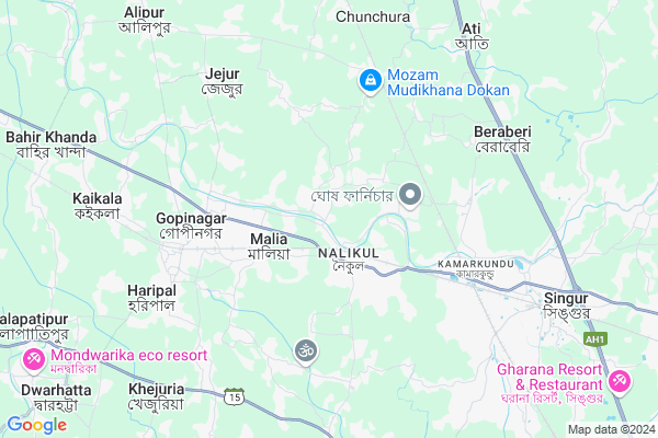
Bandipur
Bandipur Map
EDIT Map
Add Your House
 ..
..
Current Corona Virus Infected Patients Count in Hooghly District
| City Name | District Name | Total Covid cases |
|---|---|---|
| Hooghly District | Hooghly | 1 |
Locality Name :
Bandipur
( বান্দিপুর )
Block Name : Haripal
District : Hooghly
State : West Bengal
Division : Burdwan
Language : Bengali
Current Time 09:34 AM
Date: Wednesday , Apr 30,2025 (IST)
Time zone: IST (UTC+5:30)
Elevation / Altitude: 15 meters. Above Seal level
Telephone Code / Std Code: 03212
Assembly constituency : Haripal assembly constituency
Assembly MLA : Dr. Karabi Manna
Lok Sabha constituency : Arambagh parliamentary constituency
Parliament MP : APARUPA PODDAR (AFRIN ALI)
Serpanch Name :
Pin Code : 712407
Post Office Name : Nalikul
Commodities Prices : Champadanga Market / Mandi
Edit below overview about Bandipur
Edit below overview about Bandipur
OverView of Bandipur
Bandipur has a rural public library.( west Bengal govt aid ) it's name is "Bandipur palli pathagar" established in 1917Edit below overview about Bandipur
National Highways Reachable To Bandipur
Nationa High Way :NH19
Nationa High Way :NH19
Rivers Near Bandipur
Bhagirathi :Hooghly River
Dwarakeshwar
Bhagirathi :Hooghly River
Dwarakeshwar
About Bandipur
Bandipur is a Village in Haripal Block in Hooghly District of West Bengal State, India. It belongs to Burdwan Division . It is located 29 KM towards west from District head quarters Hugli-chuchura. 6 KM from Haripal. 43 KM from State capital Kolkata
Bandipur Pin code is 712407 and postal head office is Nalikul .
Jejur ( 5 KM ) , Haripal ( 7 KM ) , Beraberi ( 7 KM ) , Kaikala ( 8 KM ) , Balarambati ( 8 KM ) are the nearby Villages to Bandipur. Bandipur is surrounded by Singur Block towards East , Dhaniakhali Block towards North , Tarakeswar Block towards west , Chanditala-I Block towards South .
Tarakeswar , Chandannagar , Monoharpur , Barrackpur are the near by Cities to Bandipur.
This Place is in the border of the Hooghly District and Howrah District. Howrah District Jagatballavpur is South towards this place .
Bandipur 2011 Census Details
Bandipur Local Language is Bengali. Bandipur Village Total population is 4979 and number of houses are 1131. Female Population is 49.1%. Village literacy rate is 78.1% and the Female Literacy rate is 36.0%.
Population
| Census Parameter | Census Data |
| Total Population | 4979 |
| Total No of Houses | 1131 |
| Female Population % | 49.1 % ( 2447) |
| Total Literacy rate % | 78.1 % ( 3890) |
| Female Literacy rate | 36.0 % ( 1792) |
| Scheduled Tribes Population % | 5.6 % ( 277) |
| Scheduled Caste Population % | 29.9 % ( 1489) |
| Working Population % | 38.0 % |
| Child(0 -6) Population by 2011 | 428 |
| Girl Child(0 -6) Population % by 2011 | 48.1 % ( 206) |
Bandipur Census More Deatils.
Politics in Bandipur
CPM , CPI(M) , AITC , All India Trinamool Congress , INC are the major political parties in this area.Polling Stations /Booths near Bandipur
1)Bamonjole Primary School2)Bandipur Girls High School (room No.-1)
3)Bandipur Girls High School (room No.-2)
4)Bandipur High School
5)Bandipur Girls High School (room No.-3)
HOW TO REACH Bandipur
By Rail
Nalikul Rail Way Station , Maliya Halt Rail Way Station are the very nearby railway stations to Bandipur.Colleges near Bandipur
Bejoy Krishna College
Address :
Modern Institute Of Engineering And Technology
Address :
Hooghly Mohsin College
Address :
Schools in Bandipur
Bandipur Girls' High School
Address : vill+p.o-bandipur,p.s-haripal,dist-hooghly
Bandipur Boys' High School
Address : vill+p.o-bandipur,p.s-haripal,dist-hooghly
Govt Health Centers near Bandipur
1) Brindabanpur SC , , , Pond2) Madhyahigla SC , Madhyahigla Sub Center , Madhyahigla Road , Madhyahigla Baroyaritala
3) Pergopalnagar SC , Saraswata Pathagar , Kamarkundu Bajemelia Road , Pergopalnagar (Bank Of India )
Colleges in Bandipur,Haripal
MCA COMPUTER CENTER;NALIKUL
NALIKUL;HOOGHLY-712407; SH 2; Nawapara; Nalikul; West Bengal 712407; India
1.6 KM distance Detail
more ..
Schools in Bandipur,Haripal
Kinkarbati Belepara Sishu Siksha Kendra
Ichhlampur; West Bengal 712407; India
2.1 KM distance Detail
Electronic Shops in Bandipur,Haripal
M. K. INFOTECH
Nalikul hatt; Nalikul; Hooghly; Hooghly; West Bengal 712407; India
1.5 KM distance Detail
Tarama Marketing
Nalikul Station To Tarakeswar Rd; Nalikul; West Bengal 712407; India
1.6 KM distance Detail
Super Markets in Bandipur,Haripal
কামারকুণ্ড বালাজী হাউস
Baidyabati - Tarkeshwar - Champadanga Rd; Brahmanpara; West Bengal 712405; India
3.2 KM distance Detail
Police Stations near Bandipur,Haripal
Superintendent Of Police; Hooghly Rural Police Commissionerate
Singur; Kamarkundu; West Bengal 712407; India
6.5 KM distance Detail
About Bandipur &
History
How to reach Bandipur
Tourist Places Near By Bandipur
Schools in Bandipur
Colleges in Bandipur
Temperature & weather of Bandipur
places in Bandipur
Bandipur photos
More Information
How to reach Bandipur
Tourist Places Near By Bandipur
Schools in Bandipur
Colleges in Bandipur
Temperature & weather of Bandipur
places in Bandipur
Bandipur photos
More Information
Village Talk
Post News or Events about this Village
Near Cities
Tarakeswar 17 KM near
Chandannagar 25 KM near
Monoharpur 25 KM near
Barrackpur 26 KM near
Tarakeswar 17 KM near
Chandannagar 25 KM near
Monoharpur 25 KM near
Barrackpur 26 KM near
Near By Taluks
Haripal 6 KM near
Singur 8 KM near
Chanditala-I 16 KM near
Dhaniakhali 16 KM near
Haripal 6 KM near
Singur 8 KM near
Chanditala-I 16 KM near
Dhaniakhali 16 KM near
Near By Air Ports
Netaji Subhas Chandra Bose Airport 40 KM near
Ranchi Airport 330 KM near
Singerbhil Airport 376 KM near
Bhubaneswar Airport 421 KM near
Netaji Subhas Chandra Bose Airport 40 KM near
Ranchi Airport 330 KM near
Singerbhil Airport 376 KM near
Bhubaneswar Airport 421 KM near
Near By Tourist Places
Howrah 32 KM near
Kolkata 40 KM near
Alipore 43 KM near
Shankarpur 45 KM near
Bardhaman 60 KM near
Howrah 32 KM near
Kolkata 40 KM near
Alipore 43 KM near
Shankarpur 45 KM near
Bardhaman 60 KM near
Near By Districts
Hooghly 27 KM near
Howrah 36 KM near
24 Paraganas North 39 KM near
Kolkata 44 KM near
Hooghly 27 KM near
Howrah 36 KM near
24 Paraganas North 39 KM near
Kolkata 44 KM near
Near By RailWay Station
Nalikul Rail Way Station 1.5 KM near
Maliya Halt Rail Way Station 3.1 KM near
Madhusudanpur Rail Way Station 4.0 KM near
Seoraphuli Junction Rail Way Station 20 KM near
Bandel Junction Rail Way Station 27 KM near
Nalikul Rail Way Station 1.5 KM near
Maliya Halt Rail Way Station 3.1 KM near
Madhusudanpur Rail Way Station 4.0 KM near
Seoraphuli Junction Rail Way Station 20 KM near
Bandel Junction Rail Way Station 27 KM near