| Home | City Bus | Maps | Villages | Cities | Rail | Tourist Places | School | College | Pin Codes | Corona Cases Count |
| Distance Calculator Bus Services IFSC Codes Trace Mobile Number Weather Search Place Trace IP Available Cash ATM/Banks Locate Polling Booth Report an Error contact People |
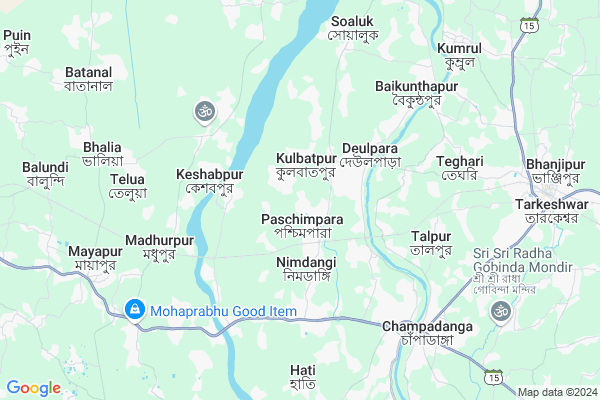
Paschimpara
Paschimpara Map
EDIT Map
Add Your House
 ..
..
Current Corona Virus Infected Patients Count in Hooghly District
| City Name | District Name | Total Covid cases |
|---|---|---|
| Hooghly District | Hooghly | 1 |
Locality Name :
Paschimpara
( পশ্চিমপাড়া )
Block Name : Goghat-ii
District : Hooghly
State : West Bengal
Division : Burdwan
Language : Bengali
Current Time 08:48 AM
Date: Wednesday , Apr 30,2025 (IST)
Time zone: IST (UTC+5:30)
Elevation / Altitude: 41 meters. Above Seal level
Telephone Code / Std Code: 03211
Assembly constituency : Pursurah assembly constituency
Assembly MLA : Biman Ghosh
Lok Sabha constituency : Arambagh parliamentary constituency
Parliament MP : APARUPA PODDAR (AFRIN ALI)
Serpanch Name :
Pin Code : 712612
Post Office Name : Kamarpukur
Commodities Prices : Champadanga Market / Mandi
Edit below overview about Paschimpara
Edit below overview about Paschimpara
OverView of Paschimpara
Assembly constituency- Goghat MLA- Manas Majumdar Post Office name- Paschimpara Commodity prices- kamarpukur market All the information below comment box is wrong. Actually there Are two paschimpara in hooghly district and the information is jumbled.Edit below overview about Paschimpara
National Highways Reachable To Paschimpara
Nationa High Way :NH19
Nationa High Way :NH19
Rivers Near Paschimpara
Dwarakeshwar
Shilabati
Dwarakeshwar
Shilabati
About Paschimpara
Paschimpara is a Village in Goghat-ii Block in Hooghly District of West Bengal State, India. It belongs to Burdwan Division . It is located 55 KM towards west from District head quarters Hugli-chuchura. 33 KM from Goghat-Ii. 65 KM from State capital Kolkata
Paschimpara Pin code is 712612 and postal head office is Kamarpukur .
Pursurah-ii ( 4 KM ) , Talpur ( 5 KM ) , Pursurah ( 6 KM ) , Champadanga ( 7 KM ) , Santoshpur ( 7 KM ) are the nearby Villages to Paschimpara. Paschimpara is surrounded by Tarakeswar Block towards East , Arambagh Block towards west , Raina-Ii Block towards North , Khanakul-I Block towards South .
Tarakeswar , Arambagh , Memari , Bardhaman are the near by Cities to Paschimpara.
This Place is in the border of the Hooghly District and Bankura District. Bankura District Kotulpur is west towards this place . Also it is in the Border of other district Medinipur West .
Demographics of Paschimpara
Bengali is the Local Language here.Politics in Paschimpara
CPM , CPI(M) , AITC , All India Trinamool Congress , INC are the major political parties in this area.Polling Stations /Booths near Paschimpara
1)Parul Prathamik Bidyalay2)Pashchimapara 2 No Prathamik Bidyalaya
3)Kulabatapur Bord Prathamik Bidyalaya
4)Kabilpur Paschim K.m.d Prathamik Vidyalaya
5)Krishnapur Jr. Basic School (room- 2)
HOW TO REACH Paschimpara
By Rail
Takipur Halt Rail Way Station , Tilakpur Rail Way Station are the very nearby railway stations to Paschimpara.Colleges near Paschimpara
Bejoy Krishna College
Address :
Modern Institute Of Engineering And Technology
Address :
Hooghly Mohsin College
Address :
Schools near Paschimpara
Kamarpukur Nayantara Girls Sc
Address : kamarpukur-x , goghat-ii , hugli , West Bengal . PIN- 712612 , Post - Kamarpukur
Singrapur Junior High School
Address : mandaran-ix , goghat-ii , hugli , West Bengal . PIN- 712614 , Post - Goghat.
Satberia H.s School
Address : kamarpukur-v , goghat-ii , hugli , West Bengal . PIN- 712612 , Post - Kamarpukur
Samantakhanda Harendra K. High
Address : bengai-i , goghat-ii , hugli , West Bengal . PIN- 722141 , Post - Kotalpur
Govt Health Centers near Paschimpara
1) Nimdangi SC , Nimdangi SC , Vill-Namdangi ,2) Kanaria SC , Kanaria Sub Centre , Tarakeswar Kanaria Road , Attached Keshabchak G.P
3) Tullyan SC , Tullyan Sub Centre , Mohanbati Primary School Road , Mohanbati Football Ground
Petrol Bunks in Paschimpara,Goghat-ii
Maa Sarada Filling Station
Jangalpara Pursurah PO Jangalpara; Kolkata; West Bengal 712419; India
5.4 KM distance Detail
more ..
Schools in Paschimpara,Goghat-ii
Paschimpara Prathamik Bidyalaya
Kulbatpur Rd; Paschimpara; West Bengal 712414; India
0.7 KM distance Detail
Harinakhali Prathamik Bidyalaya
Kulbatpur Rd; Kulbatpur; West Bengal 712414; India
0.7 KM distance Detail
Super Markets in Paschimpara,Goghat-ii
ABACUS COMPUTER TRAINING & ONLINE CENTRE & JNCLD
Champadanga; West Bengal 712401; India
7.5 KM distance Detail
Local Parks in Paschimpara,Goghat-ii
Champadanga Balimath
chpmpadanga; Collage Rd; Tarkeshwar; West Bengal 712410; India
8.1 KM distance Detail
About Paschimpara &
History
How to reach Paschimpara
Tourist Places Near By Paschimpara
Schools in Paschimpara
Colleges in Paschimpara
Temperature & weather of Paschimpara
places in Paschimpara
Paschimpara photos
More Information
How to reach Paschimpara
Tourist Places Near By Paschimpara
Schools in Paschimpara
Colleges in Paschimpara
Temperature & weather of Paschimpara
places in Paschimpara
Paschimpara photos
More Information
Village Talk
Post News or Events about this Village
Near Cities
Tarakeswar 9 KM near
Arambagh 15 KM near
Memari 45 KM near
Bardhaman 45 KM near
Tarakeswar 9 KM near
Arambagh 15 KM near
Memari 45 KM near
Bardhaman 45 KM near
Near By Taluks
Pursurah 4 KM near
Tarakeswar 9 KM near
Arambagh 15 KM near
Raina-Ii 17 KM near
Pursurah 4 KM near
Tarakeswar 9 KM near
Arambagh 15 KM near
Raina-Ii 17 KM near
Near By Air Ports
Netaji Subhas Chandra Bose Airport 65 KM near
Ranchi Airport 303 KM near
Singerbhil Airport 399 KM near
Bhubaneswar Airport 408 KM near
Netaji Subhas Chandra Bose Airport 65 KM near
Ranchi Airport 303 KM near
Singerbhil Airport 399 KM near
Bhubaneswar Airport 408 KM near
Near By Tourist Places
Shankarpur 27 KM near
Jairambati 35 KM near
Bardhaman 45 KM near
Burdwan 45 KM near
Howrah 52 KM near
Shankarpur 27 KM near
Jairambati 35 KM near
Bardhaman 45 KM near
Burdwan 45 KM near
Howrah 52 KM near
Near By Districts
Bardhaman 46 KM near
Hooghly 53 KM near
Howrah 57 KM near
Kolkata 64 KM near
Bardhaman 46 KM near
Hooghly 53 KM near
Howrah 57 KM near
Kolkata 64 KM near
Near By RailWay Station
Takipur Halt Rail Way Station 2.2 KM near
Tilakpur Rail Way Station 4.1 KM near
Talpur Halt Rail Way Station 4.1 KM near
Barddhaman Junction Rail Way Station 46 KM near
Seoraphuli Junction Rail Way Station 47 KM near
Takipur Halt Rail Way Station 2.2 KM near
Tilakpur Rail Way Station 4.1 KM near
Talpur Halt Rail Way Station 4.1 KM near
Barddhaman Junction Rail Way Station 46 KM near
Seoraphuli Junction Rail Way Station 47 KM near