| Home | City Bus | Maps | Villages | Cities | Rail | Tourist Places | School | College | Pin Codes | Corona Cases Count |
| Distance Calculator Bus Services IFSC Codes Trace Mobile Number Weather Search Place Trace IP Available Cash ATM/Banks Locate Polling Booth Report an Error contact People |
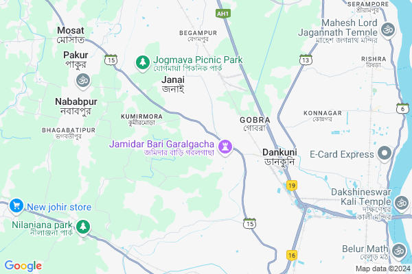
Barijhati
Barijhati Map
EDIT Map
Add Your House
 ..
..
Current Corona Virus Infected Patients Count in Hooghly District
| City Name | District Name | Total Covid cases |
|---|---|---|
| Hooghly District | Hooghly | 1 |
Locality Name :
Barijhati
( বড়িঝাটি )
Block Name : Chanditala-ii
District : Hooghly
State : West Bengal
Division : Burdwan
Language : Bengali
Current Time 12:40 PM
Date: Monday , Apr 28,2025 (IST)
Time zone: IST (UTC+5:30)
Elevation / Altitude: 6 meters. Above Seal level
Telephone Code / Std Code: 03214
Assembly constituency : Chanditala assembly constituency
Assembly MLA : Swati Khandoker
Lok Sabha constituency : Serampore parliamentary constituency
Parliament MP : KALYAN BANERJEE
Serpanch Name :
Pin Code : 712702
Post Office Name : Chanditala
Commodities Prices : Kalipur Market / Mandi
Barijhati Live Weather
Temperature: 33.0 °C
haze
Humidity: 58%
Wind : 2.06 mt/sec towards SE
StationName : "Krishnapur"
observed on 41 Mins Back
Temperature: 33.0 °C
haze
Humidity: 58%
Wind : 2.06 mt/sec towards SE
StationName : "Krishnapur"
observed on 41 Mins Back
Barijhati Weather Forecast for Next 5 days
29-04-2025
21.8°C to 29.8°C
moderate rain, light rain, broken clouds
21.8°C to 29.8°C
moderate rain, light rain, broken clouds
30-04-2025
23.1°C to 35.8°C
scattered clouds, clear sky, light rain, heavy intensity rain, overcast clouds
23.1°C to 35.8°C
scattered clouds, clear sky, light rain, heavy intensity rain, overcast clouds
01-05-2025
21.3°C to 34.7°C
clear sky, scattered clouds, light rain, heavy intensity rain, overcast clouds
21.3°C to 34.7°C
clear sky, scattered clouds, light rain, heavy intensity rain, overcast clouds
02-05-2025
22.4°C to 34.6°C
broken clouds, clear sky, light rain, few clouds, scattered clouds, moderate rain, heavy intensity rain
22.4°C to 34.6°C
broken clouds, clear sky, light rain, few clouds, scattered clouds, moderate rain, heavy intensity rain
03-05-2025
24.0°C to 32.2°C
light rain, overcast clouds, clear sky, few clouds
24.0°C to 32.2°C
light rain, overcast clouds, clear sky, few clouds
National Highways Reachable To Barijhati
Nationa High Way :NH12
Nationa High Way :NH19
Nationa High Way :NH12
Nationa High Way :NH19
About Barijhati
Correct below Info and add more info about BarijhatiBarijhati is a Village in Chanditala-ii Block in Hooghly District of West Bengal State, India. It belongs to Burdwan Division . It is located 31 KM towards South from District head quarters Hugli-chuchura. 1 KM from Chanditala. 19 KM from State capital Kolkata
Barijhati Pin code is 712702 and postal head office is Chanditala .
Chanditala ( 1 KM ) , Garalgachha ( 1 KM ) , Naiti ( 2 KM ) , Mrigala ( 3 KM ) , Janai ( 4 KM ) are the nearby Villages to Barijhati. Barijhati is surrounded by Bally-Jagacha Block towards East , Chanditala-I Block towards west , Domjur Block towards South , Konnagar Block towards East .
Monoharpur , Bally , Konnagar , Howrah are the near by Cities to Barijhati.
This Place is in the border of the Hooghly District and Howrah District. Howrah District Domjur is South towards this place .
Demographics of Barijhati
Bengali is the Local Language here.Politics in Barijhati
CPM , CPI(M) , AITC , All India Trinamool Congress are the major political parties in this area.Polling Stations /Booths near Barijhati
1)Barijhatty Ashutosh Prathomik Vidyalay. Room 22)Barijhatty Girlu0027s High School R-2
3)Barijhatty Girlu0027s High School. R-1
4)Heriadaha Biharilal Pry. School-r2
5)Hooghly Zilla Parisad Chanditala Dak Bunglow. Room 1
HOW TO REACH Barijhati
By Rail
Gobra Rail Way Station , Dankuni Junction Rail Way Station are the very nearby railway stations to Barijhati.Colleges near Barijhati
Bejoy Krishna College
Address :
Modern Institute Of Engineering And Technology
Address :
Hooghly Mohsin College
Address :
Schools near Barijhati
Naity High School
Address : naity-xiii , chanditala-ii , hugli , West Bengal . PIN- 712702 , Post - Chanditala
Begampur High School
Address : begampur-vi , chanditala-ii , hugli , West Bengal . PIN- 712306 , Post - Begampur (Hooghly)
Janai Bhagwan Debi Goenka Girl
Address : janai-ii , chanditala-ii , hugli , West Bengal . PIN- 712304 , Post - Janai
Baratajpur High(hs)
Address : panchghara-ii , chanditala-ii , hugli , West Bengal . PIN- 712306 , Post - Begampur (Hooghly)
Govt Health Centers near Barijhati
1) Barijhatty SC , BARIJHATTY SUB CENTRE , VILL- BARIJHATTY, PO- CHANDITALA, HOOGHLY , BARIJHATTY GIRLS HIGH SCHOOL2) Chanditala SC , CHANDITALA SUB CENTRE , AHALLABY ROAD , CHANDITALA RURAL HOSPITAL
3) Chanditala RH , CHANDITALA RURAL HOSPITAL , AHALLABY ROAD , CHANDITALA POLICE STSTION
Hospitals in Barijhati,Chanditala-ii
Chanditala Rural Hospital
Ahilyabai Holkar Road; Chanditala; West Bengal 712702; India
0.5 KM distance Detail
The Eye Point
Chanditala Serampore Road; MA Chandi Apartment; Hooghly; West Bengal 712702; India
0.7 KM distance Detail
more ..
Petrol Bunks in Barijhati,Chanditala-ii
Iodian Oil
Bankura - Beliator - Sonamukhi - Khandaghosh - Nischintapur Road; Gobra; Dankuni; West Bengal 712708; India
1.8 KM distance Detail
more ..
Colleges in Barijhati,Chanditala-ii
Tara Maa Medical Stores
TN Mukerjee Rd; Lichubagan; Station Pally; Dankuni; West Bengal 712708; India
2.8 KM distance Detail
Ekloky Primary School
Baluhati - Chanditala Rd; Eklakhi; West Bengal 712708; India
3.0 KM distance Detail
Apace Spoken English
TN Mukerjee Rd; Monoharpur; Gobra; Dankuni; West Bengal 712311; India
3.7 KM distance Detail
more ..
Schools in Barijhati,Chanditala-ii
Barijahatty Girls' High School
Barijahatty Football Ground; Chanditala; West Bengal 712702; India
0.2 KM distance Detail
begampure Boys High School
Police Station; Chanditala; Chanditala; West Bengal; India
0.6 KM distance Detail
Manisha Saha's English Coaching Center
Barijahatty; Chakraborty Para;Chanditala; Hooghly; West Bengal 712702; India
0.6 KM distance Detail
Kapasharia high School Chanditala Hooghly
Gobra; Chanditala; West Bengal 712702; India
0.8 KM distance Detail
Super Markets in Barijhati,Chanditala-ii
Verma.Bag.Company
3437; Nataji Nagar; Gobra; Dankuni; West Bengal 712702; India
2.5 KM distance Detail
Local Parks in Barijhati,Chanditala-ii
Chamuda Mandir Park
2633 TN Mukerjee Rd Himnagar; TN Mukerjee Rd; Himnagar; Monoharpur; Housing Estate Colony; Belanagar; Dankuni; West Bengal 712311; India
3.5 KM distance Detail
Police Stations near Barijhati,Chanditala-ii
Dankuni Police Station
Near Dankuni Signal Point; Dankuni Township; Post Dankuni Coal Complex; Dankuni; Hooghly; West Bengal 712310; India
4.3 KM distance Detail
About Barijhati &
History
How to reach Barijhati
Tourist Places Near By Barijhati
Schools in Barijhati
Colleges in Barijhati
Temperature & weather of Barijhati
places in Barijhati
Barijhati photos
More Information
How to reach Barijhati
Tourist Places Near By Barijhati
Schools in Barijhati
Colleges in Barijhati
Temperature & weather of Barijhati
places in Barijhati
Barijhati photos
More Information
Village Talk
Post News or Events about this Village
Near Cities
Monoharpur 4 KM near
Bally 10 KM near
Konnagar 10 KM near
Howrah 11 KM near
Monoharpur 4 KM near
Bally 10 KM near
Konnagar 10 KM near
Howrah 11 KM near
Near By Taluks
Chanditala-Ii 1 KM near
Chanditala-I 7 KM near
Bally-Jagacha 8 KM near
Domjur 8 KM near
Chanditala-Ii 1 KM near
Chanditala-I 7 KM near
Bally-Jagacha 8 KM near
Domjur 8 KM near
Near By Air Ports
Netaji Subhas Chandra Bose Airport 21 KM near
Ranchi Airport 345 KM near
Singerbhil Airport 372 KM near
Bhubaneswar Airport 415 KM near
Netaji Subhas Chandra Bose Airport 21 KM near
Ranchi Airport 345 KM near
Singerbhil Airport 372 KM near
Bhubaneswar Airport 415 KM near
Near By Tourist Places
Howrah 11 KM near
Kolkata 18 KM near
Alipore 21 KM near
Shankarpur 54 KM near
Raichak 62 KM near
Howrah 11 KM near
Kolkata 18 KM near
Alipore 21 KM near
Shankarpur 54 KM near
Raichak 62 KM near
Near By Districts
Howrah 14 KM near
Kolkata 22 KM near
24 Paraganas North 25 KM near
24 Paraganas South 28 KM near
Howrah 14 KM near
Kolkata 22 KM near
24 Paraganas North 25 KM near
24 Paraganas South 28 KM near
Near By RailWay Station
Gobra Rail Way Station 2.5 KM near
Dankuni Junction Rail Way Station 4.1 KM near
Janai Road Rail Way Station 4.2 KM near
Dakshineswar Rail Way Station 12 KM near
Seoraphuli Junction Rail Way Station 13 KM near
Gobra Rail Way Station 2.5 KM near
Dankuni Junction Rail Way Station 4.1 KM near
Janai Road Rail Way Station 4.2 KM near
Dakshineswar Rail Way Station 12 KM near
Seoraphuli Junction Rail Way Station 13 KM near