| Home | City Bus | Maps | Villages | Cities | Rail | Tourist Places | School | College | Pin Codes | Corona Cases Count |
| Distance Calculator Bus Services IFSC Codes Trace Mobile Number Weather Search Place Trace IP Available Cash ATM/Banks Locate Polling Booth Report an Error contact People |
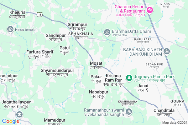
Masat
Masat Map
EDIT Map
Add Your House
 ..
..
Current Corona Virus Infected Patients Count in Hooghly District
| City Name | District Name | Total Covid cases |
|---|---|---|
| Hooghly District | Hooghly | 1 |
Locality Name :
Masat
( মাস্ট )
Block Name : Chanditala-i
District : Hooghly
State : West Bengal
Division : Burdwan
Language : Bengali
Current Time 03:49 PM
Date: Wednesday , Apr 30,2025 (IST)
Time zone: IST (UTC+5:30)
Elevation / Altitude: 2077 meters. Above Seal level
Telephone Code / Std Code: 03214
Assembly constituency : Jangipara assembly constituency
Assembly MLA : Snehasis Chakraborty
Lok Sabha constituency : Serampore parliamentary constituency
Parliament MP : KALYAN BANERJEE
Serpanch Name :
Pin Code : 712701
Post Office Name : Masat
Commodities Prices : Kalipur Market / Mandi
Masat Live Weather
Temperature: 28.0 °C
few clouds
Humidity: 30%
Wind : 2.65 mt/sec towards SW
StationName : "Parbatipur"
observed on 2 Mins Back
Temperature: 28.0 °C
few clouds
Humidity: 30%
Wind : 2.65 mt/sec towards SW
StationName : "Parbatipur"
observed on 2 Mins Back
Masat Weather Forecast for Next 5 days
01-05-2025
25.9°C to 28.2°C
light rain, scattered clouds
25.9°C to 28.2°C
light rain, scattered clouds
02-05-2025
21.7°C to 36.7°C
few clouds, clear sky, scattered clouds, heavy intensity rain, moderate rain, overcast clouds, broken clouds
21.7°C to 36.7°C
few clouds, clear sky, scattered clouds, heavy intensity rain, moderate rain, overcast clouds, broken clouds
03-05-2025
23.9°C to 35.5°C
broken clouds, scattered clouds, clear sky, few clouds
23.9°C to 35.5°C
broken clouds, scattered clouds, clear sky, few clouds
04-05-2025
24.4°C to 35.3°C
light rain, moderate rain, clear sky, heavy intensity rain, broken clouds
24.4°C to 35.3°C
light rain, moderate rain, clear sky, heavy intensity rain, broken clouds
05-05-2025
25.5°C to 37.2°C
broken clouds, scattered clouds, few clouds, clear sky, heavy intensity rain, light rain
25.5°C to 37.2°C
broken clouds, scattered clouds, few clouds, clear sky, heavy intensity rain, light rain
Edit below overview about Masat
Edit below overview about Masat
OverView of Masat
in masat, there is a lord shiva temple aka bisweswar mandir, is very populer. there also a big football ground and a big pond, the area is called bisweswar talaEdit below overview about Masat
National Highways Reachable To Masat
Nationa High Way :NH12
Nationa High Way :NH19
Nationa High Way :NH12
Nationa High Way :NH19
About Masat
Masat is a Village in Chanditala-i Block in Hooghly District of West Bengal State, India. It belongs to Burdwan Division . It is located 31 KM towards west from District head quarters Hugli-chuchura. 4 KM from Chanditala-I. 30 KM from State capital Kolkata
Masat Pin code is 712701 and postal head office is Masat .
Gangadharpur ( 3 KM ) , Shiyakhala ( 4 KM ) , Basubati ( 4 KM ) , Madhabpur ( 5 KM ) , Nababpur ( 5 KM ) are the nearby Villages to Masat. Masat is surrounded by Chanditala-Ii Block towards East , Singur Block towards North , Domjur Block towards South , Sirampur-Uttarpara Block towards East .
Monoharpur , Konnagar , Howrah , Bally are the near by Cities to Masat.
This Place is in the border of the Hooghly District and Howrah District. Howrah District Domjur is South towards this place .
Demographics of Masat
Bengali is the Local Language here.Politics in Masat
CPM , CPI(M) , AITC , All India Trinamool Congress are the major political parties in this area.Polling Stations /Booths near Masat
1)Morhal Narayan Abaitanik Prathamik Bidyalay - Room - 22)Shilbati Prathamik Bidyalay - Room - 2
3)Shree Shree Ramkrishna Pry. School R1
4)Moshat North Pry.school R2
5)Moshat Vivekananda Pry. School R1
HOW TO REACH Masat
By Rail
Baruipara Rail Way Station , Mirzapur Bankipur Rail Way Station are the very nearby railway stations to Masat.Colleges near Masat
Bejoy Krishna College
Address :
Modern Institute Of Engineering And Technology
Address :
Hooghly Mohsin College
Address :
Schools in Masat
Masat Aptap Mitra Hish School (h.s)
Address : Masat Bazar
Govt Health Centers near Masat
1) Basubati GPSC , Basubati Gram Panchyat Sub Center , Banamalipur Road , Vidyasagar Stachu Basubati Gram Panchyat2) Bireswarpur , , , Bireswarpur SC
3) Jagannathbati SC , Jagannathbati Sub Centre , Jagannathbati , HARIMATH
Petrol Bunks in Masat,Chanditala-i
HP Petrol Pump Kris Rampur
Krishnarampur Chanditala; Ahilyabai Holkar Rd; Kolkata; West Bengal 712705; India
2.8 KM distance Detail
more ..
Colleges in Masat,Chanditala-i
Sheakhala ICMS
floor - 1st; Ahilyabai Holkar Rd; Sheakhala; Srirampur; West Bengal 712706; India
4.6 KM distance Detail
Pir Abubaker Memorial College
Furfura; Jangipara; Hooghly; 31; Patul; West Bengal 712706; India
5.3 KM distance Detail
more ..
Schools in Masat,Chanditala-i
Swami Vivekananda National Youth Computer Centre
Mosat; West Bengal 712701; India
0.5 KM distance Detail
Local Parks in Masat,Chanditala-i
Itkholar Math
gangadharpur;chanditala;hooghly; Rd Number 31; Gangadharpur; West Bengal 712306; India
4.4 KM distance Detail
Police Stations near Masat,Chanditala-i
Bora Police Station
712306; Sahana; Bara Kamalapur; West Bengal 712306; India
9.3 KM distance Detail
Singur Rural Police Station
Singur; Purusattampur; West Bengal 712409; India
10.5 KM distance Detail
About Masat &
History
How to reach Masat
Tourist Places Near By Masat
Schools in Masat
Colleges in Masat
Temperature & weather of Masat
places in Masat
Masat photos
More Information
How to reach Masat
Tourist Places Near By Masat
Schools in Masat
Colleges in Masat
Temperature & weather of Masat
places in Masat
Masat photos
More Information
Village Talk
Post News or Events about this Village
Near Cities
Monoharpur 14 KM near
Konnagar 19 KM near
Howrah 19 KM near
Bally 20 KM near
Monoharpur 14 KM near
Konnagar 19 KM near
Howrah 19 KM near
Bally 20 KM near
Near By Taluks
Chanditala-I 3 KM near
Chanditala-Ii 10 KM near
Singur 11 KM near
Domjur 15 KM near
Chanditala-I 3 KM near
Chanditala-Ii 10 KM near
Singur 11 KM near
Domjur 15 KM near
Near By Air Ports
Netaji Subhas Chandra Bose Airport 30 KM near
Ranchi Airport 336 KM near
Singerbhil Airport 377 KM near
Bhubaneswar Airport 414 KM near
Netaji Subhas Chandra Bose Airport 30 KM near
Ranchi Airport 336 KM near
Singerbhil Airport 377 KM near
Bhubaneswar Airport 414 KM near
Near By Tourist Places
Howrah 19 KM near
Kolkata 29 KM near
Alipore 30 KM near
Shankarpur 46 KM near
Raichak 66 KM near
Howrah 19 KM near
Kolkata 29 KM near
Alipore 30 KM near
Shankarpur 46 KM near
Raichak 66 KM near
Near By Districts
Howrah 23 KM near
Hooghly 30 KM near
Kolkata 32 KM near
24 Paraganas North 33 KM near
Howrah 23 KM near
Hooghly 30 KM near
Kolkata 32 KM near
24 Paraganas North 33 KM near
Near By RailWay Station
Baruipara Rail Way Station 6.6 KM near
Mirzapur Bankipur Rail Way Station 7.7 KM near
Begampur Rail Way Station 7.9 KM near
Seoraphuli Junction Rail Way Station 16 KM near
Santragachi Junction Rail Way Station 22 KM near
Baruipara Rail Way Station 6.6 KM near
Mirzapur Bankipur Rail Way Station 7.7 KM near
Begampur Rail Way Station 7.9 KM near
Seoraphuli Junction Rail Way Station 16 KM near
Santragachi Junction Rail Way Station 22 KM near