| Home | City Bus | Maps | Villages | Cities | Rail | Tourist Places | School | College | Pin Codes | Corona Cases Count |
| Distance Calculator Bus Services IFSC Codes Trace Mobile Number Weather Search Place Trace IP Available Cash ATM/Banks Locate Polling Booth Report an Error contact People |
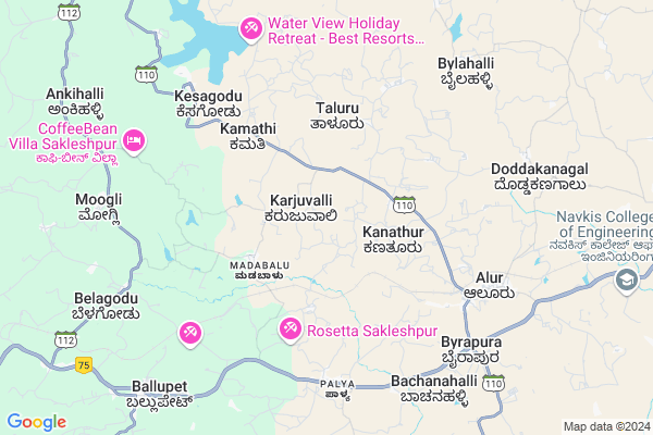
Yerahally Map
EDIT Map
Add Your House
 ..
..
Current Corona Virus Infected Patients Count in Hassan District
| City Name | District Name | Total Covid cases |
|---|
Locality Name :
Yerahally
( ಏರ್ಹಾಲ್ಯ್ )
Taluk Name : Alur
District : Hassan
State : Karnataka
Division : Mysore
Language : Kannada and Sanskrit, Tamil, Marathi, Marwari And Mahajani
Current Time 02:48 AM
Date: Saturday , Apr 26,2025 (IST)
Time zone: IST (UTC+5:30)
Elevation / Altitude: 953 meters. Above Seal level
Telephone Code / Std Code: 08170
Assembly constituency : Sakleshpur assembly constituency
Assembly MLA : Cement Manju
Lok Sabha constituency : Hassan parliamentary constituency
Parliament MP : PRAJWAL REVANNA
Serpanch Name :
Pin Code : 573213
Post Office Name : Alur (Hassan)
Main Village Name : Yelaganahalli
Commodities Prices : Arakalgud Market / Mandi
Yerahally Live Weather
Temperature: 21.5 °C
overcast clouds
Humidity: 93%
Wind : 2.33 mt/sec towards W
StationName : "Alūr"
observed on 2 Mins Back
Temperature: 21.5 °C
overcast clouds
Humidity: 93%
Wind : 2.33 mt/sec towards W
StationName : "Alūr"
observed on 2 Mins Back
Yerahally Weather Forecast for Next 5 days
27-04-2025
21.0°C to 35.5°C
overcast clouds, light rain
21.0°C to 35.5°C
overcast clouds, light rain
28-04-2025
19.8°C to 31.6°C
light rain, overcast clouds, broken clouds
19.8°C to 31.6°C
light rain, overcast clouds, broken clouds
29-04-2025
19.4°C to 32.7°C
scattered clouds, few clouds, broken clouds, light rain
19.4°C to 32.7°C
scattered clouds, few clouds, broken clouds, light rain
30-04-2025
20.0°C to 32.0°C
broken clouds, scattered clouds, light rain, overcast clouds
20.0°C to 32.0°C
broken clouds, scattered clouds, light rain, overcast clouds
National Highways Reachable To Yerahally
Nationa High Way :NH75
Nationa High Way :NH373
Nationa High Way :NH75
Nationa High Way :NH373
Rivers Near Yerahally
Yettinahole :ಎತ್ತಿನಹೊಳೆ :Ettinahoḷe
Shisla Hole :ಸಿಶ್ಲಾ
Yettinahole :ಎತ್ತಿನಹೊಳೆ :Ettinahoḷe
Shisla Hole :ಸಿಶ್ಲಾ
About Yerahally
Correct below Info and add more info about YerahallyYerahally is a small Village/hamlet in Alur Taluk in Hassan District of Karnataka State, India. It comes under Yelaganahalli Panchayath. It belongs to Mysore Division . It is located 20 KM towards west from District head quarters Hassan. 9 KM from Alur. 209 KM from State capital Bangalore
Yerahally Pin code is 573213 and postal head office is Alur (Hassan).
Yerahally is surrounded by Belur Taluk towards North , Hassan Taluk towards East , Sakaleshpur Taluk towards west , Arkalgud Taluk towards South .
Hassan , Sakleshpur , Chikmagalur , Arasikere are the near by Cities to Yerahally.
Demographics of Yerahally
Kannada is the Local Language here. Total population of Yerahally is 315 .Males are 155 and Females are 160 living in 59 Houses. Total area of Yerahally is 133 hectares.Politics in Yerahally
Janata Dal (Secular) , JD(S) , BJP , Bharatiya Janata Party (BJP) , INC are the major political parties in this area.Polling Stations /Booths near Yerahally
1)Govt. Higher Primary School Marasu2)Govt. Higher Primary School Kanathuru.
3)Govt. Lower Primary School Hale Alur
4)Govt. Lower Primary School Thaluru.
5)Govt. Lower Primary School Kirahalli
HOW TO REACH Yerahally
By Road
Alur is the Nearest Town to Yerahally. Alur is 8 km from Yerahally. Road connectivity is there from Alur to Yerahally.By Rail
Alur Halt Rail Way Station is the very nearby railway stations to Yerahally. Also you can consider railway Stations from Near By town Alur. Alur Halt Rail Way Station are the railway Stations near to Alur. You can reach from Alur to Yerahally by road after .Colleges near Yerahally
Mangala College Of Nursing
Address :
Governament Pu College
Address :
Vidyaranya Pre University College
Address :
Govt.pre University College Thatanahally
Address :
Ck College Of Tears
Address :
Schools near Yerahally
Pvt Bthesda Model School
Address : byarapura , alur , hassan , Karnataka . PIN- 573213 , Post - Alur (Hassan)
Ghps Murarji
Address : byarapura , alur , hassan , Karnataka . PIN- 573213 , Post - Alur (Hassan)
Ghps Marasu
Address : alur , alur , hassan , Karnataka . PIN- 573213 , Post - Alur (Hassan)
Ghps Kaganoor
Address : kaganoor , alur , hassan , Karnataka . PIN- 573129 , Post - Kenchammanahosakote
Govt Health Centers near Yerahally
1) DODDAKANAGAL , SC Doddakanagalu , Main road , Next to Ayurvedic Hospital2) Arehalli CHC , Community Health Center Arehalli , Sakleshpur Belur Main Road , Near Arehalli Police Station
3) MALASAVARA , CHC Arehalli , Main Road , Near Police Station
Hospitals in Yerahally,Alur
Primary Health Center
Palya; Hassan; NH-48; Mangalore Bangalore Highway; Alur; Alur; Karnataka 573218; India
6.6 KM distance Detail
more ..
Petrol Bunks in Yerahally,Alur
SSM Petrol Bunk
Singapura; Kanadahalli; Hassan; NH-48; Mangalore Bangalore Highway; Alur; Alur; Karnataka 573218; India
7.0 KM distance Detail
more ..
Colleges in Yerahally,Alur
Government Pre University College
Palya; Hassan; NH-48; Mangalore Bangalore Highway; Alur; Alur; Karnataka 573218; India
6.6 KM distance Detail
NDRK Institute of Technology
KIADB; Thimmanahally Industrial Area; Kandali; NH - 75; Hassan; Karnataka 573255; India
12.4 KM distance Detail
more ..
Schools in Yerahally,Alur
GOVT PRIMARY SCHOOL T GUDDENAHALLI
T GUDDENAHALLI; Taluru; Karnataka 573213; India
4.1 KM distance Detail
Electronic Shops in Yerahally,Alur
Sri Veerabhadreswara Electrical
Palya; चन्नाहल्ली; Haralur; Karnataka 573218; India
6.3 KM distance Detail
Police Stations near Yerahally,Alur
Arehalli Police Station
Saklespura- Arehally- Talallu -Belur Rd; Arehally; Karnataka 573101; India
18.5 KM distance Detail
Governement Offices near Yerahally,Alur
MANAPPURAM FINANCE LIMITED
HARSHITH COMPLEX; BM Rd; Alur; Karnataka 573213; India
6.8 KM distance Detail
BCM Office; Alur
Ground Floor; Hk Range gowda building; Asha Extension; Near KEB; BM Road; Hassan district; Alur; Karnataka 573213; India
7.7 KM distance Detail
About Yerahally &
History
How to reach Yerahally
Tourist Places Near By Yerahally
Schools in Yerahally
Colleges in Yerahally
Temperature & weather of Yerahally
places in Yerahally
Yerahally photos
More Information
How to reach Yerahally
Tourist Places Near By Yerahally
Schools in Yerahally
Colleges in Yerahally
Temperature & weather of Yerahally
places in Yerahally
Yerahally photos
More Information
Village Talk
Post News or Events about this Village
Near Cities
Hassan 14 KM near
Sakleshpur 20 KM near
Chikmagalur 45 KM near
Arasikere 54 KM near
Hassan 14 KM near
Sakleshpur 20 KM near
Chikmagalur 45 KM near
Arasikere 54 KM near
Near By Taluks
Alur 9 KM near
Belur 19 KM near
Hassan 21 KM near
Sakaleshpur 22 KM near
Alur 9 KM near
Belur 19 KM near
Hassan 21 KM near
Sakaleshpur 22 KM near
Near By Air Ports
Mysore Airport 122 KM near
Bajpe Airport 127 KM near
Bengaluru International Airport 215 KM near
Calicut Airport 231 KM near
Mysore Airport 122 KM near
Bajpe Airport 127 KM near
Bengaluru International Airport 215 KM near
Calicut Airport 231 KM near
Near By Tourist Places
Hassan 19 KM near
Sakleshpur 20 KM near
Belur 22 KM near
Halebid 27 KM near
Chikmagalur 44 KM near
Hassan 19 KM near
Sakleshpur 20 KM near
Belur 22 KM near
Halebid 27 KM near
Chikmagalur 44 KM near
Near By Districts
Hassan 19 KM near
Chikmagalur 45 KM near
Kodagu 75 KM near
Mysore 121 KM near
Hassan 19 KM near
Chikmagalur 45 KM near
Kodagu 75 KM near
Mysore 121 KM near
Near By RailWay Station
Alur Halt Rail Way Station 8.1 KM near
Sakleshpur Rail Way Station 20 KM near
Hassan Junction Rail Way Station 21 KM near
Alur Halt Rail Way Station 8.1 KM near
Sakleshpur Rail Way Station 20 KM near
Hassan Junction Rail Way Station 21 KM near