| Home | City Bus | Maps | Villages | Cities | Rail | Tourist Places | School | College | Pin Codes | Corona Cases Count |
| Distance Calculator Bus Services IFSC Codes Trace Mobile Number Weather Search Place Trace IP Available Cash ATM/Banks Locate Polling Booth Report an Error contact People |
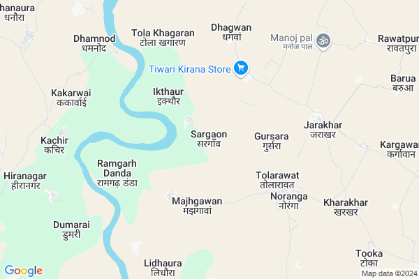
Sargaon
Sargaon Map
EDIT Map
Add Your House
 ..
..
Current Corona Virus Infected Patients Count in Hamirpur District District
| City Name | District Name | Total Covid cases |
|---|
Locality Name :
Sargaon
( सर्गों )
Block Name : Rath
District : Hamirpur District
State : Uttar Pradesh
Division : Chitrakoot
Language : Hindi and Urdu, Bagheli
Current Time 05:42 AM
Date: Saturday , Apr 26,2025 (IST)
Time zone: IST (UTC+5:30)
Elevation / Altitude: 208 meters. Above Seal level
Telephone Code / Std Code: 05280
Assembly constituency : Rath assembly constituency
Assembly MLA : Manisha
Lok Sabha constituency : Hamirpur parliamentary constituency
Parliament MP : KUNWAR PUSHPENDRA SINGH CHANDEL
Serpanch Name :
Commodities Prices : Raath Market / Mandi
Sargaon Live Weather
Temperature: 30.3 °C
few clouds
Humidity: 11%
Wind : 3.64 mt/sec towards W
StationName : "GohÄ\u0081nd"
observed on Now
Temperature: 30.3 °C
few clouds
Humidity: 11%
Wind : 3.64 mt/sec towards W
StationName : "GohÄ\u0081nd"
observed on Now
Sargaon Weather Forecast for Next 5 days
27-04-2025
32.2°C to 43.4°C
few clouds, clear sky, scattered clouds, broken clouds
32.2°C to 43.4°C
few clouds, clear sky, scattered clouds, broken clouds
28-04-2025
30.2°C to 41.9°C
broken clouds, scattered clouds, overcast clouds
30.2°C to 41.9°C
broken clouds, scattered clouds, overcast clouds
29-04-2025
30.5°C to 43.3°C
broken clouds, few clouds, scattered clouds, clear sky
30.5°C to 43.3°C
broken clouds, few clouds, scattered clouds, clear sky
30-04-2025
30.3°C to 44.8°C
clear sky
30.3°C to 44.8°C
clear sky
01-05-2025
29.7°C to 42.2°C
clear sky, few clouds
29.7°C to 42.2°C
clear sky, few clouds
Edit below overview about Sargaon
Edit below overview about Sargaon
OverView of Sargaon
The name Sargaon is define the place.The word Sar means pond and gaon means village. The landlord Akbar Khan purchase this village in 20rs from British government.akbar Khan has two sons 1[masood khan] 2[majeed khan]. Later masood Khan big son haji Mohammed Abdul raheem Khan was left Sargaon in 1979 and now the family of Abdul rahim Khan live in bilaspur.Edit below overview about Sargaon
Rivers Near Sargaon
Shyam
Dhasan
Shyam
Dhasan
About Sargaon
Sargaon is a Village in Rath Block in Hamirpur District District of Uttar Pradesh State, India. It belongs to Chitrakoot Division . It is located 93 KM towards west from District head quarters Hamirpur,. 15 KM from Rath. 236 KM from State capital Lucknow
Dhagwan ( 5 KM ) , Tola Khagaran ( 6 KM ) , Jarakhar ( 6 KM ) , Lidhaura ( 8 KM ) , Nahdoura ( 8 KM ) are the nearby Villages to Sargaon. Sargaon is surrounded by Gohand Block towards East , Bamaur Block towards west , Gursarai Block towards west , Panwari Block towards South .
Rath , Niwari , Orai , Charkhari are the near by Cities to Sargaon.
Sargaon 2011 Census Details
Sargaon Local Language is Hindi. Sargaon Village Total population is 1591 and number of houses are 323. Female Population is 45.5%. Village literacy rate is 56.1% and the Female Literacy rate is 21.2%.
Population
| Census Parameter | Census Data |
| Total Population | 1591 |
| Total No of Houses | 323 |
| Female Population % | 45.5 % ( 724) |
| Total Literacy rate % | 56.1 % ( 893) |
| Female Literacy rate | 21.2 % ( 338) |
| Scheduled Tribes Population % | 0.0 % ( 0) |
| Scheduled Caste Population % | 26.5 % ( 422) |
| Working Population % | 37.0 % |
| Child(0 -6) Population by 2011 | 176 |
| Girl Child(0 -6) Population % by 2011 | 40.3 % ( 71) |
Sargaon Census More Deatils.
Politics in Sargaon
RTKP , SP , BSP , INC are the major political parties in this area.Polling Stations /Booths near Sargaon
1)Sargaon2)Saina
3)Atagaon
4)Tola Khangaran
5)Tikariya
HOW TO REACH Sargaon
By Rail
There is no railway station near to Sargaon in less than 10 km.Pincodes near Sargaon
210430 ( Gohand ) , 284203 ( Garautha ) , 210431 ( Rath )Colleges near Sargaon
Chitragupt Inter College
Address :
Schools in Sargaon
Ups Sargaon
Address : sargaon , rath , hamirpur (u.p.) , Uttar Pradesh . PIN- 210431 , Post - Rath
Govt Health Centers near Sargaon
1) Sargovn , , ,2) Dhawar , chc panwari , rath road ,
3) Gohand , Gohand , ,
Petrol Bunks in Sargaon,Rath
HP PETROL PUMP - AKANKSHA HP CENTRE
Vill Gohand ON Tehsil Sarila; SH 21; Uttar Pradesh 210430; India
15.4 KM distance Detail
HP PETROL PUMP - MANNI LAL AGARWAL AND SONS
Rath Panwari Road Tehsil Rath Dt- UP; Kanpur; Uttar Pradesh 210506; India
18.2 KM distance Detail
more ..
Super Markets in Sargaon,Rath
Mahadev Baba Ka Mandir Yadav Kirana Store
Jarakhar; Rath; Uttar Pradesh; India
6.1 KM distance Detail
महाऋषि आयुर्वेदिक औषधि केन्द्र ब्रह्मानन्द भवन पड़ाव राठ
महाऋषि आयुर्वेदिक औषधि केन्द्र; Barah Khambha; ब्रह्मानन्द भवन; Rath; Uttar Pradesh 210431; India
18.3 KM distance Detail
Police Stations near Sargaon,Rath
Kot Bazar Police Chowki
Main Market Rd; Kot Bazar; Rath; Uttar Pradesh 210431; India
18.5 KM distance Detail
About Sargaon &
History
How to reach Sargaon
Tourist Places Near By Sargaon
Schools in Sargaon
Colleges in Sargaon
Temperature & weather of Sargaon
places in Sargaon
Sargaon photos
More Information
How to reach Sargaon
Tourist Places Near By Sargaon
Schools in Sargaon
Colleges in Sargaon
Temperature & weather of Sargaon
places in Sargaon
Sargaon photos
More Information
Village Talk
Post News or Events about this Village
Near Cities
Rath 17 KM near
Niwari 42 KM near
Orai 42 KM near
Charkhari 48 KM near
Rath 17 KM near
Niwari 42 KM near
Orai 42 KM near
Charkhari 48 KM near
Near By Taluks
Rath 14 KM near
Gohand 17 KM near
Bamaur 28 KM near
Gursarai 28 KM near
Rath 14 KM near
Gohand 17 KM near
Bamaur 28 KM near
Gursarai 28 KM near
Near By Air Ports
Khajuraho Airport 117 KM near
Kanpur Airport 145 KM near
Gwalior Airport 155 KM near
Amausi Airport 214 KM near
Khajuraho Airport 117 KM near
Kanpur Airport 145 KM near
Gwalior Airport 155 KM near
Amausi Airport 214 KM near
Near By Tourist Places
Orchha 95 KM near
Jhansi 98 KM near
Datia 106 KM near
Khajuraho 116 KM near
Sonagir 117 KM near
Orchha 95 KM near
Jhansi 98 KM near
Datia 106 KM near
Khajuraho 116 KM near
Sonagir 117 KM near
Near By Districts
Jalaun 62 KM near
Mahoba 67 KM near
Hamirpur District 89 KM near
Chhatarpur 93 KM near
Jalaun 62 KM near
Mahoba 67 KM near
Hamirpur District 89 KM near
Chhatarpur 93 KM near
Near By RailWay Station
Ait Junction Rail Way Station 37 KM near
Orai Rail Way Station 41 KM near
Ait Junction Rail Way Station 37 KM near
Orai Rail Way Station 41 KM near