| Home | City Bus | Maps | Villages | Cities | Rail | Tourist Places | School | College | Pin Codes | Corona Cases Count |
| Distance Calculator Bus Services IFSC Codes Trace Mobile Number Weather Search Place Trace IP Available Cash ATM/Banks Locate Polling Booth Report an Error contact People |
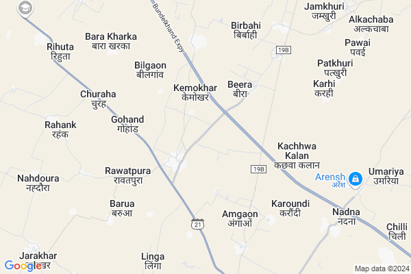
Chilli
Chilli Map
EDIT Map
Add Your House
 ..
..
Current Corona Virus Infected Patients Count in Hamirpur District District
| City Name | District Name | Total Covid cases |
|---|
Locality Name :
Chilli
( चिल्ली )
Block Name : Gohand
District : Hamirpur District
State : Uttar Pradesh
Division : Chitrakoot
Language : Hindi and Urdu, Bagheli
Current Time 09:07 AM
Date: Wednesday , Apr 30,2025 (IST)
Time zone: IST (UTC+5:30)
Elevation / Altitude: 139 meters. Above Seal level
Telephone Code / Std Code: 05280
Assembly constituency : Rath assembly constituency
Assembly MLA : Manisha
Lok Sabha constituency : Hamirpur parliamentary constituency
Parliament MP : KUNWAR PUSHPENDRA SINGH CHANDEL
Serpanch Name :
Commodities Prices : Raath Market / Mandi
Rivers Near Chilli
Parwar Nadi
Dhasan
Parwar Nadi
Dhasan
About Chilli
Correct below Info and add more info about ChilliChilli is a Village in Gohand Block in Hamirpur District District of Uttar Pradesh State, India. It belongs to Chitrakoot Division . It is located 76 KM towards west from District head quarters Hamirpur,. 219 KM from State capital Lucknow
Chilli is surrounded by Rath Block towards South , Sarila Block towards East , Dakore Block towards North , Muskara Block towards East .
Rath , Orai , Niwari , Charkhari are the near by Cities to Chilli.
Chilli 2011 Census Details
Chilli Local Language is Hindi. Chilli Village Total population is 4107 and number of houses are 858. Female Population is 47.7%. Village literacy rate is 55.9% and the Female Literacy rate is 20.5%.
Population
| Census Parameter | Census Data |
| Total Population | 4107 |
| Total No of Houses | 858 |
| Female Population % | 47.7 % ( 1959) |
| Total Literacy rate % | 55.9 % ( 2294) |
| Female Literacy rate | 20.5 % ( 840) |
| Scheduled Tribes Population % | 0.0 % ( 0) |
| Scheduled Caste Population % | 10.9 % ( 449) |
| Working Population % | 51.0 % |
| Child(0 -6) Population by 2011 | 493 |
| Girl Child(0 -6) Population % by 2011 | 49.5 % ( 244) |
Chilli Census More Deatils.
Politics in Chilli
RTKP , SP , BSP , INC are the major political parties in this area.Polling Stations /Booths near Chilli
1)Gohand2)Girwar
3)Gohand
4)Leenga
5)Rigwara Khurd
HOW TO REACH Chilli
By Rail
There is no railway station near to Chilli in less than 10 km.Pincodes near Chilli
210430 ( Gohand ) , 210431 ( Rath ) , 285122 ( Dakore )Colleges near Chilli
Govt High School Bajehata
Address : Govt High School Bajehata
Chitragupt Inter College
Address :
Govt. Degree College, Maudaha
Address :
Rahmaniya Inter College
Address :
Ramaiya Inter College Madaha Hamirpur
Address :
Schools in Chilli
Bundelkhand Ups Chilli
Address : chilli , gohand , hamirpur (u.p.) , Uttar Pradesh . PIN- 210431 , Post - Rath
Sri Vikram Singh Ups
Address : chilli , gohand , hamirpur (u.p.) , Uttar Pradesh . PIN- 210431 , Post - Rath
Govt Health Centers near Chilli
1) Gohand , Gohand , ,2) Kariyari , karyari sub center , karyari , temple
3) UPHC Rath , Purani PHC Rath , Purani PHC Rath ,
Petrol Bunks in Chilli,Gohand
HP PETROL PUMP - AKANKSHA HP CENTRE
Vill Gohand ON Tehsil Sarila; SH 21; Uttar Pradesh 210430; India
3.6 KM distance Detail
Hansraj Tiwari and Sons
Kalpi Dhagwan Rath Marg; Pawai; Uttar Pradesh 210422; India
7.8 KM distance Detail
Rav Rani Filling station Essar Oil Petrol Pump
Rath; Hamirpur; SH-21; Orai Road; Hamirpur; Hamirpur; Uttar Pradesh 210431; India
12.0 KM distance Detail
more ..
Colleges in Chilli,Gohand
Abhinav pragya mahavidhyalaya Rath hamirpur
Khumari Chandaut Road Rath Hamirpur; Rath; Uttar Pradesh 210431; India
9.4 KM distance Detail
more ..
Schools in Chilli,Gohand
Shri Gandhi Inter College Gohand Hamirpur
Gohand; Uttar Pradesh 210430; India
2.1 KM distance Detail
Super Markets in Chilli,Gohand
Mahadev Baba Ka Mandir Yadav Kirana Store
Jarakhar; Rath; Uttar Pradesh; India
12.3 KM distance Detail
United India Insurance Office
1; SH 21; Bhatiyana; Ratanada; SH 21; Bhatiyana; Ratanada; Rath; Uttar Pradesh 210431; India
14.3 KM distance Detail
Police Stations near Chilli,Gohand
Kot Bazar Police Chowki
Main Market Rd; Kot Bazar; Rath; Uttar Pradesh 210431; India
15.0 KM distance Detail
About Chilli &
History
How to reach Chilli
Tourist Places Near By Chilli
Schools in Chilli
Colleges in Chilli
Temperature & weather of Chilli
places in Chilli
Chilli photos
More Information
How to reach Chilli
Tourist Places Near By Chilli
Schools in Chilli
Colleges in Chilli
Temperature & weather of Chilli
places in Chilli
Chilli photos
More Information
Village Talk
Post News or Events about this Village
Near Cities
Rath 13 KM near
Orai 37 KM near
Niwari 38 KM near
Charkhari 44 KM near
Rath 13 KM near
Orai 37 KM near
Niwari 38 KM near
Charkhari 44 KM near
Near By Taluks
Gohand 0 KM near
Rath 18 KM near
Sarila 22 KM near
Dakore 34 KM near
Gohand 0 KM near
Rath 18 KM near
Sarila 22 KM near
Dakore 34 KM near
Near By Air Ports
Khajuraho Airport 118 KM near
Kanpur Airport 128 KM near
Gwalior Airport 165 KM near
Amausi Airport 197 KM near
Khajuraho Airport 118 KM near
Kanpur Airport 128 KM near
Gwalior Airport 165 KM near
Amausi Airport 197 KM near
Near By Tourist Places
Orchha 113 KM near
Jhansi 115 KM near
Khajuraho 116 KM near
Datia 122 KM near
Kanpur 126 KM near
Orchha 113 KM near
Jhansi 115 KM near
Khajuraho 116 KM near
Datia 122 KM near
Kanpur 126 KM near
Near By Districts
Jalaun 59 KM near
Mahoba 62 KM near
Hamirpur District 72 KM near
Banda 91 KM near
Jalaun 59 KM near
Mahoba 62 KM near
Hamirpur District 72 KM near
Banda 91 KM near
Near By RailWay Station
Orai Rail Way Station 35 KM near
Ait Junction Rail Way Station 44 KM near
Orai Rail Way Station 35 KM near
Ait Junction Rail Way Station 44 KM near