| Home | City Bus | Maps | Villages | Cities | Rail | Tourist Places | School | College | Pin Codes | Corona Cases Count |
| Distance Calculator Bus Services IFSC Codes Trace Mobile Number Weather Search Place Trace IP Available Cash ATM/Banks Locate Polling Booth Report an Error contact People |
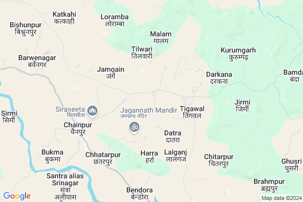
Nichekuniyo Map
EDIT Map
Add Your House
 ..
..
Current Corona Virus Infected Patients Count in Gumla District
| City Name | District Name | Total Covid cases |
|---|
Locality Name :
Nichekuniyo
( नीचेकुनियो )
Block Name : Chainpur
District : Gumla
State : Jharkhand
Language : Nagpuri and Hindi, Oriya, Bihari, Kurukh.
Current Time 10:32 PM
Date: Sunday , Apr 27,2025 (IST)
Time zone: IST (UTC+5:30)
Elevation / Altitude: 643 meters. Above Seal level
Telephone Code / Std Code: 06524
Assembly constituency : Gumla assembly constituency
Assembly MLA : BHUSHAN TIRKEY
Lok Sabha constituency : Lohardaga parliamentary constituency
Parliament MP : SUDARSHAN BHAGAT
Serpanch Name :
Main Village Name : Kuinyo
Commodities Prices : Jaspur Market / Mandi
Nichekuniyo Live Weather
Temperature: 24.5 °C
overcast clouds
Humidity: 43%
Wind : 7.78 mt/sec towards W
StationName : "GumlÄ\u0081"
observed on 29 Mins Back
Temperature: 24.5 °C
overcast clouds
Humidity: 43%
Wind : 7.78 mt/sec towards W
StationName : "GumlÄ\u0081"
observed on 29 Mins Back
Nichekuniyo Weather Forecast for Next 5 days
28-04-2025
22.1°C to 24.3°C
light rain, broken clouds
22.1°C to 24.3°C
light rain, broken clouds
29-04-2025
19.7°C to 31.2°C
broken clouds, scattered clouds, light rain, clear sky
19.7°C to 31.2°C
broken clouds, scattered clouds, light rain, clear sky
30-04-2025
18.6°C to 34.5°C
clear sky, few clouds, light rain, scattered clouds
18.6°C to 34.5°C
clear sky, few clouds, light rain, scattered clouds
01-05-2025
18.6°C to 35.1°C
scattered clouds, clear sky, light rain, few clouds
18.6°C to 35.1°C
scattered clouds, clear sky, light rain, few clouds
02-05-2025
19.5°C to 33.8°C
clear sky, moderate rain, heavy intensity rain, overcast clouds
19.5°C to 33.8°C
clear sky, moderate rain, heavy intensity rain, overcast clouds
Rivers Near Nichekuniyo
Sankh River :Sankh River
South Koel River
Sankh River :Sankh River
South Koel River
About Nichekuniyo
Correct below Info and add more info about NichekuniyoNichekuniyo is a small Village/hamlet in Chainpur Block in Gumla District of Jharkhand State, India. It comes under Kuinyo Panchayath. It is located 32 KM towards west from District head quarters Gumla. 124 KM from State capital Ranchi
Nichekuniyo is surrounded by Dumri Block towards west , Raidih Block towards South , Ghaghra Block towards East , Gumla Block towards East .
Gumla , Jashpurnagar , Lohardaga , Simdega are the near by Cities to Nichekuniyo.
Demographics of Nichekuniyo
Nagpuri is the Local Language here.Politics in Nichekuniyo
Bharatiya Janata Party , BJP , JMM , INC are the major political parties in this area.Polling Stations /Booths near Nichekuniyo
1)Middle School Majhgaon2)Govt. Primary School Govindpur
3)Aganbari Centre Karida
4)Primary School Tigawal
5)Primary School Chuglu
HOW TO REACH Nichekuniyo
By Rail
There is no railway station near to Nichekuniyo in less than 10 km.Pincodes near Nichekuniyo
835206 ( Chainpur (Gumla) ) , 835230 ( Noadih ) , 835218 ( Netarhat )Colleges near Nichekuniyo
Albert Ekka Collage
Address :
Schools near Nichekuniyo
Lutheran High Chainpur
Address : Kurumgarh Road Chainpur, Gumla
Barway High School (bhs)
Address : SHRINAGAR ROAD NEAR BAAJAR TAND
St. Ann's Girls High School
Address : Gumla road, Premnagar, Chainpur
Govt Health Centers near Nichekuniyo
1) HSC DAHUDARHGAON , DAHUDANGRA , ,2) HSC DATRA , DATRA , ,
3) HSC TINTANGAR , TINTANGAR , ,
Colleges in Nichekuniyo,Chainpur
Paramvir Albert Ekka Memorial College ;Chainpur;
Chhatarpur; Jharkhand 835206; India
7.2 KM distance Detail
more ..
Schools in Nichekuniyo,Chainpur
St. Xavier's School;Barway;Chainpur.
Church Rd; Mohammadpur urf Chainpur; Jharkhand 835206; India
6.5 KM distance Detail
Electronic Shops in Nichekuniyo,Chainpur
Palak Digit Studio & Railway Reservation
Nawadi Chowk; District Gumla; Dumri; 835230; India
18.8 KM distance Detail
Super Markets in Nichekuniyo,Chainpur
Local Parks in Nichekuniyo,Chainpur
Police Stations near Nichekuniyo,Chainpur
Governement Offices near Nichekuniyo,Chainpur
About Nichekuniyo &
History
How to reach Nichekuniyo
Tourist Places Near By Nichekuniyo
Schools in Nichekuniyo
Colleges in Nichekuniyo
Temperature & weather of Nichekuniyo
places in Nichekuniyo
Nichekuniyo photos
More Information
How to reach Nichekuniyo
Tourist Places Near By Nichekuniyo
Schools in Nichekuniyo
Colleges in Nichekuniyo
Temperature & weather of Nichekuniyo
places in Nichekuniyo
Nichekuniyo photos
More Information
Village Talk
Post News or Events about this Village
Near Cities
Gumla 31 KM near
Jashpurnagar 35 KM near
Lohardaga 56 KM near
Simdega 70 KM near
Gumla 31 KM near
Jashpurnagar 35 KM near
Lohardaga 56 KM near
Simdega 70 KM near
Near By Taluks
Chainpur 0 KM near
Dumri 16 KM near
Raidih 25 KM near
Ghaghra 30 KM near
Chainpur 0 KM near
Dumri 16 KM near
Raidih 25 KM near
Ghaghra 30 KM near
Near By Air Ports
Ranchi Airport 120 KM near
Gaya Airport 212 KM near
Patna Airport 317 KM near
Varanasi Airport 329 KM near
Ranchi Airport 120 KM near
Gaya Airport 212 KM near
Patna Airport 317 KM near
Varanasi Airport 329 KM near
Near By Tourist Places
Gumla 31 KM near
Jashpur 37 KM near
Netarhat 39 KM near
Lohardaga 56 KM near
Simdega 71 KM near
Gumla 31 KM near
Jashpur 37 KM near
Netarhat 39 KM near
Lohardaga 56 KM near
Simdega 71 KM near
Near By Districts
Gumla 31 KM near
Jashpur 37 KM near
Lohardaga 57 KM near
Simdega 70 KM near
Gumla 31 KM near
Jashpur 37 KM near
Lohardaga 57 KM near
Simdega 70 KM near
Near By RailWay Station
Latehar Rail Way Station 74 KM near
Tori Junction Rail Way Station 83 KM near
Latehar Rail Way Station 74 KM near
Tori Junction Rail Way Station 83 KM near