| Home | City Bus | Maps | Villages | Cities | Rail | Tourist Places | School | College | Pin Codes | Corona Cases Count |
| Distance Calculator Bus Services IFSC Codes Trace Mobile Number Weather Search Place Trace IP Available Cash ATM/Banks Locate Polling Booth Report an Error contact People |
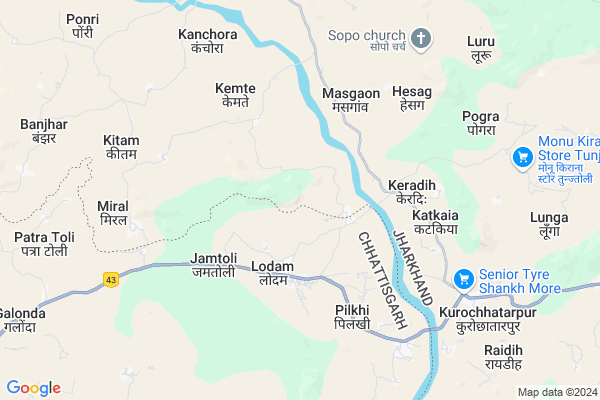
Kating Map
EDIT Map
Add Your House
 ..
..
Current Corona Virus Infected Patients Count in Gumla District
| City Name | District Name | Total Covid cases |
|---|
Locality Name :
Kating
( कटिंग )
Block Name : Chainpur
District : Gumla
State : Jharkhand
Language : Nagpuri and Hindi, Oriya, Bihari, Kurukh.
Current Time 10:47 AM
Date: Tuesday , Apr 29,2025 (IST)
Time zone: IST (UTC+5:30)
Elevation / Altitude: 643 meters. Above Seal level
Telephone Code / Std Code: 06524
Assembly constituency : Gumla assembly constituency
Assembly MLA :
Lok Sabha constituency : Lohardaga parliamentary constituency
Parliament MP :
Serpanch Name :
Pin Code : 835206
Post Office Name : Chainpur (Gumla)
Commodities Prices : Jaspur Market / Mandi
Kating Live Weather
Temperature: 32.8 °C
clear sky
Humidity: 25%
Wind : 4.76 mt/sec towards SW
StationName : "GumlÄ\u0081"
observed on Now
Temperature: 32.8 °C
clear sky
Humidity: 25%
Wind : 4.76 mt/sec towards SW
StationName : "GumlÄ\u0081"
observed on Now
Kating Weather Forecast for Next 5 days
30-04-2025
21.0°C to 34.2°C
clear sky, light rain, overcast clouds, broken clouds
21.0°C to 34.2°C
clear sky, light rain, overcast clouds, broken clouds
01-05-2025
19.8°C to 37.5°C
clear sky, few clouds, light rain, broken clouds
19.8°C to 37.5°C
clear sky, few clouds, light rain, broken clouds
02-05-2025
20.0°C to 36.0°C
clear sky, scattered clouds, moderate rain, light rain, broken clouds, few clouds
20.0°C to 36.0°C
clear sky, scattered clouds, moderate rain, light rain, broken clouds, few clouds
03-05-2025
19.8°C to 34.2°C
clear sky, light rain, moderate rain, overcast clouds, broken clouds
19.8°C to 34.2°C
clear sky, light rain, moderate rain, overcast clouds, broken clouds
04-05-2025
20.6°C to 35.2°C
scattered clouds, clear sky, light rain, moderate rain, overcast clouds
20.6°C to 35.2°C
scattered clouds, clear sky, light rain, moderate rain, overcast clouds
Rivers Near Kating
Sankh River :Sankh River
South Koel River
Sankh River :Sankh River
South Koel River
About Kating
Correct below Info and add more info about KatingKating is a Village in Chainpur Block in Gumla District of Jharkhand State, India. It is located 24 KM towards west from District head quarters Gumla. 23 KM from Chainpur. 124 KM from State capital Ranchi
Kating Pin code is 835206 and postal head office is Chainpur (Gumla).
Nawagarh ( 12 KM ) , Raidih ( 12 KM ) , Sikoi ( 14 KM ) , Bendora ( 17 KM ) are the nearby Villages to Kating. Kating is surrounded by Jashpur Block towards west , Chainpur Block towards North , Gumla Block towards East , Pakartanr Block towards South .
Gumla , Jashpurnagar , Simdega , Lohardaga are the near by Cities to Kating.
Demographics of Kating
Nagpuri is the Local Language here.Politics in Kating
Bharatiya Janata Party , BJP , JMM , INC are the major political parties in this area.Polling Stations /Booths near Kating
1)R. C. Middle School Manjhatoli2)R.c. Primary School Soso
3)Govt. Middle School Kansir
4)Govt. Middle School Kemte
5)Upg. Middle School Kathgaon
HOW TO REACH Kating
By Rail
There is no railway station near to Kating in less than 10 km.Colleges near Kating
Albert Ekka Collage
Address :
Schools near Kating
Lutheran High Chainpur
Address : Kurumgarh Road Chainpur, Gumla
Barway High School (bhs)
Address : SHRINAGAR ROAD NEAR BAAJAR TAND
St. Ann's Girls High School
Address : Gumla road, Premnagar, Chainpur
Govt Health Centers near Kating
1) HSC TUDURMA , TUDURMA , ,2) HSC KATHKAYA , KATKAYA , ,
3) HSC KEMTE , KEMTEY , ,
Petrol Bunks in Kating,Chainpur
Ma Aashapura Fuel Centre
kurochatarpur ; manjatoli; Raidih ; Dist; Jharkhand; India
8.6 KM distance Detail
more ..
Colleges in Kating,Chainpur
Paramvir Albert Ekka Memorial College ;Chainpur;
Chhatarpur; Jharkhand 835206; India
21.1 KM distance Detail
more ..
Local Parks in Kating,Chainpur
About Kating &
History
How to reach Kating
Tourist Places Near By Kating
Schools in Kating
Colleges in Kating
Temperature & weather of Kating
places in Kating
Kating photos
More Information
How to reach Kating
Tourist Places Near By Kating
Schools in Kating
Colleges in Kating
Temperature & weather of Kating
places in Kating
Kating photos
More Information
Village Talk
Post News or Events about this Village
Near Cities
Gumla 23 KM near
Jashpurnagar 25 KM near
Simdega 48 KM near
Lohardaga 67 KM near
Gumla 23 KM near
Jashpurnagar 25 KM near
Simdega 48 KM near
Lohardaga 67 KM near
Near By Taluks
Raidih 7 KM near
Jashpur 19 KM near
Chainpur 22 KM near
Gumla 26 KM near
Raidih 7 KM near
Jashpur 19 KM near
Chainpur 22 KM near
Gumla 26 KM near
Near By Air Ports
Ranchi Airport 119 KM near
Gaya Airport 230 KM near
Patna Airport 336 KM near
Varanasi Airport 351 KM near
Ranchi Airport 119 KM near
Gaya Airport 230 KM near
Patna Airport 336 KM near
Varanasi Airport 351 KM near
Near By Tourist Places
Gumla 22 KM near
Jashpur 26 KM near
Simdega 49 KM near
Netarhat 61 KM near
Lohardaga 67 KM near
Gumla 22 KM near
Jashpur 26 KM near
Simdega 49 KM near
Netarhat 61 KM near
Lohardaga 67 KM near
Near By Districts
Gumla 23 KM near
Jashpur 27 KM near
Simdega 48 KM near
Lohardaga 68 KM near
Gumla 23 KM near
Jashpur 27 KM near
Simdega 48 KM near
Lohardaga 68 KM near
Near By RailWay Station
Latehar Rail Way Station 93 KM near
Tori Junction Rail Way Station 98 KM near
Latehar Rail Way Station 93 KM near
Tori Junction Rail Way Station 98 KM near