| Home | City Bus | Maps | Villages | Cities | Rail | Tourist Places | School | College | Pin Codes | Corona Cases Count |
| Distance Calculator Bus Services IFSC Codes Trace Mobile Number Weather Search Place Trace IP Available Cash ATM/Banks Locate Polling Booth Report an Error contact People |
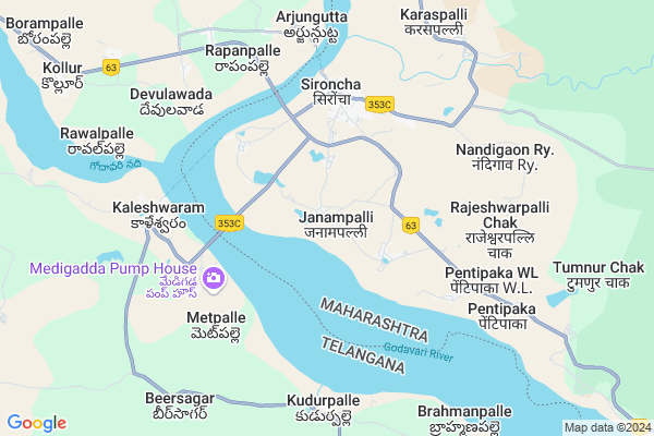
Maddikuntha
Maddikuntha Map
EDIT Map
Add Your House
 ..
..
Current Corona Virus Infected Patients Count in Gadchiroli District
| City Name | District Name | Total Covid cases |
|---|
Locality Name :
Maddikuntha
( मद्दीकुंठ )
Taluka Name : Sironcha
District : Gadchiroli
State : Maharashtra
Region : Vidarbh
Division : Nagpur
Language : Marathi and Hindi,gondi,bengali, Telgu
Current Time 06:34 AM
Date: Monday , Apr 28,2025 (IST)
Time zone: IST (UTC+5:30)
Elevation / Altitude: 189 meters. Above Seal level
Telephone Code / Std Code: 07131
Assembly constituency : Aheri assembly constituency
Assembly MLA : Aatram Dharamraobaba Bhagwantrao
Lok Sabha constituency : Gadchiroli-Chimur parliamentary constituency
Parliament MP : ASHOK MAHADEORAO NETE
Serpanch Name :
Pin Code : 442504
Post Office Name : Sironcha
Alternate Village Name : Madikuntha
Commodities Prices : Sironcha Market / Mandi
Maddikuntha Live Weather
Temperature: 27.5 °C
clear sky
Humidity: 63%
Wind : 2.02 mt/sec towards S
StationName : "Manthani"
observed on 10 Mins Back
Temperature: 27.5 °C
clear sky
Humidity: 63%
Wind : 2.02 mt/sec towards S
StationName : "Manthani"
observed on 10 Mins Back
Maddikuntha Weather Forecast for Next 5 days
29-04-2025
28.7°C to 41.7°C
clear sky, scattered clouds
28.7°C to 41.7°C
clear sky, scattered clouds
30-04-2025
27.8°C to 42.6°C
clear sky, few clouds, scattered clouds
27.8°C to 42.6°C
clear sky, few clouds, scattered clouds
01-05-2025
28.4°C to 44.3°C
clear sky, few clouds
28.4°C to 44.3°C
clear sky, few clouds
02-05-2025
28.2°C to 43.7°C
clear sky, scattered clouds
28.2°C to 43.7°C
clear sky, scattered clouds
03-05-2025
28.8°C to 43.7°C
broken clouds, scattered clouds, clear sky, light rain, few clouds
28.8°C to 43.7°C
broken clouds, scattered clouds, clear sky, light rain, few clouds
Edit below overview about Maddikuntha
Edit below overview about Maddikuntha
OverView of Maddikuntha
Maddikunta is situated about 2.50km from Sironcha.It was formed 300years ago from migrant telugu people from Andhra Pradesh.Therefore this village's mother tongue is Telugu eventhough it is in Maharashtra.this village' s main accupation is forming.The culture here is that of Telangana region. All hindu festivals as like in Telangana are celebrated here.This village has a gram panchayat run by most efficient surpanch and members. I hope they will tranform this village green and clean.Edit below overview about Maddikuntha
National Highways Reachable To Maddikuntha
Nationa High Way :NH63
Nationa High Way :NH363
Nationa High Way :NH63
Nationa High Way :NH363
Rivers Near Maddikuntha
Godavari :गोदावरी :ಗೋದಾವರಿ :गोदावरी :கோதாவரி :గోదావరి
Are Vagu
Godavari :गोदावरी :ಗೋದಾವರಿ :गोदावरी :கோதாவரி :గోదావరి
Are Vagu
About Maddikuntha
Maddikuntha is a Village in Sironcha Taluka in Gadchiroli District of Maharashtra State, India. It belongs to Vidarbh region . It belongs to Nagpur Division . It is located 179 KM towards South from District head quarters Gadchiroli. 6 KM from Sironcha. 874 KM from State capital Mumbai
Maddikuntha Pin code is 442504 and postal head office is Sironcha .
Ramanjapur (vl) ( 2 KM ) , Arda ( 2 KM ) , Nagram ( 4 KM ) , Sironcha ( 4 KM ) , Sironcha (ryt) ( 4 KM ) are the nearby Villages to Maddikuntha. Maddikuntha is surrounded by Mahadevpur Taluka towards South , Kotapally Taluka towards North , Chennur Taluka towards west , Kataram Taluka towards South .
Ramagundam , Mancherial , Mandamarri , Bellampalle are the near by Cities to Maddikuntha.
This Place is in the border of the Gadchiroli District and Karimnagar District. Karimnagar District Mahadevpur is South towards this place . It is near to the Telangana State Border.
Maddikuntha 2011 Census Details
Maddikuntha Local Language is Marathi. Maddikuntha Village Total population is 644 and number of houses are 184. Female Population is 49.8%. Village literacy rate is 55.6% and the Female Literacy rate is 23.0%.
Population
| Census Parameter | Census Data |
| Total Population | 644 |
| Total No of Houses | 184 |
| Female Population % | 49.8 % ( 321) |
| Total Literacy rate % | 55.6 % ( 358) |
| Female Literacy rate | 23.0 % ( 148) |
| Scheduled Tribes Population % | 7.0 % ( 45) |
| Scheduled Caste Population % | 28.7 % ( 185) |
| Working Population % | 59.9 % |
| Child(0 -6) Population by 2011 | 63 |
| Girl Child(0 -6) Population % by 2011 | 42.9 % ( 27) |
Maddikuntha Census More Deatils.
Politics in Maddikuntha
BJP , NCP , are the major political parties in this area.Polling Stations /Booths near Maddikuntha
1)Machhigatta2)Chinchagundi
3)Ankisa Mal
4)Jambiya
5)Nagepalli M
HOW TO REACH Maddikuntha
By Rail
There is no railway station near to Maddikuntha in less than 10 km. Manchiryal Rail Way Station (near to Mancherial) , Balharshah Junction Rail Way Station (near to Ballarpur) , Gondwana Visapur Rail Way Station (near to Ballarpur) , Warangal Rail Way Station (near to Warangal) , Ravindrakhani Rail Way Station (near to Mancherial) , Kazipet Town Rail Way Station (near to Warangal) are the Rail way stations reachable from near by towns.By Road
Mancherial , Warangal , Ballarpur , Gadchiroli are the nearby by towns to Maddikuntha having road connectivity to MaddikunthaColleges near Maddikuntha
Z.p [e.x]govt High School Junior Science Collage Sironcha
Address :
Schools in Maddikuntha
Z.p. Upper Prm. School
Address : maddikuntha , sironcha , gadchiroli , Maharashtra . PIN- 442504 , Post - Sironcha
Govt Health Centers near Maddikuntha
1) Nagulwahi , NAGULWAHI , NAGULWAHI , NAGULWAHI2) Gomani , GOMNI , GOMNI , GOMNI
3) Dhaba , Sub Centre Dhaba , Gondpipri Road , Near Police Station
Schools in Maddikuntha,Sironcha
Electronic Shops in Maddikuntha,Sironcha
Super Markets in Maddikuntha,Sironcha
Local Parks in Maddikuntha,Sironcha
Police Stations near Maddikuntha,Sironcha
Governement Offices near Maddikuntha,Sironcha
About Maddikuntha &
History
How to reach Maddikuntha
Tourist Places Near By Maddikuntha
Schools in Maddikuntha
Colleges in Maddikuntha
Temperature & weather of Maddikuntha
places in Maddikuntha
Maddikuntha photos
More Information
How to reach Maddikuntha
Tourist Places Near By Maddikuntha
Schools in Maddikuntha
Colleges in Maddikuntha
Temperature & weather of Maddikuntha
places in Maddikuntha
Maddikuntha photos
More Information
Village Talk
Post News or Events about this Village
Near Cities
Ramagundam 57 KM near
Mancherial 59 KM near
Mandamarri 59 KM near
Bellampalle 62 KM near
Ramagundam 57 KM near
Mancherial 59 KM near
Mandamarri 59 KM near
Bellampalle 62 KM near
Near By Taluks
Sironcha 6 KM near
Mahadevpur 15 KM near
Kotapally 20 KM near
Chennur 22 KM near
Sironcha 6 KM near
Mahadevpur 15 KM near
Kotapally 20 KM near
Chennur 22 KM near
Near By Air Ports
Rajiv Gandhi International Airport 266 KM near
Vijayawada Airport 300 KM near
Sonegaon Airport 302 KM near
Rajahmundry Airport 305 KM near
Rajiv Gandhi International Airport 266 KM near
Vijayawada Airport 300 KM near
Sonegaon Airport 302 KM near
Rajahmundry Airport 305 KM near
Near By Tourist Places
Medaram 69 KM near
Sirpur 94 KM near
Bhamragarh Wildlife Sanctuary 105 KM near
Warangal 109 KM near
Chandrapur 161 KM near
Medaram 69 KM near
Sirpur 94 KM near
Bhamragarh Wildlife Sanctuary 105 KM near
Warangal 109 KM near
Chandrapur 161 KM near
Near By Districts
Bijapur 100 KM near
Karimnagar 108 KM near
Warangal 112 KM near
Chandrapur 161 KM near
Bijapur 100 KM near
Karimnagar 108 KM near
Warangal 112 KM near
Chandrapur 161 KM near
Near By RailWay Station
Manchiryal Rail Way Station 60 KM near
Ramagundam Rail Way Station 62 KM near
Manchiryal Rail Way Station 60 KM near
Ramagundam Rail Way Station 62 KM near