| Home | City Bus | Maps | Villages | Cities | Rail | Tourist Places | School | College | Pin Codes | Corona Cases Count |
| Distance Calculator Bus Services IFSC Codes Trace Mobile Number Weather Search Place Trace IP Available Cash ATM/Banks Locate Polling Booth Report an Error contact People |
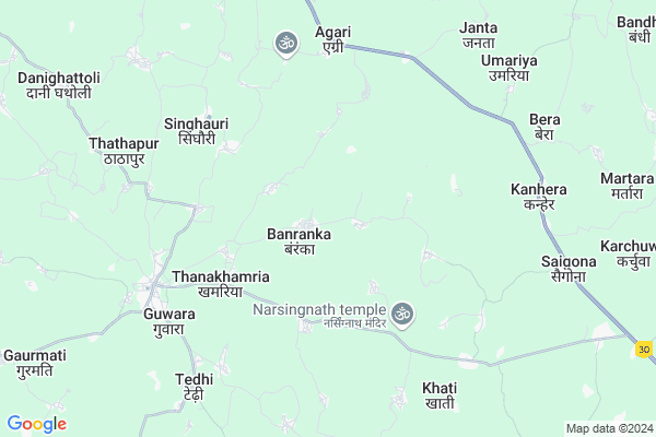
Banranka
Banranka Map
EDIT Map
Add Your House
 ..
..
Current Corona Virus Infected Patients Count in Durg District
| City Name | District Name | Total Covid cases |
|---|---|---|
| Bhilai | Durg | 1 |
Locality Name :
Banranka
( बांरंका )
Tehsil Name : Saja
District : Durg
State : Chattisgarh
Language : Chhattisgarhi and Hindi, Urdu
Current Time 04:41 AM
Date: Saturday , Apr 26,2025 (IST)
Time zone: IST (UTC+5:30)
Elevation / Altitude: 291 meters. Above Seal level
Telephone Code / Std Code: 07821
Assembly constituency : Saja assembly constituency
Assembly MLA : Ishwar Sahu
Lok Sabha constituency : Durg parliamentary constituency
Parliament MP : VIJAY BAGHEL
Serpanch Name :
Pin Code : 491338
Post Office Name : Khamaria (Durg)
Alternate Village Name : Banraka
Commodities Prices : Bemetara Market / Mandi
Banranka Live Weather
Temperature: 28.0 °C
scattered clouds
Humidity: 18%
Wind : 2.29 mt/sec towards S
StationName : "BemetÄ\u0081ra"
observed on Now
Temperature: 28.0 °C
scattered clouds
Humidity: 18%
Wind : 2.29 mt/sec towards S
StationName : "BemetÄ\u0081ra"
observed on Now
Banranka Weather Forecast for Next 5 days
27-04-2025
27.6°C to 44.6°C
scattered clouds, few clouds, clear sky, broken clouds, light rain
27.6°C to 44.6°C
scattered clouds, few clouds, clear sky, broken clouds, light rain
28-04-2025
26.2°C to 38.8°C
overcast clouds, broken clouds, scattered clouds, light rain, clear sky
26.2°C to 38.8°C
overcast clouds, broken clouds, scattered clouds, light rain, clear sky
29-04-2025
25.5°C to 41.8°C
few clouds, clear sky, scattered clouds
25.5°C to 41.8°C
few clouds, clear sky, scattered clouds
30-04-2025
24.5°C to 44.0°C
scattered clouds, clear sky, broken clouds
24.5°C to 44.0°C
scattered clouds, clear sky, broken clouds
Rivers Near Banranka
Shivnath :Seonath
Kharun River
Shivnath :Seonath
Kharun River
About Banranka
Correct below Info and add more info about BanrankaBanranka is a Village in Saja Tehsil in Durg District of Chattisgarh State, India. It is located 83 KM towards North from District head quarters Durg. 28 KM from Saja. 80 KM from State capital Raipur
Banranka Pin code is 491338 and postal head office is Khamaria (Durg).
Kanhera ( 7 KM ) , Bera ( 9 KM ) , Karesara ( 11 KM ) , Semariya ( 13 KM ) , Padmi ( 14 KM ) are the nearby Villages to Banranka. Banranka is surrounded by Bemetara Tehsil towards East , S.Lohara Tehsil towards west , Kabirdham Tehsil towards North , Saja Tehsil towards South .
Bemetra , Kawardha , Mungeli , Tilda Newra are the near by Cities to Banranka.
Banranka 2011 Census Details
Banranka Local Language is Chhattisgarhi. Banranka Village Total population is 1671 and number of houses are 356. Female Population is 49.6%. Village literacy rate is 57.9% and the Female Literacy rate is 22.8%.
Population
| Census Parameter | Census Data |
| Total Population | 1671 |
| Total No of Houses | 356 |
| Female Population % | 49.6 % ( 829) |
| Total Literacy rate % | 57.9 % ( 968) |
| Female Literacy rate | 22.8 % ( 381) |
| Scheduled Tribes Population % | 1.3 % ( 22) |
| Scheduled Caste Population % | 23.4 % ( 391) |
| Working Population % | 51.0 % |
| Child(0 -6) Population by 2011 | 239 |
| Girl Child(0 -6) Population % by 2011 | 50.6 % ( 121) |
Banranka Census More Deatils.
Politics in Banranka
Bharatiya Janata Party , BJP , INC are the major political parties in this area.Polling Stations /Booths near Banranka
1)Baniyadih2)Bamhin
3)Chicha
4)Godmarra
5)Arsi
HOW TO REACH Banranka
By Rail
There is no railway station near to Banranka in less than 10 km.Colleges near Banranka
Govt College Armarikala
Address :
Demo Mobile Colllege
Address :
Chhattisgarh Institute Of Management And Technology Bhilai
Address :
Gov.collage Of Art,commerce & Seince Jamgaon R
Address : Jamgaon R , Patan ,durg ,chattisgarh
Govt. College Bori Bujurg
Address : Vill & Post-bori
thana- Bori
dist- Durg
chattisgarh
pin-491001
Schools in Banranka
Govt Ms
Address : banraka , saja , durg , Chattisgarh . PIN- 491338 , Post - Khamaria (Durg)
Govt Health Centers near Banranka
1) SHC Nawagowkala , , old bus Stand , Bemetara Road2) SHC Gyanpur , , ,
3) SHC Khamhariya(DURG) , Sub Health Center , Thankhamhariya , Near CHC Thankhamhariya , Bus Stand Thankhamhariya
Schools in Banranka,Saja
Odia Primary School
Odia; Odiya; Bemetara; NH-12A; Simga Kawardha Road; Bemetara; Bemetara; Chhattisgarh 491335; India
6.8 KM distance Detail
Super Markets in Banranka,Saja
Mahalxmi Brtan Bhandar
Sikriganj - Gorakhpur Main Rd; Raut Dadee; Uttar Pradesh 491335; India
14.3 KM distance Detail
Local Parks in Banranka,Saja
कार्यालय रक्षित आरक्षी केन्र्द बेमेतरा छत्तीसगढ़
Char Bhatha; Chhattisgarh 491335; India
19.5 KM distance Detail
Police Stations near Banranka,Saja
Police Station
Birampur - Thengabhat Road; Darhi; Chhattisgarh 491335; India
14.5 KM distance Detail
About Banranka &
History
How to reach Banranka
Tourist Places Near By Banranka
Schools in Banranka
Colleges in Banranka
Temperature & weather of Banranka
places in Banranka
Banranka photos
More Information
How to reach Banranka
Tourist Places Near By Banranka
Schools in Banranka
Colleges in Banranka
Temperature & weather of Banranka
places in Banranka
Banranka photos
More Information
Village Talk
Post News or Events about this Village
Near Cities
Bemetra 22 KM near
Kawardha 27 KM near
Mungeli 45 KM near
Tilda Newra 56 KM near
Bemetra 22 KM near
Kawardha 27 KM near
Mungeli 45 KM near
Tilda Newra 56 KM near
Near By Taluks
Kawardha 21 KM near
Bemetara 23 KM near
S.Lohara 26 KM near
Saja 26 KM near
Kawardha 21 KM near
Bemetara 23 KM near
S.Lohara 26 KM near
Saja 26 KM near
Near By Air Ports
Raipur Airport 88 KM near
Jabalpur Airport 199 KM near
Sonegaon Airport 285 KM near
Khajuraho Airport 409 KM near
Raipur Airport 88 KM near
Jabalpur Airport 199 KM near
Sonegaon Airport 285 KM near
Khajuraho Airport 409 KM near
Near By Tourist Places
Kawardha 29 KM near
Raipur 76 KM near
Bhilai 76 KM near
Durg 79 KM near
Bilaspur 92 KM near
Kawardha 29 KM near
Raipur 76 KM near
Bhilai 76 KM near
Durg 79 KM near
Bilaspur 92 KM near
Near By Districts
Kabirdham 29 KM near
Raipur 77 KM near
Durg 79 KM near
Bilaspur 94 KM near
Kabirdham 29 KM near
Raipur 77 KM near
Durg 79 KM near
Bilaspur 94 KM near
Near By RailWay Station
Tilda Rail Way Station 57 KM near
Bhatapara Rail Way Station 65 KM near
Tilda Rail Way Station 57 KM near
Bhatapara Rail Way Station 65 KM near