| Home | City Bus | Maps | Villages | Cities | Rail | Tourist Places | School | College | Pin Codes | Corona Cases Count |
| Distance Calculator Bus Services IFSC Codes Trace Mobile Number Weather Search Place Trace IP Available Cash ATM/Banks Locate Polling Booth Report an Error contact People |
Indiranagar
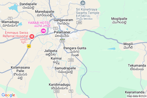
Indiranagar Map
EDIT Map
Add Your House
 ..
..
Current Corona Virus Infected Patients Count in Chittoor District
| City Name | District Name | Total Covid cases |
|---|---|---|
| Chittoor District | Chittoor | 59 |
| Thyagaraja Nagar,Tirupathi | Chittoor | 3 |
| Srikalahasti | Chittoor | 3 |
| Nagiri | Chittoor | 2 |
| Chinna Masjid | Chittoor | 1 |
| Keelapattu nagari | Chittoor | 1 |
| Renigunta | Chittoor | 1 |
| Vadamalapeta | Chittoor | 1 |
| Tirupati | Chittoor | 1 |
| Nindra | Chittoor | 1 |
Locality Name :
Indiranagar
( ఇందిరానగర్ )
Mandal Name : Palamaner
District : Chittoor
State : Andhra Pradesh
Region : Rayalaseema
Language : Telugu and Urdu
Current Time 05:32 AM
Date: Monday , Apr 28,2025 (IST)
Time zone: IST (UTC+5:30)
Elevation / Altitude: 305 meters. Above Seal level
Telephone Code / Std Code: 08579
Assembly constituency : assembly constituency
Assembly MLA : N VENKATE GOWDA
Lok Sabha constituency : parliamentary constituency
Parliament MP :
Serpanch Name :
Pin Code : 517408
Post Office Name : Pathapeta-palamaner
Main Village Name : Pengara Gunta
Commodities Prices : Gudiyatham Market / Mandi
Indiranagar Live Weather
Temperature: 21.1 °C
scattered clouds
Humidity: 93%
Wind : 0.64 mt/sec towards SE
StationName : "Palmaner"
observed on 5 Mins Back
Temperature: 21.1 °C
scattered clouds
Humidity: 93%
Wind : 0.64 mt/sec towards SE
StationName : "Palmaner"
observed on 5 Mins Back
Indiranagar Weather Forecast for Next 5 days
29-04-2025
21.4°C to 35.1°C
broken clouds, overcast clouds
21.4°C to 35.1°C
broken clouds, overcast clouds
30-04-2025
22.2°C to 37.0°C
overcast clouds, few clouds, scattered clouds, broken clouds
22.2°C to 37.0°C
overcast clouds, few clouds, scattered clouds, broken clouds
01-05-2025
23.7°C to 39.1°C
overcast clouds, scattered clouds, few clouds, broken clouds, light rain
23.7°C to 39.1°C
overcast clouds, scattered clouds, few clouds, broken clouds, light rain
02-05-2025
24.7°C to 39.1°C
light rain, scattered clouds, broken clouds, overcast clouds
24.7°C to 39.1°C
light rain, scattered clouds, broken clouds, overcast clouds
National Highways Reachable To Indiranagar
Nationa High Way :NH69
Nationa High Way :NH42;NH69
Nationa High Way :NH69
Nationa High Way :NH42;NH69
Rivers Near Indiranagar
Palar :ಪಾಲಾರ್ :பாலா
Kaundinya :Koundinya :ಕೌಂಡಿನ್ಯ
Palar :ಪಾಲಾರ್ :பாலா
Kaundinya :Koundinya :ಕೌಂಡಿನ್ಯ
About Indiranagar
Correct below Info and add more info about IndiranagarIndiranagar is a small Village/hamlet in Palamaner Mandal in Chittoor District of Andhra Pradesh State, India. It comes under Pengara Gunta Panchayath. It belongs to Rayalaseema region . It is located 41 KM towards west from District head quarters Chittoor. 4 KM from Palamaner. 548 KM from State capital Hyderabad
Indiranagar Pin code is 517408 and postal head office is Pathapeta-palamaner .
Indiranagar is surrounded by Gangavaram Mandal towards west , Peddapanjani Mandal towards North , Bangarupalem Mandal towards East , Baireddipalle Mandal towards west .
Pernampattu , Punganur , Pallikonda , Chittoor are the near by Cities to Indiranagar.
Demographics of Indiranagar
Telugu is the Local Language here. Total population of Indiranagar is 4984 .Males are 2500 and Females are 2,484 living in 1047 Houses. Total area of Indiranagar is 796 hectares.HOW TO REACH Indiranagar
By Road
Chittoor is the Nearest Town to Indiranagar. Chittoor is 46 km from Indiranagar. Road connectivity is there from Chittoor to Indiranagar.By Rail
There is no railway station near to Indiranagar in less than 10 km. How ever there are railway Stations from Near By town Chittoor. are the railway Stations near to Chittoor. You can reach from Chittoor to Indiranagar by road after .By Bus
Palamaneru APSRTC Bus Station , Bangarupalyem APSRTC Bus Station , Bireddypally APSRTC Bus Station are the nearby by Bus Stations to Indiranagar .APSRTC runs Number of busses from major cities to here.Colleges near Indiranagar
Sri Muninarayana Junior College
Address :
Sree Vidya Arts & Science Degree College.
Address :
Svcr Govt Degree College
Address :
Madhu Vidhyanikethan
Address :
Saint Francis Junior College - Father's Bunglow Palamaner
Address :
Schools in Indiranagar
Zphs P.gunta
Address : pengara gunta , palamaner , chittoor , Andhra Pradesh . PIN- 517408 , Post - Pathapeta-palamaner
Govt Health Centers near Indiranagar
1) PENGARAGUNTA , , Pengaragunta , Near to school2) GOBBILLAKOTHUR , , , Near to temple
3) PALAMANER (S) , , Near Jandamatam , Palamaner
Schools in Indiranagar,Palamaner
Electronic Shops in Indiranagar,Palamaner
Super Markets in Indiranagar,Palamaner
Local Parks in Indiranagar,Palamaner
Police Stations near Indiranagar,Palamaner
Governement Offices near Indiranagar,Palamaner
About Indiranagar &
History
How to reach Indiranagar
Tourist Places Near By Indiranagar
Schools in Indiranagar
Colleges in Indiranagar
Temperature & weather of Indiranagar
places in Indiranagar
Indiranagar photos
More Information
How to reach Indiranagar
Tourist Places Near By Indiranagar
Schools in Indiranagar
Colleges in Indiranagar
Temperature & weather of Indiranagar
places in Indiranagar
Indiranagar photos
More Information
Village Talk
Post News or Events about this Village
Near Cities
Pernampattu 30 KM near
Punganur 32 KM near
Pallikonda 38 KM near
Chittoor 38 KM near
Pernampattu 30 KM near
Punganur 32 KM near
Pallikonda 38 KM near
Chittoor 38 KM near
Near By Taluks
Palamaner 3 KM near
Gangavaram 10 KM near
Peddapanjani 17 KM near
Bangarupalem 21 KM near
Palamaner 3 KM near
Gangavaram 10 KM near
Peddapanjani 17 KM near
Bangarupalem 21 KM near
Near By Air Ports
Tirupati Airport 110 KM near
Bengaluru International Airport 127 KM near
Chennai Airport 172 KM near
Salem Airport 203 KM near
Tirupati Airport 110 KM near
Bengaluru International Airport 127 KM near
Chennai Airport 172 KM near
Salem Airport 203 KM near
Near By Tourist Places
Chittoor 41 KM near
vellore 55 KM near
Horsley Hills 73 KM near
Yelagiri 76 KM near
Tirupati 97 KM near
Chittoor 41 KM near
vellore 55 KM near
Horsley Hills 73 KM near
Yelagiri 76 KM near
Tirupati 97 KM near
Near By Districts
Chittoor 40 KM near
Vellore 56 KM near
Kolar 76 KM near
Krishnagiri 104 KM near
Chittoor 40 KM near
Vellore 56 KM near
Kolar 76 KM near
Krishnagiri 104 KM near
Near By RailWay Station
Gudiyattam Rail Way Station 35 KM near
Chittoor Rail Way Station 41 KM near
Gudiyattam Rail Way Station 35 KM near
Chittoor Rail Way Station 41 KM near