| Home | City Bus | Maps | Villages | Cities | Rail | Tourist Places | School | College | Pin Codes | Corona Cases Count |
| Distance Calculator Bus Services IFSC Codes Trace Mobile Number Weather Search Place Trace IP Available Cash ATM/Banks Locate Polling Booth Report an Error contact People |
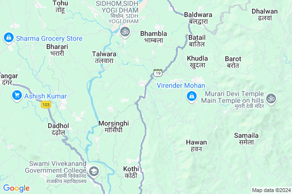
Kuthera
Kuthera Map
EDIT Map
Add Your House
 ..
..
Current Corona Virus Infected Patients Count in Bilaspur District District
| City Name | District Name | Total Covid cases |
|---|
Locality Name :
Kuthera
( कुठेड़ा )
Tehsil Name : Ghumarwin
District : Bilaspur District
State : Himachal Pradesh
Language : Hindi
Current Time 07:12 AM
Date: Saturday , Apr 26,2025 (IST)
Time zone: IST (UTC+5:30)
Elevation / Altitude: 375 meters. Above Seal level
Telephone Code / Std Code: 01978
Assembly constituency : Bilaspur assembly constituency
Assembly MLA : Trilok Jamwal
Lok Sabha constituency : Hamirpur parliamentary constituency
Parliament MP : ANURAG SINGH THAKUR
Serpanch Name :
Pin Code : 174026
Post Office Name : Kuthera BLP
Commodities Prices : Dhanotu (Mandi) Market / Mandi
Kuthera Live Weather
Temperature: 19.2 °C
clear sky
Humidity: 25%
Wind : 2.67 mt/sec towards NE
StationName : "GhumÄ\u0081rwÄ«n"
observed on 2 Hours Back
Temperature: 19.2 °C
clear sky
Humidity: 25%
Wind : 2.67 mt/sec towards NE
StationName : "GhumÄ\u0081rwÄ«n"
observed on 2 Hours Back
Kuthera Weather Forecast for Next 5 days
27-04-2025
17.6°C to 35.4°C
clear sky, few clouds
17.6°C to 35.4°C
clear sky, few clouds
28-04-2025
18.8°C to 36.8°C
clear sky, scattered clouds, few clouds
18.8°C to 36.8°C
clear sky, scattered clouds, few clouds
29-04-2025
19.2°C to 37.7°C
clear sky, scattered clouds, few clouds
19.2°C to 37.7°C
clear sky, scattered clouds, few clouds
30-04-2025
20.0°C to 38.3°C
clear sky, scattered clouds
20.0°C to 38.3°C
clear sky, scattered clouds
Edit below overview about Kuthera
Edit below overview about Kuthera
OverView of Kuthera
Kuthera is a Village in Ghumarwin Tehsil in Bilaspur District District of Himachal Pradesh State, India. It is located 31 KM towards North from District head quarters Bilaspur,. 12 KM from Ghumarwin. 110 KM from State capital ShimlaEdit below overview about Kuthera
National Highways Reachable To Kuthera
Nationa High Way :NH205
Nationa High Way :NH503A
Nationa High Way :NH205
Nationa High Way :NH503A
Rivers Near Kuthera
Sutlej :Sutlej River :सतलुज नदी :ਸਤਲੁਜ :ستلج
Bakhli Khad
Sutlej :Sutlej River :सतलुज नदी :ਸਤਲੁਜ :ستلج
Bakhli Khad
About Kuthera
Kuthera is a Village in Ghumarwin Tehsil in Bilaspur District District of Himachal Pradesh State, India. It is located 21 KM towards North from District head quarters Bilaspur,. 10 KM from Ghumarwin. 72 KM from State capital Shimla
Kuthera Pin code is 174026 and postal head office is Kuthera BLP .
Ladda ( 2 KM ) , Pater ( 3 KM ) , Talyana ( 3 KM ) , Talwara ( 4 KM ) , Mehri Kathla ( 4 KM ) are the nearby Villages to Kuthera. Kuthera is surrounded by Bhoranj Tehsil towards North , Jhandutta Tehsil towards South , Bijhri Tehsil towards west , Balh Tehsil towards East .
Sundarnagar , Hamirpur , Mandi , Nangal are the near by Cities to Kuthera.
This Place is in the border of the Bilaspur District District and Hamirpur District. Hamirpur District Bijhri is west towards this place . Also it is in the Border of other district Mandi .
Kuthera 2011 Census Details
Kuthera Local Language is Hindi. Kuthera Village Total population is 684 and number of houses are 138. Female Population is 47.1%. Village literacy rate is 81.3% and the Female Literacy rate is 36.1%.
Population
| Census Parameter | Census Data |
| Total Population | 684 |
| Total No of Houses | 138 |
| Female Population % | 47.1 % ( 322) |
| Total Literacy rate % | 81.3 % ( 556) |
| Female Literacy rate | 36.1 % ( 247) |
| Scheduled Tribes Population % | 0.0 % ( 0) |
| Scheduled Caste Population % | 20.3 % ( 139) |
| Working Population % | 60.8 % |
| Child(0 -6) Population by 2011 | 72 |
| Girl Child(0 -6) Population % by 2011 | 45.8 % ( 33) |
Kuthera Census More Deatils.
Politics in Kuthera
Bharatiya Janata Party , BJP , INC are the major political parties in this area.Polling Stations /Booths near Kuthera
1)G.s.s.s.- Kuh Manjhwar2)Panchayat Ghar- Maihrikathla
3)G.m.s.-baharanota
4)G.p.s.- Manwan
5)G.p.s.- Balhbhalwana
HOW TO REACH Kuthera
By Rail
There is no railway station near to Kuthera in less than 10 km.Colleges near Kuthera
G.d.c. Jukhala
Address :
Schools in Kuthera
Anupam School Kuthera
Address : kuthera , ghumarwin-i , bilaspur (h.p.) , Himachal Pradesh . PIN- 174026 , Post - Kuthera BLP
Adarsh Vidyalaya Kuthera
Address : kuthera , ghumarwin-i , bilaspur (h.p.) , Himachal Pradesh . PIN- 174026 , Post - Kuthera BLP
Govt Health Centers near Kuthera
1) Karer SC , VPO Karer Tehsil Barsar Distt. Hamirpur H.P. , Karer ,2) Dhaned Seribaloni PHC , VPO Dhaned Tehsil &Distt. Hamirpur H.P. , Dhaned ,
3) Battal PHC , NA , NA , Near GDC
Hospitals in Kuthera,Ghumarwin
Dr Vikas Clinic
Kuthera; Mandi; SH-19; Joginder Nagar Sarkaghat Ghumarwin Road; Jahu; Jahu; Himachal Pradesh 175001; India
0.4 KM distance Detail
Govt Ayurvedic Dispensary Bari Bhagot
Bhulswai; Himachal Pradesh 174026; India
2.0 KM distance Detail
more ..
Petrol Bunks in Kuthera,Ghumarwin
Lt Raj Kumar Petrol Pump
Shimla-Kangra Rd; Ghumarwin; Himachal Pradesh 174026; India
7.5 KM distance Detail
more ..
Colleges in Kuthera,Ghumarwin
Swami Vivekanand Government College
Shimla-Kangra Rd; Ghumarwin; Himachal Pradesh 174021; India
7.6 KM distance Detail
Ma Santoshi Private Industrial Training Institutes
SH 19; Balaur; Himachal Pradesh 174021; India
8.2 KM distance Detail
Shiv Hari Chadda Industrial Training Institute
Harkukar; SH 19; Ghumarwin; Himachal Pradesh 174021; India
9.0 KM distance Detail
more ..
Schools in Kuthera,Ghumarwin
Anupam Public Sr. Sec. School Kuthera
NH 19; Behind UCO Bank; Kuthera; Himachal Pradesh 174026; India
0.2 KM distance Detail
OHEL INTERNATIONAL SCHOOL KUTHERA (JOLPLAKHIN)
SH 19; Jol Palakhin; Himachal Pradesh 174026; India
0.5 KM distance Detail
Electronic Shops in Kuthera,Ghumarwin
Suryansh Mobile And Computer Store
Joginder Nagar - Sarkaghat - Ghumarwin; Chalag; Himachal Pradesh 174026; India
0.3 KM distance Detail
Super Markets in Kuthera,Ghumarwin
Thakur Vegetables And Mushrooms Farm Pater
Kuthera - Ladher Road; Pater; Himachal Pradesh 174026; India
3.4 KM distance Detail
Local Parks in Kuthera,Ghumarwin
Reserved Forest Area Ghumarwin
Ghumarwin-Berthin-Talai-Bhakra Rd; Ghumarwin; Himachal Pradesh 174021; India
9.6 KM distance Detail
Police Stations near Kuthera,Ghumarwin
Ghumarwin Police Station
Tehsil Rd; Bilaspur; Ghumarwin; Himachal Pradesh 174021; India
9.0 KM distance Detail
Sub Divisional Police Officer
Ghumarwin Link Rd; Ghumarwin; Himachal Pradesh 174021; India
9.1 KM distance Detail
Governement Offices near Kuthera,Ghumarwin
Gram Panchayat Smaila
Kuthera-Smaila Rd; Smaila; Himachal Pradesh 175034; India
3.9 KM distance Detail
About Kuthera &
History
How to reach Kuthera
Tourist Places Near By Kuthera
Schools in Kuthera
Colleges in Kuthera
Temperature & weather of Kuthera
places in Kuthera
Kuthera photos
More Information
How to reach Kuthera
Tourist Places Near By Kuthera
Schools in Kuthera
Colleges in Kuthera
Temperature & weather of Kuthera
places in Kuthera
Kuthera photos
More Information
Village Talk
Post News or Events about this Village
Near Cities
Sundarnagar 16 KM near
Hamirpur 30 KM near
Mandi 33 KM near
Nangal 41 KM near
Sundarnagar 16 KM near
Hamirpur 30 KM near
Mandi 33 KM near
Nangal 41 KM near
Near By Taluks
Ghumarwin 9 KM near
Bhoranj 14 KM near
Jhandutta 17 KM near
Bijhri 21 KM near
Ghumarwin 9 KM near
Bhoranj 14 KM near
Jhandutta 17 KM near
Bijhri 21 KM near
Near By Air Ports
Simla Airport 66 KM near
Bhuntar Airport 70 KM near
Chandigarh Airport 104 KM near
Gaggal Airport 109 KM near
Simla Airport 66 KM near
Bhuntar Airport 70 KM near
Chandigarh Airport 104 KM near
Gaggal Airport 109 KM near
Near By Tourist Places
Rewalsar 18 KM near
Mandi 33 KM near
Una 49 KM near
Chindi 50 KM near
Jawalaji 62 KM near
Rewalsar 18 KM near
Mandi 33 KM near
Una 49 KM near
Chindi 50 KM near
Jawalaji 62 KM near
Near By Districts
Bilaspur District 20 KM near
Hamirpur 31 KM near
Mandi 32 KM near
Una 49 KM near
Bilaspur District 20 KM near
Hamirpur 31 KM near
Mandi 32 KM near
Una 49 KM near
Near By RailWay Station
Nangal Dam Rail Way Station 41 KM near
Anandpur Sahib Rail Way Station 42 KM near
Nangal Dam Rail Way Station 41 KM near
Anandpur Sahib Rail Way Station 42 KM near