| Home | City Bus | Maps | Villages | Cities | Rail | Tourist Places | School | College | Pin Codes | Corona Cases Count |
| Distance Calculator Bus Services IFSC Codes Trace Mobile Number Weather Search Place Trace IP Available Cash ATM/Banks Locate Polling Booth Report an Error contact People |
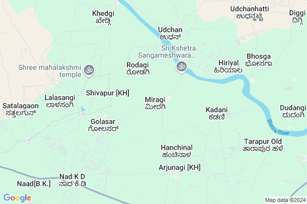
Miragi
Miragi Map
EDIT Map
Add Your House
 ..
..
Current Corona Virus Infected Patients Count in Bijapur District District
| City Name | District Name | Total Covid cases |
|---|
Locality Name :
Miragi
( ಮಿರಾಗಿ )
Taluk Name : Indi
District : Bijapur District
State : Karnataka
Division : Belgaum
Language : Kannada and English,
Current Time 08:53 AM
Date: Thursday , Apr 24,2025 (IST)
Time zone: IST (UTC+5:30)
Elevation / Altitude: 490 meters. Above Seal level
Telephone Code / Std Code: 08359
Assembly constituency : Indi assembly constituency
Assembly MLA : Yashavantaraygoud. Vittalagoud. Patil
Lok Sabha constituency : Bijapur parliamentary constituency
Parliament MP : JIGAJINAGI RAMESH CHANDAPPA
Serpanch Name :
Pin Code : 586217
Post Office Name : Salotgi
Commodities Prices : Sindagi Market / Mandi
Miragi Live Weather
Temperature: 35.7 °C
broken clouds
Humidity: 19%
Wind : 6.31 mt/sec towards NW
StationName : "Afzalpur"
observed on Now
Temperature: 35.7 °C
broken clouds
Humidity: 19%
Wind : 6.31 mt/sec towards NW
StationName : "Afzalpur"
observed on Now
Miragi Weather Forecast for Next 5 days
25-04-2025
33.4°C to 41.6°C
broken clouds, scattered clouds, light rain, overcast clouds
33.4°C to 41.6°C
broken clouds, scattered clouds, light rain, overcast clouds
26-04-2025
31.3°C to 42.2°C
scattered clouds, clear sky, few clouds, overcast clouds, broken clouds
31.3°C to 42.2°C
scattered clouds, clear sky, few clouds, overcast clouds, broken clouds
27-04-2025
31.5°C to 41.4°C
broken clouds, scattered clouds, overcast clouds
31.5°C to 41.4°C
broken clouds, scattered clouds, overcast clouds
28-04-2025
32.0°C to 40.1°C
broken clouds, scattered clouds, few clouds
32.0°C to 40.1°C
broken clouds, scattered clouds, few clouds
29-04-2025
28.6°C to 41.0°C
clear sky, broken clouds, overcast clouds
28.6°C to 41.0°C
clear sky, broken clouds, overcast clouds
Edit below overview about Miragi
Edit below overview about Miragi
OverView of Miragi
Miragi is derived from Mirr janaang. There are two lakes called by Ooruhalla and back side of village Naviluhalla and a Bhima river. From village 2km. away the famous Sangameshwar(Ishawar) Temple is situated at joint of river Bhima and lake Oorhalla. Every year in January, on Makar-Sankranti village Jatra celebrates and near by village Jattilingeshwar temple is situated at bank of Oorhalla. Apart from these two temples recently under-developing a Math in the name of Shri Yellaling Swamiji who borned in village Miragi but got popularred by devotees from the place Mughulkodh. Totally black soil, Main crops: Jawar, Wheat, Cotton,Sugarcane and Limon fruit.Edit below overview about Miragi
National Highways Reachable To Miragi
Nationa High Way :NH150
Nationa High Way :NH150
Rivers Near Miragi
Bhima :भीमा :ಭೀಮಾ :भीमा
Bhima :भीमा :ಭೀಮಾ :भीमा
Bhima :भीमा :ಭೀಮಾ :भीमा
Bhima :भीमा :ಭೀಮಾ :भीमा
About Miragi
Miragi is a Village in Indi Taluk in Bijapur District District of Karnataka State, India. It belongs to Belgaum Division . It is located 69 KM towards East from District head quarters Bijapur. 34 KM from Indi. 574 KM from State capital Bangalore
Miragi Pin code is 586217 and postal head office is Salotgi .
Lalasangi ( 7 KM ) , Almel ( 12 KM ) , Shirashyad ( 13 KM ) , Hirebevanur ( 15 KM ) are the nearby Villages to Miragi. Miragi is surrounded by Indi Taluk towards west , Sindagi Taluk towards South , Akkalkot Taluk towards North , South Solapur Taluk towards North .
Sindgi , Solapur , Bijapur , Kalburgi are the near by Cities to Miragi.
Miragi 2011 Census Details
Miragi Local Language is Kannada. Miragi Village Total population is 3348 and number of houses are 616. Female Population is 47.5%. Village literacy rate is 51.0% and the Female Literacy rate is 18.7%.
Population
| Census Parameter | Census Data |
| Total Population | 3348 |
| Total No of Houses | 616 |
| Female Population % | 47.5 % ( 1590) |
| Total Literacy rate % | 51.0 % ( 1709) |
| Female Literacy rate | 18.7 % ( 627) |
| Scheduled Tribes Population % | 0.1 % ( 3) |
| Scheduled Caste Population % | 10.5 % ( 350) |
| Working Population % | 51.8 % |
| Child(0 -6) Population by 2011 | 499 |
| Girl Child(0 -6) Population % by 2011 | 47.3 % ( 236) |
Miragi Census More Deatils.
Politics in Miragi
Bharatiya Janata Party , BJP , Indian National Congress (INC) , INC are the major political parties in this area.Polling Stations /Booths near Miragi
1)Govt.kannada Boys School South Wing Lalasangi2)Govt.kannada Boys School North Wing New Building Miragi
3)Kannada Boys School Hanjagi Lt
4)Kannada Boys School New Building East Wing Atharga
5)Kannada Boys School New Building South Wing Halagunaki
HOW TO REACH Miragi
By Road
Indi is the Nearest Town to Miragi. Indi is 30 km from Miragi. Road connectivity is there from Indi to Miragi.By Rail
There is no railway station near to Miragi in less than 10 km. How ever there are railway Stations from Near By town Indi. are the railway Stations near to Indi. You can reach from Indi to Miragi by road after .Colleges near Miragi
Shri Siddeshwar Pre-university College
Address :
Sri Aurobindo Vidya Vardhaka Sangha Halasangi
Address :
Shee Sangameshwar Degree Collge
Address :
Govt Pu College Golasar
Address :
Bldeas Basaveshwar Arts And Commerce College
Address : Basavan Bagewadi, Bijapur, Karnataka, India.
Schools in Miragi
Govt Hps Miragi
Address : miragi , indi , bijapur , Karnataka . PIN- 586217 , Post - Salotgi
Govt Health Centers near Miragi
1) Rampur Pa , , Rampur Pa ,2) Devar Hubballi , Devar Hubballi , Devar Hubballi , Devar Hubballi
3) Taddewadi , , Taddewadi ,
Sub Villages in Miragi
Hospitals in Miragi,Indi
Dr. Habbu and Patil Hospital
Near bus stand; Indi Road; Almel Taluka Sindagi; Dist; Karnataka 586202; India
12.6 KM distance Detail
more ..
Petrol Bunks in Miragi,Indi
laksmi Petrol Pump Indi Road Tamba
Indi Road; Adarsh Nagar; Almel; Karnataka 586202; India
12.4 KM distance Detail
Sri Siddeshwara Petroleums Indian Oil Outlet
SH 34; Almel; Karnataka 586202; India
12.7 KM distance Detail
Deshra Petroleum Indian Oil Petrol Pump
Almel; Kazi Colony; Bijapur; SH-34; Sindagi Kalaburagi Road; Sindagi; Sindagi; Karnataka 586202; India
12.7 KM distance Detail
more ..
Police Stations near Miragi,Indi
Governement Offices near Miragi,Indi
About Miragi &
History
How to reach Miragi
Tourist Places Near By Miragi
Schools in Miragi
Colleges in Miragi
Temperature & weather of Miragi
places in Miragi
Miragi photos
More Information
How to reach Miragi
Tourist Places Near By Miragi
Schools in Miragi
Colleges in Miragi
Temperature & weather of Miragi
places in Miragi
Miragi photos
More Information
Village Talk
Post News or Events about this Village
Near Cities
Sindgi 32 KM near
Solapur 69 KM near
Bijapur 71 KM near
Kalburgi 82 KM near
Sindgi 32 KM near
Solapur 69 KM near
Bijapur 71 KM near
Kalburgi 82 KM near
Near By Taluks
Afzalpur 32 KM near
Indi 32 KM near
Sindagi 37 KM near
Akkalkot 40 KM near
Afzalpur 32 KM near
Indi 32 KM near
Sindagi 37 KM near
Akkalkot 40 KM near
Near By Air Ports
Sholapur Airport 63 KM near
Latur Airport 158 KM near
Kolhapur Airport 226 KM near
Sambre Airport 246 KM near
Sholapur Airport 63 KM near
Latur Airport 158 KM near
Kolhapur Airport 226 KM near
Sambre Airport 246 KM near
Near By Tourist Places
Bijapur 68 KM near
Solapur 69 KM near
Gulbarga 82 KM near
Tuljapur 105 KM near
Pandharpur 117 KM near
Bijapur 68 KM near
Solapur 69 KM near
Gulbarga 82 KM near
Tuljapur 105 KM near
Pandharpur 117 KM near
Near By Districts
Bijapur District 66 KM near
Solapur 67 KM near
Gulbarga 82 KM near
Yadgir 126 KM near
Bijapur District 66 KM near
Solapur 67 KM near
Gulbarga 82 KM near
Yadgir 126 KM near
Near By RailWay Station
Dudhani Rail Way Station 35 KM near
Hotgi Junction Rail Way Station 53 KM near
Dudhani Rail Way Station 35 KM near
Hotgi Junction Rail Way Station 53 KM near