| Home | City Bus | Maps | Villages | Cities | Rail | Tourist Places | School | College | Pin Codes | Corona Cases Count |
| Distance Calculator Bus Services IFSC Codes Trace Mobile Number Weather Search Place Trace IP Available Cash ATM/Banks Locate Polling Booth Report an Error contact People |
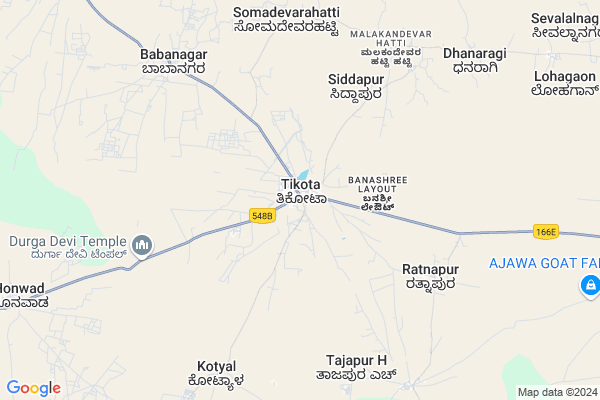
Tikota
Tikota Map
EDIT Map
Add Your House
 ..
..
Current Corona Virus Infected Patients Count in Bijapur District District
| City Name | District Name | Total Covid cases |
|---|
Locality Name :
Tikota
( ತಿಕೋಟಾ )
Taluk Name : Bijapur
District : Bijapur District
State : Karnataka
Division : Belgaum
Language : Kannada and English,
Current Time 01:06 PM
Date: Tuesday , Apr 29,2025 (IST)
Time zone: IST (UTC+5:30)
Elevation / Altitude: 629 meters. Above Seal level
Telephone Code / Std Code: 08352
Assembly constituency : Babaleshwar assembly constituency
Assembly MLA : M B Patil.
Lok Sabha constituency : Bijapur parliamentary constituency
Parliament MP : JIGAJINAGI RAMESH CHANDAPPA
Serpanch Name :
Pin Code : 586130
Post Office Name : Tikota
Commodities Prices : Bijapur Market / Mandi
Edit below overview about Tikota
Edit below overview about Tikota
OverView of Tikota
Tikota Is Taluk In Sr Kurandawad Princy State After Merger To Union Of India On 8 March 1948 Tikota Come Under Bijapur Taluk And District Now Karnataka Government Form New Taluk From 26jan 2018.
Edit below overview about Tikota
National Highways Reachable To Tikota
Nationa High Way :NH50
Nationa High Way :NH52
Nationa High Way :NH50
Nationa High Way :NH52
Rivers Near Tikota
Doni :Doni :ಡೋಣಿ :डॊणि
Hanchinala :ಹಂಚಿನಾಳ
Doni :Doni :ಡೋಣಿ :डॊणि
Hanchinala :ಹಂಚಿನಾಳ
About Tikota
Tikota is a Village in Bijapur Taluk in Bijapur District District of Karnataka State, India. It belongs to Belgaum Division . It is located 25 KM towards west from District head quarters Bijapur. 23 KM from Bijapur. 567 KM from State capital Bangalore
Tikota Pin code is 586130 and postal head office is Tikota .
Babanagar ( 7 KM ) , Tajapur .h ( 7 KM ) , Kotyal ( 8 KM ) , Honawad ( 13 KM ) , Bijjaragi ( 13 KM ) are the nearby Villages to Tikota. Tikota is surrounded by Jath Taluk towards west , Jamkhandi Taluk towards South , Athni Taluk towards west , Indi Taluk towards East .
Bijapur , Rabkavi Banhatti , Mudhol , Sangole are the near by Cities to Tikota.
Tikota 2011 Census Details
Tikota Local Language is Kannada. Tikota Village Total population is 11984 and number of houses are 2235. Female Population is 49.0%. Village literacy rate is 60.7% and the Female Literacy rate is 26.2%.
Population
| Census Parameter | Census Data |
| Total Population | 11984 |
| Total No of Houses | 2235 |
| Female Population % | 49.0 % ( 5873) |
| Total Literacy rate % | 60.7 % ( 7274) |
| Female Literacy rate | 26.2 % ( 3136) |
| Scheduled Tribes Population % | 0.2 % ( 19) |
| Scheduled Caste Population % | 13.6 % ( 1626) |
| Working Population % | 39.1 % |
| Child(0 -6) Population by 2011 | 1596 |
| Girl Child(0 -6) Population % by 2011 | 49.2 % ( 785) |
Tikota Census More Deatils.
Politics in Tikota
Bharatiya Janata Party , BJP , Indian National Congress (INC) , INC are the major political parties in this area.Polling Stations /Booths near Tikota
1)Kannada Boys School Room No 7 Dhanaragi2)Govt.kannada Boys School Room No 5 Kotyal
3)Kannada Girls School Room No 4 Kanamadi
4)Samaj Mandir Bijjaragi
5)Kannada Boys School Tajapur P.m
HOW TO REACH Tikota
By Road
Bijapur is the Nearest Town to Tikota. Bijapur is 20 km from Tikota. Road connectivity is there from Bijapur to Tikota.By Rail
There is no railway station near to Tikota in less than 10 km. How ever there are railway Stations from Near By town Bijapur. are the railway Stations near to Bijapur. You can reach from Bijapur to Tikota by road after .Colleges near Tikota
Secab P.u.college For Boys,bijapur.
Address :
V V S High School
Address : V V S High School
Bvvs Shyadree Degree Collage
Address : Vijayapur
Tungal Ind. Puc Science College
Address : Yatnal Road Ittangihal
B.l.d.e.as College Of Enginnering And Technology
Address : B.l.d.e.as College Of Enginnering And Technology A
Schools in Tikota
Govt Morarji Res Sch Tikota
Address : tikota , bijapur rural , bijapur , Karnataka . PIN- 586130 , Post - Tikota
Aided Haji Mastan Arebic Tikota
Address : tikota , bijapur rural , bijapur , Karnataka . PIN- 586130 , Post - Tikota
Unaided Gajanan Lps Tikota
Address : tikota , bijapur rural , bijapur , Karnataka . PIN- 586130 , Post - Tikota
Govt Kbhps Ramapur
Address : tikota , bijapur rural , bijapur , Karnataka . PIN- 586130 , Post - Tikota
Govt Kghps Tikota
Address : tikota , bijapur rural , bijapur , Karnataka . PIN- 586130 , Post - Tikota
Govt Health Centers near Tikota
1) HONAWADA (24X7) , At post Honawada Athani road , Athani road ,2) JAINAPURA , At post Jainapura , Jainapura ,
3) Devar Hubballi , Devar Hubballi , Devar Hubballi , Devar Hubballi
Sub Villages in Tikota
Hospitals in Tikota,Bijapur
Al Ameen Rural Health Training Centre; Tikita
Tikota-Bijapur Rd; Tikota; Karnataka 586130; India
0.1 KM distance Detail
Daimond Pan Shop
Miraj - Athani - Vijaypura Rd; Tikota; Karnataka 586130; India
0.4 KM distance Detail
more ..
Petrol Bunks in Tikota,Bijapur
Ms Danamma Devi Agencies Indian Oil Petrol Pump
Bijapur; SH-12; Vijayapura Road; Tikota; Tikota; Karnataka 586130; India
0.1 KM distance Detail
Muragesh Petrol Pump
SH 12; Banashree Layout; Tikota; Karnataka 586130; India
0.8 KM distance Detail
HP PETROL PUMP - BIRADAR PETROLEUM
Hpcl Dealer Sh-12;bijapur Sankeshwar Road Near PWD IB; Karnataka 586103; India
1.3 KM distance Detail
more ..
Electronic Shops in Tikota,Bijapur
Indo Ferm Show Room Bijapur
Miraj - Athani - Vijaypura Rd; Tikota; Karnataka 586130; India
0.1 KM distance Detail
вєℓgααυикαя αυтσмσвιℓєα
gandhi nagar tikota; Vijayapura; Karnataka 586130; India
0.2 KM distance Detail
Wasim Auto Electrician
Tikota-Bijapur Rd; Shastri Nagar; Vijayapura; Karnataka 586130; India
0.2 KM distance Detail
Local Parks in Tikota,Bijapur
Kasappa Garden
Tikota-Bijapur Rd; Banashree Layout; Tikota; Karnataka 586130; India
0.7 KM distance Detail
About Tikota &
History
How to reach Tikota
Tourist Places Near By Tikota
Schools in Tikota
Colleges in Tikota
Temperature & weather of Tikota
places in Tikota
Tikota photos
More Information
How to reach Tikota
Tourist Places Near By Tikota
Schools in Tikota
Colleges in Tikota
Temperature & weather of Tikota
places in Tikota
Tikota photos
More Information
Village Talk
Post News or Events about this Village
Near Cities
Bijapur 22 KM near
Rabkavi Banhatti 66 KM near
Mudhol 68 KM near
Sangole 69 KM near
Bijapur 22 KM near
Rabkavi Banhatti 66 KM near
Mudhol 68 KM near
Sangole 69 KM near
Near By Taluks
Bijapur 22 KM near
Jath 43 KM near
Jamkhandi 46 KM near
Athni 57 KM near
Bijapur 22 KM near
Jath 43 KM near
Jamkhandi 46 KM near
Athni 57 KM near
Near By Air Ports
Sholapur Airport 110 KM near
Kolhapur Airport 143 KM near
Sambre Airport 162 KM near
Hubli Airport 191 KM near
Sholapur Airport 110 KM near
Kolhapur Airport 143 KM near
Sambre Airport 162 KM near
Hubli Airport 191 KM near
Near By Tourist Places
Bijapur 23 KM near
Pandharpur 106 KM near
Aihole 110 KM near
Solapur 114 KM near
Pattadakkal 116 KM near
Bijapur 23 KM near
Pandharpur 106 KM near
Aihole 110 KM near
Solapur 114 KM near
Pattadakkal 116 KM near
Near By Districts
Bijapur District 24 KM near
Bagalkot 84 KM near
Solapur 112 KM near
Sangli 112 KM near
Bijapur District 24 KM near
Bagalkot 84 KM near
Solapur 112 KM near
Sangli 112 KM near
Near By RailWay Station
Vijayapura Rail Way Station 26 KM near
Almatti Rail Way Station 76 KM near
Vijayapura Rail Way Station 26 KM near
Almatti Rail Way Station 76 KM near