| Home | City Bus | Maps | Villages | Cities | Rail | Tourist Places | School | College | Pin Codes | Corona Cases Count |
| Distance Calculator Bus Services IFSC Codes Trace Mobile Number Weather Search Place Trace IP Available Cash ATM/Banks Locate Polling Booth Report an Error contact People |
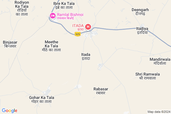
Itada Map
EDIT Map
Add Your House
 ..
..
Current Corona Virus Infected Patients Count in Barmer District
| City Name | District Name | Total Covid cases |
|---|---|---|
| Barmer District | Barmer | 2 |
Locality Name :
Itada
( इटादा )
Tehsil Name : Chohtan
District : Barmer
State : Rajasthan
Division : Jodhpur
Language : Rajasthani and Hindi ,english
Current Time 12:31 PM
Date: Monday , Apr 28,2025 (IST)
Time zone: IST (UTC+5:30)
Elevation / Altitude: 218 meters. Above Seal level
Telephone Code / Std Code: 02989
Assembly constituency : Chohtan assembly constituency
Assembly MLA : Adu Ram Meghwal
Lok Sabha constituency : Barmer parliamentary constituency
Parliament MP : KAILASH CHOUDHARY
Serpanch Name :
Pin Code : 344702
Post Office Name : Chohtan
Commodities Prices : Barmer Market / Mandi
About Itada
Correct below Info and add more info about ItadaItada is a Village in Chohtan Tehsil in Barmer District of Rajasthan State, India. It belongs to Jodhpur Division . It is located 80 KM towards South from District head quarters Barmer. 20 KM from Chohtan. 604 KM from State capital Jaipur
Itada Pin code is 344702 and postal head office is Chohtan .
Meethe Ka Tala ( 5 KM ) , Gohar Ka Tala ( 9 KM ) , Buran Ka Tala ( 9 KM ) , Binjasar ( 10 KM ) , Booth Rathoran ( 14 KM ) are the nearby Villages to Itada. Itada is surrounded by Dhorimanna Tehsil towards East , Barmer Tehsil towards North , Sindhari Tehsil towards East , Sanchore Tehsil towards East .
Barmer , Sanchore , Tharad , Bhinmal are the near by Cities to Itada.
Itada 2011 Census Details
Itada Local Language is Rajasthani. Itada Village Total population is 3239 and number of houses are 587. Female Population is 46.8%. Village literacy rate is 27.5% and the Female Literacy rate is 7.7%.
Population
| Census Parameter | Census Data |
| Total Population | 3239 |
| Total No of Houses | 587 |
| Female Population % | 46.8 % ( 1515) |
| Total Literacy rate % | 27.5 % ( 892) |
| Female Literacy rate | 7.7 % ( 251) |
| Scheduled Tribes Population % | 0.0 % ( 1) |
| Scheduled Caste Population % | 17.8 % ( 578) |
| Working Population % | 52.7 % |
| Child(0 -6) Population by 2011 | 784 |
| Girl Child(0 -6) Population % by 2011 | 49.0 % ( 384) |
Itada Census More Deatils.
Politics in Itada
Bharatiya Janata Party , BJP , INC are the major political parties in this area.Polling Stations /Booths near Itada
1)Goverment Aadarsh Siniour Secondary School Purvi Bhag Bakhasar2)Goverment Secondary School Ishrol
3)Goverment Upper Praimary School Husain Ka Tala
4)Goverment Upper Praimary School Samejon Ki Dhani
5)Goverment Upper Primary School Daya Bhag Jaton Ka Bera
HOW TO REACH Itada
By Rail
There is no railway station near to Itada in less than 10 km.Colleges near Itada
Daksh College Chohtan
Address :
Shree Gramotthan College Sedwa
Address : V/p Sedwa
Schools in Itada
Maulana Abul Kalam Azad, Upper Primary School, Itada
Address : Itada
Govt Health Centers near Itada
1) Etada , , ,2) Itada , Itada , Itada , Itada
3) Rabaser , , ,
Schools in Itada,Chohtan
Madrsa Darul Uloom Islamia Arabia Mithe Ka Tala
Ibre Ka Tala; Rajasthan 344702; India
6.9 KM distance Detail
Super Markets in Itada,Chohtan
K G N टायर पिंचर सेंटर मुबीन मार्केट
Rbasr Road; Itada; Rajasthan 344702; India
3.8 KM distance Detail
Local Parks in Itada,Chohtan
Police Stations near Itada,Chohtan
About Itada &
History
How to reach Itada
Tourist Places Near By Itada
Schools in Itada
Colleges in Itada
Temperature & weather of Itada
places in Itada
Itada photos
More Information
How to reach Itada
Tourist Places Near By Itada
Schools in Itada
Colleges in Itada
Temperature & weather of Itada
places in Itada
Itada photos
More Information
Village Talk
Post News or Events about this Village
Near Cities
Barmer 78 KM near
Sanchore 104 KM near
Tharad 127 KM near
Bhinmal 145 KM near
Barmer 78 KM near
Sanchore 104 KM near
Tharad 127 KM near
Bhinmal 145 KM near
Near By Taluks
Chohtan 20 KM near
Dhorimanna 51 KM near
Barmer 66 KM near
Sindhari 101 KM near
Chohtan 20 KM near
Dhorimanna 51 KM near
Barmer 66 KM near
Sindhari 101 KM near
Near By Air Ports
Jaisalmer Airport 209 KM near
Jodhpur Airport 263 KM near
Kandla Airport 283 KM near
Rudra Mata Airport 285 KM near
Jaisalmer Airport 209 KM near
Jodhpur Airport 263 KM near
Kandla Airport 283 KM near
Rudra Mata Airport 285 KM near
Near By Tourist Places
Barmer 76 KM near
Kutch 179 KM near
Jalore 183 KM near
Dholavira 190 KM near
Jaisalmer 208 KM near
Barmer 76 KM near
Kutch 179 KM near
Jalore 183 KM near
Dholavira 190 KM near
Jaisalmer 208 KM near
Near By Districts
Barmer 76 KM near
Jalore 184 KM near
Jaisalmer 208 KM near
Banas Kantha 209 KM near
Barmer 76 KM near
Jalore 184 KM near
Jaisalmer 208 KM near
Banas Kantha 209 KM near
Near By RailWay Station
Barmer Rail Way Station 77 KM near
Balotra Rail Way Station 159 KM near
Barmer Rail Way Station 77 KM near
Balotra Rail Way Station 159 KM near