| Home | City Bus | Maps | Villages | Cities | Rail | Tourist Places | School | College | Pin Codes | Corona Cases Count |
| Distance Calculator Bus Services IFSC Codes Trace Mobile Number Weather Search Place Trace IP Available Cash ATM/Banks Locate Polling Booth Report an Error contact People |
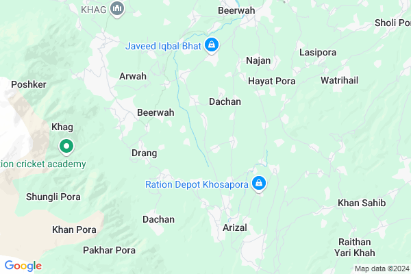
Qumroo
Qumroo Map
EDIT Map
Add Your House
 ..
..
Current Corona Virus Infected Patients Count in Badgam District
| City Name | District Name | Total Covid cases |
|---|
Locality Name :
Qumroo
( कुमरू )
Block Name : Khan-sahib
District : Badgam
State : Jammu & Kashmir
Language : Hindi and Urdu
Current Time 12:06 PM
Date: Tuesday , Apr 29,2025 (IST)
Time zone: IST (UTC+5:30)
Elevation / Altitude: 1668 meters. Above Seal level
Telephone Code / Std Code: 01951
Assembly constituency : assembly constituency
Assembly MLA :
Lok Sabha constituency : parliamentary constituency
Parliament MP :
Serpanch Name :
Pin Code : 193411
Post Office Name : Beerwah
Commodities Prices : Parimpore Market / Mandi
Qumroo Live Weather
Temperature: 18.9 °C
clear sky
Humidity: 32%
Wind : 2.68 mt/sec towards NE
StationName : "MÄ\u0081gÄ\u0081m"
observed on 1 Hours Back
Temperature: 18.9 °C
clear sky
Humidity: 32%
Wind : 2.68 mt/sec towards NE
StationName : "MÄ\u0081gÄ\u0081m"
observed on 1 Hours Back
Qumroo Weather Forecast for Next 5 days
30-04-2025
13.1°C to 24.0°C
clear sky
13.1°C to 24.0°C
clear sky
01-05-2025
11.4°C to 25.0°C
clear sky
11.4°C to 25.0°C
clear sky
02-05-2025
12.8°C to 25.3°C
clear sky, light rain, overcast clouds, broken clouds
12.8°C to 25.3°C
clear sky, light rain, overcast clouds, broken clouds
03-05-2025
12.0°C to 22.0°C
broken clouds, scattered clouds, light rain, overcast clouds
12.0°C to 22.0°C
broken clouds, scattered clouds, light rain, overcast clouds
04-05-2025
11.5°C to 20.6°C
light rain, overcast clouds
11.5°C to 20.6°C
light rain, overcast clouds
Edit below overview about Qumroo
Edit below overview about Qumroo
OverView of Qumroo
There is also a Govt. Authorized Common Service Centre (CSC) "Gazi Computers" Near Middle School Qumroo VLE name BARKAT ALI KHAN. Contact!: 8082664324Opening date of the CSC is 23 JULY 2018.Edit below overview about Qumroo
National Highways Reachable To Qumroo
Nationa High Way :NH444
Nationa High Way :NH44
Nationa High Way :NH444
Nationa High Way :NH44
Rivers Near Qumroo
Jhelum River :Jhelum River
Sukhnag River
Jhelum River :Jhelum River
Sukhnag River
About Qumroo
Qumroo is a Village in Khan-sahib Block in Badgam District of Jammu & Kashmir State, India. It is located 26 KM towards west from District head quarters Budgam. 7 KM from Khan-Sahib. 29 KM from State capital Srinagar, Jammu
Qumroo Pin code is 193411 and postal head office is Beerwah .
Arizal ( 3 KM ) , Pethkoot ( 4 KM ) , Sail ( 5 KM ) , Najan ( 5 KM ) , Kandoora ( 5 KM ) are the nearby Villages to Qumroo. Qumroo is surrounded by Khan-Sahib Block towards East , Khag Block towards North , Breng Block towards North , Badgam Block towards East .
Srinagar , Baramula , Sopore , Punch are the near by Cities to Qumroo.
This Place is in the border of the Badgam District and Pulwama District. Pulwama District Pulwama is East towards this place .
Qumroo 2011 Census Details
Qumroo Local Language is Hindi. Qumroo Village Total population is 997 and number of houses are 159. Female Population is 45.5%. Village literacy rate is 30.9% and the Female Literacy rate is 10.9%.
Population
| Census Parameter | Census Data |
| Total Population | 997 |
| Total No of Houses | 159 |
| Female Population % | 45.5 % ( 454) |
| Total Literacy rate % | 30.9 % ( 308) |
| Female Literacy rate | 10.9 % ( 109) |
| Scheduled Tribes Population % | 0.0 % ( 0) |
| Scheduled Caste Population % | 0.0 % ( 0) |
| Working Population % | 26.3 % |
| Child(0 -6) Population by 2011 | 308 |
| Girl Child(0 -6) Population % by 2011 | 37.0 % ( 114) |
Qumroo Census More Deatils.
HOW TO REACH Qumroo
By Rail
There is no railway station near to Qumroo in less than 10 km.Colleges near Qumroo
Govt.degree College Khansahib
Address :
Schools in Qumroo
Ms Qumroo
Address : qumroo , hardu-punzoo , badgam , Jammu & Kashmir . PIN- 193411 , Post - Beerwah
Govt Health Centers near Qumroo
1) PHC Pethzanigam , Abdul Rasheed Shah(Rented) , Manzimpora , Near Jamia Masjid2) PHC Hardpanzoo , Govt Building , Chopan Mohalla , Govt Boys Higher Secondary School
3) SC Chill , Nazir Ahmad Lone(Rented Building) , Bonpora , Near Ziyarat Shareef
Hospitals in Qumroo,Khan-sahib
Dr Nazir Clinic
Opp. Jamia Masjid; Jamia Chowk; Najan Road; Sonpah; Jammu and Kashmir 193411
7.0 KM distance Detail
Primary Health Centre Khag
33°59'44. 74°31'48.; 0"N; AH2; Dokmoka; Assam 782441
7.1 KM distance Detail
more ..
Petrol Bunks in Qumroo,Khan-sahib
HP PETROL PUMP - ALMDHAR HP FILLING STATION
Sonpah; DIET Beerwah; Jammu; Jammu and Kashmir 193411
7.4 KM distance Detail
more ..
Colleges in Qumroo,Khan-sahib
Government Degree College Beerwah
GDC Beerwah; Budgam; Beerwah; Jammu and Kashmir 193411
6.7 KM distance Detail
Govt Degree College Beerwah
Government Degree College; Beerwah College Rd; Beerwah; 193411
6.7 KM distance Detail
more ..
Super Markets in Qumroo,Khan-sahib
About Qumroo &
History
How to reach Qumroo
Tourist Places Near By Qumroo
Schools in Qumroo
Colleges in Qumroo
Temperature & weather of Qumroo
places in Qumroo
Qumroo photos
More Information
How to reach Qumroo
Tourist Places Near By Qumroo
Schools in Qumroo
Colleges in Qumroo
Temperature & weather of Qumroo
places in Qumroo
Qumroo photos
More Information
Village Talk
Post News or Events about this Village
Near Cities
Srinagar 36 KM near
Baramula 37 KM near
Sopore 43 KM near
Punch 54 KM near
Srinagar 36 KM near
Baramula 37 KM near
Sopore 43 KM near
Punch 54 KM near
Near By Taluks
Beerwah 6 KM near
Khag 7 KM near
Khan-Sahib 8 KM near
Breng 16 KM near
Beerwah 6 KM near
Khag 7 KM near
Khan-Sahib 8 KM near
Breng 16 KM near
Near By Air Ports
Srinagar Airport 19 KM near
Satwari Airport 161 KM near
Pathankot Airport 243 KM near
Gaggal Airport 271 KM near
Srinagar Airport 19 KM near
Satwari Airport 161 KM near
Pathankot Airport 243 KM near
Gaggal Airport 271 KM near
Near By Tourist Places
Yusmarg 18 KM near
Budgam 22 KM near
Gulmarg 23 KM near
Khilanmarg 25 KM near
Srinagar 27 KM near
Yusmarg 18 KM near
Budgam 22 KM near
Gulmarg 23 KM near
Khilanmarg 25 KM near
Srinagar 27 KM near
Near By Districts
Badgam 25 KM near
Srinagar 27 KM near
Pulwama 35 KM near
Ganderbal 37 KM near
Badgam 25 KM near
Srinagar 27 KM near
Pulwama 35 KM near
Ganderbal 37 KM near
Near By RailWay Station
Udhampur Rail Way Station 141 KM near
Jammu Tawi Rail Way Station 159 KM near
Udhampur Rail Way Station 141 KM near
Jammu Tawi Rail Way Station 159 KM near