| Home | City Bus | Maps | Villages | Cities | Rail | Tourist Places | School | College | Pin Codes | Corona Cases Count |
| Distance Calculator Bus Services IFSC Codes Trace Mobile Number Weather Search Place Trace IP Available Cash ATM/Banks Locate Polling Booth Report an Error contact People |
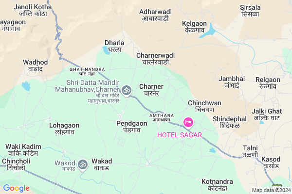
Charner
Charner Map
EDIT Map
Add Your House
 ..
..
Current Corona Virus Infected Patients Count in Aurangabad District District
| City Name | District Name | Total Covid cases |
|---|---|---|
| Aurangabad | Aurangabad | 20 |
| Aurangabad District | Aurangabad | 14 |
| Aurangabad Rural | Aurangabad | 3 |
Locality Name :
Charner
( चर्नर )
Taluka Name : Sillod
District : Aurangabad District
State : Maharashtra
Region : Marathwada
Division : Aurangabad
Language : Hindi and Ahirani, Kandeshi,marathi, Bhili, Andh, Indo-aryan
Current Time 10:03 AM
Date: Thursday , Apr 24,2025 (IST)
Time zone: IST (UTC+5:30)
Elevation / Altitude: 330 meters. Above Seal level
Telephone Code / Std Code: 02430
Assembly constituency : Kannad assembly constituency
Assembly MLA : Udaysing Sardarsing Rajput
Lok Sabha constituency : Aurangabad parliamentary constituency
Parliament MP : Imtiaz Jaleel Syed
Serpanch Name :
Pin Code : 431113
Post Office Name : Bharadi
Commodities Prices : Sillod(Bharadi) Market / Mandi
Edit below overview about Charner
Edit below overview about Charner
OverView of Charner
Rajput hospital charner, Hari om medical charner..... temple chakradhar swami mandir,,, charna laghu prakalp. Chithleshwar mahadeo mandir.hotel jay malhar and tea house.Edit below overview about Charner
National Highways Reachable To Charner
Nationa High Way :NH753A
Nationa High Way :NH753A
Rivers Near Charner
Purna
Tittur
Purna
Tittur
About Charner
Charner is a Village in Sillod Taluka in Aurangabad District District of Maharashtra State, India. It belongs to Marathwada region . It belongs to Aurangabad Division . It is located 73 KM towards North from District head quarters Aurangabad. 15 KM from Sillod. 368 KM from State capital Mumbai
Charner Pin code is 431113 and postal head office is Bharadi .
Amthana ( 2 KM ) , Ghatnandra ( 5 KM ) , Kelgaon ( 6 KM ) , Jambhai ( 6 KM ) , Shindephal ( 7 KM ) are the nearby Villages to Charner. Charner is surrounded by Soegaon Taluka towards North , Pachora Taluka towards North , Phulambri Taluka towards South , Kanand Taluka towards west .
Soyagaon , Sillod , Pachora , Chalisgaon are the near by Cities to Charner.
This Place is in the border of the Aurangabad District District and Jalna District. Jalna District Bhokardan is East towards this place .
Charner 2011 Census Details
Charner Local Language is Hindi. Charner Village Total population is 2653 and number of houses are 513. Female Population is 50.8%. Village literacy rate is 55.4% and the Female Literacy rate is 23.4%.
Population
| Census Parameter | Census Data |
| Total Population | 2653 |
| Total No of Houses | 513 |
| Female Population % | 50.8 % ( 1349) |
| Total Literacy rate % | 55.4 % ( 1469) |
| Female Literacy rate | 23.4 % ( 622) |
| Scheduled Tribes Population % | 5.3 % ( 140) |
| Scheduled Caste Population % | 2.9 % ( 77) |
| Working Population % | 48.4 % |
| Child(0 -6) Population by 2011 | 431 |
| Girl Child(0 -6) Population % by 2011 | 50.6 % ( 218) |
Charner Census More Deatils.
Politics in Charner
All India Majlis-E-Ittehadul Muslimeen , MNS , NCP , SHS , INC are the major political parties in this area.Polling Stations /Booths near Charner
1)Banshendra2)Wakad
3)Wadi Sutanda
4)Lohgaon
5)Langdatanda
HOW TO REACH Charner
By Road
Sillod is the Nearest Town to Charner. Sillod is 26 km from Charner. Road connectivity is there from Sillod to Charner.By Rail
There is no railway station near to Charner in less than 10 km.Colleges near Charner
Sunny Kulkarni Hattikar Co
Address :
Yeshwan Jr. College
Address :
Jogeshowri College Ghatnandra
Address :
Murdeshwar Vidyalaya Kelgaon
Address :
Schools in Charner
Ps Charner
Address : charner , sillod , aurangabad (maharashtra) , Maharashtra . PIN- 431113 , Post - Bharadi
Govt Health Centers near Charner
1) Avhana , Sub Center Avhana , At Post Avhana , PHC Anwa2) Tandulwadi , Sub Center Tandulwadi , At Post Tandulwadi , PHC Anwa
3) Anwa , Sub Center Anwa , At Post Anwa , PHC Anwa
Hospitals in Charner,Sillod
Varad clinical laboratory अंभोरे
Amthana; Pendgaon; Maharashtra 431113; India
2.1 KM distance Detail
Dr. Vinod Mewal
Sai General hospital and Balrugnalaya; Amthana; Pendgaon; Maharashtra; India
2.3 KM distance Detail
more ..
Colleges in Charner,Sillod
Shri Goraksha Arts And Science Junior College
Borgaon Bazar; Sillod; Maharashtra 431113; India
11.5 KM distance Detail
SARSWATI COCHING CLASSES
AT POST AMBHAI TQ SILLOD DIST AURANGABAD; Ambhai; Maharashtra 431113; India
14.0 KM distance Detail
more ..
Schools in Charner,Sillod
National Urdu And Marathi High School5
Ghat Nandra; Maharashtra 431113; India
5.1 KM distance Detail
Local Parks in Charner,Sillod
Governement Offices near Charner,Sillod
Jai Siddesheshwar FPO
20°22'08. 75°33'08.; AH2; Naramari No.1; Assam 782412; India
13.8 KM distance Detail
About Charner &
History
How to reach Charner
Tourist Places Near By Charner
Schools in Charner
Colleges in Charner
Temperature & weather of Charner
places in Charner
Charner photos
More Information
How to reach Charner
Tourist Places Near By Charner
Schools in Charner
Colleges in Charner
Temperature & weather of Charner
places in Charner
Charner photos
More Information
Village Talk
Post News or Events about this Village
Near Cities
Soyagaon 27 KM near
Sillod 28 KM near
Pachora 31 KM near
Chalisgaon 53 KM near
Soyagaon 27 KM near
Sillod 28 KM near
Pachora 31 KM near
Chalisgaon 53 KM near
Near By Taluks
Sillod 15 KM near
Soegaon 21 KM near
Pachora 29 KM near
Phulambri 38 KM near
Sillod 15 KM near
Soegaon 21 KM near
Pachora 29 KM near
Phulambri 38 KM near
Near By Air Ports
Chikkalthana Airport 70 KM near
Gandhinagar Airport 201 KM near
Nanded Airport 267 KM near
Latur Airport 277 KM near
Chikkalthana Airport 70 KM near
Gandhinagar Airport 201 KM near
Nanded Airport 267 KM near
Latur Airport 277 KM near
Near By Tourist Places
Grishneshwar 60 KM near
Aurangabad 70 KM near
Dhule 99 KM near
Burhanpur 111 KM near
Shirdi 141 KM near
Grishneshwar 60 KM near
Aurangabad 70 KM near
Dhule 99 KM near
Burhanpur 111 KM near
Shirdi 141 KM near
Near By Districts
Aurangabad District 69 KM near
Jalgaon 71 KM near
Buldhana 86 KM near
Jalna 87 KM near
Aurangabad District 69 KM near
Jalgaon 71 KM near
Buldhana 86 KM near
Jalna 87 KM near
Near By RailWay Station
Pachora Junction Rail Way Station 32 KM near
Chalisgaon Junction Rail Way Station 53 KM near
Pachora Junction Rail Way Station 32 KM near
Chalisgaon Junction Rail Way Station 53 KM near