| Home | City Bus | Maps | Villages | Cities | Rail | Tourist Places | School | College | Pin Codes | Corona Cases Count |
| Distance Calculator Bus Services IFSC Codes Trace Mobile Number Weather Search Place Trace IP Available Cash ATM/Banks Locate Polling Booth Report an Error contact People |
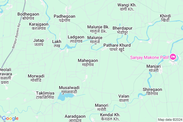
Mahegaon
Mahegaon Map
EDIT Map
Add Your House
 ..
..
Current Corona Virus Infected Patients Count in Ahmednagar District
| City Name | District Name | Total Covid cases |
|---|
Locality Name :
Mahegaon
( माहेगाव )
Taluka Name : Rahuri
District : Ahmednagar
State : Maharashtra
Region : Khandesh and Northern Maharashtra
Division : Nashik
Language : English and Hindi, Marathi, Urdu
Current Time 01:00 PM
Date: Tuesday , Apr 29,2025 (IST)
Time zone: IST (UTC+5:30)
Elevation / Altitude: 519 meters. Above Seal level
Telephone Code / Std Code: 02426
Assembly constituency : Shrirampur assembly constituency
Assembly MLA : Kanade Lahu Natha
Lok Sabha constituency : Shirdi parliamentary constituency
Parliament MP : SADASHIV KISAN LOKHANDE
Serpanch Name :
Pin Code : 413721
Post Office Name : Padhegaon
Commodities Prices : Rahuri(Vambori) Market / Mandi
Mahegaon Live Weather
Temperature: 39.7 °C
clear sky
Humidity: 11%
Wind : 2.78 mt/sec towards N
StationName : "RÄ\u0081huri"
observed on 17 Mins Back
Temperature: 39.7 °C
clear sky
Humidity: 11%
Wind : 2.78 mt/sec towards N
StationName : "RÄ\u0081huri"
observed on 17 Mins Back
Mahegaon Weather Forecast for Next 5 days
30-04-2025
29.9°C to 40.4°C
clear sky, broken clouds, scattered clouds
29.9°C to 40.4°C
clear sky, broken clouds, scattered clouds
01-05-2025
28.6°C to 41.8°C
clear sky, few clouds, overcast clouds, broken clouds
28.6°C to 41.8°C
clear sky, few clouds, overcast clouds, broken clouds
02-05-2025
28.3°C to 42.0°C
clear sky, overcast clouds, broken clouds
28.3°C to 42.0°C
clear sky, overcast clouds, broken clouds
03-05-2025
28.4°C to 41.2°C
clear sky, broken clouds, scattered clouds
28.4°C to 41.2°C
clear sky, broken clouds, scattered clouds
04-05-2025
25.5°C to 40.6°C
clear sky, scattered clouds, broken clouds, light rain
25.5°C to 40.6°C
clear sky, scattered clouds, broken clouds, light rain
National Highways Reachable To Mahegaon
Nationa High Way :NH753F
Nationa High Way :NH60
Nationa High Way :NH753F
Nationa High Way :NH60
Rivers Near Mahegaon
Gora
Lendga
Gora
Lendga
About Mahegaon
Correct below Info and add more info about MahegaonMahegaon is a Village in Rahuri Taluka in Ahmednagar District of Maharashtra State, India. It belongs to Khandesh and Northern Maharashtra region . It belongs to Nashik Division . It is located 48 KM towards North from District head quarters Ahmednagar. 10 KM from Rahuri Khurd. 236 KM from State capital Mumbai
Mahegaon Pin code is 413721 and postal head office is Padhegaon .
Musalwadi ( 4 KM ) , Pathare Khurd ( 4 KM ) , Khudsargaon ( 5 KM ) , Lakh ( 5 KM ) , Bherdapur ( 6 KM ) are the nearby Villages to Mahegaon. Mahegaon is surrounded by Shrirampur Taluka towards North , Nevasa Taluka towards East , Rahata Taluka towards west , Ahmednagar Taluka towards South .
Rahuri , Shrirampur , Shirdi , Ahmednagar are the near by Cities to Mahegaon.
Mahegaon 2011 Census Details
Mahegaon Local Language is English. Mahegaon Village Total population is 1965 and number of houses are 398. Female Population is 48.6%. Village literacy rate is 66.1% and the Female Literacy rate is 28.9%.
Population
| Census Parameter | Census Data |
| Total Population | 1965 |
| Total No of Houses | 398 |
| Female Population % | 48.6 % ( 955) |
| Total Literacy rate % | 66.1 % ( 1299) |
| Female Literacy rate | 28.9 % ( 567) |
| Scheduled Tribes Population % | 12.2 % ( 240) |
| Scheduled Caste Population % | 10.8 % ( 212) |
| Working Population % | 38.7 % |
| Child(0 -6) Population by 2011 | 269 |
| Girl Child(0 -6) Population % by 2011 | 40.1 % ( 108) |
Mahegaon Census More Deatils.
Politics in Mahegaon
RPI(A) , BJP , Shivsena , SHS , INC are the major political parties in this area.Polling Stations /Booths near Mahegaon
1)Mahankal Wadgaon Z.p.school South North Building From North Side Room No 32)Lakh. Z.p.school South North Building From South Room No 3
3)Malewadi Z. P. School South-north Building From North Side Room No 1
4)Khokar Z.p.school South Side East West Building From East Side Room No 3
5)D.d.kachole Madhyamik Vidyalaya ( Janta Vidyalaya )south North Building From South Side Room No 4
HOW TO REACH Mahegaon
By Road
Shrirampur is the Nearest Town to Mahegaon. Shrirampur is 10 km from Mahegaon. Road connectivity is there from Shrirampur to Mahegaon.By Rail
Taklimiya Rail Way Station , Padhegaon Rail Way Station are the very nearby railway stations to Mahegaon. Also you can consider railway Stations from Near By town Shrirampur. Belapur Rail Way Station , Nipani Vadgaon Rail Way Station are the railway Stations near to Shrirampur. You can reach from Shrirampur to Mahegaon by road after .Colleges near Mahegaon
Svnht's College Of B.pharmacy,shrishivajinagar .rahuri Factory.rahuri.
Address :
Schools in Mahegaon
M.v.karwadi
Address : mahegaon , rahuri , ahmadnagar , Maharashtra . PIN- 413721 , Post - Padhegaon
Govt Health Centers near Mahegaon
1) Malunja , Health Center Malunja , Gavthan , Gavthan2) Bherdapur , Health Center Bherdapur , Gavthan , Gavthan
3) Padhegaon , Primary Health Center Padhegaon , Gavthan , Gavthan
Sub Villages in Mahegaon
Hospitals in Mahegaon,Rahuri
Metropolis Healthcare Ltd
Tejomai Apartment;Ganesh Housing Society; Pandharpur Road Miraj; pandharpur; Maharashtra 416410; India
7.6 KM distance Detail
more ..
Petrol Bunks in Mahegaon,Rahuri
Nimse Petrol Pump
Morewadi; Pimpri Colony; Pimpri-Chinchwad; Maharashtra 413716; India
8.4 KM distance Detail
more ..
Colleges in Mahegaon,Rahuri
KIRAN KHULE
16;District High way Newasa Rahuri Road; Maharashtra 413705; India
7.7 KM distance Detail
Shri shivajinagar engineering college Shivajinagr
16;District High way Newasa Rahuri Rd; Aaradgaon; Maharashtra 413705; India
8.3 KM distance Detail
Chandragiri Secondary & Higher Secondary School
Manjari; Maharashtra 413705; India
8.4 KM distance Detail
more ..
Schools in Mahegaon,Rahuri
Zilla Parishad Primary School Pathare Kh.
Ahmednagar; Maharashtra 413721; India
3.8 KM distance Detail
Electronic Shops in Mahegaon,Rahuri
जय भद्रा हार्डवेअर &इलेक्ट्रीकल पाथरे खुदॅ
pathare kd shaendegaon Road ;Rahuri; Maharashtra 413721; India
4.7 KM distance Detail
About Mahegaon &
History
How to reach Mahegaon
Tourist Places Near By Mahegaon
Schools in Mahegaon
Colleges in Mahegaon
Temperature & weather of Mahegaon
places in Mahegaon
Mahegaon photos
More Information
How to reach Mahegaon
Tourist Places Near By Mahegaon
Schools in Mahegaon
Colleges in Mahegaon
Temperature & weather of Mahegaon
places in Mahegaon
Mahegaon photos
More Information
Village Talk
Post News or Events about this Village
Near Cities
Rahuri 14 KM near
Shrirampur 17 KM near
Shirdi 47 KM near
Ahmednagar 48 KM near
Rahuri 14 KM near
Shrirampur 17 KM near
Shirdi 47 KM near
Ahmednagar 48 KM near
Near By Taluks
Rahuri 10 KM near
Shrirampur 17 KM near
Nevasa 25 KM near
Rahata 37 KM near
Rahuri 10 KM near
Shrirampur 17 KM near
Nevasa 25 KM near
Rahata 37 KM near
Near By Air Ports
Chikkalthana Airport 92 KM near
Gandhinagar Airport 121 KM near
Lohegaon Airport 147 KM near
Chhatrapati Shivaji International Airport 222 KM near
Chikkalthana Airport 92 KM near
Gandhinagar Airport 121 KM near
Lohegaon Airport 147 KM near
Chhatrapati Shivaji International Airport 222 KM near
Near By Tourist Places
Shirdi 47 KM near
Ahmednagar 51 KM near
Grishneshwar 84 KM near
Aurangabad 85 KM near
Ozar 96 KM near
Shirdi 47 KM near
Ahmednagar 51 KM near
Grishneshwar 84 KM near
Aurangabad 85 KM near
Ozar 96 KM near
Near By Districts
Ahmednagar 47 KM near
Aurangabad District 87 KM near
Nashik 124 KM near
Beed 137 KM near
Ahmednagar 47 KM near
Aurangabad District 87 KM near
Nashik 124 KM near
Beed 137 KM near
Near By RailWay Station
Taklimiya Rail Way Station 6.5 KM near
Padhegaon Rail Way Station 7.0 KM near
Belapur Rail Way Station 17 KM near
Puntamba Junction Rail Way Station 35 KM near
Taklimiya Rail Way Station 6.5 KM near
Padhegaon Rail Way Station 7.0 KM near
Belapur Rail Way Station 17 KM near
Puntamba Junction Rail Way Station 35 KM near