| Home | City Bus | Maps | Villages | Cities | Rail | Tourist Places | School | College | Pin Codes | Corona Cases Count |
| Distance Calculator Bus Services IFSC Codes Trace Mobile Number Weather Search Place Trace IP Available Cash ATM/Banks Locate Polling Booth Report an Error contact People |
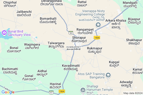
Kumbarpet Map
EDIT Map
Add Your House
 ..
..
Current Corona Virus Infected Patients Count in Yadgir District
| City Name | District Name | Total Covid cases |
|---|
Village Name :
Kumbarpet
( ಕುಂಬರ್ಪ್ಟ್ )
Taluk Name : Shorapur
District : Yadgir
State : Karnataka
Division : Gulbarga
Language : Kannada
Current Time 07:04 AM
Date: Monday , Apr 28,2025 (IST)
Time zone: IST (UTC+5:30)
Elevation / Altitude: 383 meters. Above Seal level
Telephone Code / Std Code: 08443
Ward : Ward
Assembly constituency : Shorapur assembly constituency
Assembly MLA : Raja Venkatappa Naik
Lok Sabha constituency : Raichur parliamentary constituency
Parliament MP : RAJA AMARESHWARA NAIK
Pin Code : 585290
Post Office Name : Kumbarpeth
Alternate Village Name : Kumbarpet
Commodities Prices : Devadurga Market / Mandi
Kumbarpet Live Weather
Temperature: 30.0 °C
clear sky
Humidity: 43%
Wind : 3.51 mt/sec towards SW
StationName : "ShorÄ\u0081pur"
observed on Now
Temperature: 30.0 °C
clear sky
Humidity: 43%
Wind : 3.51 mt/sec towards SW
StationName : "ShorÄ\u0081pur"
observed on Now
Kumbarpet Weather Forecast for Next 5 days
29-04-2025
31.2°C to 38.4°C
clear sky, scattered clouds, few clouds
31.2°C to 38.4°C
clear sky, scattered clouds, few clouds
30-04-2025
30.3°C to 39.3°C
broken clouds, scattered clouds, few clouds, clear sky
30.3°C to 39.3°C
broken clouds, scattered clouds, few clouds, clear sky
01-05-2025
28.7°C to 40.2°C
broken clouds, scattered clouds, few clouds, clear sky, overcast clouds
28.7°C to 40.2°C
broken clouds, scattered clouds, few clouds, clear sky, overcast clouds
02-05-2025
28.5°C to 42.2°C
broken clouds, scattered clouds, few clouds, clear sky, overcast clouds
28.5°C to 42.2°C
broken clouds, scattered clouds, few clouds, clear sky, overcast clouds
03-05-2025
29.7°C to 42.3°C
scattered clouds, few clouds, clear sky, broken clouds, overcast clouds
29.7°C to 42.3°C
scattered clouds, few clouds, clear sky, broken clouds, overcast clouds
National Highways Reachable To Kumbarpet
Nationa High Way :NH150
Nationa High Way :NH150A
Nationa High Way :NH150
Nationa High Way :NH150A
Rivers Near Kumbarpet
Bhima :ಭೀಮಾ :भीमा :కృష్ణా
Bhima :ಭೀಮಾ :भीमा :కృష్ణా
Bhima :ಭೀಮಾ :भीमा :కృష్ణా
Bhima :ಭೀಮಾ :भीमा :కృష్ణా
About Kumbarpet
Correct below Info and add more info about KumbarpetKumbarpet is a Locality in Shorapur City in Karnataka State, India. It is belongs to Gulbarga Division .
Kumbarpet Pin code is 585290 and postal head office is Kumbarpeth .
Venkatapur , Devikera , Devapur , Peth Ammapur , Devatkal are the nearby Localities to Kumbarpet.
Shorapur , Shahpur , Talikota , Yadgir are the nearby Cities to Shorapur.
Demographics of Kumbarpet
Kannada is the Local Language here.Politics in Kumbarpet
JD(U) , Bharatiya Janata Party , JD(S) , BJP , Bharatiya Janata Party (BJP) , INC are the major political parties in this area.Polling Stations /Booths near Kumbarpet
1)Govt Lower Primary School Kuppi2)Govt Lower Primary School Urdu (right Wing) Kodekal
3)Govt Higher Primary School (right Wing) Kudalagi
4)Govt. Higher Primary School (right Wing) Tinthini
5)Govt.higher Primary School Godihal T
HOW TO REACH Kumbarpet
By Rail
There is no railway station near to Kumbarpet in less than 10 km.By Road
Shorapur , Talikota , Muddebihal are the nearby by towns to Shorapur having road connectivity to Shorapur and KumbarpetGovt Health Centers near Kumbarpet
1) Shorapur , shorapur , Shorapur ,2) MANGALURA , MANGALURA , Petammapur ,
3) Devapura , devapura sub centre , Pethammapura phc ,
Police Stations near Kumbarpet,Shorapur
Police Station Shahapur
Police Station; Kondhwa Rd; Kondhwa; Pune; Maharashtra 411048; India
2.4 KM distance Detail
About Kumbarpet &
History
How to reach Kumbarpet
Tourist Places Near By Kumbarpet
Schools in Kumbarpet
Colleges in Kumbarpet
Temperature & weather of Kumbarpet
places in Kumbarpet
Kumbarpet photos
More Information
How to reach Kumbarpet
Tourist Places Near By Kumbarpet
Schools in Kumbarpet
Colleges in Kumbarpet
Temperature & weather of Kumbarpet
places in Kumbarpet
Kumbarpet photos
More Information
Locality Talk
Post News or Events about this Locality
Near Cities
Shorapur 1 KM near
Shahpur 25 KM near
Talikota 51 KM near
Yadgir 55 KM near
Shorapur 1 KM near
Shahpur 25 KM near
Talikota 51 KM near
Yadgir 55 KM near
Near By Taluks
Shorapur 12 KM near
Shahapur 27 KM near
Devadurga 31 KM near
Jevargi 54 KM near
Shorapur 12 KM near
Shahapur 27 KM near
Devadurga 31 KM near
Jevargi 54 KM near
Near By Air Ports
Sholapur Airport 170 KM near
Rajiv Gandhi International Airport 219 KM near
Latur Airport 238 KM near
Hubli Airport 245 KM near
Sholapur Airport 170 KM near
Rajiv Gandhi International Airport 219 KM near
Latur Airport 238 KM near
Hubli Airport 245 KM near
Near By Tourist Places
Gulbarga 103 KM near
Mantralayam 107 KM near
Aihole 120 KM near
Bijapur 129 KM near
Pattadakkal 131 KM near
Gulbarga 103 KM near
Mantralayam 107 KM near
Aihole 120 KM near
Bijapur 129 KM near
Pattadakkal 131 KM near
Near By Districts
Yadgir 55 KM near
Raichur 81 KM near
Gulbarga 103 KM near
Bijapur District 128 KM near
Yadgir 55 KM near
Raichur 81 KM near
Gulbarga 103 KM near
Bijapur District 128 KM near
Near By RailWay Station
Yadgir Rail Way Station 53 KM near
Nalwar Rail Way Station 62 KM near
Yadgir Rail Way Station 53 KM near
Nalwar Rail Way Station 62 KM near