| Home | City Bus | Maps | Villages | Cities | Rail | Tourist Places | School | College | Pin Codes | Corona Cases Count |
| Distance Calculator Bus Services IFSC Codes Trace Mobile Number Weather Search Place Trace IP Available Cash ATM/Banks Locate Polling Booth Report an Error contact People |
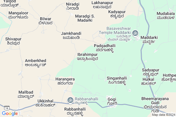
Ibrahimpur Map
EDIT Map
Add Your House
 ..
..
Current Corona Virus Infected Patients Count in Yadgir District
| City Name | District Name | Total Covid cases |
|---|
Locality Name :
Ibrahimpur
( ಇಬ್ರಾಹಿಂಪುರ್ )
Taluk Name : Shahapur
District : Yadgir
State : Karnataka
Division : Gulbarga
Language : Kannada
Current Time 07:27 AM
Date: Saturday , Apr 26,2025 (IST)
Time zone: IST (UTC+5:30)
Elevation / Altitude: 383 meters. Above Seal level
Telephone Code / Std Code: 08479
Assembly constituency : Jewargi assembly constituency
Assembly MLA : Ajay Singh
Lok Sabha constituency : Gulbarga parliamentary constituency
Parliament MP : DR. UMESH G JADHAV
Serpanch Name :
Pin Code : 585309
Post Office Name : Gogi
Commodities Prices : Shahapur Market / Mandi
Ibrahimpur Live Weather
Temperature: 32.0 °C
scattered clouds
Humidity: 35%
Wind : 1.67 mt/sec towards S
StationName : "ShÄ\u0081hpur"
observed on Now
Temperature: 32.0 °C
scattered clouds
Humidity: 35%
Wind : 1.67 mt/sec towards S
StationName : "ShÄ\u0081hpur"
observed on Now
Ibrahimpur Weather Forecast for Next 5 days
27-04-2025
30.6°C to 39.4°C
scattered clouds, broken clouds, light rain
30.6°C to 39.4°C
scattered clouds, broken clouds, light rain
28-04-2025
31.1°C to 37.8°C
overcast clouds, scattered clouds, broken clouds, few clouds
31.1°C to 37.8°C
overcast clouds, scattered clouds, broken clouds, few clouds
29-04-2025
29.6°C to 39.6°C
clear sky, few clouds, scattered clouds, broken clouds
29.6°C to 39.6°C
clear sky, few clouds, scattered clouds, broken clouds
30-04-2025
29.7°C to 40.4°C
broken clouds, clear sky, few clouds, scattered clouds
29.7°C to 40.4°C
broken clouds, clear sky, few clouds, scattered clouds
01-05-2025
28.5°C to 40.9°C
scattered clouds, few clouds, clear sky, broken clouds
28.5°C to 40.9°C
scattered clouds, few clouds, clear sky, broken clouds
Edit below overview about Ibrahimpur
Edit below overview about Ibrahimpur
OverView of Ibrahimpur
SHRI SAI SIDDASHRAMA Temple is Located in Ibrahimpur, Shri. Maharaj Diggi is a relationship holding faith of the community for the benefit of the community. The binding factor is the total faith and trust on SHRI SAI god. The guiding light is Shri. Maharaj Diggi.Edit below overview about Ibrahimpur
National Highways Reachable To Ibrahimpur
Nationa High Way :NH50
Nationa High Way :NH167
Nationa High Way :NH50
Nationa High Way :NH167
Rivers Near Ibrahimpur
Kagina :ಕಾಗಿನಾ
Bhima :ಭೀಮಾ :भीमा
Kagina :ಕಾಗಿನಾ
Bhima :ಭೀಮಾ :भीमा
About Ibrahimpur
Ibrahimpur is a Village in Shahapur Taluk in Yadgir District of Karnataka State, India. It belongs to Gulbarga Division . It is located 51 KM towards west from District head quarters Yadgir. 23 KM from Shahapur. 507 KM from State capital Bangalore
Ibrahimpur Pin code is 585309 and postal head office is Gogi .
Gogikona ( 10 KM ) , Chamnal ( 13 KM ) , Hoskera ( 15 KM ) are the nearby Villages to Ibrahimpur. Ibrahimpur is surrounded by Shahapur Taluk towards East , Shorapur Taluk towards South , Wadi Taluk towards North , Sindagi Taluk towards west .
Shahpur , Shorapur , Wadi , Yadgir are the near by Cities to Ibrahimpur.
Ibrahimpur 2011 Census Details
Ibrahimpur Local Language is Kannada. Ibrahimpur Village Total population is 3905 and number of houses are 651. Female Population is 49.1%. Village literacy rate is 36.8% and the Female Literacy rate is 14.1%.
Population
| Census Parameter | Census Data |
| Total Population | 3905 |
| Total No of Houses | 651 |
| Female Population % | 49.1 % ( 1918) |
| Total Literacy rate % | 36.8 % ( 1438) |
| Female Literacy rate | 14.1 % ( 550) |
| Scheduled Tribes Population % | 35.7 % ( 1396) |
| Scheduled Caste Population % | 17.2 % ( 672) |
| Working Population % | 53.2 % |
| Child(0 -6) Population by 2011 | 625 |
| Girl Child(0 -6) Population % by 2011 | 47.0 % ( 294) |
Ibrahimpur Census More Deatils.
Politics in Ibrahimpur
Bharatiya Janata Party , BJP , Indian National Congress (INC) , INC are the major political parties in this area.Polling Stations /Booths near Ibrahimpur
1)Govt. Lower Primary School Building Neeralkod2)Govt. Lower Primary School Building Gudur S.n
3)Govt. Lower Primary School Building Jamakhandi
4)Govt. Higher Primary School Kasarbhosga
5)Govt. Lower Primary School Building Kachur
HOW TO REACH Ibrahimpur
By Rail
There is no railway station near to Ibrahimpur in less than 10 km.Colleges near Ibrahimpur
Ddu College Shahapur
Address :
Schools in Ibrahimpur
Govt Hps Ibrahimpur
Address : ibrahimpur , shahapur , yadagiri , Karnataka . PIN- 585223 , Post - Shahapur Town
Govt Health Centers near Ibrahimpur
1) GOGI (K) , GOGI (K) , GOGI (K) , GOGI (K)2) GOGI (P) , GOGI (P) , GOGI (P) , GOGI (P)
3) GOGI (24X7) , GOGI (24X7) , GOGI (24X7) , GOGI (24X7)
Hospitals in Ibrahimpur,Shahapur
Government Hospital; Naganoor
Naganoor Shorapur Road; Naganoor; Karnataka 585309; India
18.7 KM distance Detail
more ..
Schools in Ibrahimpur,Shahapur
Govt Urdu High School Gogi
Near Hazrat chanda hussaini darga peth; Gogi; Karnataka 585309; India
7.0 KM distance Detail
Electronic Shops in Ibrahimpur,Shahapur
Vodafone Mini Store Gogi ANUSHA COMMUNICTION
Gogipeth; Karnataka 585309; India
6.8 KM distance Detail
Super Markets in Ibrahimpur,Shahapur
Local Parks in Ibrahimpur,Shahapur
About Ibrahimpur &
History
How to reach Ibrahimpur
Tourist Places Near By Ibrahimpur
Schools in Ibrahimpur
Colleges in Ibrahimpur
Temperature & weather of Ibrahimpur
places in Ibrahimpur
Ibrahimpur photos
More Information
How to reach Ibrahimpur
Tourist Places Near By Ibrahimpur
Schools in Ibrahimpur
Colleges in Ibrahimpur
Temperature & weather of Ibrahimpur
places in Ibrahimpur
Ibrahimpur photos
More Information
Village Talk
Post News or Events about this Village
Near Cities
Shahpur 16 KM near
Shorapur 32 KM near
Wadi 46 KM near
Yadgir 48 KM near
Shahpur 16 KM near
Shorapur 32 KM near
Wadi 46 KM near
Yadgir 48 KM near
Near By Taluks
Jevargi 20 KM near
Shahapur 22 KM near
Shorapur 36 KM near
Wadi 46 KM near
Jevargi 20 KM near
Shahapur 22 KM near
Shorapur 36 KM near
Wadi 46 KM near
Near By Air Ports
Sholapur Airport 141 KM near
Latur Airport 205 KM near
Rajiv Gandhi International Airport 211 KM near
Hubli Airport 263 KM near
Sholapur Airport 141 KM near
Latur Airport 205 KM near
Rajiv Gandhi International Airport 211 KM near
Hubli Airport 263 KM near
Near By Tourist Places
Gulbarga 70 KM near
Bijapur 120 KM near
Mantralayam 134 KM near
Aihole 137 KM near
Solapur 147 KM near
Gulbarga 70 KM near
Bijapur 120 KM near
Mantralayam 134 KM near
Aihole 137 KM near
Solapur 147 KM near
Near By Districts
Yadgir 49 KM near
Gulbarga 70 KM near
Raichur 104 KM near
Bijapur District 118 KM near
Yadgir 49 KM near
Gulbarga 70 KM near
Raichur 104 KM near
Bijapur District 118 KM near
Near By RailWay Station
Nalwar Rail Way Station 40 KM near
Wadi Junction Rail Way Station 46 KM near
Nalwar Rail Way Station 40 KM near
Wadi Junction Rail Way Station 46 KM near