| Home | City Bus | Maps | Villages | Cities | Rail | Tourist Places | School | College | Pin Codes | Corona Cases Count |
| Distance Calculator Bus Services IFSC Codes Trace Mobile Number Weather Search Place Trace IP Available Cash ATM/Banks Locate Polling Booth Report an Error contact People |
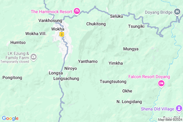
Yanthamo Map
EDIT Map
Add Your House
 ..
..
Current Corona Virus Infected Patients Count in Wokha District
| City Name | District Name | Total Covid cases |
|---|
Locality Name :
Yanthamo
( यथामो )
Tehsil Name : Chukitong
District : Wokha
State : Nagaland
Language : English and Khasi, Garo
Current Time 09:49 AM
Date: Wednesday , Mar 12,2025 (IST)
Time zone: IST (UTC+5:30)
Assembly constituency : assembly constituency
Assembly MLA :
Lok Sabha constituency : parliamentary constituency
Parliament MP :
Serpanch Name :
Pin Code : 797111
Post Office Name : Wokha
Commodities Prices : Baghry Market / Mandi
National Highways Reachable To Yanthamo
Nationa High Way :NH702A
Nationa High Way :NH2
Nationa High Way :NH702A
Nationa High Way :NH2
Rivers Near Yanthamo
Dhansiri River
Doyang
Dhansiri River
Doyang
About Yanthamo
Correct below Info and add more info about YanthamoYanthamo is a Village in Chukitong Tehsil in Wokha District of Nagaland State, India. It is located 5 KM towards East from District head quarters Wokha. 3 KM from Chukitong. 289 KM from State capital Shillong
Yanthamo Pin code is 797111 and postal head office is Wokha .
Longla ( 2 KM ) , Yimkha ( 3 KM ) , Longsachung ( 3 KM ) , Longsa ( 4 KM ) , Chukitong ( 5 KM ) are the nearby Villages to Yanthamo. Yanthamo is surrounded by Wokha Tehsil towards North , Sanis Tehsil towards North , Akuluto Tehsil towards East , Tseminyu Tehsil towards South .
Wokha , Zunheboto , Mokokchung , Kohima are the near by Cities to Yanthamo.
Yanthamo 2011 Census Details
Yanthamo Local Language is English. Yanthamo Village Total population is 1000 and number of houses are 194. Female Population is 52.3%. Village literacy rate is 62.4% and the Female Literacy rate is 30.6%.
Population
| Census Parameter | Census Data |
| Total Population | 1000 |
| Total No of Houses | 194 |
| Female Population % | 52.3 % ( 523) |
| Total Literacy rate % | 62.4 % ( 624) |
| Female Literacy rate | 30.6 % ( 306) |
| Scheduled Tribes Population % | 99.9 % ( 999) |
| Scheduled Caste Population % | 0.0 % ( 0) |
| Working Population % | 34.8 % |
| Child(0 -6) Population by 2011 | 178 |
| Girl Child(0 -6) Population % by 2011 | 46.6 % ( 83) |
Yanthamo Census More Deatils.
HOW TO REACH Yanthamo
By Rail
There is no railway station near to Yanthamo in less than 10 km.Schools near Yanthamo
Schools in Yanthamo,Chukitong
Eurokids
H.No-151; Near SP Office; Blue Hill Colony;; Wokha Town; Wokha; Nagaland 797111; India
4.4 KM distance Detail
About Yanthamo &
History
How to reach Yanthamo
Tourist Places Near By Yanthamo
Schools in Yanthamo
Colleges in Yanthamo
Temperature & weather of Yanthamo
places in Yanthamo
Yanthamo photos
More Information
How to reach Yanthamo
Tourist Places Near By Yanthamo
Schools in Yanthamo
Colleges in Yanthamo
Temperature & weather of Yanthamo
places in Yanthamo
Yanthamo photos
More Information
Village Talk
Post News or Events about this Village
Near Cities
Wokha 4 KM near
Zunheboto 28 KM near
Mokokchung 42 KM near
Kohima 53 KM near
Wokha 4 KM near
Zunheboto 28 KM near
Mokokchung 42 KM near
Kohima 53 KM near
Near By Taluks
Chukitong 3 KM near
Wokha 8 KM near
Sanis 19 KM near
Akuluto 19 KM near
Chukitong 3 KM near
Wokha 8 KM near
Sanis 19 KM near
Akuluto 19 KM near
Near By Air Ports
Dimapur Airport 62 KM near
Rowriah Airport 83 KM near
Lilabari Airport 153 KM near
Imphal Municipal Airport 168 KM near
Dimapur Airport 62 KM near
Rowriah Airport 83 KM near
Lilabari Airport 153 KM near
Imphal Municipal Airport 168 KM near
Near By Tourist Places
Wokha 4 KM near
Mokokchung 38 KM near
Kohima 53 KM near
Phek 55 KM near
Tuensang 62 KM near
Wokha 4 KM near
Mokokchung 38 KM near
Kohima 53 KM near
Phek 55 KM near
Tuensang 62 KM near
Near By Districts
Wokha 5 KM near
Zunheboto 25 KM near
Mokokchung 42 KM near
Phek 49 KM near
Wokha 5 KM near
Zunheboto 25 KM near
Mokokchung 42 KM near
Phek 49 KM near
Near By RailWay Station
Sarupathar Rail Way Station 50 KM near
Bokajan Rail Way Station 57 KM near
Sarupathar Rail Way Station 50 KM near
Bokajan Rail Way Station 57 KM near