| Home | City Bus | Maps | Villages | Cities | Rail | Tourist Places | School | College | Pin Codes | Corona Cases Count |
| Distance Calculator Bus Services IFSC Codes Trace Mobile Number Weather Search Place Trace IP Available Cash ATM/Banks Locate Polling Booth Report an Error contact People |
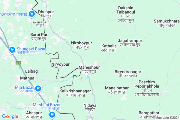
Sonapur
Sonapur Map
EDIT Map
Add Your House
 ..
..
Current Corona Virus Infected Patients Count in West Tripura District
| City Name | District Name | Total Covid cases |
|---|
Locality Name :
Sonapur
( সোনাপুর )
Block Name : Kathalia
District : West Tripura
State : Tripura
Language : Bengali and Kokborok, English
Current Time 01:13 PM
Date: Tuesday , Apr 29,2025 (IST)
Time zone: IST (UTC+5:30)
Elevation / Altitude: 25 meters. Above Seal level
Telephone Code / Std Code: 03823
Assembly constituency : Dhanpur assembly constituency
Assembly MLA : manik sarkar
Lok Sabha constituency : Tripura West parliamentary constituency
Parliament MP : Pratima Bhoumik
Serpanch Name :
Pin Code : 799131
Post Office Name : Sonamura
Commodities Prices : Barpathari Market / Mandi
Edit below overview about Sonapur
Edit below overview about Sonapur
OverView of Sonapur
Sonapur is the most popular village in Sonamura subdivision. Its awesome village of the Sonapur.Edit below overview about Sonapur
Rivers Near Sonapur
Gomati River :गोमती नदी
Gomati River :गोमती नदी
Gomati River :गोमती नदी
Gomati River :गोमती नदी
About Sonapur
Sonapur is a Village in Kathalia Block in West Tripura District of Tripura State, India. It is located 60 KM towards South from District head quarters Agartala. 60 KM from State capital Agartala
Sonapur Pin code is 799131 and postal head office is Sonamura .
Sonapur is surrounded by Melaghar Block towards North , Rajnagar Block towards South , Kakraban Block towards North , Udaipur Block towards North .
Udaipur , Badharghat , Jogendranagar , Pratapgarh are the near by Cities to Sonapur.
This Place is in the border of the West Tripura District and South Tripura District. South Tripura District Rajnagar is South towards this place .
Demographics of Sonapur
Bengali is the Local Language here.Politics in Sonapur
CPM , INC are the major political parties in this area.Polling Stations /Booths near Sonapur
1)Kanthaliya Bari S.b.school2)Poorba Chandigarh J.b. School
3)Ramkali Anganwadi Centre (pashchimangsha)
4)Kathaliya Dwadash Shreni Vidyalaya
5)Kanthaliya Sericulture Office
HOW TO REACH Sonapur
By Rail
There is no railway station near to Sonapur in less than 10 km.Colleges near Sonapur
Rahim Pur
Address :
Schools in Sonapur
Sonapur Ahmedia Sr. Madrassa
Address : sonapur , kathalia , west tripura , Tripura . PIN- 799181
Govt Health Centers near Sonapur
1) Barpathari PHC , , Barpathari , Near Samar Choudhury Smriti Milanyatan2) North Taibandal Subcentre , North Taibandal ADC , , Near Taibandal PHC
3) Madhupur PHC , , Madhupur , Near Agartala Kamalasagar Road
Hospitals in Sonapur,Kathalia
Veterinary Dipensary; Kathalia.
Office Tilla; Uttar Mahespur; Kathalia; Tripura 799131; India
1.0 KM distance Detail
more ..
Electronic Shops in Sonapur,Kathalia
GADGET ZONE
Opposite of Sonamura; Electric Office; Sonamura; Tripura 799131; India
15.6 KM distance Detail
About Sonapur &
History
How to reach Sonapur
Tourist Places Near By Sonapur
Schools in Sonapur
Colleges in Sonapur
Temperature & weather of Sonapur
places in Sonapur
Sonapur photos
More Information
How to reach Sonapur
Tourist Places Near By Sonapur
Schools in Sonapur
Colleges in Sonapur
Temperature & weather of Sonapur
places in Sonapur
Sonapur photos
More Information
Village Talk
Post News or Events about this Village
Near Cities
Udaipur 26 KM near
Badharghat 52 KM near
Jogendranagar 54 KM near
Pratapgarh 54 KM near
Udaipur 26 KM near
Badharghat 52 KM near
Jogendranagar 54 KM near
Pratapgarh 54 KM near
Near By Taluks
Kathalia 0 KM near
Melaghar 15 KM near
Rajnagar 16 KM near
Kakraban 20 KM near
Kathalia 0 KM near
Melaghar 15 KM near
Rajnagar 16 KM near
Kakraban 20 KM near
Near By Air Ports
Singerbhil Airport 65 KM near
Aizawl Airport 158 KM near
Kumbhirgram Airport 268 KM near
Shillong Airport 280 KM near
Singerbhil Airport 65 KM near
Aizawl Airport 158 KM near
Kumbhirgram Airport 268 KM near
Shillong Airport 280 KM near
Near By Tourist Places
Agartala 57 KM near
Ambassa 91 KM near
Kailashahar 143 KM near
Unakoti 144 KM near
Mamit 149 KM near
Agartala 57 KM near
Ambassa 91 KM near
Kailashahar 143 KM near
Unakoti 144 KM near
Mamit 149 KM near
Near By Districts
South Tripura 31 KM near
West Tripura 57 KM near
Dhalai 92 KM near
North Tripura 141 KM near
South Tripura 31 KM near
West Tripura 57 KM near
Dhalai 92 KM near
North Tripura 141 KM near
Near By RailWay Station
Agartala Rail Way Station 52 KM near
Ambassa Rail Way Station 92 KM near
Agartala Rail Way Station 52 KM near
Ambassa Rail Way Station 92 KM near