| Home | City Bus | Maps | Villages | Cities | Rail | Tourist Places | School | College | Pin Codes | Corona Cases Count |
| Distance Calculator Bus Services IFSC Codes Trace Mobile Number Weather Search Place Trace IP Available Cash ATM/Banks Locate Polling Booth Report an Error contact People |
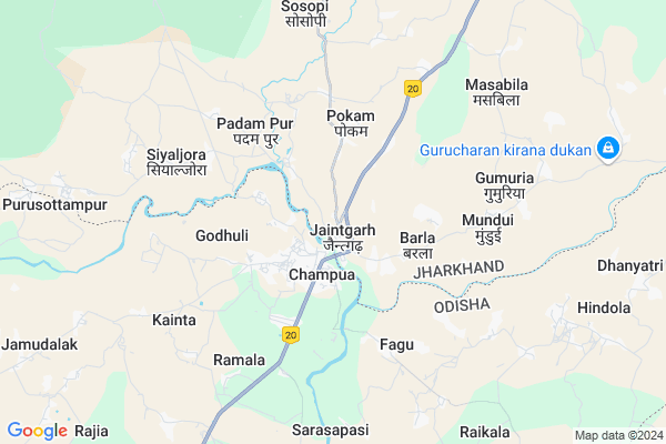
Jaintgarh
Jaintgarh Map
EDIT Map
Add Your House
 ..
..
Current Corona Virus Infected Patients Count in West Singhbhum District
| City Name | District Name | Total Covid cases |
|---|
Locality Name :
Jaintgarh
( जैंतगढ़ )
Block Name : Jagannathpur
District : West Singhbhum
State : Jharkhand
Language : Hindi and Santali
Current Time 07:22 AM
Date: Saturday , Apr 26,2025 (IST)
Time zone: IST (UTC+5:30)
Elevation / Altitude: 438 meters. Above Seal level
Telephone Code / Std Code: 06588
Assembly constituency : Jaganathpur assembly constituency
Assembly MLA : SONA RAM SINKU
Lok Sabha constituency : Singhbhum parliamentary constituency
Parliament MP : GEETA KORA
Serpanch Name :
Pin Code : 833203
Post Office Name : Jagannathpur
Commodities Prices : Karanjia Market / Mandi
Edit below overview about Jaintgarh
Edit below overview about Jaintgarh
OverView of Jaintgarh
jaintgarh pin code :833214,near railway station :maluka, 2 s s high school in jaintgarh,language :urdu ,english and hindiEdit below overview about Jaintgarh
National Highways Reachable To Jaintgarh
Nationa High Way :NH320G
Nationa High Way :NH320G
Rivers Near Jaintgarh
Kalia
Meghahatu Nallah
Kalia
Meghahatu Nallah
About Jaintgarh
Jaintgarh is a Village in Jagannathpur Block in West Singhbhum District of Jharkhand State, India. It is located 63 KM towards South from District head quarters Chaibasa. 12 KM from Jagannathpur. 170 KM from State capital Ranchi
Jaintgarh Pin code is 833203 and postal head office is Jagannathpur .
Gumuria ( 6 KM ) , Siyaljora ( 7 KM ) , Kasira ( 9 KM ) , Maluka ( 10 KM ) , Asanpat ( 11 KM ) are the nearby Villages to Jaintgarh. Jaintgarh is surrounded by Champua Block towards South , Manjhgaon Block towards East , Raruan Block towards East , Noamundi Block towards west .
Joda , Barbil , Karanjia , Kendujhar are the near by Cities to Jaintgarh.
This Place is in the border of the West Singhbhum District and Kendujhar District. Kendujhar District Champua is South towards this place . It is near to the Odisha State Border.
Jaintgarh 2011 Census Details
Jaintgarh Local Language is Hindi. Jaintgarh Village Total population is 3432 and number of houses are 656. Female Population is 48.0%. Village literacy rate is 74.0% and the Female Literacy rate is 32.3%.
Population
| Census Parameter | Census Data |
| Total Population | 3432 |
| Total No of Houses | 656 |
| Female Population % | 48.0 % ( 1646) |
| Total Literacy rate % | 74.0 % ( 2541) |
| Female Literacy rate | 32.3 % ( 1109) |
| Scheduled Tribes Population % | 9.8 % ( 337) |
| Scheduled Caste Population % | 21.8 % ( 748) |
| Working Population % | 33.7 % |
| Child(0 -6) Population by 2011 | 469 |
| Girl Child(0 -6) Population % by 2011 | 47.5 % ( 223) |
Jaintgarh Census More Deatils.
Politics in Jaintgarh
Indian National Congress , JBSP , BJP , INC are the major political parties in this area.Polling Stations /Booths near Jaintgarh
1)Govt. Primary School Baliyaidih2)Middle School Mahudi (west Part)
3)Upgrade Middle School Katepara
4)Middle School Guasai (west Part)
5)Primary School Chhotamahuldiha (north Part)
HOW TO REACH Jaintgarh
By Rail
There is no railway station near to Jaintgarh in less than 10 km.Colleges near Jaintgarh
Degree College Jagannathpur
Address : College Name Degree College Jagannathpur: degree College Jagannathpur
college Alternate Name : degree College Jagannathpur
city/village :jagannathpur jharkhand, West Singhbhum , Jagannathpur , Jagannathpur
public/private : public
college Type art
Jagannathpur Inter College
Address :
Schools near Jaintgarh
St. Paul's Middle School Maluka
Address :
U H S Siyaljora
Address : u h s siyaljora
Govt Health Centers near Jaintgarh
1) HSC KHUNTIPADA , KHUNTIPADA , KHUNTIPADA , KHUNTIPADA2) HSC GORIADUBA , GORIADUBA , GORIADUBA , GORIADUBA
3) HSC POKAM , Pokam , Pokam , Pokam
Hospitals in Jaintgarh,Jagannathpur
parbati health care gandhi market chmpua
Champua - Raruan Rd; Champua; Odisha 758041; India
2.8 KM distance Detail
more ..
Petrol Bunks in Jaintgarh,Jagannathpur
BPCL DEALER GUPTA PRASAD &SON JAINTGARH
NH20; Jaintgarh; Odisha 833203; India
0.5 KM distance Detail
HP PETROL PUMP - SHANU FUEL CENTRE
Hpcl Petrol Pump;jaintgarh PO Jaintgarh;ps -jagannathpur NH-75 (extension); Ranchi; JH 833214; India
0.5 KM distance Detail
GUPTA PRASAD & SONS
JAINTGARH; NH 75(E); SINGHBHUM WEST; Jharkhand 833214; India
0.6 KM distance Detail
more ..
Electronic Shops in Jaintgarh,Jagannathpur
KABEER COMPUTER CARE
Jamshedpur - Keonjhar Hwy; Champua; Odisha 758041; India
1.8 KM distance Detail
About Jaintgarh &
History
How to reach Jaintgarh
Tourist Places Near By Jaintgarh
Schools in Jaintgarh
Colleges in Jaintgarh
Temperature & weather of Jaintgarh
places in Jaintgarh
Jaintgarh photos
More Information
How to reach Jaintgarh
Tourist Places Near By Jaintgarh
Schools in Jaintgarh
Colleges in Jaintgarh
Temperature & weather of Jaintgarh
places in Jaintgarh
Jaintgarh photos
More Information
Village Talk
Post News or Events about this Village
Near Cities
Joda 28 KM near
Barbil 31 KM near
Karanjia 52 KM near
Kendujhar 55 KM near
Joda 28 KM near
Barbil 31 KM near
Karanjia 52 KM near
Kendujhar 55 KM near
Near By Taluks
Jagannathpur 11 KM near
Champua 14 KM near
Manjhgaon 23 KM near
Noamundi 25 KM near
Jagannathpur 11 KM near
Champua 14 KM near
Manjhgaon 23 KM near
Noamundi 25 KM near
Near By Air Ports
Ranchi Airport 159 KM near
Bhubaneswar Airport 228 KM near
Netaji Subhas Chandra Bose Airport 326 KM near
Gaya Airport 342 KM near
Ranchi Airport 159 KM near
Bhubaneswar Airport 228 KM near
Netaji Subhas Chandra Bose Airport 326 KM near
Gaya Airport 342 KM near
Near By Tourist Places
Seraikela 83 KM near
Barehipani & Joranda Barehipani & Joranda Falls 86 KM near
Rourkela 93 KM near
Jamshedpur 109 KM near
Baripada 124 KM near
Seraikela 83 KM near
Barehipani & Joranda Barehipani & Joranda Falls 86 KM near
Rourkela 93 KM near
Jamshedpur 109 KM near
Baripada 124 KM near
Near By Districts
Kendujhar 52 KM near
West Singhbhum 60 KM near
Saraikela Kharsawan 82 KM near
East Singhbum 107 KM near
Kendujhar 52 KM near
West Singhbhum 60 KM near
Saraikela Kharsawan 82 KM near
East Singhbum 107 KM near
Near By RailWay Station
Dangoaposi Rail Way Station 14 KM near
Goilkera Rail Way Station 62 KM near
Dangoaposi Rail Way Station 14 KM near
Goilkera Rail Way Station 62 KM near