| Home | City Bus | Maps | Villages | Cities | Rail | Tourist Places | School | College | Pin Codes | Corona Cases Count |
| Distance Calculator Bus Services IFSC Codes Trace Mobile Number Weather Search Place Trace IP Available Cash ATM/Banks Locate Polling Booth Report an Error contact People |
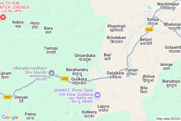
Dipasai
Dipasai Map
EDIT Map
Add Your House
 ..
..
Current Corona Virus Infected Patients Count in West Singhbhum District
| City Name | District Name | Total Covid cases |
|---|
Locality Name :
Dipasai
( डिपसै )
Block Name : Goelkera
District : West Singhbhum
State : Jharkhand
Language : Hindi and Santali
Current Time 11:07 AM
Date: Tuesday , Apr 29,2025 (IST)
Time zone: IST (UTC+5:30)
Elevation / Altitude: 333 meters. Above Seal level
Telephone Code / Std Code: 06593
Assembly constituency : Chakradharpur assembly constituency
Assembly MLA : SUKHRAM ORAON
Lok Sabha constituency : Singhbhum parliamentary constituency
Parliament MP : GEETA KORA
Serpanch Name :
Main Village Name : Katkara
Commodities Prices : Panposh Market / Mandi
Dipasai Live Weather
Temperature: 31.1 °C
clear sky
Humidity: 34%
Wind : 1.11 mt/sec towards SE
StationName : "Manoharpur"
observed on 2 Hours Back
Temperature: 31.1 °C
clear sky
Humidity: 34%
Wind : 1.11 mt/sec towards SE
StationName : "Manoharpur"
observed on 2 Hours Back
Dipasai Weather Forecast for Next 5 days
30-04-2025
22.7°C to 38.3°C
clear sky, scattered clouds, broken clouds, overcast clouds
22.7°C to 38.3°C
clear sky, scattered clouds, broken clouds, overcast clouds
01-05-2025
21.8°C to 40.1°C
clear sky, scattered clouds, light rain, overcast clouds, broken clouds
21.8°C to 40.1°C
clear sky, scattered clouds, light rain, overcast clouds, broken clouds
02-05-2025
20.6°C to 38.6°C
scattered clouds, clear sky, light rain, broken clouds
20.6°C to 38.6°C
scattered clouds, clear sky, light rain, broken clouds
03-05-2025
20.5°C to 38.9°C
few clouds, clear sky, light rain, broken clouds, overcast clouds
20.5°C to 38.9°C
few clouds, clear sky, light rain, broken clouds, overcast clouds
04-05-2025
21.6°C to 39.0°C
broken clouds, clear sky, few clouds, light rain, overcast clouds
21.6°C to 39.0°C
broken clouds, clear sky, few clouds, light rain, overcast clouds
National Highways Reachable To Dipasai
Nationa High Way :NH320D
Nationa High Way :NH320G
Nationa High Way :NH320D
Nationa High Way :NH320G
Rivers Near Dipasai
Karo River
ଦକ୍ଷିଣ କାରୋ ନଦୀ :South Karo :ଦକ୍ଷିଣ କାରୋ ନଦୀ
Karo River
ଦକ୍ଷିଣ କାରୋ ନଦୀ :South Karo :ଦକ୍ଷିଣ କାରୋ ନଦୀ
About Dipasai
Correct below Info and add more info about DipasaiDipasai is a small Village/hamlet in Goelkera Block in West Singhbhum District of Jharkhand State, India. It comes under Katkara Panchayath. It is located 49 KM towards west from District head quarters Chaibasa. 106 KM from State capital Ranchi
Dipasai is surrounded by Sonua Block towards North , Gudri Block towards west , Anandpur Block towards west , Tonto Block towards East .
Chakradharpur , Chaibasa , Barbil , Barughutu are the near by Cities to Dipasai.
Demographics of Dipasai
Hindi is the Local Language here.Politics in Dipasai
Indian National Congress , JBSP , BJP , JMM , are the major political parties in this area.Polling Stations /Booths near Dipasai
1)P/s Bhaliyadih2)M/s Hathiya
3)Upgrade M/s Sharda
4)P/s Kandeyong
5)P/s Ichahatu
HOW TO REACH Dipasai
By Rail
Goilkera Rail Way Station , Tunia Rail Way Station are the very nearby railway stations to Dipasai.Pincodes near Dipasai
833105 ( Sonua ) , 833106 ( Chiria ) , 833103 ( Goilkera )Colleges near Dipasai
Degree College Jagannathpur
Address : College Name Degree College Jagannathpur: degree College Jagannathpur
college Alternate Name : degree College Jagannathpur
city/village :jagannathpur jharkhand, West Singhbhum , Jagannathpur , Jagannathpur
public/private : public
college Type art
St. Augustine College, Manoharpur
Address : Same As College.
Jagannathpur Inter College
Address :
Inter College Manjhgaon
Address :
Kolhan University Chaibasa
Address :
Schools near Dipasai
Govt Health Centers near Dipasai
1) HSC BARI , HSC Bari , Bari A , Near By Panchayat Bhaban2) HSC GOILKERA , , , Goilkera
3) PHC KHARIMATI , PHC Kharimati , Kharimati , Near By AW
Super Markets in Dipasai,Goelkera
Local Parks in Dipasai,Goelkera
Police Stations near Dipasai,Goelkera
About Dipasai &
History
How to reach Dipasai
Tourist Places Near By Dipasai
Schools in Dipasai
Colleges in Dipasai
Temperature & weather of Dipasai
places in Dipasai
Dipasai photos
More Information
How to reach Dipasai
Tourist Places Near By Dipasai
Schools in Dipasai
Colleges in Dipasai
Temperature & weather of Dipasai
places in Dipasai
Dipasai photos
More Information
Village Talk
Post News or Events about this Village
Near Cities
Chakradharpur 32 KM near
Chaibasa 47 KM near
Barbil 51 KM near
Barughutu 58 KM near
Chakradharpur 32 KM near
Chaibasa 47 KM near
Barbil 51 KM near
Barughutu 58 KM near
Near By Taluks
Goelkera 0 KM near
Sonua 11 KM near
Gudri 14 KM near
Anandpur 26 KM near
Goelkera 0 KM near
Sonua 11 KM near
Gudri 14 KM near
Anandpur 26 KM near
Near By Air Ports
Ranchi Airport 98 KM near
Gaya Airport 280 KM near
Bhubaneswar Airport 287 KM near
Netaji Subhas Chandra Bose Airport 350 KM near
Ranchi Airport 98 KM near
Gaya Airport 280 KM near
Bhubaneswar Airport 287 KM near
Netaji Subhas Chandra Bose Airport 350 KM near
Near By Tourist Places
Seraikela 65 KM near
Rourkela 68 KM near
Chotanagpur 73 KM near
Dassam Falls 83 KM near
Jamshedpur 99 KM near
Seraikela 65 KM near
Rourkela 68 KM near
Chotanagpur 73 KM near
Dassam Falls 83 KM near
Jamshedpur 99 KM near
Near By Districts
West Singhbhum 47 KM near
Saraikela Kharsawan 65 KM near
Khunti 69 KM near
East Singhbum 96 KM near
West Singhbhum 47 KM near
Saraikela Kharsawan 65 KM near
Khunti 69 KM near
East Singhbum 96 KM near
Near By RailWay Station
Goilkera Rail Way Station 3.4 KM near
Tunia Rail Way Station 4.5 KM near
Mahadevsal Rail Way Station 7.7 KM near
Manoharpur Rail Way Station 29 KM near
Goilkera Rail Way Station 3.4 KM near
Tunia Rail Way Station 4.5 KM near
Mahadevsal Rail Way Station 7.7 KM near
Manoharpur Rail Way Station 29 KM near