| Home | City Bus | Maps | Villages | Cities | Rail | Tourist Places | School | College | Pin Codes | Corona Cases Count |
| Distance Calculator Bus Services IFSC Codes Trace Mobile Number Weather Search Place Trace IP Available Cash ATM/Banks Locate Polling Booth Report an Error contact People |
Bumjipanga-baragang
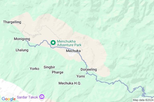
Bumjipanga-baragang Map
EDIT Map
Add Your House
 ..
..
Current Corona Virus Infected Patients Count in West Siang District
| City Name | District Name | Total Covid cases |
|---|
Locality Name :
Bumjipanga-baragang
( Bumjipanga-बरगंग )
Tehsil Name : Mechuka-tato
District : West Siang
State : Arunachal Pradesh
Language : English and Adi, Sino-tibetan
Current Time 02:51 AM
Date: Thursday , Mar 13,2025 (IST)
Time zone: IST (UTC+5:30)
Telephone Code / Std Code: 03793
Assembly constituency : Mechukha assembly constituency
Assembly MLA : PASANG DORJEE SONA
Lok Sabha constituency : parliamentary constituency
Parliament MP :
Serpanch Name :
Bumjipanga-baragang Live Weather
Temperature: 6.1 °C
overcast clouds
Humidity: 95%
Wind : 0.77 mt/sec towards NE
StationName : "Tungdor"
observed on Now
Temperature: 6.1 °C
overcast clouds
Humidity: 95%
Wind : 0.77 mt/sec towards NE
StationName : "Tungdor"
observed on Now
Bumjipanga-baragang Weather Forecast for Next 5 days
14-03-2025
6.2°C to 9.9°C
light rain, overcast clouds
6.2°C to 9.9°C
light rain, overcast clouds
15-03-2025
5.6°C to 12.4°C
overcast clouds, broken clouds, light rain
5.6°C to 12.4°C
overcast clouds, broken clouds, light rain
16-03-2025
6.0°C to 14.5°C
broken clouds, scattered clouds, light rain, overcast clouds
6.0°C to 14.5°C
broken clouds, scattered clouds, light rain, overcast clouds
17-03-2025
7.9°C to 14.3°C
overcast clouds, light rain
7.9°C to 14.3°C
overcast clouds, light rain
Rivers Near Bumjipanga-baragang
Yargyapchu :巴恰西仁河 :bāqiàxīrén hé
Kurik :河流F
Yargyapchu :巴恰西仁河 :bāqiàxīrén hé
Kurik :河流F
About Bumjipanga-baragang
Correct below Info and add more info about Bumjipanga-baragangBumjipanga-baragang is a Village in Mechuka-tato Tehsil in West Siang District of Arunachal Pradesh State, India. It is located 94 KM towards west from District head quarters Along. 201 KM from State capital Itanagar
Bumjipanga-baragang is surrounded by Siyum Tehsil towards South , Payeng Tehsil towards South , Nacho Tehsil towards west , Lower Koloriang Tehsil towards South .
Pasighat , Silapathar , Dibrugarh , Naharlagun are the near by Cities to Bumjipanga-baragang.
Barangang 2011 Census Details
Bumjipanga-baragang Local Language is English. Barangang Village Total population is 117 and number of houses are 15. Female Population is 59.0%. Village literacy rate is 47.0% and the Female Literacy rate is 23.9%.
Population
| Census Parameter | Census Data |
| Total Population | 117 |
| Total No of Houses | 15 |
| Female Population % | 59.0 % ( 69) |
| Total Literacy rate % | 47.0 % ( 55) |
| Female Literacy rate | 23.9 % ( 28) |
| Scheduled Tribes Population % | 100.0 % ( 117) |
| Scheduled Caste Population % | 0.0 % ( 0) |
| Working Population % | 29.1 % |
| Child(0 -6) Population by 2011 | 24 |
| Girl Child(0 -6) Population % by 2011 | 62.5 % ( 15) |
Barangang Census More Deatils.
Politics in Bumjipanga-baragang
N.A , AC , Bharatiya Janata Party , NCP , INC are the major political parties in this area.Polling Stations /Booths near Bumjipanga-baragang
1)Govt. Primary School Yapik2)Community Hall Yorni
3)Govt. I.v School Papikurung
4)Govt.primary School Rego
5)Community Hall Thargelling
HOW TO REACH Bumjipanga-baragang
By Rail
There is no railway station near to Bumjipanga-baragang in less than 10 km.Pincodes near Bumjipanga-baragang
791122 ( Daporijo ) , 791001 ( Along ) , 791002 ( Yingkiong )Schools near Bumjipanga-baragang
Mechukha H.s.s
Address : mechukha h.q. , mechukha , west siang , Arunachal Pradesh . PIN- 792051
Kgbv
Address : mechukha h.q. , mechukha , west siang , Arunachal Pradesh . PIN- 792051
Sfs Pre. Pry School Tato
Address : tato h.q. , mechukha , west siang , Arunachal Pradesh . PIN- 792051
Tso Yorgay Public P S
Address : mechukha h.q. , mechukha , west siang , Arunachal Pradesh . PIN- 792051
Govt Health Centers near Bumjipanga-baragang
1) PHC Sarli , PHC Sarli , ,2) CHC Boleng , CHC Boleng , ,
3) DH Yingkiong , , ,
Schools in Bumjipanga-baragang,Mechuka-tato
Govt. Hr. Sec. School; Mechukha
P/O-Mechukha; Via Aalo; Dt- West Siang; Arunachal Pradesh- 791001; West Siang; Arunachal Pradesh 792015
2.6 KM distance Detail
Electronic Shops in Bumjipanga-baragang,Mechuka-tato
Super Markets in Bumjipanga-baragang,Mechuka-tato
Local Parks in Bumjipanga-baragang,Mechuka-tato
Governement Offices near Bumjipanga-baragang,Mechuka-tato
About Bumjipanga-baragang &
History
How to reach Bumjipanga-baragang
Tourist Places Near By Bumjipanga-baragang
Schools in Bumjipanga-baragang
Colleges in Bumjipanga-baragang
Temperature & weather of Bumjipanga-baragang
places in Bumjipanga-baragang
Bumjipanga-baragang photos
More Information
How to reach Bumjipanga-baragang
Tourist Places Near By Bumjipanga-baragang
Schools in Bumjipanga-baragang
Colleges in Bumjipanga-baragang
Temperature & weather of Bumjipanga-baragang
places in Bumjipanga-baragang
Bumjipanga-baragang photos
More Information
Village Talk
Post News or Events about this Village
Near Cities
Pasighat 146 KM near
Silapathar 152 KM near
Dibrugarh 163 KM near
Naharlagun 190 KM near
Pasighat 146 KM near
Silapathar 152 KM near
Dibrugarh 163 KM near
Naharlagun 190 KM near
Near By Taluks
Mechuka-Tato 0 KM near
Siyum 23 KM near
Payeng 26 KM near
Nacho 41 KM near
Mechuka-Tato 0 KM near
Siyum 23 KM near
Payeng 26 KM near
Nacho 41 KM near
Near By Air Ports
Lilabari Airport 163 KM near
Chabua Airport 169 KM near
Rowriah Airport 232 KM near
Salonibari Airport 278 KM near
Lilabari Airport 163 KM near
Chabua Airport 169 KM near
Rowriah Airport 232 KM near
Salonibari Airport 278 KM near
Near By Tourist Places
Mouling National Park (Jengging) 68 KM near
Daporijo 76 KM near
Along 90 KM near
Yingkiong 99 KM near
Koloriang 122 KM near
Mouling National Park (Jengging) 68 KM near
Daporijo 76 KM near
Along 90 KM near
Yingkiong 99 KM near
Koloriang 122 KM near
Near By Districts
Upper Subansiri 76 KM near
West Siang 90 KM near
Upper Siang 99 KM near
Kurung Kumey 122 KM near
Upper Subansiri 76 KM near
West Siang 90 KM near
Upper Siang 99 KM near
Kurung Kumey 122 KM near
Near By RailWay Station
Dibrugarh Rail Way Station 162 KM near
New Tinsukia Junction Rail Way Station 191 KM near
Dibrugarh Rail Way Station 162 KM near
New Tinsukia Junction Rail Way Station 191 KM near