| Home | City Bus | Maps | Villages | Cities | Rail | Tourist Places | School | College | Pin Codes | Corona Cases Count |
| Distance Calculator Bus Services IFSC Codes Trace Mobile Number Weather Search Place Trace IP Available Cash ATM/Banks Locate Polling Booth Report an Error contact People |
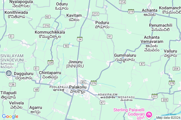
Mattaparru
Mattaparru Map
EDIT Map
Add Your House
 ..
..
Current Corona Virus Infected Patients Count in West Godavari District
| City Name | District Name | Total Covid cases |
|---|---|---|
| West Godavari District | West Godavari | 43 |
| Penugonda | West Godavari | 3 |
| Eluru | West Godavari | 2 |
| Tadepalligudem | West Godavari | 1 |
| Tallamundunurupadu | West Godavari | 1 |
| Narsapuram | West Godavari | 1 |
Locality Name :
Mattaparru
( మట్టపర్రు )
Mandal Name : Poduru
District : West Godavari
State : Andhra Pradesh
Region : Andhra
Language : Telugu
Current Time 06:12 AM
Date: Saturday , Apr 26,2025 (IST)
Time zone: IST (UTC+5:30)
Elevation / Altitude: 14 meters. Above Seal level
Telephone Code / Std Code: 08862
Assembly constituency : Kuppam assembly constituency
Assembly MLA : Nara Chandra Babu Naidu
Lok Sabha constituency : parliamentary constituency
Parliament MP : KANUMURU RAGHU RAMA KRISHNA RAJU
Serpanch Name :
Pin Code : 534265
Post Office Name : Jinnuru
Commodities Prices : Ambajipeta Market / Mandi
Mattaparru Live Weather
Temperature: 27.6 °C
few clouds
Humidity: 84%
Wind : 0.42 mt/sec towards E
StationName : "Penugonda"
observed on Now
Temperature: 27.6 °C
few clouds
Humidity: 84%
Wind : 0.42 mt/sec towards E
StationName : "Penugonda"
observed on Now
Mattaparru Weather Forecast for Next 5 days
27-04-2025
27.2°C to 36.0°C
scattered clouds, few clouds, broken clouds, clear sky
27.2°C to 36.0°C
scattered clouds, few clouds, broken clouds, clear sky
28-04-2025
25.8°C to 36.1°C
broken clouds, light rain, scattered clouds, few clouds
25.8°C to 36.1°C
broken clouds, light rain, scattered clouds, few clouds
29-04-2025
25.7°C to 35.4°C
broken clouds, few clouds, clear sky, light rain, scattered clouds
25.7°C to 35.4°C
broken clouds, few clouds, clear sky, light rain, scattered clouds
30-04-2025
26.8°C to 35.7°C
clear sky, light rain, broken clouds, scattered clouds
26.8°C to 35.7°C
clear sky, light rain, broken clouds, scattered clouds
01-05-2025
26.7°C to 36.3°C
light rain, few clouds, clear sky, overcast clouds
26.7°C to 36.3°C
light rain, few clouds, clear sky, overcast clouds
National Highways Reachable To Mattaparru
Nationa High Way :NH165
Nationa High Way :NH165
Rivers Near Mattaparru
Godavari
Vainateyam Godavari
Godavari
Vainateyam Godavari
About Mattaparru
Correct below Info and add more info about MattaparruMattaparru is a Village in Poduru Mandal in West Godavari District of Andhra Pradesh State, India. It belongs to Andhra region . It is located 81 KM towards East from District head quarters Eluru. 2 KM from Poduru. 418 KM from State capital Hyderabad
Mattaparru Pin code is 534265 and postal head office is Jinnuru .
Vedangi ( 2 KM ) , Penumadham ( 2 KM ) , Ullamparu ( 2 KM ) , Ullamparru ( 2 KM ) , Parvathi Nagar ( 3 KM ) are the nearby Villages to Mattaparru. Mattaparru is surrounded by Palacole Mandal towards South , Elamanchili Mandal towards East , Achanta Mandal towards East , Veeravasaram Mandal towards west .
Palacole , Narasapur , Mogalthur , Bhimavaram are the near by Cities to Mattaparru.
Mettaparru 2011 Census Details
Mattaparru Local Language is Telugu. Mettaparru Village Total population is 3814 and number of houses are 1064. Female Population is 49.6%. Village literacy rate is 73.5% and the Female Literacy rate is 34.5%.
Population
| Census Parameter | Census Data |
| Total Population | 3814 |
| Total No of Houses | 1064 |
| Female Population % | 49.6 % ( 1892) |
| Total Literacy rate % | 73.5 % ( 2805) |
| Female Literacy rate | 34.5 % ( 1315) |
| Scheduled Tribes Population % | 0.8 % ( 31) |
| Scheduled Caste Population % | 23.2 % ( 884) |
| Working Population % | 51.8 % |
| Child(0 -6) Population by 2011 | 364 |
| Girl Child(0 -6) Population % by 2011 | 49.5 % ( 180) |
Mettaparru Census More Deatils.
Politics in Mattaparru
TDP , YSRC , Telugu Desam , INC are the major political parties in this area.HOW TO REACH Mattaparru
By Road
Palacole is the Nearest Town to Mattaparru. Palacole is 5 km from Mattaparru. Road connectivity is there from Palacole to Mattaparru.By Rail
Chinta Parru Halt Rail Way Station , Palakollu Rail Way Station are the very nearby railway stations to Mattaparru. Also you can consider railway Stations from Near By town Palacole. Palakollu Rail Way Station , Chinta Parru Halt Rail Way Station are the railway Stations near to Palacole. You can reach from Palacole to Mattaparru by road after .By Bus
Palakollu APSRTC Bus Station , Marteru APSRTC Bus Station , Siddhantam APSRTC Bus Station are the nearby by Bus Stations to Mattaparru .APSRTC runs Number of busses from major cities to here.Colleges near Mattaparru
Sri Gowtami Degree College
Address : D.no.8-147, Jinnuru (v), Poduru (m), W.g.dist.
Schools in Mattaparru
Mpupsmattaparru
Address : mattaparru , poduru , west godavari , Andhra Pradesh . PIN- 534265 , Post - Jinnuru
Govt Health Centers near Mattaparru
1) ULLAMPURAM Sub Centre , 2-100/1 , canal street , canal2) APPANA CHERUVU Sub Centre , 02 - 087 , Ambetkhar street , Near AW centre
3) GUMMULURU Sub Centre , May-42 , Peda Peta Road , Near Community Hall
Sub Villages in Mattaparru
Petrol Bunks in Mattaparru,Poduru
SRI VARALAKSHMI SERVICE STATION
ATTILI; WEST GODAVARI; Andhra Pradesh 534134; India
3.8 KM distance Detail
more ..
Colleges in Mattaparru,Poduru
Sir C.V. Raman Polytechnic
Ullampar Rd; Ullamparu; Palakollu; Andhra Pradesh 534267; India
2.7 KM distance Detail
Adityacollege
Ullampar Rd; Ullamparu; Palakollu; Andhra Pradesh 534267; India
2.9 KM distance Detail
more ..
Electronic Shops in Mattaparru,Poduru
Sai Krishna Enterprises; Palakollu
Mattam Street; Venkateswara Colony; Palakollu; Andhra Pradesh 534260; India
4.3 KM distance Detail
Super Markets in Mattaparru,Poduru
venkateswara general store (purushotham)
Mattaparru; Andhra Pradesh 534265; India
0.4 KM distance Detail
Padarthi Koteswra Rao and Sons Kirana
Yedla Bazar; Main Road; Palakollu; Andhra Pradesh; India
4.4 KM distance Detail
Local Parks in Mattaparru,Poduru
Ramagundam Park
Palakollu - Razole Rd; Palakollu; Andhra Pradesh 534260; India
4.8 KM distance Detail
Police Stations near Mattaparru,Poduru
Police Control Room
Someswara Agraharam; Palakollu; Andhra Pradesh 534260; India
5.2 KM distance Detail
Poduru Police Station
Poduru Road; Government Office Compound; West Godavari District; Poduru; Andhra Pradesh 534327; India
5.8 KM distance Detail
About Mattaparru &
History
How to reach Mattaparru
Tourist Places Near By Mattaparru
Schools in Mattaparru
Colleges in Mattaparru
Temperature & weather of Mattaparru
places in Mattaparru
Mattaparru photos
More Information
How to reach Mattaparru
Tourist Places Near By Mattaparru
Schools in Mattaparru
Colleges in Mattaparru
Temperature & weather of Mattaparru
places in Mattaparru
Mattaparru photos
More Information
Village Talk
Post News or Events about this Village
Near Cities
Palacole 4 KM near
Narasapur 15 KM near
Mogalthur 23 KM near
Bhimavaram 24 KM near
Palacole 4 KM near
Narasapur 15 KM near
Mogalthur 23 KM near
Bhimavaram 24 KM near
Near By Taluks
Poduru 2 KM near
Palacole 4 KM near
Elamanchili 9 KM near
Achanta 11 KM near
Poduru 2 KM near
Palacole 4 KM near
Elamanchili 9 KM near
Achanta 11 KM near
Near By Air Ports
Rajahmundry Airport 70 KM near
Vijayawada Airport 112 KM near
Vishakhapatnam Airport 229 KM near
Rajiv Gandhi International Airport 403 KM near
Rajahmundry Airport 70 KM near
Vijayawada Airport 112 KM near
Vishakhapatnam Airport 229 KM near
Rajiv Gandhi International Airport 403 KM near
Near By Tourist Places
Konaseema 27 KM near
Rajahamundry 56 KM near
Kakinada 77 KM near
Machelipatnam 85 KM near
Papi Kondalu 118 KM near
Konaseema 27 KM near
Rajahamundry 56 KM near
Kakinada 77 KM near
Machelipatnam 85 KM near
Papi Kondalu 118 KM near
Near By Districts
East Godavari 76 KM near
West Godavari 77 KM near
Krishna 86 KM near
Guntur 159 KM near
East Godavari 76 KM near
West Godavari 77 KM near
Krishna 86 KM near
Guntur 159 KM near
Near By RailWay Station
Chinta Parru Halt Rail Way Station 4.3 KM near
Palakollu Rail Way Station 4.7 KM near
Lankalakoderu Rail Way Station 7.9 KM near
Attili Rail Way Station 21 KM near
Bhimavaram Town Rail Way Station 26 KM near
Chinta Parru Halt Rail Way Station 4.3 KM near
Palakollu Rail Way Station 4.7 KM near
Lankalakoderu Rail Way Station 7.9 KM near
Attili Rail Way Station 21 KM near
Bhimavaram Town Rail Way Station 26 KM near