| Home | City Bus | Maps | Villages | Cities | Rail | Tourist Places | School | College | Pin Codes | Corona Cases Count |
| Distance Calculator Bus Services IFSC Codes Trace Mobile Number Weather Search Place Trace IP Available Cash ATM/Banks Locate Polling Booth Report an Error contact People |
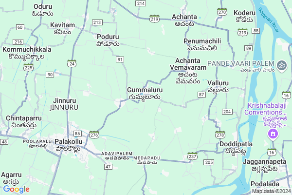
Gummuluru
Gummuluru Map
EDIT Map
Add Your House
 ..
..
Current Corona Virus Infected Patients Count in West Godavari District
| City Name | District Name | Total Covid cases |
|---|---|---|
| West Godavari District | West Godavari | 43 |
| Penugonda | West Godavari | 3 |
| Eluru | West Godavari | 2 |
| Tadepalligudem | West Godavari | 1 |
| Tallamundunurupadu | West Godavari | 1 |
| Narsapuram | West Godavari | 1 |
Locality Name :
Gummuluru
( గుమ్ములూరు )
Mandal Name : Poduru
District : West Godavari
State : Andhra Pradesh
Region : Andhra
Language : Telugu
Current Time 10:55 PM
Date: Monday , Apr 28,2025 (IST)
Time zone: IST (UTC+5:30)
Elevation / Altitude: 14 meters. Above Seal level
Telephone Code / Std Code: 08862
Assembly constituency : Kuppam assembly constituency
Assembly MLA : Nara Chandra Babu Naidu
Lok Sabha constituency : parliamentary constituency
Parliament MP : KANUMURU RAGHU RAMA KRISHNA RAJU
Serpanch Name :
Pin Code : 534267
Post Office Name : Gummaluru
Commodities Prices : Ambajipeta Market / Mandi
Gummuluru Live Weather
Temperature: 26.7 °C
scattered clouds
Humidity: 86%
Wind : 1.01 mt/sec towards SE
StationName : "Penugonda"
observed on Now
Temperature: 26.7 °C
scattered clouds
Humidity: 86%
Wind : 1.01 mt/sec towards SE
StationName : "Penugonda"
observed on Now
Gummuluru Weather Forecast for Next 5 days
29-04-2025
25.7°C to 26.3°C
few clouds
25.7°C to 26.3°C
few clouds
30-04-2025
25.3°C to 35.7°C
clear sky, few clouds, scattered clouds
25.3°C to 35.7°C
clear sky, few clouds, scattered clouds
01-05-2025
26.2°C to 36.0°C
light rain, broken clouds, clear sky, few clouds, scattered clouds
26.2°C to 36.0°C
light rain, broken clouds, clear sky, few clouds, scattered clouds
02-05-2025
26.6°C to 36.6°C
scattered clouds, clear sky, broken clouds
26.6°C to 36.6°C
scattered clouds, clear sky, broken clouds
03-05-2025
27.2°C to 36.8°C
scattered clouds, light rain, clear sky
27.2°C to 36.8°C
scattered clouds, light rain, clear sky
National Highways Reachable To Gummuluru
Nationa High Way :NH165
Nationa High Way :NH165
Rivers Near Gummuluru
Godavari
Vainateyam Godavari
Godavari
Vainateyam Godavari
About Gummuluru
Correct below Info and add more info about GummuluruGummuluru is a Village in Poduru Mandal in West Godavari District of Andhra Pradesh State, India. It belongs to Andhra region . It is located 86 KM towards East from District head quarters Eluru. 2 KM from Poduru. 423 KM from State capital Hyderabad
Gummuluru Pin code is 534267 and postal head office is Gummaluru .
Penumadham ( 2 KM ) , Nerudumilli ( 3 KM ) , Miniminchilipadu ( 3 KM ) , Vaddiparru ( 3 KM ) , Penumarru ( 4 KM ) are the nearby Villages to Gummuluru. Gummuluru is surrounded by Elamanchili Mandal towards South , Achanta Mandal towards East , Palacole Mandal towards west , Penugonda Mandal towards North .
Palacole , Narasapur , Kothapeta , Tanuku are the near by Cities to Gummuluru.
Gummaluru 2011 Census Details
Gummuluru Local Language is Telugu. Gummaluru Village Total population is 5889 and number of houses are 1686. Female Population is 49.8%. Village literacy rate is 75.1% and the Female Literacy rate is 35.7%.
Population
| Census Parameter | Census Data |
| Total Population | 5889 |
| Total No of Houses | 1686 |
| Female Population % | 49.8 % ( 2932) |
| Total Literacy rate % | 75.1 % ( 4422) |
| Female Literacy rate | 35.7 % ( 2100) |
| Scheduled Tribes Population % | 0.8 % ( 47) |
| Scheduled Caste Population % | 34.5 % ( 2033) |
| Working Population % | 46.1 % |
| Child(0 -6) Population by 2011 | 513 |
| Girl Child(0 -6) Population % by 2011 | 47.0 % ( 241) |
Gummaluru Census More Deatils.
Politics in Gummuluru
TDP , YSRC , Telugu Desam , INC are the major political parties in this area.HOW TO REACH Gummuluru
By Road
Palacole is the Nearest Town to Gummuluru. Palacole is 9 km from Gummuluru. Road connectivity is there from Palacole to Gummuluru.By Rail
Palakollu Rail Way Station , Chinta Parru Halt Rail Way Station are the very nearby railway stations to Gummuluru. Also you can consider railway Stations from Near By town Palacole. Palakollu Rail Way Station , Chinta Parru Halt Rail Way Station are the railway Stations near to Palacole. You can reach from Palacole to Gummuluru by road after .By Bus
Palakollu APSRTC Bus Station , Siddhantam APSRTC Bus Station , Marteru APSRTC Bus Station are the nearby by Bus Stations to Gummuluru .APSRTC runs Number of busses from major cities to here.Colleges near Gummuluru
Sri Gowtami Degree College
Address : D.no.8-147, Jinnuru (v), Poduru (m), W.g.dist.
Schools in Gummuluru
Zpooh High School ,gualuru
Address : petrol bunk near
Govt Health Centers near Gummuluru
1) GUMMULURU Sub Centre , May-42 , Peda Peta Road , Near Community Hall2) APPANA CHERUVU Sub Centre , 02 - 087 , Ambetkhar street , Near AW centre
3) VADDIPARRU Sub Centre , 1-106 , Vaddiparru Main , Panchayati Office
Sub Villages in Gummuluru
Hospitals in Gummuluru,Poduru
Dr. Satyanarayana Hospital R.M.P
Neredumilli Rd; Neredumilli; Andhra Pradesh 534268; India
3.6 KM distance Detail
Homeopathic Hospital
Bala Sangham Garagalamma Temple Rd; Kacheri Savidi; Poduru; Andhra Pradesh 534327; India
6.1 KM distance Detail
more ..
Petrol Bunks in Gummuluru,Poduru
Essar Petrol Pum
y.v.; Valluru - Palakollu Rd; Chintala Garuvu; Andhra Pradesh 534266; India
4.2 KM distance Detail
more ..
Colleges in Gummuluru,Poduru
Vestal Academy Of Information Technology And Management
G N T Road; Vatluru; Eluru; Andhra Pradesh; India
6.2 KM distance Detail
Sri Chaitanya Junior College
Bipass Rd; Brodipet; Palakollu; Andhra Pradesh 534260; India
6.5 KM distance Detail
Aditya Junior College
Bi-Pass Road; Brodipet; West Godavari District; Palakollu; Andhra Pradesh 534260; India
6.8 KM distance Detail
more ..
Schools in Gummuluru,Poduru
Sirigineedi Raghavulu (Bhajana Guru)
Neredumilli Rd; Andhra Pradesh 534268; India
2.7 KM distance Detail
Electronic Shops in Gummuluru,Poduru
subrahmanyam Cycle Shop
Valluru - Palakollu Rd; Raavi Goppu; Andhra Pradesh 534267; India
1.5 KM distance Detail
Lakshmi Digitals
Doddipatla - Palakollu Rd; Kattu Kalva; Andhra Pradesh 534266; India
6.7 KM distance Detail
Super Markets in Gummuluru,Poduru
venkateswara general store (purushotham)
Mattaparru; Andhra Pradesh 534265; India
4.9 KM distance Detail
NAGESWARAO KIRANA Merchant
Valluru Road; Valluru; Andhra Pradesh 534269; India
6.4 KM distance Detail
KS Kirana
Doddipatla Road; opp ASNM College; Palakollu; Andhra Pradesh; India
6.9 KM distance Detail
Local Parks in Gummuluru,Poduru
Ramagundam Park
Palakollu - Razole Rd; Palakollu; Andhra Pradesh 534260; India
7.9 KM distance Detail
Police Stations near Gummuluru,Poduru
Poduru Police Station
Poduru Road; Government Office Compound; West Godavari District; Poduru; Andhra Pradesh 534327; India
7.5 KM distance Detail
About Gummuluru &
History
How to reach Gummuluru
Tourist Places Near By Gummuluru
Schools in Gummuluru
Colleges in Gummuluru
Temperature & weather of Gummuluru
places in Gummuluru
Gummuluru photos
More Information
How to reach Gummuluru
Tourist Places Near By Gummuluru
Schools in Gummuluru
Colleges in Gummuluru
Temperature & weather of Gummuluru
places in Gummuluru
Gummuluru photos
More Information
Village Talk
Post News or Events about this Village
Near Cities
Palacole 7 KM near
Narasapur 18 KM near
Kothapeta 25 KM near
Tanuku 26 KM near
Palacole 7 KM near
Narasapur 18 KM near
Kothapeta 25 KM near
Tanuku 26 KM near
Near By Taluks
Poduru 2 KM near
Elamanchili 6 KM near
Achanta 7 KM near
Palacole 8 KM near
Poduru 2 KM near
Elamanchili 6 KM near
Achanta 7 KM near
Palacole 8 KM near
Near By Air Ports
Rajahmundry Airport 69 KM near
Vijayawada Airport 117 KM near
Vishakhapatnam Airport 226 KM near
Rajiv Gandhi International Airport 408 KM near
Rajahmundry Airport 69 KM near
Vijayawada Airport 117 KM near
Vishakhapatnam Airport 226 KM near
Rajiv Gandhi International Airport 408 KM near
Near By Tourist Places
Konaseema 25 KM near
Rajahamundry 55 KM near
Kakinada 73 KM near
Machelipatnam 89 KM near
Papi Kondalu 120 KM near
Konaseema 25 KM near
Rajahamundry 55 KM near
Kakinada 73 KM near
Machelipatnam 89 KM near
Papi Kondalu 120 KM near
Near By Districts
East Godavari 73 KM near
West Godavari 82 KM near
Krishna 90 KM near
Guntur 164 KM near
East Godavari 73 KM near
West Godavari 82 KM near
Krishna 90 KM near
Guntur 164 KM near
Near By RailWay Station
Palakollu Rail Way Station 8.7 KM near
Chinta Parru Halt Rail Way Station 9.0 KM near
Attili Rail Way Station 25 KM near
Tanuku Rail Way Station 28 KM near
Palakollu Rail Way Station 8.7 KM near
Chinta Parru Halt Rail Way Station 9.0 KM near
Attili Rail Way Station 25 KM near
Tanuku Rail Way Station 28 KM near