| Home | City Bus | Maps | Villages | Cities | Rail | Tourist Places | School | College | Pin Codes | Corona Cases Count |
| Distance Calculator Bus Services IFSC Codes Trace Mobile Number Weather Search Place Trace IP Available Cash ATM/Banks Locate Polling Booth Report an Error contact People |
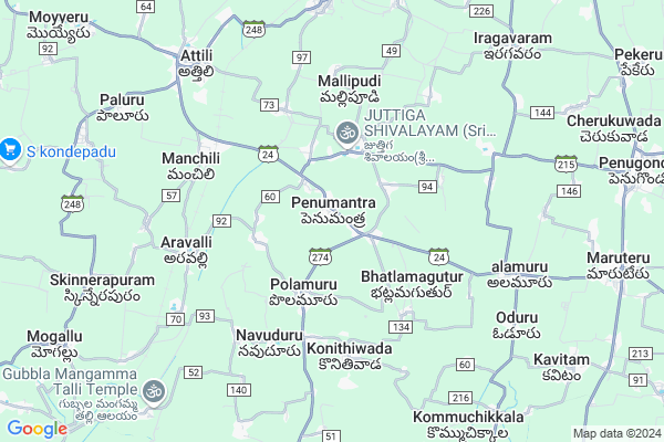
Penumantra
Penumantra Map
EDIT Map
Add Your House
 ..
..
Current Corona Virus Infected Patients Count in West Godavari District
| City Name | District Name | Total Covid cases |
|---|---|---|
| West Godavari District | West Godavari | 43 |
| Penugonda | West Godavari | 3 |
| Eluru | West Godavari | 2 |
| Tadepalligudem | West Godavari | 1 |
| Tallamundunurupadu | West Godavari | 1 |
| Narsapuram | West Godavari | 1 |
Locality Name :
Penumantra
( పెనుమంట్ర )
Mandal Name : Penumantra
District : West Godavari
State : Andhra Pradesh
Region : Andhra
Language : Telugu
Current Time 05:01 AM
Date: Saturday , Apr 26,2025 (IST)
Time zone: IST (UTC+5:30)
Elevation / Altitude: 13 meters. Above Seal level
Telephone Code / Std Code: 08819
Assembly constituency : Kuppam assembly constituency
Assembly MLA : Nara Chandra Babu Naidu
Lok Sabha constituency : parliamentary constituency
Parliament MP : KANUMURU RAGHU RAMA KRISHNA RAJU
Serpanch Name :
Pin Code : 534124
Post Office Name : Penumantra
Commodities Prices : Ambajipeta Market / Mandi
Penumantra Live Weather
Temperature: 27.2 °C
broken clouds
Humidity: 86%
Wind : 2.09 mt/sec towards S
StationName : "Penugonda"
observed on 1 Hours Back
Temperature: 27.2 °C
broken clouds
Humidity: 86%
Wind : 2.09 mt/sec towards S
StationName : "Penugonda"
observed on 1 Hours Back
Penumantra Weather Forecast for Next 5 days
27-04-2025
25.6°C to 37.0°C
broken clouds, scattered clouds, few clouds, clear sky
25.6°C to 37.0°C
broken clouds, scattered clouds, few clouds, clear sky
28-04-2025
25.5°C to 37.9°C
few clouds, broken clouds, scattered clouds, clear sky
25.5°C to 37.9°C
few clouds, broken clouds, scattered clouds, clear sky
29-04-2025
25.9°C to 36.9°C
few clouds, clear sky, scattered clouds, broken clouds
25.9°C to 36.9°C
few clouds, clear sky, scattered clouds, broken clouds
30-04-2025
26.4°C to 36.7°C
scattered clouds, few clouds, clear sky
26.4°C to 36.7°C
scattered clouds, few clouds, clear sky
Rivers Near Penumantra
Godavari
Tammileru
Godavari
Tammileru
About Penumantra
Correct below Info and add more info about PenumantraPenumantra is a Town in Penumantra Mandal in West Godavari District of Andhra Pradesh State, India. It belongs to Andhra region . It is located 68 KM towards East from District head quarters Eluru. It is a Mandal head quarter.
Penumantra Pin code is 534124 and postal head office is Penumantra .
Juttiga ( 2 KM ) , Natta Rameswaram ( 2 KM ) , Mamuduru ( 3 KM ) , Polamuru ( 3 KM ) , Mallipudi ( 3 KM ) are the nearby Villages to Penumantra. Penumantra is surrounded by Attili Mandal towards west , Iragavaram Mandal towards East , Veeravasaram Mandal towards South , Palakoderu Mandal towards west .
Tanuku , Palacole , Bhimavaram , Narasapur are the nearby Cities to Penumantra.
Penumantra 2011 Census Details
Penumantra Local Language is Telugu. Penumantra town Total population is 10658 and number of houses are 2900. Female Population is 50.8%. town literacy rate is 71.1% and the Female Literacy rate is 34.5%.
Population
| Census Parameter | Census Data |
| Total Population | 10658 |
| Total No of Houses | 2900 |
| Female Population % | 50.8 % ( 5411) |
| Total Literacy rate % | 71.1 % ( 7577) |
| Female Literacy rate | 34.5 % ( 3682) |
| Scheduled Tribes Population % | 0.4 % ( 39) |
| Scheduled Caste Population % | 20.7 % ( 2204) |
| Working Population % | 47.1 % |
| Child(0 -6) Population by 2011 | 960 |
| Girl Child(0 -6) Population % by 2011 | 50.0 % ( 480) |
Penumantra Census More Deatils.
Demographics of Penumantra
Telugu is the Local Language here. Total population of Penumantra is 11061 .Males are 5491 and Females are 5,570 living in 2820 Houses. Total area of Penumantra is 1523 hectares.Politics in Penumantra
TDP , YSRC , Telugu Desam , INC are the major political parties in this area.HOW TO REACH Penumantra
By Road
Tanuku is the Nearest Town to Penumantra. Tanuku is 18 km from Penumantra. Road connectivity is there from Tanuku to Penumantra.By Rail
Manchili Rail Way Station , Attili Rail Way Station are the very nearby railway stations to Penumantra. Also you can consider railway Stations from Near By town Tanuku. Tanuku Rail Way Station , Velpuru Rail Way Station are the railway stations near to Tanuku. You can reach from Tanuku to Penumantra by road after .By Bus
Marteru APSRTC Bus Station , Veeravasaram APSRTC Bus Station , Tanuku APSRTC Bus Station are the nearby by Bus Stations to Penumantra .APSRTC runs Number of busses from major cities to here.Govt Health Centers near Penumantra
1) Penumantra , 2-134 , Mainroad , Opp London Building2) PENUMANTRA Sub Centre , 3-Feb , Main Road , Near Gosatni Bridge
3) KAKILERU Sub Centre , 4-.45 , Main Road , Near Community Hall
Sub Villages in Penumantra
Hospitals in Penumantra,Penumantra
Rama Krishna Reddy Memorial Hospital
Penumantra; Andhra Pradesh 534124; India
1.0 KM distance Detail
more ..
Schools in Penumantra,Penumantra
our exam centre
Attili-Narasapuram-Marteru Rd; Penumantra; Andhra Pradesh 534124; India
0.5 KM distance Detail
Electronic Shops in Penumantra,Penumantra
Anandhienterprises
Attili-Narasapuram-Marteru Rd; Penumantra; Andhra Pradesh 534124; India
0.6 KM distance Detail
Sri Refrigeration & A/c Works
SH 42; Penumantra; Andhra Pradesh 534124; India
0.6 KM distance Detail
Local Parks in Penumantra,Penumantra
Sir Arthur Cotton Statue
Bhimavaram-attili road;near vemana mandir;534231.; dt.; Aravalli; Andhra Pradesh; India
5.7 KM distance Detail
Sai Babu Gari Makam
Aratlakatta - Kommuchikkala Rd; Kommuchikkala; Andhra Pradesh 534338; India
10.0 KM distance Detail
Police Stations near Penumantra,Penumantra
Penugonda Mandal Police Station
Penugonda Bus Stand Rd; Narsapuram Road; Palakol; Andhra Pradesh 534320; India
12.0 KM distance Detail
Governement Offices near Penumantra,Penumantra
MeeSeva Center
Attili-Narasapuram-Marteru Rd; Penumantra; Andhra Pradesh 534124; India
0.4 KM distance Detail
About Penumantra &
History
How to reach Penumantra
Tourist Places Near By Penumantra
Schools in Penumantra
Colleges in Penumantra
Temperature & weather of Penumantra
places in Penumantra
Penumantra photos
More Information
How to reach Penumantra
Tourist Places Near By Penumantra
Schools in Penumantra
Colleges in Penumantra
Temperature & weather of Penumantra
places in Penumantra
Penumantra photos
More Information
Town Talk
Post News or Events about this Town
Near Cities
Tanuku 15 KM near
Palacole 17 KM near
Bhimavaram 18 KM near
Narasapur 23 KM near
Tanuku 15 KM near
Palacole 17 KM near
Bhimavaram 18 KM near
Narasapur 23 KM near
Near By Taluks
Penumantra 2 KM near
Attili 6 KM near
Iragavaram 9 KM near
Veeravasaram 9 KM near
Penumantra 2 KM near
Attili 6 KM near
Iragavaram 9 KM near
Veeravasaram 9 KM near
Near By Air Ports
Rajahmundry Airport 61 KM near
Vijayawada Airport 102 KM near
Vishakhapatnam Airport 231 KM near
Rajiv Gandhi International Airport 391 KM near
Rajahmundry Airport 61 KM near
Vijayawada Airport 102 KM near
Vishakhapatnam Airport 231 KM near
Rajiv Gandhi International Airport 391 KM near
Near By Tourist Places
Konaseema 28 KM near
Rajahamundry 47 KM near
Kakinada 79 KM near
Machelipatnam 83 KM near
Papi Kondalu 105 KM near
Konaseema 28 KM near
Rajahamundry 47 KM near
Kakinada 79 KM near
Machelipatnam 83 KM near
Papi Kondalu 105 KM near
Near By Districts
West Godavari 65 KM near
East Godavari 78 KM near
Krishna 85 KM near
Guntur 151 KM near
West Godavari 65 KM near
East Godavari 78 KM near
Krishna 85 KM near
Guntur 151 KM near
Near By RailWay Station
Manchili Rail Way Station 5.4 KM near
Attili Rail Way Station 6.7 KM near
Aravalli Rail Way Station 6.9 KM near
Tanuku Rail Way Station 14 KM near
Manchili Rail Way Station 5.4 KM near
Attili Rail Way Station 6.7 KM near
Aravalli Rail Way Station 6.9 KM near
Tanuku Rail Way Station 14 KM near