| Home | City Bus | Maps | Villages | Cities | Rail | Tourist Places | School | College | Pin Codes | Corona Cases Count |
| Distance Calculator Bus Services IFSC Codes Trace Mobile Number Weather Search Place Trace IP Available Cash ATM/Banks Locate Polling Booth Report an Error contact People |
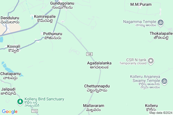
Agadalanka
Agadalanka Map
EDIT Map
Add Your House
 ..
..
Current Corona Virus Infected Patients Count in West Godavari District
| City Name | District Name | Total Covid cases |
|---|---|---|
| West Godavari District | West Godavari | 43 |
| Penugonda | West Godavari | 3 |
| Eluru | West Godavari | 2 |
| Tadepalligudem | West Godavari | 1 |
| Tallamundunurupadu | West Godavari | 1 |
| Narsapuram | West Godavari | 1 |
Locality Name :
Agadalanka
( ఆగదలంక )
Mandal Name : Bhimadole
District : West Godavari
State : Andhra Pradesh
Region : Andhra
Language : Telugu
Current Time 04:54 AM
Date: Saturday , Apr 26,2025 (IST)
Time zone: IST (UTC+5:30)
Elevation / Altitude: 20 meters. Above Seal level
Telephone Code / Std Code: 08829
Assembly constituency : assembly constituency
Assembly MLA :
Lok Sabha constituency : parliamentary constituency
Parliament MP : KOTAGIRI SRIDHAR
Serpanch Name :
Pin Code : 534427
Post Office Name : Gundugolanu So.
Commodities Prices : Chintalapudi Market / Mandi
Agadalanka Live Weather
Temperature: 27.9 °C
broken clouds
Humidity: 82%
Wind : 2.21 mt/sec towards S
StationName : "Akivīdu"
observed on Now
Temperature: 27.9 °C
broken clouds
Humidity: 82%
Wind : 2.21 mt/sec towards S
StationName : "Akivīdu"
observed on Now
Agadalanka Weather Forecast for Next 5 days
27-04-2025
27.4°C to 37.7°C
broken clouds, scattered clouds, few clouds
27.4°C to 37.7°C
broken clouds, scattered clouds, few clouds
28-04-2025
26.5°C to 39.9°C
broken clouds, scattered clouds, light rain
26.5°C to 39.9°C
broken clouds, scattered clouds, light rain
29-04-2025
26.4°C to 38.0°C
scattered clouds, clear sky, light rain, broken clouds, few clouds
26.4°C to 38.0°C
scattered clouds, clear sky, light rain, broken clouds, few clouds
30-04-2025
26.7°C to 38.0°C
few clouds, scattered clouds, clear sky
26.7°C to 38.0°C
few clouds, scattered clouds, clear sky
National Highways Reachable To Agadalanka
Nationa High Way :NH216A
Nationa High Way :NH5
Nationa High Way :NH216A
Nationa High Way :NH5
About Agadalanka
Correct below Info and add more info about AgadalankaAgadalanka is a Village in Bhimadole Mandal in West Godavari District of Andhra Pradesh State, India. It belongs to Andhra region . It is located 19 KM towards East from District head quarters Eluru. 11 KM from Bhimadole. 355 KM from State capital Hyderabad
Agadalanka Pin code is 534427 and postal head office is Gundugolanu So. .
Potunuru ( 6 KM ) , Dosapadu ( 8 KM ) , Gundugolanu ( 8 KM ) , Mondikodu ( 9 KM ) , Muppavaram ( 10 KM ) are the nearby Villages to Agadalanka. Agadalanka is surrounded by Denduluru Mandal towards west , Eluru Mandal towards west , Akividu Mandal towards South , Nidamarru Mandal towards East .
Eluru , Tadepalligudem , Hanuman Junction , Bhimavaram are the near by Cities to Agadalanka.
Agadallanka 2011 Census Details
Agadalanka Local Language is Telugu. Agadallanka Village Total population is 7195 and number of houses are 1978. Female Population is 48.5%. Village literacy rate is 62.3% and the Female Literacy rate is 27.8%.
Population
| Census Parameter | Census Data |
| Total Population | 7195 |
| Total No of Houses | 1978 |
| Female Population % | 48.5 % ( 3488) |
| Total Literacy rate % | 62.3 % ( 4483) |
| Female Literacy rate | 27.8 % ( 1999) |
| Scheduled Tribes Population % | 0.4 % ( 28) |
| Scheduled Caste Population % | 21.6 % ( 1551) |
| Working Population % | 52.7 % |
| Child(0 -6) Population by 2011 | 759 |
| Girl Child(0 -6) Population % by 2011 | 48.2 % ( 366) |
Agadallanka Census More Deatils.
HOW TO REACH Agadalanka
By Road
Eluru is the Nearest Town to Agadalanka. Eluru is 21 km from Agadalanka. Road connectivity is there from Eluru to Agadalanka.By Rail
Bhimadolu Rail Way Station , Sitampet Rail Way Station are the very nearby railway stations to Agadalanka. Also you can consider railway Stations from Near By town Eluru. Powerpet Rail Way Station , Eluru Rail Way Station are the railway Stations near to Eluru. You can reach from Eluru to Agadalanka by road after .By Bus
Bhimadolu APSRTC Bus Station , Eluru Ashram Hospital APSRTC Bus Station , Monduru APSRTC Bus Station are the nearby by Bus Stations to Agadalanka .APSRTC runs Number of busses from major cities to here.Colleges near Agadalanka
Sirdhrtha
Address :
Sri K P R Raju Mem Jc Gundugolanu
Address : Sri K P R Raju Mem Jc Gundugolanu
Sri Ku Degree College
Address : D.no.5/1, Polasani Palli, Bhimadole - 534425, W.g
Svu Degree College
Address : R.s No.70/6 & D.no.6-10, Bhimadole (v&m), W.g.dis
Schools near Agadalanka
Apsw Residential Hs
Address : polasanipalli , bhimadole , west godavari , Andhra Pradesh . PIN- 534425 , Post - Bhimadole
S Kakatiya Concept Hs
Address : bhimadole , bhimadole , west godavari , Andhra Pradesh . PIN- 534425 , Post - Bhimadole
Manasa Emhs
Address : bhimadole , bhimadole , west godavari , Andhra Pradesh . PIN- 534425 , Post - Bhimadole
Zphs Kurellagudem
Address : amberpeta , bhimadole , west godavari , Andhra Pradesh . PIN- 534401 , Post - Pulla
Govt Health Centers near Agadalanka
1) AGADALALANKA Sub Center , Mar-56 , SC Area , RCM School2) CHETTUNNAPADU Sub Center , , , Panchayati Office
3) POTHUNURU-I Sub Center , , Kothuru , Beside Panchayathi Office
Hospitals in Agadalanka,Bhimadole
Pothunuru Primary Health Centre (PHC) 24X7
Pothunuru; Andhra Pradesh 534442; India
6.2 KM distance Detail
General Hospital
Eluru Gundugolanu Kovvur Rd; Pothunuru; Andhra Pradesh 534442; India
6.2 KM distance Detail
Hospital Dosapadu
Eluru Gundugolanu Kovvur Rd; Dosapadu; Andhra Pradesh 534442; India
7.5 KM distance Detail
more ..
Petrol Bunks in Agadalanka,Bhimadole
Reliance Petroleum
SINGAVARAM VILLAGE; DENDULURU MANDAM NH5; WEST GODAVARI DISTRICT; Gundugolu; Andhra Pradesh 534427; India
8.9 KM distance Detail
more ..
Colleges in Agadalanka,Bhimadole
Sri Venkateshwara Junior and Degree College
Bhimadole; Andhra Pradesh 534425; India
12.6 KM distance Detail
Vijayanagesh College of Elementary Teacher Education
West Godavari Dist; Denduluru; Andhra Pradesh 534432; India
12.8 KM distance Detail
government hostal
Eluru Gundugolanu Kovvur Rd; Bhimadole; Andhra Pradesh 534425; India
13.0 KM distance Detail
more ..
Local Parks in Agadalanka,Bhimadole
Purushotham Park
Seethampet 8th ward; NH16; 8th Ward; Seethampeta; Kothagudem; Andhra Pradesh 534427; India
11.9 KM distance Detail
Police Stations near Agadalanka,Bhimadole
Police Chowki Denduluru
Gundugolanu; West Godavari; NH-5; Eluru Vijayawada Road; Bhimadolu; Bhimadole; Andhra Pradesh 534401; India
9.2 KM distance Detail
Governement Offices near Agadalanka,Bhimadole
Grama Panchayat Office
Eluru Gundugolanu Kovvur Rd; Pothunuru; Andhra Pradesh 534442; India
6.2 KM distance Detail
About Agadalanka &
History
How to reach Agadalanka
Tourist Places Near By Agadalanka
Schools in Agadalanka
Colleges in Agadalanka
Temperature & weather of Agadalanka
places in Agadalanka
Agadalanka photos
More Information
How to reach Agadalanka
Tourist Places Near By Agadalanka
Schools in Agadalanka
Colleges in Agadalanka
Temperature & weather of Agadalanka
places in Agadalanka
Agadalanka photos
More Information
Village Talk
Post News or Events about this Village
Near Cities
Eluru 19 KM near
Tadepalligudem 35 KM near
Hanuman Junction 35 KM near
Bhimavaram 38 KM near
Eluru 19 KM near
Tadepalligudem 35 KM near
Hanuman Junction 35 KM near
Bhimavaram 38 KM near
Near By Taluks
Denduluru 10 KM near
Bhimadole 11 KM near
Eluru 17 KM near
Akividu 19 KM near
Denduluru 10 KM near
Bhimadole 11 KM near
Eluru 17 KM near
Akividu 19 KM near
Near By Air Ports
Vijayawada Airport 60 KM near
Rajahmundry Airport 82 KM near
Vishakhapatnam Airport 265 KM near
Rajiv Gandhi International Airport 343 KM near
Vijayawada Airport 60 KM near
Rajahmundry Airport 82 KM near
Vishakhapatnam Airport 265 KM near
Rajiv Gandhi International Airport 343 KM near
Near By Tourist Places
Machelipatnam 68 KM near
Rajahamundry 70 KM near
Konaseema 72 KM near
Vijayawada 79 KM near
Papi Kondalu 98 KM near
Machelipatnam 68 KM near
Rajahamundry 70 KM near
Konaseema 72 KM near
Vijayawada 79 KM near
Papi Kondalu 98 KM near
Near By Districts
West Godavari 18 KM near
Krishna 69 KM near
Guntur 112 KM near
East Godavari 118 KM near
West Godavari 18 KM near
Krishna 69 KM near
Guntur 112 KM near
East Godavari 118 KM near
Near By RailWay Station
Eluru Rail Way Station 16 KM near
Akividu Rail Way Station 21 KM near
Eluru Rail Way Station 16 KM near
Akividu Rail Way Station 21 KM near