| Home | City Bus | Maps | Villages | Cities | Rail | Tourist Places | School | College | Pin Codes | Corona Cases Count |
| Distance Calculator Bus Services IFSC Codes Trace Mobile Number Weather Search Place Trace IP Available Cash ATM/Banks Locate Polling Booth Report an Error contact People |
Debajani
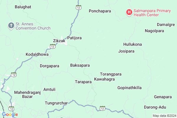
Debajani Map
EDIT Map
Add Your House
 ..
..
Current Corona Virus Infected Patients Count in West Garo Hills District
| City Name | District Name | Total Covid cases |
|---|
Locality Name :
Debajani
( देबजानी )
Block Name : Zikzak
District : West Garo Hills
State : Meghalaya
Language : English and Khasi, Garo, A Tong
Current Time 12:29 PM
Date: Wednesday , Feb 05,2025 (IST)
Time zone: IST (UTC+5:30)
Telephone Code / Std Code: 03651
Assembly constituency : Salmanpara assembly constituency
Assembly MLA : winnerson d. sangma
Lok Sabha constituency : Tura parliamentary constituency
Parliament MP : AGATHA K. SANGMA
Serpanch Name :
Pin Code : 794115
Post Office Name : Ampati
Commodities Prices : Ampati Market / Mandi
Debajani Live Weather
Temperature: 26.9 °C
clear sky
Humidity: 33%
Wind : 2.14 mt/sec towards S
StationName : "MankÄ\u0081char"
observed on 45 Mins Back
Temperature: 26.9 °C
clear sky
Humidity: 33%
Wind : 2.14 mt/sec towards S
StationName : "MankÄ\u0081char"
observed on 45 Mins Back
Debajani Weather Forecast for Next 5 days
06-02-2025
18.0°C to 29.2°C
clear sky
18.0°C to 29.2°C
clear sky
07-02-2025
16.1°C to 31.5°C
clear sky
16.1°C to 31.5°C
clear sky
08-02-2025
15.4°C to 30.0°C
clear sky
15.4°C to 30.0°C
clear sky
09-02-2025
14.4°C to 29.3°C
clear sky, few clouds, broken clouds, scattered clouds
14.4°C to 29.3°C
clear sky, few clouds, broken clouds, scattered clouds
10-02-2025
14.5°C to 29.5°C
few clouds, clear sky
14.5°C to 29.5°C
few clouds, clear sky
Rivers Near Debajani
Jinjiram River
Brahmaputra
Jinjiram River
Brahmaputra
About Debajani
Correct below Info and add more info about DebajaniDebajani is a Village in Zikzak Block in West Garo Hills District of Meghalaya State, India. It is located 37 KM towards west from District head quarters Tura. 3 KM from Zikzak. 229 KM from State capital Shillong
Debajani Pin code is 794115 and postal head office is Ampati .
Patijora ( 3 KM ) , Zikzak ( 4 KM ) , Marengpara ( 5 KM ) , Baghana ( 5 KM ) , Chapahati-i ( 5 KM ) are the nearby Villages to Debajani. Debajani is surrounded by Betasing Block towards North , Mankachar Block towards North , Dalu Block towards East , Gambegre Block towards East .
Mankachar , Tura , Dhubri , Gauripur are the near by Cities to Debajani.
This Place is in the border of the West Garo Hills District and Dhubri District. Dhubri District Mankachar is North towards this place . It is near to the Assam State Border.
Debajani 2011 Census Details
Debajani Local Language is English. Debajani Village Total population is 291 and number of houses are 50. Female Population is 46.7%. Village literacy rate is 67.7% and the Female Literacy rate is 31.3%.
Population
| Census Parameter | Census Data |
| Total Population | 291 |
| Total No of Houses | 50 |
| Female Population % | 46.7 % ( 136) |
| Total Literacy rate % | 67.7 % ( 197) |
| Female Literacy rate | 31.3 % ( 91) |
| Scheduled Tribes Population % | 99.0 % ( 288) |
| Scheduled Caste Population % | 0.0 % ( 0) |
| Working Population % | 43.0 % |
| Child(0 -6) Population by 2011 | 49 |
| Girl Child(0 -6) Population % by 2011 | 38.8 % ( 19) |
Debajani Census More Deatils.
Politics in Debajani
National People's Party , NCP , NPP , INC are the major political parties in this area.Polling Stations /Booths near Debajani
1)Hullukona2)Halchati
3)Okchokgre
4)Bhatuagaon
5)Dolsi Nokat
HOW TO REACH Debajani
By Rail
There is no railway station near to Debajani in less than 10 km.Colleges near Debajani
Phulbari Govt. College
Address :
Schools in Debajani
Debajani Govt. Lps
Address : debajani , zikzak , west garo hills , Meghalaya . PIN- 794106 , Post - Mahendraganj (West Garo Hills)
Govt Health Centers near Debajani
1) Debajani SC , Debajani SC , VEC Street , Near U. P School2) Tarapara SC , Tarapara SC , PWD Street , Near LP School
3) Nogorpara PHC , Nogorpara PHC , PWD Street , Near SSA School
Petrol Bunks in Debajani,Zikzak
HP PETROL PUMP - MANKACHAR SERVICE STATION
Mankachar DT Assam; Gauhati; Assam 783131; India
23.0 KM distance Detail
more ..
Schools in Debajani,Zikzak
Good Shepherd Sec. School; Chapahati-Nogorpara
West Garo Hills; Meghalaya 794106; India
10.8 KM distance Detail
JNV South West Garo Hills
Kendrikona; District; South West Garo Hills; Mahendraganj; Meghalaya 794106; India
11.3 KM distance Detail
Electronic Shops in Debajani,Zikzak
Mustafizur computer shop in nayapara
Nayapara PWD road; Mahendraganj; Meghalaya 794106; India
13.8 KM distance Detail
Super Markets in Debajani,Zikzak
About Debajani &
History
How to reach Debajani
Tourist Places Near By Debajani
Schools in Debajani
Colleges in Debajani
Temperature & weather of Debajani
places in Debajani
Debajani photos
More Information
How to reach Debajani
Tourist Places Near By Debajani
Schools in Debajani
Colleges in Debajani
Temperature & weather of Debajani
places in Debajani
Debajani photos
More Information
Village Talk
Post News or Events about this Village
Near Cities
Mankachar 22 KM near
Tura 38 KM near
Dhubri 81 KM near
Gauripur 89 KM near
Mankachar 22 KM near
Tura 38 KM near
Dhubri 81 KM near
Gauripur 89 KM near
Near By Taluks
Zikzak 2 KM near
Betasing 20 KM near
Mankachar 24 KM near
Dalu 26 KM near
Zikzak 2 KM near
Betasing 20 KM near
Mankachar 24 KM near
Dalu 26 KM near
Near By Air Ports
Rupsi Airport 97 KM near
Borjhar Airport 206 KM near
Shillong Airport 219 KM near
Singerbhil Airport 235 KM near
Rupsi Airport 97 KM near
Borjhar Airport 206 KM near
Shillong Airport 219 KM near
Singerbhil Airport 235 KM near
Near By Tourist Places
Tura 36 KM near
Williamnagar 77 KM near
Baghmara 81 KM near
Goalpara 120 KM near
Cooch-Behar 130 KM near
Tura 36 KM near
Williamnagar 77 KM near
Baghmara 81 KM near
Goalpara 120 KM near
Cooch-Behar 130 KM near
Near By Districts
West Garo Hills 35 KM near
Dhubri 79 KM near
South Garo Hills 80 KM near
Goalpara 126 KM near
West Garo Hills 35 KM near
Dhubri 79 KM near
South Garo Hills 80 KM near
Goalpara 126 KM near
Near By RailWay Station
Goalpara Town Rail Way Station 121 KM near
Fakiragram Junction Rail Way Station 126 KM near
Goalpara Town Rail Way Station 121 KM near
Fakiragram Junction Rail Way Station 126 KM near