| Home | City Bus | Maps | Villages | Cities | Rail | Tourist Places | School | College | Pin Codes | Corona Cases Count |
| Distance Calculator Bus Services IFSC Codes Trace Mobile Number Weather Search Place Trace IP Available Cash ATM/Banks Locate Polling Booth Report an Error contact People |
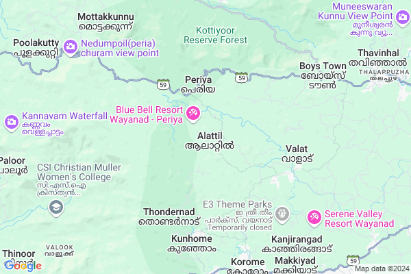
Alattil
Alattil Map
EDIT Map
Add Your House
 ..
..
Current Corona Virus Infected Patients Count in Wayanad District
| City Name | District Name | Total Covid cases |
|---|---|---|
| Wayanad District | Wayanad | 3 |
Locality Name :
Alattil
( അലട്ടിൽ )
Block Name : Mananthavady
District : Wayanad
State : Kerala
Division : North Kerala
Language : Malayalam and English
Current Time 05:19 AM
Date: Saturday , Apr 26,2025 (IST)
Time zone: IST (UTC+5:30)
Elevation / Altitude: 18 meters. Above Seal level
Telephone Code / Std Code: 04935
Assembly constituency : Mananthavady assembly constituency
Assembly MLA : O.R.Kelu
Lok Sabha constituency : Wayanad parliamentary constituency
Parliament MP : Rahul Gandhi
Serpanch Name :
Pin Code : 670644
Post Office Name : Thalappuzha
Main Village Name : Thavinhal
Commodities Prices : Manathavady Market / Mandi
Alattil Live Weather
Temperature: 21.9 °C
overcast clouds
Humidity: 95%
Wind : 0.79 mt/sec towards E
StationName : "NÄ\u0081dÄ\u0081puram"
observed on Now
Temperature: 21.9 °C
overcast clouds
Humidity: 95%
Wind : 0.79 mt/sec towards E
StationName : "NÄ\u0081dÄ\u0081puram"
observed on Now
Alattil Weather Forecast for Next 5 days
27-04-2025
21.5°C to 31.7°C
overcast clouds, light rain
21.5°C to 31.7°C
overcast clouds, light rain
28-04-2025
20.9°C to 31.1°C
overcast clouds, light rain, moderate rain
20.9°C to 31.1°C
overcast clouds, light rain, moderate rain
29-04-2025
19.8°C to 31.6°C
overcast clouds, scattered clouds, few clouds, light rain, moderate rain
19.8°C to 31.6°C
overcast clouds, scattered clouds, few clouds, light rain, moderate rain
30-04-2025
20.5°C to 29.6°C
overcast clouds, broken clouds, light rain, moderate rain
20.5°C to 29.6°C
overcast clouds, broken clouds, light rain, moderate rain
National Highways Reachable To Alattil
Nationa High Way :NH66
Nationa High Way :NH66
Rivers Near Alattil
Kabini :ಕಬಿನಿ :കബിനി
Kabini River
Kabini :ಕಬಿನಿ :കബിനി
Kabini River
About Alattil
Correct below Info and add more info about AlattilAlattil is a small Village/hamlet in Mananthavady Block in Wayanad District of Kerala State, India. It comes under Thavinhal Panchayath. It belongs to North Kerala Division . It is located 38 KM towards west from District head quarters Kalpetta. 14 KM from Mananthavady. 453 KM from State capital Thiruvananthapuram
Alattil Pin code is 670644 and postal head office is Thalappuzha .
Vellamunda ( 13 KM ) , Edavaka ( 13 KM ) are the nearby Villages to Alattil. Alattil is surrounded by Peravoor Block towards west , Kunnummal Block towards South , Thuneri Block towards west , Iritty Block towards west .
Koothuparamba , Peringathur , Kalpetta , Mattannur are the near by Cities to Alattil.
Demographics of Alattil
Malayalam is the Local Language here.Politics in Alattil
CPM , Indian National Congress , CPI , INC are the major political parties in this area.Polling Stations /Booths near Alattil
1)Nirmala Lower Primary School Alattil (east Wing)2)Nehru Memmoriyal Upper Primary School Valliyoorkav (west Portion)
3)Govt.high School Kunhome (second Building)
4)Govt.high School Periya (lower Building)
5)Govt.higher Secondary School Valad (east Building)
HOW TO REACH Alattil
By Rail
There is no railway station near to Alattil in less than 10 km.Colleges near Alattil
Techer Education Center Kannur Univescity Wayanad
Address :
Govt. College, Mananthavady, Wynand
Address : Govt.college Mananthavadynallurnadu Postwayanad Di
Government Engineering College
Address : Mananthavady, Nalloornad, Wayanad - 670645
Mary Matha Arts & Science College
Address : Vemom P O, Mananthavady,wayanad 670 645, Kerala
Schools in Alattil
Ghss Thalappuzha
Address : thavinhal , mananthavady , wayanad , Kerala . PIN- 670644 , Post - Thalappuzha
Gths Edathana
Address : thavinhal , mananthavady , wayanad , Kerala . PIN- 670644 , Post - Thalappuzha
Ghss Valat
Address : thavinhal , mananthavady , wayanad , Kerala . PIN- 670644 , Post - Thalappuzha
Gups Thalappuzha
Address : thavinhal , mananthavady , wayanad , Kerala . PIN- 670644 , Post - Thalappuzha
Sups Porur
Address : thavinhal , mananthavady , wayanad , Kerala . PIN- 670644 , Post - Thalappuzha
Govt Health Centers near Alattil
1) Malabar Cancer Centre , Kodiyeri,Thalassery, , Muzhikkara - MCC Rd, Illathaazha, , -Petrol Bunks in Alattil,Mananthavady
Indian Oil Thalapuzha Petrol Pump
Thalappuzha; Thavinhal; Kerala 670644; India
12.3 KM distance Detail
more ..
Colleges in Alattil,Mananthavady
Rahath Education Center Thalappuzha
Thalappuzha; Thavinhal; Kerala 670644; India
12.7 KM distance Detail
more ..
Schools in Alattil,Mananthavady
പൊള്ളoപാറ പള്ളി
Near government ayurvedic dispensary pollampara; Kanjirangad; Puthussery; P. O; India
7.0 KM distance Detail
St. Sebastian's L P School Poroor
Kaattimoola Rd; Valat; Kerala 670644; India
8.6 KM distance Detail
About Alattil &
History
How to reach Alattil
Tourist Places Near By Alattil
Schools in Alattil
Colleges in Alattil
Temperature & weather of Alattil
places in Alattil
Alattil photos
More Information
How to reach Alattil
Tourist Places Near By Alattil
Schools in Alattil
Colleges in Alattil
Temperature & weather of Alattil
places in Alattil
Alattil photos
More Information
Village Talk
Post News or Events about this Village
Near Cities
Koothuparamba 34 KM near
Peringathur 34 KM near
Kalpetta 35 KM near
Mattannur 36 KM near
Koothuparamba 34 KM near
Peringathur 34 KM near
Kalpetta 35 KM near
Mattannur 36 KM near
Near By Taluks
Mananthavady 14 KM near
Peravoor 18 KM near
Kunnummal 22 KM near
Thuneri 26 KM near
Mananthavady 14 KM near
Peravoor 18 KM near
Kunnummal 22 KM near
Thuneri 26 KM near
Near By Air Ports
Calicut Airport 84 KM near
Mysore Airport 113 KM near
Peelamedu Airport 173 KM near
Bajpe Airport 185 KM near
Calicut Airport 84 KM near
Mysore Airport 113 KM near
Peelamedu Airport 173 KM near
Bajpe Airport 185 KM near
Near By Tourist Places
Mananthavady 17 KM near
Thirunelli 20 KM near
Tholpetty 30 KM near
Muthanga Wildlife Sanctuary 30 KM near
Wayanad 32 KM near
Mananthavady 17 KM near
Thirunelli 20 KM near
Tholpetty 30 KM near
Muthanga Wildlife Sanctuary 30 KM near
Wayanad 32 KM near
Near By Districts
Wayanad 36 KM near
Kannur 59 KM near
Kozhikode 67 KM near
Kodagu 77 KM near
Wayanad 36 KM near
Kannur 59 KM near
Kozhikode 67 KM near
Kodagu 77 KM near
Near By RailWay Station
Mahe Rail Way Station 40 KM near
Vadakara Rail Way Station 42 KM near
Mahe Rail Way Station 40 KM near
Vadakara Rail Way Station 42 KM near