| Home | City Bus | Maps | Villages | Cities | Rail | Tourist Places | School | College | Pin Codes | Corona Cases Count |
| Distance Calculator Bus Services IFSC Codes Trace Mobile Number Weather Search Place Trace IP Available Cash ATM/Banks Locate Polling Booth Report an Error contact People |
 ..
..
Current Corona Virus Infected Patients Count in Washim District
| City Name | District Name | Total Covid cases |
|---|---|---|
| Washim District | Washim | 1 |
Taluka Name : Karanja
District : Washim
State : Maharashtra
Region : Vidarbha
Division : Amravati
Language : Marathi
Current Time 01:47 PM
Date: Tuesday , Apr 29,2025 (IST)
Time zone: IST (UTC+5:30)
Elevation / Altitude: 402 meters. Above Seal level
Telephone Code / Std Code: 07253
Assembly constituency : Karanja assembly constituency
Assembly MLA : Patni Rajendra Sukhanand
Lok Sabha constituency : Yavatmal-Washim parliamentary constituency
Parliament MP : Bhavana Pundlikrao Gawali
Serpanch Name :
Pin Code : 444105
Post Office Name : Karanja (Washim)
Alternate Village Name : Kamathwada
Commodities Prices : Karanja Market / Mandi
Temperature: 39.0 °C
scattered clouds
Humidity: 11%
Wind : 1.43 mt/sec towards NE
StationName : "KÄ\u0081ranja"
observed on 1 Hours Back
34.0°C to 41.5°C
scattered clouds, few clouds, broken clouds, clear sky
30.7°C to 43.0°C
clear sky, scattered clouds
30.5°C to 43.3°C
clear sky, scattered clouds, few clouds
30.9°C to 43.1°C
clear sky, few clouds, scattered clouds
29.9°C to 42.8°C
few clouds, clear sky
OverView of Kamathawada
Kamathwada is a great village which is situated between karanja lad and darwha road, seven kilometers far from karanja towards darwha and one kilometer far from kamathwada stand towards north direction. It is the birth place of 'shree sadguru govind maharaj'.
Shree sadguru govind maharaj's temple constructed at 1947. Maharaj was born in kale pariwar and his mother name was dharmali mata. Shree govind maharaj saint was very famous and found senior than mungsazi maraj dhamangaon dev in the test which was held in that two great saint period.
At every year in the month of the april there was a big event ( yatra) called baras in kamathwada. All kamathwadavasi whom the native place is kamathwad surely attend the baras event, either he will be at village or out of state.
All villagers have the great faith on the sadguru and maharaj also helping everybody who is remember him. Finally shree sadguru govind maharaj is a live devasthan at kamathwada.
" bolo shree sadguru govind maharaj ki -- jay.
Edit below overview about Kamathawada
Nationa High Way :NH161E;NH753C
Nationa High Way :NH161A
Uma
Bembla
About Kamathawada
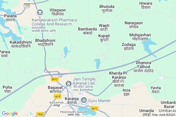
Kamathawada is a Village in Karanja Taluka in Washim District of Maharashtra State, India. It belongs to Vidarbha region . It belongs to Amravati Division . It is located 70 KM towards North from District head quarters Washim. 601 KM from State capital Mumbai
Kamathawada Pin code is 444105 and postal head office is Karanja (Washim).
Kamathawada is surrounded by Murtijapur Taluka towards North , Mangrulpir Taluka towards South , Nandgaon Kh Taluka towards East , Manora Taluka towards South .
Murtijapur , Mangrulpir , Amravati , Patur are the near by Cities to Kamathawada.
Kamathwada 2011 Census Details
Kamathawada Local Language is Marathi. Kamathwada Village Total population is 1173 and number of houses are 255. Female Population is 48.0%. Village literacy rate is 72.0% and the Female Literacy rate is 30.8%.
Population
| Census Parameter | Census Data |
| Total Population | 1173 |
| Total No of Houses | 255 |
| Female Population % | 48.0 % ( 563) |
| Total Literacy rate % | 72.0 % ( 845) |
| Female Literacy rate | 30.8 % ( 361) |
| Scheduled Tribes Population % | 0.0 % ( 0) |
| Scheduled Caste Population % | 20.5 % ( 241) |
| Working Population % | 48.8 % |
| Child(0 -6) Population by 2011 | 129 |
| Girl Child(0 -6) Population % by 2011 | 43.4 % ( 56) |
Kamathwada Census More Deatils.
Politics in Kamathawada
BJP , NCP , BBM , SHS , INC are the major political parties in this area.Polling Stations /Booths near Kamathawada
1)Pimpri2)Pimpri Modak 1
3)Pipanlaganv Khu.
4)Mohagavhan
5)Januna Khurd
HOW TO REACH Kamathawada
By Rail
Karanja Rail Way Station , Karanja Town Rail Way Station are the very nearby railway stations to Kamathawada. Badnera Junction Rail Way Station (near to Amravati) , Amravati Rail Way Station (near to Amravati) are the Rail way stations reachable from near by towns.By Road
Amravati are the nearby by towns to Kamathawada having road connectivity to KamathawadaColleges near Kamathawada
M.b.highschool Dhanj BkSchools in Kamathawada
Zpps KamathwadaGovt Health Centers near Kamathawada
1) Shaha , Sub Centre Shaha , Shaha , Gram Panchayat2) R.H.Karanja , Rural Hospital , Court Road , Near Bus Stand
3) Bhadshivani , Sub Centre Bhadshiwani , Bhadshiwani , Gram Panchayat
Hospitals in Kamathawada,Karanja
JAWAHAR Multispacaility Hospital
Karanja Main Rd; Gawalipura; Karanja; Maharashtra 444105; India
6.1 KM distance Detail
more ..
Petrol Bunks in Kamathawada,Karanja
HP PETROL PUMP - SIDDHESHWAR PETROLEUM
Karanjha LAD- Karanjha Byepass Taluka- Karanjha LAD; Maharashtra 444105; India
6.0 KM distance Detail
Indian Oil Petrol Pump
Qazipura; Washim; SH-212; Yavatmal Darwha Karanja Murtajapur Daryapur Road; Washim; Washim; Maharashtra 444105; India
6.9 KM distance Detail
more ..
Colleges in Kamathawada,Karanja
Mups College Of Pharmacy
Pundlik Nagar; Degaon; Washim; Maharashtra 444105; India
4.7 KM distance Detail
sn patel institute of technology
vidyabharti campus ;umrakh;mota bardoli road; India
5.6 KM distance Detail
Swatantrya Sainik Shri Kanhaiyalalji Ramchandra Innani Mahavidyalaya
MURTIZAPUR ROAD; KARANJA LAD; WASHIM; Maharashtra 444105; India
5.6 KM distance Detail
more ..
Schools in Kamathawada,Karanja
Bachpan...a play school
V.R.T.M Education Society;Appo Goverment Polytenic;; At Anjan Gaon (Surji) Dist.; Maharashtra 444105; India
4.7 KM distance Detail
Shri Mahavir Bramhacharyashram High School
MH SH 212; Sampat Colony; Karanja; Maharashtra 444105; India
5.0 KM distance Detail
Shri Samantabhadra Primary Marathi School
MH SH 212; Sampat Colony; Karanja; Maharashtra 444105; India
5.1 KM distance Detail
Electronic Shops in Kamathawada,Karanja
Jawahar Electronics
Karanja Main Rd; Rohidas Nagar; Karanja; Maharashtra 444105; India
6.1 KM distance Detail
Aaftab Traders Kiloskar V Guard Fountain Pumps
statue of shivaji nehru chok k n collage road; Gawalipura; Karanja; Maharashtra 444105; India
6.2 KM distance Detail
Super Markets in Kamathawada,Karanja
Shree Krushna chilij company bajar samiti Karanja lad
Shivaji Nagar; Karanja; Maharashtra 444105; India
6.3 KM distance Detail
Hitendra Kirana
Sarafa Line; Rohidas Nagar; Karanja; Maharashtra 444105; India
6.4 KM distance Detail
Local Parks in Kamathawada,Karanja
महाराष्ट्र वन पर्यटन केंद्र ;karanja (lad)
MH SH 212; Telecom Colony; Karanja; Maharashtra 444105; India
6.4 KM distance Detail
Police Stations near Kamathawada,Karanja
Karanja Rural Police Station
Sampat Colony; Karanja; Maharashtra 444105; India
5.4 KM distance Detail
Upvibhagiya Police Adhikari Office
Damini Nagar; Washim; SH-212; Yavatmal Darwha Karanja Murtajapur Daryapur Road; Washim; Washim; Maharashtra 444103; India
6.0 KM distance Detail
How to reach Kamathawada
Tourist Places Near By Kamathawada
Schools in Kamathawada
Colleges in Kamathawada
Temperature & weather of Kamathawada
places in Kamathawada
Kamathawada photos
More Information
Village Talk
Post News or Events about this Village
Murtijapur 30 KM near
Mangrulpir 30 KM near
Amravati 59 KM near
Patur 62 KM near
Karanja 0 KM near
Murtijapur 29 KM near
Mangrulpir 31 KM near
Nandgaon Kh 36 KM near
Nanded Airport 169 KM near
Sonegaon Airport 194 KM near
Chikkalthana Airport 259 KM near
Latur Airport 290 KM near
Amravati 58 KM near
Washim 67 KM near
Hingoli 108 KM near
Chikhaldara Wildlife Sanctuary 110 KM near
Melghat Tiger Reserve 116 KM near
Amravati 57 KM near
Akola 63 KM near
Washim 67 KM near
Yavatmal 75 KM near
Karanja Rail Way Station 3.8 KM near
Karanja Town Rail Way Station 5.5 KM near
Pohe Rail Way Station 7.0 KM near
Murtizapur Junction Rail Way Station 30 KM near
Badnera Junction Rail Way Station 48 KM near