| Home | City Bus | Maps | Villages | Cities | Rail | Tourist Places | School | College | Pin Codes | Corona Cases Count |
| Distance Calculator Bus Services IFSC Codes Trace Mobile Number Weather Search Place Trace IP Available Cash ATM/Banks Locate Polling Booth Report an Error contact People |
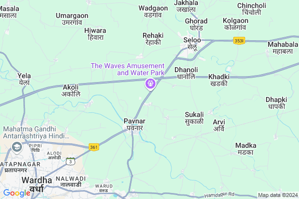
Kanhapur
Kanhapur Map
EDIT Map
Add Your House
 ..
..
Current Corona Virus Infected Patients Count in Wardha District
| City Name | District Name | Total Covid cases |
|---|
Locality Name :
Kanhapur
( कान्हापूर )
Taluka Name : Seloo
District : Wardha
State : Maharashtra
Region : Vidarbh
Division : Nagpur
Language : Marathi and Gujarati, Sindhi And Punjabi
Current Time 11:10 AM
Date: Friday , Mar 14,2025 (IST)
Time zone: IST (UTC+5:30)
Elevation / Altitude: 256 meters. Above Seal level
Telephone Code / Std Code: 07155
Assembly constituency : Wardha assembly constituency
Assembly MLA : Dr. Pankaj Rajesh Bhoyar
Lok Sabha constituency : Wardha parliamentary constituency
Parliament MP : Ramdas Chandrabhanji Tadas
Serpanch Name :
Pin Code : 442104
Post Office Name : Seloo
Commodities Prices : Sindi(Selu) Market / Mandi
Kanhapur Live Weather
Temperature: 34.3 °C
clear sky
Humidity: 11%
Wind : 3.06 mt/sec towards N
StationName : "Wardha"
observed on 1 Hours Back
Temperature: 34.3 °C
clear sky
Humidity: 11%
Wind : 3.06 mt/sec towards N
StationName : "Wardha"
observed on 1 Hours Back
Kanhapur Weather Forecast for Next 5 days
15-03-2025
28.8°C to 39.6°C
clear sky
28.8°C to 39.6°C
clear sky
16-03-2025
27.2°C to 39.7°C
clear sky, scattered clouds, broken clouds, overcast clouds
27.2°C to 39.7°C
clear sky, scattered clouds, broken clouds, overcast clouds
17-03-2025
29.2°C to 40.2°C
overcast clouds, broken clouds, few clouds, scattered clouds, clear sky
29.2°C to 40.2°C
overcast clouds, broken clouds, few clouds, scattered clouds, clear sky
18-03-2025
28.7°C to 40.2°C
few clouds, broken clouds, scattered clouds, clear sky
28.7°C to 40.2°C
few clouds, broken clouds, scattered clouds, clear sky
19-03-2025
28.2°C to 39.9°C
clear sky
28.2°C to 39.9°C
clear sky
National Highways Reachable To Kanhapur
Nationa High Way :NH361
Nationa High Way :NH353D
Nationa High Way :NH361
Nationa High Way :NH353D
Rivers Near Kanhapur
Nand
Nagan
Nand
Nagan
About Kanhapur
Correct below Info and add more info about KanhapurKanhapur is a Village in Seloo Taluka in Wardha District of Maharashtra State, India. It belongs to Vidarbh region . It belongs to Nagpur Division . It is located 11 KM towards East from District head quarters Wardha. 8 KM from Seloo. 748 KM from State capital Mumbai
Kanhapur Pin code is 442104 and postal head office is Seloo .
Pavanar ( 4 KM ) , Surgaon ( 4 KM ) , Sukali (bai) ( 4 KM ) , Sukali (st) ( 4 KM ) , Mahakal ( 5 KM ) are the nearby Villages to Kanhapur. Kanhapur is surrounded by Wardha Taluka towards west , Deoli Taluka towards west , Hinganghat Taluka towards South , Samudrapur Taluka towards East .
Wardha , Pulgaon , Nagpur , Umred are the near by Cities to Kanhapur.
Kanhapur 2011 Census Details
Kanhapur Local Language is Marathi. Kanhapur Village Total population is 1220 and number of houses are 280. Female Population is 48.7%. Village literacy rate is 78.7% and the Female Literacy rate is 36.1%.
Population
| Census Parameter | Census Data |
| Total Population | 1220 |
| Total No of Houses | 280 |
| Female Population % | 48.7 % ( 594) |
| Total Literacy rate % | 78.7 % ( 960) |
| Female Literacy rate | 36.1 % ( 441) |
| Scheduled Tribes Population % | 6.5 % ( 79) |
| Scheduled Caste Population % | 8.1 % ( 99) |
| Working Population % | 51.0 % |
| Child(0 -6) Population by 2011 | 96 |
| Girl Child(0 -6) Population % by 2011 | 46.9 % ( 45) |
Kanhapur Census More Deatils.
Politics in Kanhapur
Bharatiya Janata Party , BJP , INC are the major political parties in this area.Polling Stations /Booths near Kanhapur
1)Juvadi2)Giroli (dhage)
3)141
4)88
5)86
HOW TO REACH Kanhapur
By Rail
Seloo Road Rail Way Station , Warud Rail Way Station are the very nearby railway stations to Kanhapur. Wardha Junction Rail Way Station (near to Wardha) , Tuljapur Rail Way Station (near to Sindi) , Sewagram Junction Rail Way Station (near to Wardha) , Sindi Rail Way Station (near to Sindi) are the Rail way stations reachable from near by towns.By Road
Sindi , Wardha are the nearby by towns to Kanhapur having road connectivity to KanhapurColleges near Kanhapur
G.b.m.m Jr. College. Hinganghat
Address :
Model Junior College
Address :
Model Junior Callege
Address :
Mpl Junior College
Address :
Janta Junior College Mangrul
Address :
Schools near Kanhapur
Lt. L.b.g.ashram School Wadgao
Address : wadgaon (j) , seloo , wardha , Maharashtra . PIN- 442115
Yeshvant High School, Hamdapur
Address : hamdapur , seloo , wardha , Maharashtra . PIN- 442102 , Post - Sewagram
Yeshwant Vidaya
Address : dhegaon , seloo , wardha , Maharashtra . PIN- 442110
Mc. Nehru Vidya Seloo
Address : m.c. sindhi (r) , seloo , wardha , Maharashtra . PIN- 442105 , Post - Sindi Shahar
Govt Health Centers near Kanhapur
1) Mahatma Gandhi Institute of Medical Sciences , Kasturba Health Society Seva Gram , Wardha , .2) Mahatma Gandhi Institute of Medical Sciences (MGIMS) /Kasturba Hospital/Sevagram , Mahatma Gandhi Institute of Medical Sciences , Sevagram , Bapu Kuti Raod
3) Pipari , Sub Center Pipari , NEAR GRAMPANCHAYAT , Pipari
Hospitals in Kanhapur,Seloo
Shingare Hospital Seloo
Near Bank Of India; Baajar Road; Aurangabad - Nagpur Rd; Seloo; Maharashtra 442104; India
5.9 KM distance Detail
more ..
Petrol Bunks in Kanhapur,Seloo
Ebrahimjee Filling Station
Wardha Nagpur Road; Godapur; Kanhapur; Wardha; Maharashtra 442001; India
0.6 KM distance Detail
Hindustan Petroleum
Wardha; NH-204; Nagpur Wardha Road; Seloo; Seloo; Maharashtra 442105; India
3.6 KM distance Detail
HP PETROL PUMP - M S GANDHI
HP Petrol Pump Nagpur Road Seloo Dist; Nagpur; Maharashtra 442104; India
3.7 KM distance Detail
more ..
Colleges in Kanhapur,Seloo
Acharya Vinoba Bhave Institute Of Technology
Near Acharya vinoba Bhave Ashram ;Pawnar; Wardha; Maharashtra; India
3.1 KM distance Detail
Vidya Bharati College
Wardha; NH-204; Nagpur Wardha Road; Seloo; Seloo; Maharashtra 442105; India
4.4 KM distance Detail
more ..
Schools in Kanhapur,Seloo
Swami Vivekanand International School; Pawnar
Wardha; Maharashtra 442111; India
3.4 KM distance Detail
Super Markets in Kanhapur,Seloo
Sai Provision Kirana (Ghadre)
Main Road; Pipri; Wardha; Maharashtra 442001; India
9.7 KM distance Detail
Local Parks in Kanhapur,Seloo
Fairwell Party Lawn
48; Nagpur Road; Alodi; Nagpur Road; Alodi; Wardha; Maharashtra 442001; India
8.2 KM distance Detail
Police Stations near Kanhapur,Seloo
wardha City Checkpost
Aurangabad - Nagpur Rd; Wardha; Maharashtra 442111; India
6.7 KM distance Detail
Governement Offices near Kanhapur,Seloo
Gram Prakalp Office
Dattapur; Wardha; NH-204; Nagpur Wardha Road; Wardha; Wardha; Maharashtra 442001; India
3.6 KM distance Detail
About Kanhapur &
History
How to reach Kanhapur
Tourist Places Near By Kanhapur
Schools in Kanhapur
Colleges in Kanhapur
Temperature & weather of Kanhapur
places in Kanhapur
Kanhapur photos
More Information
How to reach Kanhapur
Tourist Places Near By Kanhapur
Schools in Kanhapur
Colleges in Kanhapur
Temperature & weather of Kanhapur
places in Kanhapur
Kanhapur photos
More Information
Village Talk
Post News or Events about this Village
Near Cities
Wardha 10 KM near
Pulgaon 58 KM near
Nagpur 62 KM near
Umred 77 KM near
Wardha 10 KM near
Pulgaon 58 KM near
Nagpur 62 KM near
Umred 77 KM near
Near By Taluks
Seloo 7 KM near
Wardha 12 KM near
Deoli 37 KM near
Hinganghat 39 KM near
Seloo 7 KM near
Wardha 12 KM near
Deoli 37 KM near
Hinganghat 39 KM near
Near By Air Ports
Sonegaon Airport 56 KM near
Nanded Airport 256 KM near
Jabalpur Airport 273 KM near
Bhopal Airport 345 KM near
Sonegaon Airport 56 KM near
Nanded Airport 256 KM near
Jabalpur Airport 273 KM near
Bhopal Airport 345 KM near
Near By Tourist Places
Sevagram 12 KM near
Nagpur 64 KM near
Amravati 107 KM near
Tadoba 110 KM near
Bhandara 121 KM near
Sevagram 12 KM near
Nagpur 64 KM near
Amravati 107 KM near
Tadoba 110 KM near
Bhandara 121 KM near
Near By Districts
Wardha 10 KM near
Nagpur 63 KM near
Yavatmal 81 KM near
Amravati 108 KM near
Wardha 10 KM near
Nagpur 63 KM near
Yavatmal 81 KM near
Amravati 108 KM near
Near By RailWay Station
Seloo Road Rail Way Station 5.3 KM near
Warud Rail Way Station 7.7 KM near
Sewagram Junction Rail Way Station 10 KM near
Wardha Junction Rail Way Station 12 KM near
Seloo Road Rail Way Station 5.3 KM near
Warud Rail Way Station 7.7 KM near
Sewagram Junction Rail Way Station 10 KM near
Wardha Junction Rail Way Station 12 KM near