| Home | City Bus | Maps | Villages | Cities | Rail | Tourist Places | School | College | Pin Codes | Corona Cases Count |
| Distance Calculator Bus Services IFSC Codes Trace Mobile Number Weather Search Place Trace IP Available Cash ATM/Banks Locate Polling Booth Report an Error contact People |
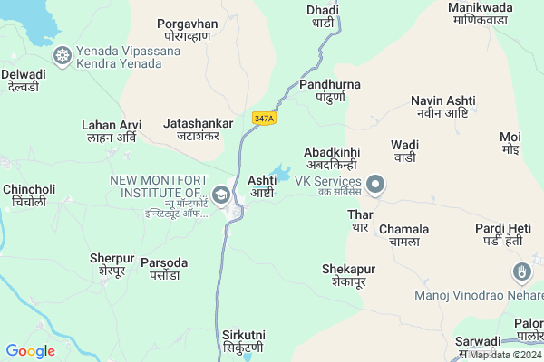
Asti
Asti Map
EDIT Map
Add Your House
 ..
..
Current Corona Virus Infected Patients Count in Wardha District
| City Name | District Name | Total Covid cases |
|---|
Locality Name :
Asti
( असती )
Taluka Name : Ashti
District : Wardha
State : Maharashtra
Region : Vidarbh
Division : Nagpur
Language : Marathi and Gujarati, Sindhi And Punjabi
Current Time 09:25 AM
Date: Wednesday , Apr 30,2025 (IST)
Time zone: IST (UTC+5:30)
Elevation / Altitude: 303 meters. Above Seal level
Telephone Code / Std Code: 07157
Assembly constituency : Arvi assembly constituency
Assembly MLA : Dadarao Yadaorao Keche
Lok Sabha constituency : Wardha parliamentary constituency
Parliament MP : Ramdas Chandrabhanji Tadas
Serpanch Name :
Pin Code : 442202
Post Office Name : Ashti (Wardha)
Alternate Village Name : Ashti
Commodities Prices : Ashti Market / Mandi
Asti Live Weather
Temperature: 35.0 °C
clear sky
Humidity: 20%
Wind : 3.68 mt/sec towards NW
StationName : "Ä\u0080rvi"
observed on 52 Mins Back
Temperature: 35.0 °C
clear sky
Humidity: 20%
Wind : 3.68 mt/sec towards NW
StationName : "Ä\u0080rvi"
observed on 52 Mins Back
Asti Weather Forecast for Next 5 days
01-05-2025
32.9°C to 42.8°C
clear sky, few clouds, overcast clouds, broken clouds
32.9°C to 42.8°C
clear sky, few clouds, overcast clouds, broken clouds
02-05-2025
31.2°C to 42.1°C
broken clouds, scattered clouds, clear sky, few clouds
31.2°C to 42.1°C
broken clouds, scattered clouds, clear sky, few clouds
03-05-2025
31.2°C to 43.3°C
scattered clouds, clear sky, overcast clouds, broken clouds
31.2°C to 43.3°C
scattered clouds, clear sky, overcast clouds, broken clouds
04-05-2025
29.9°C to 43.0°C
scattered clouds, clear sky, few clouds, broken clouds, light rain, overcast clouds
29.9°C to 43.0°C
scattered clouds, clear sky, few clouds, broken clouds, light rain, overcast clouds
05-05-2025
30.7°C to 40.1°C
overcast clouds, broken clouds, scattered clouds, few clouds
30.7°C to 40.1°C
overcast clouds, broken clouds, scattered clouds, few clouds
Edit below overview about Asti
Edit below overview about Asti
OverView of Asti
It Is Around 14km Talegaon,Located On National Highway Nagpur- Amravati. 111km From Nagpur And 61 Km From Amravati.
Edit below overview about Asti
Rivers Near Asti
Jam
Bahram Ka Sand
Jam
Bahram Ka Sand
About Asti
Asti is a Village in Ashti Taluka in Wardha District of Maharashtra State, India. It belongs to Vidarbh region . It belongs to Nagpur Division . It is located 78 KM towards North from District head quarters Wardha. 2 KM from Ashti(New). 711 KM from State capital Mumbai
Asti Pin code is 442202 and postal head office is Ashti (Wardha).
Thar ( 4 KM ) , Parsoda ( 6 KM ) , Lahanarvi ( 7 KM ) , Mamdapur ( 8 KM ) , Dhadi ( 8 KM ) are the nearby Villages to Asti. Asti is surrounded by Tiwsa Taluka towards South , Karanja Taluka towards East , Morshi Taluka towards west , Warud Taluka towards North .
Morshi , Warud , Shendurjana , Narkhed are the near by Cities to Asti.
This Place is in the border of the Wardha District and Amravati District. Amravati District Tiwsa is South towards this place .
Ashti 2011 Census Details
Asti Local Language is Marathi. Ashti Village Total population is 10936 and number of houses are 2526. Female Population is 48.4%. Village literacy rate is 82.3% and the Female Literacy rate is 38.6%.
Population
| Census Parameter | Census Data |
| Total Population | 10936 |
| Total No of Houses | 2526 |
| Female Population % | 48.4 % ( 5291) |
| Total Literacy rate % | 82.3 % ( 9004) |
| Female Literacy rate | 38.6 % ( 4221) |
| Scheduled Tribes Population % | 5.7 % ( 624) |
| Scheduled Caste Population % | 8.4 % ( 922) |
| Working Population % | 41.6 % |
| Child(0 -6) Population by 2011 | 1051 |
| Girl Child(0 -6) Population % by 2011 | 46.7 % ( 491) |
Ashti Census More Deatils.
Politics in Asti
Bharatiya Janata Party , BJP , INC are the major political parties in this area.Polling Stations /Booths near Asti
1)Arvi2)Ashti
3)Ashti
4)Ashti
5)Ashti
HOW TO REACH Asti
By Rail
There is no railway station near to Asti in less than 10 km. are the Rail way stations reachable from near by towns.By Road
Morshi , Warud , Arvi are the nearby by towns to Asti having road connectivity to AstiColleges near Asti
G.b.m.m Jr. College. Hinganghat
Address :
Model Junior College
Address :
Model Junior Callege
Address :
Mpl Junior College
Address :
Janta Junior College Mangrul
Address :
Schools in Asti
Jawahar Vidyalaya
Address : ashti , ashti , wardha , Maharashtra . PIN- 442202 , Post - Ashti (Wardha)
Hutatma Rashtriya Vidhyalaya
Address : ashti , ashti , wardha , Maharashtra . PIN- 442202 , Post - Ashti (Wardha)
Lokmanya Vidyalaya
Address : ashti , ashti , wardha , Maharashtra . PIN- 442202 , Post - Ashti (Wardha)
Shardadevi Bhargao Vidyalaya
Address : ashti , ashti , wardha , Maharashtra . PIN- 442202 , Post - Ashti (Wardha)
Anjanabai Zode Vidyalaya
Address : ashti , ashti , wardha , Maharashtra . PIN- 442202 , Post - Ashti (Wardha)
Govt Health Centers near Asti
1) Mendhala , PHC Mendhala , Mendhala , Near Water Tank2) PHC Ambada , Primary Health Centre Ambada , Ambada , PHC AMBADA
3) Brahmanwada Dive , Health Sub Centre Bramhanwada Diwe , Bramhanwada Diwe ,
Hospitals in Asti,Ashti
Pashuvaidyakiy Hospital
Wardha; SH-244; Warud Talegaon Road; Ashti; Ashti; Maharashtra 442202; India
1.9 KM distance Detail
more ..
Petrol Bunks in Asti,Ashti
Essar Oil Petrol Pump
Wardha; SH-244; Warud Talegaon Road; Ashti; Ashti; Maharashtra 442202; India
3.1 KM distance Detail
B.N. LATHIWALA & SONS
NH 6 TALEGAON;WARDHA; Wardha; Maharashtra 444701; India
12.7 KM distance Detail
Hindustan Petroleum
Talegaon; Wardha; NH-6; Amravati Nagpur Highway; Ashti; Ashti; Maharashtra 442001; India
13.1 KM distance Detail
HP PETROL PUMP - AGRAWAL PETROL AGENCY
HP Petrol Pump NH 6 Talegaon Dist-wardha; Nagpur; Maharashtra 442204; India
13.1 KM distance Detail
more ..
Colleges in Asti,Ashti
Hutatma Rashtriya Arts & Science college
Ashti; Wardha; Maharashtra 442202; India
1.3 KM distance Detail
Suryakanta Pote College of Education
Arvi Road; Ashti Dist.; Talegaon; Maharashtra 442204; India
2.0 KM distance Detail
more ..
Schools in Asti,Ashti
Kranti Dnyanpeeth English Medium School Ashti
A Post Ta Ashti; Dist; Ashti; Maharashtra; India
2.0 KM distance Detail
Local Parks in Asti,Ashti
Police Stations near Asti,Ashti
Governement Offices near Asti,Ashti
Kanishta Abhiyanta Karyalaya
Wardha; SH-244; Warud Talegaon Road; Ashti; Ashti; Maharashtra 442202; India
3.7 KM distance Detail
About Asti &
History
How to reach Asti
Tourist Places Near By Asti
Schools in Asti
Colleges in Asti
Temperature & weather of Asti
places in Asti
Asti photos
More Information
How to reach Asti
Tourist Places Near By Asti
Schools in Asti
Colleges in Asti
Temperature & weather of Asti
places in Asti
Asti photos
More Information
Village Talk
Post News or Events about this Village
Near Cities
Morshi 28 KM near
Warud 33 KM near
Shendurjana 41 KM near
Narkhed 50 KM near
Morshi 28 KM near
Warud 33 KM near
Shendurjana 41 KM near
Narkhed 50 KM near
Near By Taluks
Ashti 2 KM near
Tiwsa 25 KM near
Karanja 26 KM near
Morshi 28 KM near
Ashti 2 KM near
Tiwsa 25 KM near
Karanja 26 KM near
Morshi 28 KM near
Near By Air Ports
Sonegaon Airport 100 KM near
Jabalpur Airport 269 KM near
Nanded Airport 272 KM near
Bhopal Airport 276 KM near
Sonegaon Airport 100 KM near
Jabalpur Airport 269 KM near
Nanded Airport 272 KM near
Bhopal Airport 276 KM near
Near By Tourist Places
Amravati 61 KM near
Sevagram 75 KM near
Nagpur 102 KM near
Chikhaldara Wildlife Sanctuary 103 KM near
Melghat Tiger Reserve 124 KM near
Amravati 61 KM near
Sevagram 75 KM near
Nagpur 102 KM near
Chikhaldara Wildlife Sanctuary 103 KM near
Melghat Tiger Reserve 124 KM near
Near By Districts
Amravati 62 KM near
Wardha 74 KM near
Betul 93 KM near
Yavatmal 101 KM near
Amravati 62 KM near
Wardha 74 KM near
Betul 93 KM near
Yavatmal 101 KM near
Near By RailWay Station
Katol Rail Way Station 45 KM near
Narkher Junction Rail Way Station 49 KM near
Katol Rail Way Station 45 KM near
Narkher Junction Rail Way Station 49 KM near