| Home | City Bus | Maps | Villages | Cities | Rail | Tourist Places | School | College | Pin Codes | Corona Cases Count |
| Distance Calculator Bus Services IFSC Codes Trace Mobile Number Weather Search Place Trace IP Available Cash ATM/Banks Locate Polling Booth Report an Error contact People |
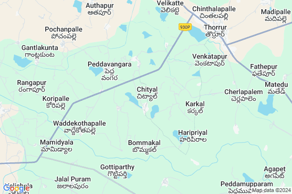
Dubba Thanda Map
EDIT Map
Add Your House
 ..
..
Current Corona Virus Infected Patients Count in Warangal District
| City Name | District Name | Total Covid cases |
|---|---|---|
| Warangal Urban District | Warangal Urban | 23 |
| Mulugu District | Mulugu | 2 |
| Mahabubabad District | Mahabubabad | 1 |
Locality Name :
Dubba Thanda
( దుబ్బ తండా )
Mandal Name : Thorrur
District : Warangal
State : Telangana
Region : Telangana
Language : Telugu and Urdu
Current Time 10:07 AM
Date: Thursday , Apr 24,2025 (IST)
Time zone: IST (UTC+5:30)
Elevation / Altitude: 222 meters. Above Seal level
Telephone Code / Std Code: 08711
Assembly constituency : Palakurthi assembly constituency
Assembly MLA : Yashaswini Mamidala
Lok Sabha constituency : Warangal parliamentary constituency
Parliament MP : DAYAKAR PASUNOORI
Serpanch Name :
Pin Code : 506163
Post Office Name : Turrur
Main Village Name : Chityala
Commodities Prices : Kesamudram Market / Mandi
Dubba Thanda Live Weather
Temperature: 35.4 °C
clear sky
Humidity: 30%
Wind : 5.43 mt/sec towards S
StationName : "SuriÄ\u0081pet"
observed on 28 Mins Back
Temperature: 35.4 °C
clear sky
Humidity: 30%
Wind : 5.43 mt/sec towards S
StationName : "SuriÄ\u0081pet"
observed on 28 Mins Back
Dubba Thanda Weather Forecast for Next 5 days
25-04-2025
29.4°C to 41.8°C
few clouds, scattered clouds, broken clouds
29.4°C to 41.8°C
few clouds, scattered clouds, broken clouds
26-04-2025
28.6°C to 40.6°C
overcast clouds, broken clouds, scattered clouds, clear sky
28.6°C to 40.6°C
overcast clouds, broken clouds, scattered clouds, clear sky
27-04-2025
28.0°C to 41.5°C
overcast clouds, broken clouds, scattered clouds, light rain
28.0°C to 41.5°C
overcast clouds, broken clouds, scattered clouds, light rain
28-04-2025
27.3°C to 40.0°C
overcast clouds, broken clouds, scattered clouds, few clouds, moderate rain, light rain
27.3°C to 40.0°C
overcast clouds, broken clouds, scattered clouds, few clouds, moderate rain, light rain
29-04-2025
28.1°C to 39.9°C
light rain, overcast clouds, broken clouds, clear sky, scattered clouds
28.1°C to 39.9°C
light rain, overcast clouds, broken clouds, clear sky, scattered clouds
Rivers Near Dubba Thanda
Munneru River
Cholleru Vagu
Munneru River
Cholleru Vagu
About Dubba Thanda
Correct below Info and add more info about Dubba ThandaDubba Thanda is a small Village/hamlet in Thorrur Mandal in Warangal District of Telangana State, India. It comes under Chityala Panchayath. It belongs to Telangana region . It is located 57 KM towards South from District head quarters Warangal. 8 KM from Thorrur.
Dubba Thanda Pin code is 506163 and postal head office is Turrur .
Dubba Thanda is surrounded by Kodakandla Mandal towards west , Thungathurthi Mandal towards South , Thirumalagiri Mandal towards west , Raiparthy Mandal towards North .
Suryapet , Jangaon , Warangal , Khammam are the near by Cities to Dubba Thanda.
This Place is in the border of the Warangal District and Nalgonda District. Nalgonda District Thungathurthi is South towards this place .
Demographics of Dubba Thanda
Telugu is the Local Language here. Total population of Dubba Thanda is 2803 .Males are 1413 and Females are 1,390 living in 608 Houses. Total area of Dubba Thanda is 1145 hectares.Politics in Dubba Thanda
TDP , TRS , INC are the major political parties in this area.Polling Stations /Booths near Dubba Thanda
1)Chinthalapally2)Chityal
3)Rayaparthy
4).thirumalayapally
5)Ramavaram
HOW TO REACH Dubba Thanda
By Road
Warangal is the Nearest Town to Dubba Thanda. Warangal is 50 km from Dubba Thanda. Road connectivity is there from Warangal to Dubba Thanda.By Rail
There is no railway station near to Dubba Thanda in less than 10 km. How ever there are railway Stations from Near By town Warangal. are the railway Stations near to Warangal. You can reach from Warangal to Dubba Thanda by road after .Colleges near Dubba Thanda
Govt Junior College Khanapur
Address : Govt Junior College Khanapur
Govt Jr College Chityal
Address : Govt Jr College Chityal
Maharshi Institute Of Pharmaceutical Science
Address : , Velikatte (v), Thorrur (m), Warangal 506 163
Schools in Dubba Thanda
Zphs Chityala
Address : chityal , thorrur , warangal , Andhra Pradesh . PIN- 506318 , Post - Waddekothapally
Govt Health Centers near Dubba Thanda
1) SubCentre, Cityala , , CHITAYALA , Near High School2) SubCentre, Pedavangara , 5-38/1 , B.C.colony , Near Mazeed
3) SubCentre, Haripirala , , HARIPIRALA , SCHOOL.BUSSTAND AREA
Hospitals in Dubba Thanda,Thorrur
Balaji Nursing Home
3-32/6; Rayapatnam to Kodad Road;; Thorrur; Telangana 506163; India
8.3 KM distance Detail
more ..
Petrol Bunks in Dubba Thanda,Thorrur
Sri Thirumala Filling Station Hindustan Petroleum
Warangal; SH-3; Khammam Warangal Road; Warangal; Warangal; Telangana 506163; India
8.3 KM distance Detail
Narmada Petrol Pump
Khammam - Warangal Hwy; Velikatta; Thorrur; Telangana 506163; India
8.3 KM distance Detail
Someshwara Petrol Pump
Khammam - Warangal Hwy; Thorrur; Telangana 506163; India
8.4 KM distance Detail
more ..
Colleges in Dubba Thanda,Thorrur
THORRUR COLLEGE OF EDUCATION
Tirumalagiri road; Thorrur; Warangal; Telangana 506318; India
6.4 KM distance Detail
Sri Sai Balaji College of Education
Khammam - Warangal Hwy; Thorrur; Telangana 506163; India
8.1 KM distance Detail
more ..
Schools in Dubba Thanda,Thorrur
Kistuthanda Primary School
kistuthanda; chinnavangara; Thorrur; Telangana; India
1.9 KM distance Detail
Super Markets in Dubba Thanda,Thorrur
SRI BALAJI KIRANAM &GENERAL
H No 15-141 506163; Khammam - Warangal Hwy; Thorrur; Telangana; India
8.3 KM distance Detail
Police Stations near Dubba Thanda,Thorrur
Police Station; Peddavangara mandal;Mahaboobabad dist
Warangal; Telangana 506318; India
2.9 KM distance Detail
SDPO Office ; THORRUR.
Khammam - Warangal Hwy; Thorrur; Telangana 506163; India
8.4 KM distance Detail
About Dubba Thanda &
History
How to reach Dubba Thanda
Tourist Places Near By Dubba Thanda
Schools in Dubba Thanda
Colleges in Dubba Thanda
Temperature & weather of Dubba Thanda
places in Dubba Thanda
Dubba Thanda photos
More Information
How to reach Dubba Thanda
Tourist Places Near By Dubba Thanda
Schools in Dubba Thanda
Colleges in Dubba Thanda
Temperature & weather of Dubba Thanda
places in Dubba Thanda
Dubba Thanda photos
More Information
Village Talk
Post News or Events about this Village
Near Cities
Suryapet 50 KM near
Jangaon 57 KM near
Warangal 57 KM near
Khammam 73 KM near
Suryapet 50 KM near
Jangaon 57 KM near
Warangal 57 KM near
Khammam 73 KM near
Near By Taluks
Thorrur 8 KM near
Kodakandla 11 KM near
Thungathurthi 15 KM near
Thirumalagiri 16 KM near
Thorrur 8 KM near
Kodakandla 11 KM near
Thungathurthi 15 KM near
Thirumalagiri 16 KM near
Near By Air Ports
Rajiv Gandhi International Airport 145 KM near
Vijayawada Airport 189 KM near
Rajahmundry Airport 268 KM near
Nanded Airport 339 KM near
Rajiv Gandhi International Airport 145 KM near
Vijayawada Airport 189 KM near
Rajahmundry Airport 268 KM near
Nanded Airport 339 KM near
Near By Tourist Places
Warangal 56 KM near
Khammam 73 KM near
Nagarjunakonda 106 KM near
Medaram 122 KM near
Nagarjunsagar 125 KM near
Warangal 56 KM near
Khammam 73 KM near
Nagarjunakonda 106 KM near
Medaram 122 KM near
Nagarjunsagar 125 KM near
Near By Districts
Warangal 55 KM near
Khammam 73 KM near
Nalgonda 74 KM near
Karimnagar 124 KM near
Warangal 55 KM near
Khammam 73 KM near
Nalgonda 74 KM near
Karimnagar 124 KM near
Near By RailWay Station
Kesamudram Rail Way Station 38 KM near
Nekonda Rail Way Station 39 KM near
Kesamudram Rail Way Station 38 KM near
Nekonda Rail Way Station 39 KM near