| Home | City Bus | Maps | Villages | Cities | Rail | Tourist Places | School | College | Pin Codes | Corona Cases Count |
| Distance Calculator Bus Services IFSC Codes Trace Mobile Number Weather Search Place Trace IP Available Cash ATM/Banks Locate Polling Booth Report an Error contact People |
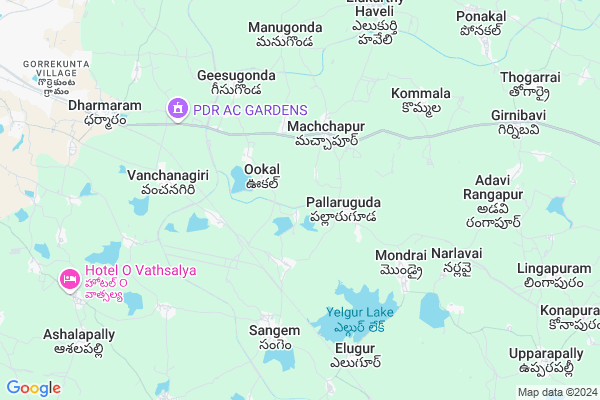
Bothala Thanda Map
EDIT Map
Add Your House
 ..
..
Current Corona Virus Infected Patients Count in Warangal District
| City Name | District Name | Total Covid cases |
|---|---|---|
| Warangal Urban District | Warangal Urban | 23 |
| Mulugu District | Mulugu | 2 |
| Mahabubabad District | Mahabubabad | 1 |
Locality Name :
Bothala Thanda
( బోధల తండా )
Mandal Name : Thorrur
District : Warangal
State : Telangana
Region : Telangana
Language : Telugu and Urdu
Current Time 04:46 PM
Date: Monday , Apr 28,2025 (IST)
Time zone: IST (UTC+5:30)
Elevation / Altitude: 222 meters. Above Seal level
Telephone Code / Std Code: 08711
Assembly constituency : Parkal assembly constituency
Assembly MLA : Revuri Prakash Reddy
Lok Sabha constituency : Warangal parliamentary constituency
Parliament MP : DAYAKAR PASUNOORI
Serpanch Name :
Pin Code : 506163
Post Office Name : Turrur
Main Village Name : Chintalapally
Commodities Prices : Warangal Market / Mandi
Bothala Thanda Live Weather
Temperature: 39.5 °C
few clouds
Humidity: 17%
Wind : 2.73 mt/sec towards S
StationName : "Warangal"
observed on 28 Mins Back
Temperature: 39.5 °C
few clouds
Humidity: 17%
Wind : 2.73 mt/sec towards S
StationName : "Warangal"
observed on 28 Mins Back
Bothala Thanda Weather Forecast for Next 5 days
29-04-2025
27.4°C to 39.1°C
few clouds, clear sky
27.4°C to 39.1°C
few clouds, clear sky
30-04-2025
26.1°C to 40.2°C
clear sky, few clouds, scattered clouds
26.1°C to 40.2°C
clear sky, few clouds, scattered clouds
01-05-2025
26.5°C to 39.2°C
scattered clouds, broken clouds, light rain, clear sky
26.5°C to 39.2°C
scattered clouds, broken clouds, light rain, clear sky
02-05-2025
26.8°C to 42.0°C
clear sky, few clouds
26.8°C to 42.0°C
clear sky, few clouds
03-05-2025
27.2°C to 41.8°C
scattered clouds, few clouds, clear sky
27.2°C to 41.8°C
scattered clouds, few clouds, clear sky
Rivers Near Bothala Thanda
Munneru River
Cholleru Vagu
Munneru River
Cholleru Vagu
About Bothala Thanda
Correct below Info and add more info about Bothala ThandaBothala Thanda is a small Village/hamlet in Thorrur Mandal in Warangal District of Telangana State, India. It comes under Chintalapally Panchayath. It belongs to Telangana region . It is located 18 KM towards East from District head quarters Warangal. 46 KM from Thorrur.
Bothala Thanda Pin code is 506163 and postal head office is Turrur .
Bothala Thanda is surrounded by Sangam Mandal towards west , Duggondi Mandal towards East , Warangal Mandal towards west , Atmakur Mandal towards North .
Warangal , Jangaon , Yellandu , Karimnagar are the near by Cities to Bothala Thanda.
This Place is in the border of the Warangal District and Nalgonda District. Nalgonda District Thungathurthi is South towards this place .
Demographics of Bothala Thanda
Telugu is the Local Language here. Total population of Bothala Thanda is 2087 .Males are 1046 and Females are 1,041 living in 447 Houses. Total area of Bothala Thanda is 838 hectares.Politics in Bothala Thanda
TDP , TRS , YSCP , INC are the major political parties in this area.Polling Stations /Booths near Bothala Thanda
1)Kothagudem2)Ookal Haveli
3)Chinthalapally
4)Oglapur
5)Charlapalli
HOW TO REACH Bothala Thanda
By Road
Warangal is the Nearest Town to Bothala Thanda. Road connectivity is there from Warangal to Bothala Thanda.By Rail
Chintalpalli Rail Way Station , Yelgur Rail Way Station are the very nearby railway stations to Bothala Thanda. Also you can consider railway Stations from Near By town Warangal. Warangal Rail Way Station , Kazipet Town Rail Way Station are the railway Stations near to Warangal. You can reach from Warangal to Bothala Thanda by road after .Colleges near Bothala Thanda
Govt Junior College Khanapur
Address : Govt Junior College Khanapur
Govt Jr College Chityal
Address : Govt Jr College Chityal
Maharshi Institute Of Pharmaceutical Science
Address : , Velikatte (v), Thorrur (m), Warangal 506 163
Schools near Bothala Thanda
Ratna Techno Hs
Address : thorrur , thorrur , warangal , Andhra Pradesh . PIN- 506163 , Post - Turrur
Krishnaveni High School
Address : thorrur , thorrur , warangal , Andhra Pradesh . PIN- 506163 , Post - Turrur
K G B V Thorrur
Address : thorrur , thorrur , warangal , Andhra Pradesh . PIN- 506163 , Post - Turrur
Aryabhatta H.s.
Address : thorrur , thorrur , warangal , Andhra Pradesh . PIN- 506163 , Post - Turrur
Govt Health Centers near Bothala Thanda
1) SubCentre, Ookal , 6-Apr , Ookal , Beside G.P2) Primary Health Centre, Sangam , , main road , near govt high school
3) SubCentre, Sangem , , Sangam , Sangam
Hospitals in Bothala Thanda,Thorrur
Karthika Medical Shop Business
Main Road; Pallaruguda; Telangana 506330; India
2.0 KM distance Detail
more ..
Petrol Bunks in Bothala Thanda,Thorrur
Panchmukhi Filling Station-Hindustan Petroleum
Konaimakula; Warangal; NH-365; Warangal Narasampet Road; Geesu Gonda; Geesu Gonda; Telangana 506331; India
4.0 KM distance Detail
more ..
Colleges in Bothala Thanda,Thorrur
Aurobindo College of Pharmaceutical Sciences
Warangal; Telangana 506330; India
2.6 KM distance Detail
more ..
Schools in Bothala Thanda,Thorrur
M.P.P Govt
Beside Gram Panchayat ; District Warangal; Vanjarapally; Telangana 506330; India
1.6 KM distance Detail
ZPSS High School
Zpss High School;Pallariguda;Sangam;Wgl;AP; Pallaruguda; 506330; India
1.9 KM distance Detail
Electronic Shops in Bothala Thanda,Thorrur
Chand Pasha Foot Ware And Mechanisms
Warangal-Narsampet Rd; Machchapur; Telangana 506330; India
3.1 KM distance Detail
V-Tech Computers
Narsampet Main Road; LB Nagar Rd; Warangal; Telangana 506002; India
4.4 KM distance Detail
Police Stations near Bothala Thanda,Thorrur
Police station
Police Station; Geesugonda; wgl;AP; Geesugonda; Telangana 506330; India
5.2 KM distance Detail
Sangem Police Station
17°53'09. 79°42'35.; 5"N; Rd Number 1; Banjara Hills; Hyderabad; Telangana 500028; India
5.9 KM distance Detail
Police Station Mills Colony
Mills Colony; Fort Road; Shambunipet; Warangal; Telangana 506002; India
15.1 KM distance Detail
About Bothala Thanda &
History
How to reach Bothala Thanda
Tourist Places Near By Bothala Thanda
Schools in Bothala Thanda
Colleges in Bothala Thanda
Temperature & weather of Bothala Thanda
places in Bothala Thanda
Bothala Thanda photos
More Information
How to reach Bothala Thanda
Tourist Places Near By Bothala Thanda
Schools in Bothala Thanda
Colleges in Bothala Thanda
Temperature & weather of Bothala Thanda
places in Bothala Thanda
Bothala Thanda photos
More Information
Village Talk
Post News or Events about this Village
Near Cities
Warangal 17 KM near
Jangaon 71 KM near
Yellandu 83 KM near
Karimnagar 96 KM near
Warangal 17 KM near
Jangaon 71 KM near
Yellandu 83 KM near
Karimnagar 96 KM near
Near By Taluks
Geesugonda 5 KM near
Sangam 7 KM near
Duggondi 11 KM near
Warangal 15 KM near
Geesugonda 5 KM near
Sangam 7 KM near
Duggondi 11 KM near
Warangal 15 KM near
Near By Air Ports
Rajiv Gandhi International Airport 175 KM near
Vijayawada Airport 216 KM near
Rajahmundry Airport 269 KM near
Nanded Airport 323 KM near
Rajiv Gandhi International Airport 175 KM near
Vijayawada Airport 216 KM near
Rajahmundry Airport 269 KM near
Nanded Airport 323 KM near
Near By Tourist Places
Warangal 15 KM near
Medaram 78 KM near
Khammam 98 KM near
Bhadrachalam 142 KM near
Nagarjunakonda 151 KM near
Warangal 15 KM near
Medaram 78 KM near
Khammam 98 KM near
Bhadrachalam 142 KM near
Nagarjunakonda 151 KM near
Near By Districts
Warangal 17 KM near
Karimnagar 93 KM near
Khammam 98 KM near
Nalgonda 122 KM near
Warangal 17 KM near
Karimnagar 93 KM near
Khammam 98 KM near
Nalgonda 122 KM near
Near By RailWay Station
Chintalpalli Rail Way Station 3.0 KM near
Warangal Rail Way Station 14 KM near
Nekonda Rail Way Station 19 KM near
Chintalpalli Rail Way Station 3.0 KM near
Warangal Rail Way Station 14 KM near
Nekonda Rail Way Station 19 KM near