| Home | City Bus | Maps | Villages | Cities | Rail | Tourist Places | School | College | Pin Codes | Corona Cases Count |
| Distance Calculator Bus Services IFSC Codes Trace Mobile Number Weather Search Place Trace IP Available Cash ATM/Banks Locate Polling Booth Report an Error contact People |
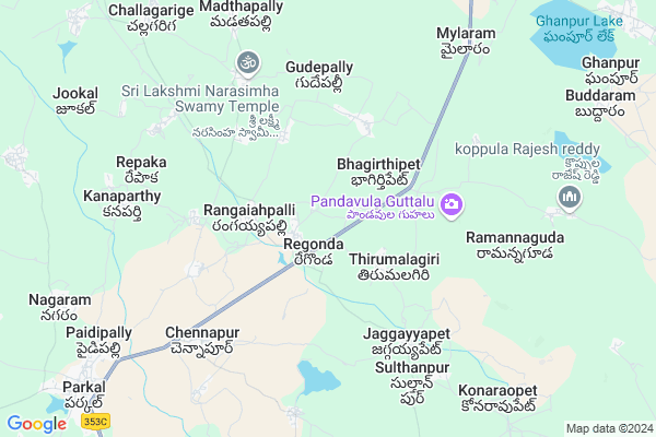
Ponugondla Map
EDIT Map
Add Your House
 ..
..
Current Corona Virus Infected Patients Count in Warangal District
| City Name | District Name | Total Covid cases |
|---|---|---|
| Warangal Urban District | Warangal Urban | 23 |
| Mulugu District | Mulugu | 2 |
| Mahabubabad District | Mahabubabad | 1 |
Locality Name :
Ponugondla
( పూనుగొండ్ల )
Mandal Name : Regonda
District : Warangal
State : Telangana
Region : Telangana
Language : Telugu and Urdu
Current Time 01:13 PM
Date: Sunday , Apr 27,2025 (IST)
Time zone: IST (UTC+5:30)
Elevation / Altitude: 251 meters. Above Seal level
Telephone Code / Std Code: 08713
Assembly constituency : Bhupalpalle assembly constituency
Assembly MLA : Gandra Satyanarayana Rao
Lok Sabha constituency : Warangal parliamentary constituency
Parliament MP : DAYAKAR PASUNOORI
Serpanch Name :
Pin Code : 506348
Post Office Name : Regonda
Alternate Village Name : Ponagandla
Commodities Prices : Parkal Market / Mandi
National Highways Reachable To Ponugondla
Nationa High Way :NH163
Nationa High Way :NH563
Nationa High Way :NH163
Nationa High Way :NH563
Rivers Near Ponugondla
Are Vagu
Sali Vagu
Are Vagu
Sali Vagu
About Ponugondla
Correct below Info and add more info about PonugondlaPonugondla is a Village in Regonda Mandal in Warangal District of Telangana State, India. It belongs to Telangana region . As part Telangana Districts re-organisation , Ponugondla Village Regonda Mandal re organised from Warangal District to Jaya Shankar district. It is located 42 KM towards North from District head quarters Warangal.
Ponugondla Pin code is 506348 and postal head office is Regonda .
Ponugondla is surrounded by Ghanapur (Mulug) Mandal towards East , Parkal Mandal towards west , Shyampet Mandal towards South , Venkatapur Mandal towards East .
Warangal , Ramagundam , Karimnagar , Mancherial are the near by Cities to Ponugondla.
Ponagandla 2011 Census Details
Ponugondla Local Language is Telugu. Ponagandla Village Total population is 2163 and number of houses are 585. Female Population is 48.4%. Village literacy rate is 48.0% and the Female Literacy rate is 18.5%.
Population
| Census Parameter | Census Data |
| Total Population | 2163 |
| Total No of Houses | 585 |
| Female Population % | 48.4 % ( 1047) |
| Total Literacy rate % | 48.0 % ( 1039) |
| Female Literacy rate | 18.5 % ( 400) |
| Scheduled Tribes Population % | 0.8 % ( 18) |
| Scheduled Caste Population % | 21.3 % ( 461) |
| Working Population % | 58.9 % |
| Child(0 -6) Population by 2011 | 217 |
| Girl Child(0 -6) Population % by 2011 | 43.8 % ( 95) |
Ponagandla Census More Deatils.
Politics in Ponugondla
TRS , INC are the major political parties in this area.Polling Stations /Booths near Ponugondla
1)Rayapally2)Regonda
3)Regonda
4)Regonda
5)Rangapur
HOW TO REACH Ponugondla
By Road
Warangal is the Nearest Town to Ponugondla. Warangal is 58 km from Ponugondla. Road connectivity is there from Warangal to Ponugondla.By Rail
There is no railway station near to Ponugondla in less than 10 km. How ever there are railway Stations from Near By town Warangal. are the railway Stations near to Warangal. You can reach from Warangal to Ponugondla by road after .Colleges near Ponugondla
Kakatiya Junior College Regonda (inct)
Address : Kakatiya Junior College Regonda (inct)
Schools in Ponugondla
Pragathi Publ Ponuga
Address : ponugondla , regonda , warangal , Andhra Pradesh . PIN- 506348 , Post - Regonda
Govt Health Centers near Ponugondla
1) SubCentre, Regonda , 8-Mar , GP Road , GP Road2) Primary Health Centre, Regonda , , main road , near kakatiya high school
3) SubCentre, thirumalagiri , , Opp Govt School , Near G.P
Petrol Bunks in Ponugondla,Regonda
HP PETROL PUMP - HIGHWAY FILLING STATION REGONDA
S NO 496 Regonda Village Regonda Mandal; Warangal; 500552; India
3.2 KM distance Detail
more ..
Colleges in Ponugondla,Regonda
harshini digital studio palakurthy
police station road; Palakurthy; Telangana 506164; India
8.6 KM distance Detail
Vaagdevi B.Ed and D.Ed College
Parkal - Mahadevpur Rd; Parkal; Telangana 506164; India
10.2 KM distance Detail
more ..
Electronic Shops in Ponugondla,Regonda
Siri Digital Kamal
Kamal; Thodupuzha - Puliyanmala Rd; Kattappana; Kerala 685515; India
1.4 KM distance Detail
Local Parks in Ponugondla,Regonda
Ambedkar Circle
Parkal - Huzurabad Rd; Adarshanagar; Parkal; Telangana 506164; India
11.8 KM distance Detail
Police Stations near Ponugondla,Regonda
Police Station
3; Parkal - Huzurabad Rd; Adarshanagar; Parkal; Telangana 506164; India
11.8 KM distance Detail
About Ponugondla &
History
How to reach Ponugondla
Tourist Places Near By Ponugondla
Schools in Ponugondla
Colleges in Ponugondla
Temperature & weather of Ponugondla
places in Ponugondla
Ponugondla photos
More Information
How to reach Ponugondla
Tourist Places Near By Ponugondla
Schools in Ponugondla
Colleges in Ponugondla
Temperature & weather of Ponugondla
places in Ponugondla
Ponugondla photos
More Information
Village Talk
Post News or Events about this Village
Near Cities
Warangal 37 KM near
Ramagundam 73 KM near
Karimnagar 82 KM near
Mancherial 86 KM near
Warangal 37 KM near
Ramagundam 73 KM near
Karimnagar 82 KM near
Mancherial 86 KM near
Near By Taluks
Regonda 0 KM near
Ghanapur (Mulug) 11 KM near
Parkal 13 KM near
Shyampet 16 KM near
Regonda 0 KM near
Ghanapur (Mulug) 11 KM near
Parkal 13 KM near
Shyampet 16 KM near
Near By Air Ports
Rajiv Gandhi International Airport 203 KM near
Vijayawada Airport 246 KM near
Rajahmundry Airport 280 KM near
Nanded Airport 312 KM near
Rajiv Gandhi International Airport 203 KM near
Vijayawada Airport 246 KM near
Rajahmundry Airport 280 KM near
Nanded Airport 312 KM near
Near By Tourist Places
Warangal 37 KM near
Medaram 55 KM near
Khammam 131 KM near
Bhadrachalam 150 KM near
Sirpur 154 KM near
Warangal 37 KM near
Medaram 55 KM near
Khammam 131 KM near
Bhadrachalam 150 KM near
Sirpur 154 KM near
Near By Districts
Warangal 40 KM near
Karimnagar 79 KM near
Khammam 131 KM near
Bijapur 139 KM near
Warangal 40 KM near
Karimnagar 79 KM near
Khammam 131 KM near
Bijapur 139 KM near
Near By RailWay Station
Jammikunta Rail Way Station 36 KM near
Warangal Rail Way Station 40 KM near
Jammikunta Rail Way Station 36 KM near
Warangal Rail Way Station 40 KM near