| Home | City Bus | Maps | Villages | Cities | Rail | Tourist Places | School | College | Pin Codes | Corona Cases Count |
| Distance Calculator Bus Services IFSC Codes Trace Mobile Number Weather Search Place Trace IP Available Cash ATM/Banks Locate Polling Booth Report an Error contact People |
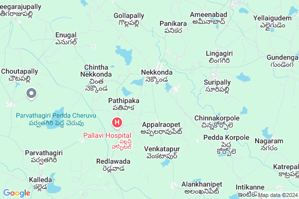
Alakhanipeta Map
EDIT Map
Add Your House
 ..
..
Current Corona Virus Infected Patients Count in Warangal District
| City Name | District Name | Total Covid cases |
|---|---|---|
| Warangal Urban District | Warangal Urban | 23 |
| Mulugu District | Mulugu | 2 |
| Mahabubabad District | Mahabubabad | 1 |
Locality Name :
Alakhanipeta
( అలకనిపేట )
Mandal Name : Nekkonda
District : Warangal
State : Telangana
Region : Telangana
Language : Telugu and Urdu
Current Time 12:04 PM
Date: Sunday , Apr 27,2025 (IST)
Time zone: IST (UTC+5:30)
Elevation / Altitude: 236 meters. Above Seal level
Telephone Code / Std Code: 08718
Assembly constituency : Narsampet assembly constituency
Assembly MLA : Donthi Madhava Reddy
Lok Sabha constituency : Mahabubabad parliamentary constituency
Parliament MP : Kavitha Malothu
Serpanch Name :
Pin Code : 506122
Post Office Name : Nekkonda
Alternate Village Name : Alankanipeta
Commodities Prices : Kesamudram Market / Mandi
Alakhanipeta Live Weather
Temperature: 35.2 °C
scattered clouds
Humidity: 32%
Wind : 5.22 mt/sec towards SE
StationName : "MahbÅ«bÄ\u0081bÄ\u0081d"
observed on 7 Mins Back
Temperature: 35.2 °C
scattered clouds
Humidity: 32%
Wind : 5.22 mt/sec towards SE
StationName : "MahbÅ«bÄ\u0081bÄ\u0081d"
observed on 7 Mins Back
Alakhanipeta Weather Forecast for Next 5 days
28-04-2025
27.6°C to 37.6°C
scattered clouds, light rain, broken clouds, clear sky
27.6°C to 37.6°C
scattered clouds, light rain, broken clouds, clear sky
29-04-2025
26.0°C to 39.5°C
clear sky, scattered clouds, few clouds, broken clouds
26.0°C to 39.5°C
clear sky, scattered clouds, few clouds, broken clouds
30-04-2025
26.4°C to 42.0°C
scattered clouds, clear sky, light rain
26.4°C to 42.0°C
scattered clouds, clear sky, light rain
01-05-2025
26.4°C to 43.6°C
broken clouds, scattered clouds, few clouds, clear sky
26.4°C to 43.6°C
broken clouds, scattered clouds, few clouds, clear sky
02-05-2025
27.4°C to 43.1°C
scattered clouds, clear sky, few clouds
27.4°C to 43.1°C
scattered clouds, clear sky, few clouds
Edit below overview about Alakhanipeta
Edit below overview about Alakhanipeta
OverView of Alakhanipeta
My Village name is alankhanipet.It is Located at 10 K.M from Nekkonda mandal. My village is very clean & green village in the Nekkonda mandal. Total 5000 Voter's in My Village. All festivals like Vinayakachavithi, Bathukamma, Dasara, Krishnashtami, Ramzan, and Crismas We celebrate very encouragely.
Edit below overview about Alakhanipeta
National Highways Reachable To Alakhanipeta
Nationa High Way :NH163
Nationa High Way :NH563
Nationa High Way :NH163
Nationa High Way :NH563
About Alakhanipeta
Alakhanipeta is a Village in Nekkonda Mandal in Warangal District of Telangana State, India. It belongs to Telangana region . As part Telangana Districts re-organisation , Alakhanipeta Village Nekkonda Mandal re organised from Warangal District to Warangal Rural district. It is located 37 KM towards East from District head quarters Warangal.
Alakhanipeta Pin code is 506122 and postal head office is Nekkonda .
Alakhanipeta is surrounded by Parvathagiri Mandal towards west , Chennaraopet Mandal towards East , Kesamudram Mandal towards South , Sangam Mandal towards west .
Warangal , Yellandu , Jangaon , Khammam are the near by Cities to Alakhanipeta.
Alamkhanipet 2011 Census Details
Alakhanipeta Local Language is Telugu. Alamkhanipet Village Total population is 3208 and number of houses are 860. Female Population is 48.9%. Village literacy rate is 53.2% and the Female Literacy rate is 21.3%.
Population
| Census Parameter | Census Data |
| Total Population | 3208 |
| Total No of Houses | 860 |
| Female Population % | 48.9 % ( 1570) |
| Total Literacy rate % | 53.2 % ( 1706) |
| Female Literacy rate | 21.3 % ( 683) |
| Scheduled Tribes Population % | 8.4 % ( 268) |
| Scheduled Caste Population % | 12.1 % ( 388) |
| Working Population % | 54.3 % |
| Child(0 -6) Population by 2011 | 315 |
| Girl Child(0 -6) Population % by 2011 | 49.2 % ( 155) |
Alamkhanipet Census More Deatils.
Politics in Alakhanipeta
TDP , TRS , INC are the major political parties in this area.Polling Stations /Booths near Alakhanipeta
1)Nekkonda2)Parshu Naik Thanda H/o Madannapeta
3)Nekkonda
4)Narsampet
5)Nekkonda
HOW TO REACH Alakhanipeta
By Road
Warangal is the Nearest Town to Alakhanipeta. Warangal is 42 km from Alakhanipeta. Road connectivity is there from Warangal to Alakhanipeta.By Rail
Nekonda Rail Way Station , Intakanne Rail Way Station are the very nearby railway stations to Alakhanipeta. Also you can consider railway Stations from Near By town Warangal. Warangal Rail Way Station , Kazipet Town Rail Way Station are the railway Stations near to Warangal. You can reach from Warangal to Alakhanipeta by road after .Colleges near Alakhanipeta
Sri Vikas Junioer And Degree Collage
Address :
Govt Jr College Nekkonda
Address : Govt Jr College Nekkonda
Prathibha Jr College Nekkonda
Address : Prathibha Jr College Nekkonda
Harshavardhan Jr Coll, Nekkonda
Address : Nekkonda
Schools in Alakhanipeta
Zilla Parishath High School
Address : alankhanipet (viil) nekkonda(mdl) warangal(dist) pin cod:506122
Govt Health Centers near Alakhanipeta
1) Primary Health Centre, Nekkonda , I-32 , Gundrapally Rd. , Beside Gpally Lake2) SubCentre, Nekkonda , IV-139 , BC Colony , Bodrai N ekkonda
3) SubCentre, Appalraopet , I-46 , BC Colony , Opp Mazeed
Sub Villages in Alakhanipeta
Hospitals in Alakhanipeta,Nekkonda
Chandra Shekar Katakam Dr
2-55 Railway Station Kesamudram; Nekkonda; Nekkonda; Warangal; Telangana 506112; India
1.8 KM distance Detail
Pardu nursing home
Opp: Market yard; Nekkonda Rd; Nekkonda; Telangana 506122; India
2.2 KM distance Detail
more ..
Petrol Bunks in Alakhanipeta,Nekkonda
HP PETROL PUMP - DURGA FILLING STN NEKKONDA
Sy.no.356/2(part) Nekkonda District; Warangal; 506122; India
2.2 KM distance Detail
Indian Oil - Abhaya Anjaneya Filling Station
Parvathagiri; Telangana 506365; India
10.6 KM distance Detail
more ..
Electronic Shops in Alakhanipeta,Nekkonda
Kavitha Mobiles &Internet
Opp: Market yard; Nekkonda Rd; Nekkonda; Telangana 506122; India
2.2 KM distance Detail
శివ సెల్ వరల్డ్ & ఇంటర్నెట్
Near High School Nekonda.; Warangal; Telangana 506002; India
2.2 KM distance Detail
MAHENDRA ELECTRICALS (TEXMO PUMPS DEALERS)
Besides busstand; Nekkonda; Telangana; India
2.3 KM distance Detail
Local Parks in Alakhanipeta,Nekkonda
Peddha Mamidi Thota
Peddhayi Cheruvu to Lachamma Gate road; Kesamudram; Telangana 506112; India
15.2 KM distance Detail
Governement Offices near Alakhanipeta,Nekkonda
MeeSeva Center
Nagelli Raj kumar;S/o.N.Cheralu; Nekkonda; Telangana 506122; India
1.9 KM distance Detail
About Alakhanipeta &
History
How to reach Alakhanipeta
Tourist Places Near By Alakhanipeta
Schools in Alakhanipeta
Colleges in Alakhanipeta
Temperature & weather of Alakhanipeta
places in Alakhanipeta
Alakhanipeta photos
More Information
How to reach Alakhanipeta
Tourist Places Near By Alakhanipeta
Schools in Alakhanipeta
Colleges in Alakhanipeta
Temperature & weather of Alakhanipeta
places in Alakhanipeta
Alakhanipeta photos
More Information
Village Talk
Post News or Events about this Village
Near Cities
Warangal 37 KM near
Yellandu 66 KM near
Jangaon 76 KM near
Khammam 77 KM near
Warangal 37 KM near
Yellandu 66 KM near
Jangaon 76 KM near
Khammam 77 KM near
Near By Taluks
Nekkonda 0 KM near
Parvathagiri 11 KM near
Chennaraopet 11 KM near
Kesamudram 16 KM near
Nekkonda 0 KM near
Parvathagiri 11 KM near
Chennaraopet 11 KM near
Kesamudram 16 KM near
Near By Air Ports
Rajiv Gandhi International Airport 176 KM near
Vijayawada Airport 195 KM near
Rajahmundry Airport 254 KM near
Nanded Airport 341 KM near
Rajiv Gandhi International Airport 176 KM near
Vijayawada Airport 195 KM near
Rajahmundry Airport 254 KM near
Nanded Airport 341 KM near
Near By Tourist Places
Warangal 34 KM near
Khammam 77 KM near
Medaram 85 KM near
Bhadrachalam 130 KM near
Nagarjunakonda 132 KM near
Warangal 34 KM near
Khammam 77 KM near
Medaram 85 KM near
Bhadrachalam 130 KM near
Nagarjunakonda 132 KM near
Near By Districts
Warangal 36 KM near
Khammam 77 KM near
Nalgonda 111 KM near
Karimnagar 113 KM near
Warangal 36 KM near
Khammam 77 KM near
Nalgonda 111 KM near
Karimnagar 113 KM near
Near By RailWay Station
Nekonda Rail Way Station 1.9 KM near
Kesamudram Rail Way Station 16 KM near
Nekonda Rail Way Station 1.9 KM near
Kesamudram Rail Way Station 16 KM near