| Home | City Bus | Maps | Villages | Cities | Rail | Tourist Places | School | College | Pin Codes | Corona Cases Count |
| Distance Calculator Bus Services IFSC Codes Trace Mobile Number Weather Search Place Trace IP Available Cash ATM/Banks Locate Polling Booth Report an Error contact People |
Ramanujapuram
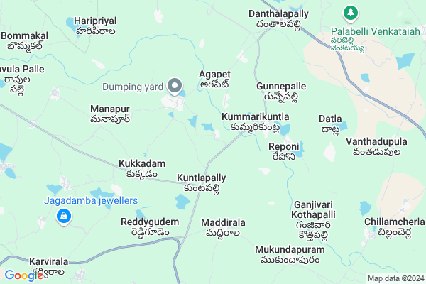
Ramanujapuram Map
EDIT Map
Add Your House
 ..
..
Current Corona Virus Infected Patients Count in Warangal District
| City Name | District Name | Total Covid cases |
|---|---|---|
| Warangal Urban District | Warangal Urban | 23 |
| Mulugu District | Mulugu | 2 |
| Mahabubabad District | Mahabubabad | 1 |
Locality Name :
Ramanujapuram
( రామానుజపురం )
Mandal Name : Narsimhulapet
District : Warangal
State : Telangana
Region : Telangana
Language : Telugu and Urdu
Current Time 01:03 PM
Date: Tuesday , Apr 29,2025 (IST)
Time zone: IST (UTC+5:30)
Elevation / Altitude: 212 meters. Above Seal level
Telephone Code / Std Code: 08719
Assembly constituency : Dornakal assembly constituency
Assembly MLA : Jatoth Ram Chander Naik
Lok Sabha constituency : Mahabubabad parliamentary constituency
Parliament MP : Kavitha Malothu
Serpanch Name :
Pin Code : 506324
Post Office Name : Dantalapalli
Alternate Village Name : Ramajapuram
Commodities Prices : Kesamudram Market / Mandi
Ramanujapuram Live Weather
Temperature: 36.8 °C
clear sky
Humidity: 29%
Wind : 4.71 mt/sec towards S
StationName : "MahbÅ«bÄ\u0081bÄ\u0081d"
observed on 1 Hours Back
Temperature: 36.8 °C
clear sky
Humidity: 29%
Wind : 4.71 mt/sec towards S
StationName : "MahbÅ«bÄ\u0081bÄ\u0081d"
observed on 1 Hours Back
Ramanujapuram Weather Forecast for Next 5 days
30-04-2025
27.4°C to 40.0°C
clear sky, few clouds, scattered clouds
27.4°C to 40.0°C
clear sky, few clouds, scattered clouds
01-05-2025
26.5°C to 40.6°C
few clouds, overcast clouds, broken clouds, scattered clouds
26.5°C to 40.6°C
few clouds, overcast clouds, broken clouds, scattered clouds
02-05-2025
27.1°C to 41.9°C
scattered clouds, few clouds, clear sky
27.1°C to 41.9°C
scattered clouds, few clouds, clear sky
03-05-2025
27.6°C to 41.4°C
scattered clouds, broken clouds, clear sky, light rain, overcast clouds
27.6°C to 41.4°C
scattered clouds, broken clouds, clear sky, light rain, overcast clouds
04-05-2025
27.7°C to 42.5°C
scattered clouds, few clouds, clear sky, light rain, broken clouds
27.7°C to 42.5°C
scattered clouds, few clouds, clear sky, light rain, broken clouds
National Highways Reachable To Ramanujapuram
Nationa High Way :NH365BB
Nationa High Way :NH365A;365BB
Nationa High Way :NH365BB
Nationa High Way :NH365A;365BB
Rivers Near Ramanujapuram
Bukleru River
Musi River
Bukleru River
Musi River
About Ramanujapuram
Correct below Info and add more info about RamanujapuramRamanujapuram is a Village in Narsimhulapet Mandal in Warangal District of Telangana State, India. It belongs to Telangana region . It is located 69 KM towards South from District head quarters Warangal. 9 KM from Narsimhulapet.
Ramanujapuram Pin code is 506324 and postal head office is Dantalapalli .
Peddamupparam ( 3 KM ) , Agapeta ( 4 KM ) , Gunnepalle ( 4 KM ) , Reponi ( 4 KM ) , Datla ( 6 KM ) are the nearby Villages to Ramanujapuram. Ramanujapuram is surrounded by Thorrur Mandal towards North , Thungathurthi Mandal towards west , Nuthankal Mandal towards South , Nallikudur Mandal towards North .
Suryapet , Khammam , Kodad , Warangal are the near by Cities to Ramanujapuram.
This Place is in the border of the Warangal District and Nalgonda District. Nalgonda District Nuthankal is South towards this place .
Demographics of Ramanujapuram
Telugu is the Local Language here.Politics in Ramanujapuram
TDP , TRS , INC are the major political parties in this area.Polling Stations /Booths near Ramanujapuram
1)Ramannagudem/mungimadugu2)Nerada
3)Veesampelly
4).kuravi
5)Kousalydevipalli
HOW TO REACH Ramanujapuram
By Rail
There is no railway station near to Ramanujapuram in less than 10 km. Warangal Rail Way Station (near to Warangal) , Kazipet Town Rail Way Station (near to Warangal) are the Rail way stations reachable from near by towns.By Road
Warangal are the nearby by towns to Ramanujapuram having road connectivity to RamanujapuramColleges near Ramanujapuram
Sai Ram Juniour College
Address :
Gowthami Jr College, Narsimhulapet
Address : Narsimhulapet
Schools near Ramanujapuram
Zphs Kummarikuntla
Address : kummarikuntla , narsimhulapet , warangal , Andhra Pradesh . PIN- 506324 , Post - Dantalapalli
Wisdom High School
Address : narsimhulapet , narsimhulapet , warangal , Andhra Pradesh . PIN- 506324 , Post - Dantalapalli
Kasturiba Balikala Vidyal
Address : narsimhulapet , narsimhulapet , warangal , Andhra Pradesh . PIN- 506324 , Post - Dantalapalli
Sri Vivekananda High Scho
Address : narsimhulapet , narsimhulapet , warangal , Andhra Pradesh . PIN- 506324 , Post - Dantalapalli
Govt Health Centers near Ramanujapuram
1) SubCentre, Vemulapally , 8-Aug , Nlg Road , Near MDO Office2) Primary Health Centre, Vemulapally , 8-Aug , Nlg Road , Near MDO Office
3) SubCentre, Kummarikuntla , , NEAR G.P.AREA , NEAR G.P.AREA
Hospitals in Ramanujapuram,Narsimhulapet
Govt. Hospital
danthala pally; sh 8; Khammam - Warangal Hwy; Danthalapally; Telangana 506324; India
9.0 KM distance Detail
Danthalapally P.H.C
main road; Danthalapally; Khammam - Warangal Hwy; Danthalapally; Telangana 506324; India
9.0 KM distance Detail
more ..
Petrol Bunks in Ramanujapuram,Narsimhulapet
ESSAR PETROLEUM
Suryapet - Warangal Road; Vemulapalle; Telangana 506324; India
0.7 KM distance Detail
Indian Oil Petrol Bunk
main road; Khammam - Warangal Hwy; Danthalapally; Telangana 506324; India
8.8 KM distance Detail
more ..
Colleges in Ramanujapuram,Narsimhulapet
GDC COLLEGE THORRUR
Suryapet - Warangal Road; Velikatta; Thorrur; Telangana 506163; India
17.2 KM distance Detail
more ..
Electronic Shops in Ramanujapuram,Narsimhulapet
Sri Srinivasa Engineering Electrical
Danthalapally; Thorrur; Telangana 506324; India
8.7 KM distance Detail
Police Stations near Ramanujapuram,Narsimhulapet
Danthalapally Police Station
main road; Khammam - Warangal Hwy; Danthalapally; Telangana 506324; India
8.8 KM distance Detail
Police Station
Narsimhulapet Mandal;; Narsimhulapet; Telangana 506324; India
14.5 KM distance Detail
About Ramanujapuram &
History
How to reach Ramanujapuram
Tourist Places Near By Ramanujapuram
Schools in Ramanujapuram
Colleges in Ramanujapuram
Temperature & weather of Ramanujapuram
places in Ramanujapuram
Ramanujapuram photos
More Information
How to reach Ramanujapuram
Tourist Places Near By Ramanujapuram
Schools in Ramanujapuram
Colleges in Ramanujapuram
Temperature & weather of Ramanujapuram
places in Ramanujapuram
Ramanujapuram photos
More Information
Village Talk
Post News or Events about this Village
Near Cities
Suryapet 41 KM near
Khammam 59 KM near
Kodad 64 KM near
Warangal 69 KM near
Suryapet 41 KM near
Khammam 59 KM near
Kodad 64 KM near
Warangal 69 KM near
Near By Taluks
Narsimhulapet 9 KM near
Thungathurthi 12 KM near
Thorrur 13 KM near
Nuthankal 14 KM near
Narsimhulapet 9 KM near
Thungathurthi 12 KM near
Thorrur 13 KM near
Nuthankal 14 KM near
Near By Air Ports
Rajiv Gandhi International Airport 153 KM near
Vijayawada Airport 174 KM near
Rajahmundry Airport 255 KM near
Nanded Airport 354 KM near
Rajiv Gandhi International Airport 153 KM near
Vijayawada Airport 174 KM near
Rajahmundry Airport 255 KM near
Nanded Airport 354 KM near
Near By Tourist Places
Khammam 59 KM near
Warangal 67 KM near
Nagarjunakonda 94 KM near
Nagarjunsagar 119 KM near
Medaram 124 KM near
Khammam 59 KM near
Warangal 67 KM near
Nagarjunakonda 94 KM near
Nagarjunsagar 119 KM near
Medaram 124 KM near
Near By Districts
Khammam 59 KM near
Warangal 66 KM near
Nalgonda 73 KM near
Karimnagar 138 KM near
Khammam 59 KM near
Warangal 66 KM near
Nalgonda 73 KM near
Karimnagar 138 KM near
Near By RailWay Station
Kesamudram Rail Way Station 36 KM near
Mahbubabad Rail Way Station 39 KM near
Kesamudram Rail Way Station 36 KM near
Mahbubabad Rail Way Station 39 KM near