| Home | City Bus | Maps | Villages | Cities | Rail | Tourist Places | School | College | Pin Codes | Corona Cases Count |
| Distance Calculator Bus Services IFSC Codes Trace Mobile Number Weather Search Place Trace IP Available Cash ATM/Banks Locate Polling Booth Report an Error contact People |
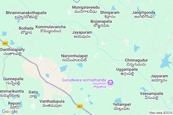
Pusairao Thanda
Pusairao Thanda Map
EDIT Map
Add Your House
 ..
..
Current Corona Virus Infected Patients Count in Warangal District
| City Name | District Name | Total Covid cases |
|---|---|---|
| Warangal Urban District | Warangal Urban | 23 |
| Mulugu District | Mulugu | 2 |
| Mahabubabad District | Mahabubabad | 1 |
Locality Name :
Pusairao Thanda
( పూసాయిరావు తండా )
Mandal Name : Narsimhulapet
District : Warangal
State : Telangana
Region : Telangana
Language : Telugu and Urdu
Current Time 01:00 PM
Date: Tuesday , Apr 29,2025 (IST)
Time zone: IST (UTC+5:30)
Elevation / Altitude: 212 meters. Above Seal level
Telephone Code / Std Code: 08719
Assembly constituency : Dornakal assembly constituency
Assembly MLA : Jatoth Ram Chander Naik
Lok Sabha constituency : Mahabubabad parliamentary constituency
Parliament MP : Kavitha Malothu
Serpanch Name :
Pin Code : 506324
Post Office Name : Dantalapalli
Main Village Name : Mungimadugu
Commodities Prices : Kesamudram Market / Mandi
Pusairao Thanda Live Weather
Temperature: 39.3 °C
clear sky
Humidity: 23%
Wind : 3.21 mt/sec towards SW
StationName : "MahbÅ«bÄ\u0081bÄ\u0081d"
observed on Now
Temperature: 39.3 °C
clear sky
Humidity: 23%
Wind : 3.21 mt/sec towards SW
StationName : "MahbÅ«bÄ\u0081bÄ\u0081d"
observed on Now
Pusairao Thanda Weather Forecast for Next 5 days
30-04-2025
27.6°C to 40.3°C
clear sky
27.6°C to 40.3°C
clear sky
01-05-2025
26.7°C to 40.9°C
clear sky, broken clouds, few clouds, scattered clouds
26.7°C to 40.9°C
clear sky, broken clouds, few clouds, scattered clouds
02-05-2025
27.3°C to 41.7°C
few clouds, clear sky, scattered clouds
27.3°C to 41.7°C
few clouds, clear sky, scattered clouds
03-05-2025
27.9°C to 41.9°C
scattered clouds, few clouds, clear sky, broken clouds
27.9°C to 41.9°C
scattered clouds, few clouds, clear sky, broken clouds
04-05-2025
27.7°C to 42.7°C
clear sky, broken clouds, scattered clouds, overcast clouds
27.7°C to 42.7°C
clear sky, broken clouds, scattered clouds, overcast clouds
National Highways Reachable To Pusairao Thanda
Nationa High Way :NH365BB
Nationa High Way :NH365A;365BB
Nationa High Way :NH365BB
Nationa High Way :NH365A;365BB
Rivers Near Pusairao Thanda
Bukleru River
Musi River
Bukleru River
Musi River
About Pusairao Thanda
Correct below Info and add more info about Pusairao ThandaPusairao Thanda is a small Village/hamlet in Narsimhulapet Mandal in Warangal District of Telangana State, India. It comes under Mungimadugu Panchayath. It belongs to Telangana region . It is located 68 KM towards South from District head quarters Warangal. 6 KM from Narsimhulapet.
Pusairao Thanda Pin code is 506324 and postal head office is Dantalapalli .
Pusairao Thanda is surrounded by Maripeda Mandal towards South , Nallikudur Mandal towards North , Thorrur Mandal towards west , Kuravi Mandal towards East .
Khammam , Suryapet , Yellandu , Kodad are the near by Cities to Pusairao Thanda.
This Place is in the border of the Warangal District and Nalgonda District. Nalgonda District Nuthankal is South towards this place .
Demographics of Pusairao Thanda
Telugu is the Local Language here. Total population of Pusairao Thanda is 4766 .Males are 2391 and Females are 2,375 living in 1072 Houses. Total area of Pusairao Thanda is 1340 hectares.Politics in Pusairao Thanda
TDP , TRS , INC are the major political parties in this area.Polling Stations /Booths near Pusairao Thanda
1)Rajole2)Ramannagudem/mungimadugu
3)Mulkalapally
4)Mungimadugu
5)Nallella
HOW TO REACH Pusairao Thanda
By Road
Warangal is the Nearest Town to Pusairao Thanda. Warangal is 85 km from Pusairao Thanda. Road connectivity is there from Warangal to Pusairao Thanda.By Rail
There is no railway station near to Pusairao Thanda in less than 10 km. How ever there are railway Stations from Near By town Warangal. are the railway Stations near to Warangal. You can reach from Warangal to Pusairao Thanda by road after .Colleges near Pusairao Thanda
Sai Ram Juniour College
Address :
Gowthami Jr College, Narsimhulapet
Address : Narsimhulapet
Schools in Pusairao Thanda
Mpups Munigimadugu
Address : mungimadugu , narsimhulapet , warangal , Andhra Pradesh . PIN- 506324 , Post - Dantalapalli
Mpups Ramanna Gudem
Address : mungimadugu , narsimhulapet , warangal , Andhra Pradesh . PIN- 506324 , Post - Dantalapalli
Govt Health Centers near Pusairao Thanda
1) SubCentre, Munigmadugu , , near school , MUNGIMADUGU2) SubCentre, Narsimhulapet , 2-107 , NEAR G.P. , NARSIMHULAPETA
3) SubCentre, Kousalyadevipally , Kousalyadevipally , Kousalyadevipally , NEAR SUBSTAION(ELC)
Petrol Bunks in Pusairao Thanda,Narsimhulapet
Indian Oil Petrol Bunk
main road; Khammam - Warangal Hwy; Danthalapally; Telangana 506324; India
11.3 KM distance Detail
more ..
Colleges in Pusairao Thanda,Narsimhulapet
St. Augustine's High School
Khammam - Warangal Hwy; Seva Nagar; Maripeda Bunglow; Telangana 506315; India
17.8 KM distance Detail
more ..
Electronic Shops in Pusairao Thanda,Narsimhulapet
Priyanka Electricals And Electronics
;; Narsimhulapet; Telangana 506324; India
1.9 KM distance Detail
SIRI PHOT STUDIO
BESIDE STATE BANK OF INDIA;; Narsimhulapet; Telangana 506324; India
2.0 KM distance Detail
Police Stations near Pusairao Thanda,Narsimhulapet
Danthalapally Police Station
main road; Khammam - Warangal Hwy; Danthalapally; Telangana 506324; India
11.3 KM distance Detail
Governement Offices near Pusairao Thanda,Narsimhulapet
Grama Panchayath Office
Rammannagudem; Narsimhulapet Mandal; Mungimadugu; 506324; India
1.2 KM distance Detail
About Pusairao Thanda &
History
How to reach Pusairao Thanda
Tourist Places Near By Pusairao Thanda
Schools in Pusairao Thanda
Colleges in Pusairao Thanda
Temperature & weather of Pusairao Thanda
places in Pusairao Thanda
Pusairao Thanda photos
More Information
How to reach Pusairao Thanda
Tourist Places Near By Pusairao Thanda
Schools in Pusairao Thanda
Colleges in Pusairao Thanda
Temperature & weather of Pusairao Thanda
places in Pusairao Thanda
Pusairao Thanda photos
More Information
Village Talk
Post News or Events about this Village
Near Cities
Khammam 50 KM near
Suryapet 52 KM near
Yellandu 61 KM near
Kodad 64 KM near
Khammam 50 KM near
Suryapet 52 KM near
Yellandu 61 KM near
Kodad 64 KM near
Near By Taluks
Narsimhulapet 6 KM near
Nallikudur 12 KM near
Maripeda 13 KM near
Thorrur 18 KM near
Narsimhulapet 6 KM near
Nallikudur 12 KM near
Maripeda 13 KM near
Thorrur 18 KM near
Near By Air Ports
Vijayawada Airport 168 KM near
Rajiv Gandhi International Airport 168 KM near
Rajahmundry Airport 243 KM near
Nanded Airport 361 KM near
Vijayawada Airport 168 KM near
Rajiv Gandhi International Airport 168 KM near
Rajahmundry Airport 243 KM near
Nanded Airport 361 KM near
Near By Tourist Places
Khammam 50 KM near
Warangal 65 KM near
Nagarjunakonda 98 KM near
Medaram 112 KM near
Bhadrachalam 128 KM near
Khammam 50 KM near
Warangal 65 KM near
Nagarjunakonda 98 KM near
Medaram 112 KM near
Bhadrachalam 128 KM near
Near By Districts
Khammam 50 KM near
Warangal 65 KM near
Nalgonda 88 KM near
Karimnagar 140 KM near
Khammam 50 KM near
Warangal 65 KM near
Nalgonda 88 KM near
Karimnagar 140 KM near
Near By RailWay Station
Kesamudram Rail Way Station 23 KM near
Mahbubabad Rail Way Station 23 KM near
Kesamudram Rail Way Station 23 KM near
Mahbubabad Rail Way Station 23 KM near